Tag Archives: NFS

Rock Creek Campground

rockintable
Rock Creek Lake 9600′ elev, Eastern Sierra

Numerous places named Rock Creek exist inside California. This particular Rock Creek page is specific to Camping and Campgrounds!

This compilation of “Rock Creeks” is to help with the confusing lists of similarly named camps and locations (which are many, inside California).

Lakes, rivers, canyons, campgrounds, 4×4 routes and wilderness trailheads. 

Eastern Sierra Campgrounds

List begins with the most well known –

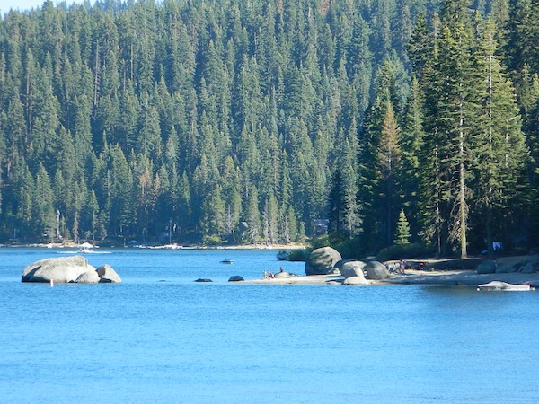
Rock Creek Lake @ Inyo National Forest

Autumn Rock Creek
Rock Creek is a top destination for Autumn Colors in OCTOBER

NFS Campgrounds on Rock Creek Road listed below:

NFSlogo
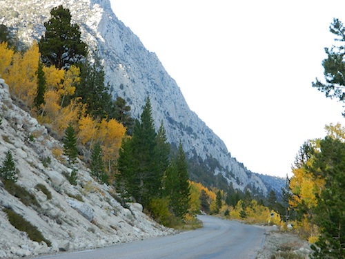
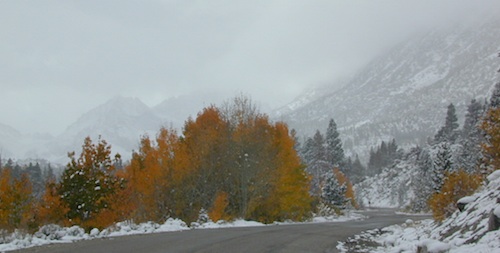
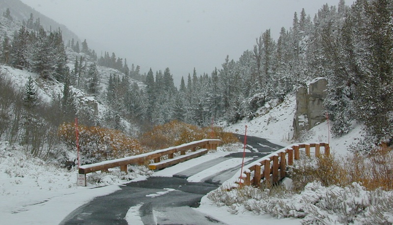
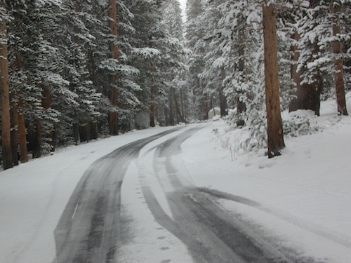
12 NFS Campgrounds are located around Eastern Sierra Rock Creek Canyon. Elevations range from 7000′ at the highway, to over 10,000′ at a trailhead parking lot at the road’s end. Most of these developed campgrounds listed are only open a few months outta the year, due to winter snow closures (NOV-APRIL). On occasion, snow can still be on the roads until MAY.

Tuff Campground ( @ frwy US 395)camp

French Campground (7500′ elev w/ 86 sites)
Holiday Campground (7500′ elev w/ 35 sites)

Aspen Group Campground (8100′ elev)

iris meadow
Iris Meadow Campground NFS

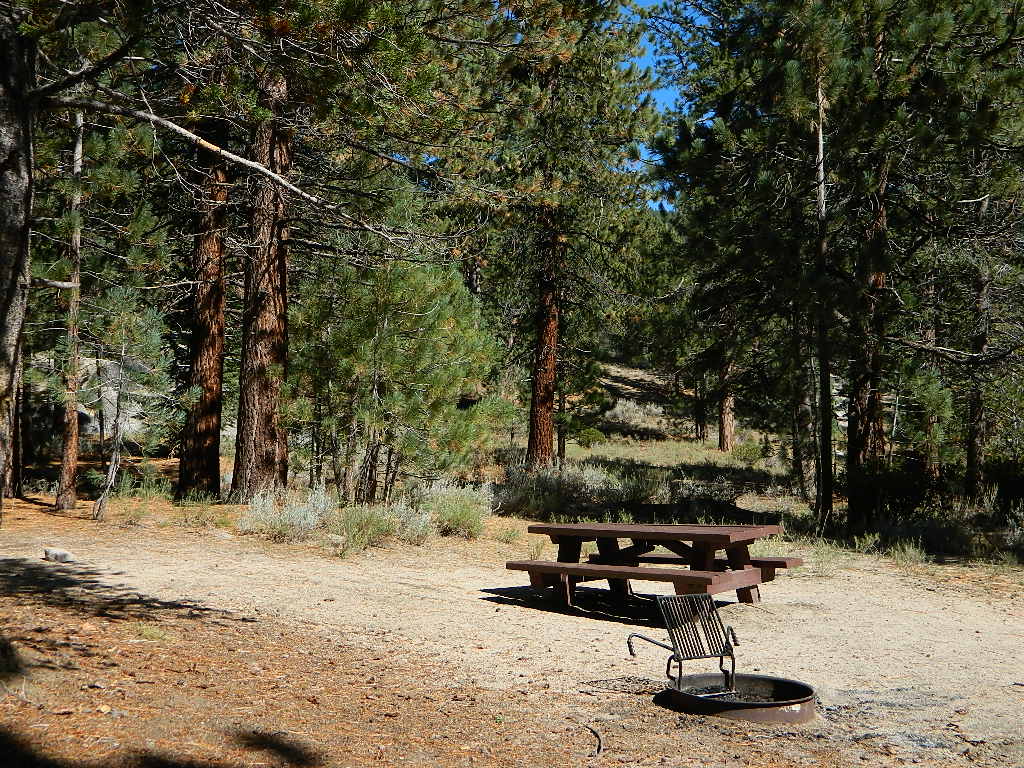
Iris Meadow Campground (8600′ elev w/ 14 sites) NFS
Big Meadow Campground (8600′ elev w/ 11 sites)
Palisade Group Campground (8600′ elev w/ 5 sites)
East Fork Campground (9000′ elev w/ 133 sites)
Pine Grove Campground (9300′ elev w/ 11 sites)

rockcreeklake

Rock Creek Lake Campground (9600′ elev w/ 66 sites) NFS

Rock Creek Lake Group Campground (by reservation) NFS

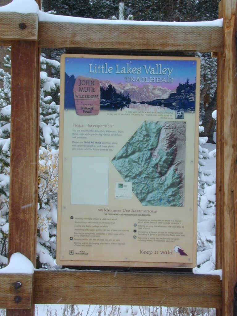
Mosquito Flat Walk-In Campground (trailhead camp) hikerSome maps may have this one listed as Little Lakes Campground, but that is just the official trailhead name.

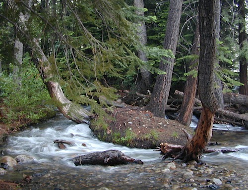
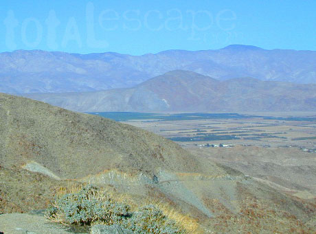
Backpackers and horseback riders frequent this Eastern Sierra canyon a lot of the year. Many high country trails lead out to Sierra peaks, alpine lakes and sheer wilderness. Download PDF Map of this canyons hiking trails.

eastern sierra snowline
eastern sierra

More Rock Creek Camps
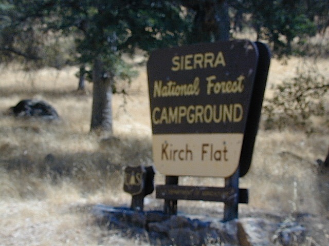
Rock Creek CampgroundMammoth Pool Reservoir, south of Yosemite National Park, behind Bass Lake, CA inside the Sierra National Forest (18 camp sites)

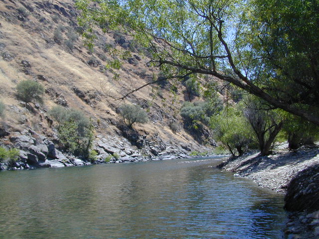
Rock Creek Campground – US Hwy 101 NorCal Redwood forests, north of Leggett, CA. Camp located on the Eel River, in the Standish Hickey State Recreation Area. (36 camp sites)

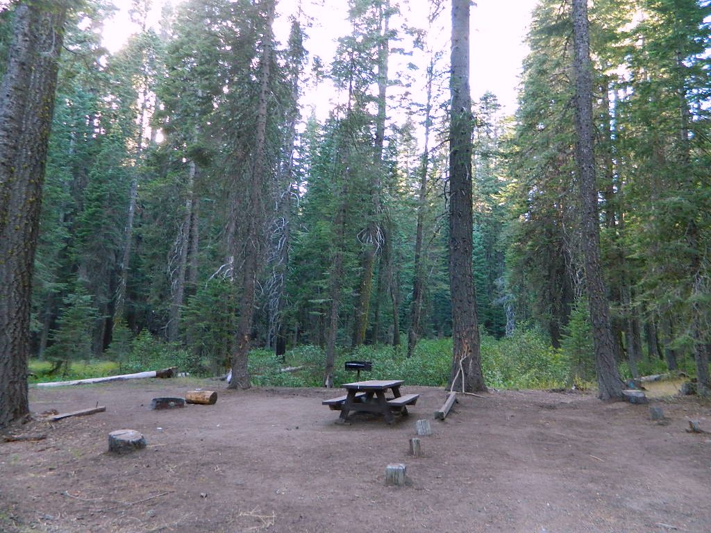
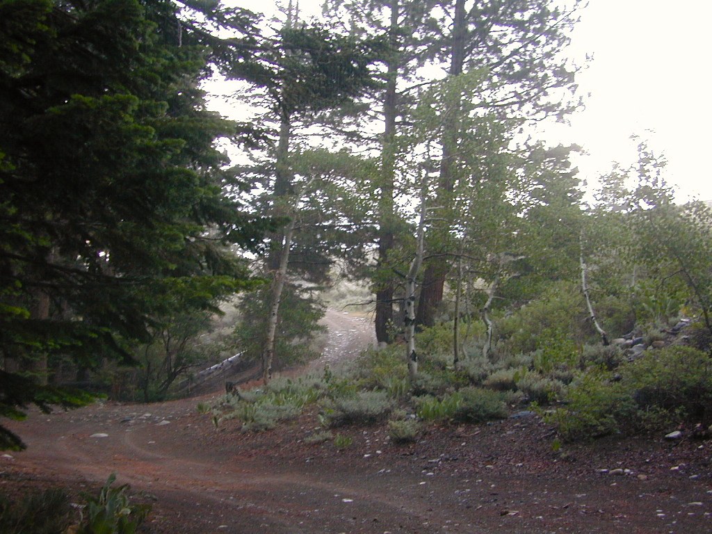
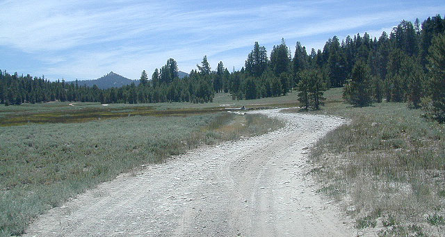
Rock Creek Loop Road – Dinkeycamptruck
Sierra Forest Road #9S09, off of paved Dinkey Creek Road. Excellent primitive camping along creek; 4×4 trailheads, as well as hiking & horseback trails. Small RVs okay. Dispersed camp sites, no facilities. Fire permits are required. Near Shaver Lake, CA inside the Sierra National Forest

Similarly named –

ROCK LAKE is located inside Lakes Basin Recreation Area, northern Gold Country @ Yuba River headwaters. Hike-in access only.4x4

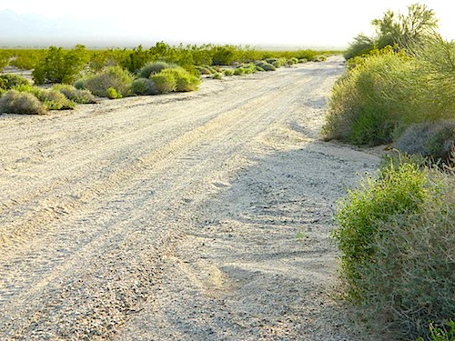
And if you want some Central Coast wheelin – 4×4 camping and trails, see the ROCK FRONT RANCH on California Hwy 166, on the way to New Cuyama, CA

lower rock creek road
Lower Rock Creek Road, off US hwy 395

We will continue to add any more Rock Creeks to this page (as we find and photograph them). Stay tuned for more of the very best camping in California.


24N10 – Plumas NF

Lake Davis Loop Drive

Lake Davis Loop: Plumas Forest Road #24N10

Plumas National Forest

also known as the Beckwourth Taylorsville Road

5,800′ elevation
Portola, CA

Lake Davis

Lake Davis Loop is a 20 mile circle around the lake. Drive or mountain bike route. Scenic drive on dirt roads, or an easy bike ride. Average ride time 2 hours for biking.

A flat, easy loop around Lake Davis is best in summer months, as snow usually closes this area in winter. The whole route is a mix of paved, dirt and gravel road. There are picnic areas along the way, lake views, bird and wildlife viewing, wildflowers.

NFSlogo


Numerous primitive camp sites and secondary dirt roads fork in various directions, off of this main loop.  Volcanic ridges line the west side of the lake, dense forest and seclusion can be found all around. Bald eagles fly overhead and wild life is abundant.

  • boat
  • camp
  • fish
  • hike
  • mountain bike
  • stargaze
  • wildlife

CROCKER GUARD STATION

campCrocker Station is for rent and reservations are required. This wooden 2-story home was built in 1912 for Forest Service personnel, and later staffed as a fire station until the 1980s.

Situated at 5700′ elevation, its alpine beauty and cooler temps make it a much sought after, especially in summertime. Located a few miles from the lake and 10 miles northeast of Portola, California. There is a small campground next door called Crocker Campground. A dirt road access to Crocker Meadow is quickest from lake, but the paved route around is longer.

Camp 5 sign

DIRECTIONS:
From California SR 70 (Highway 70) in Portola take West Street approximately 7 miles to the Lake Davis Dam. Park at the information kiosk and get acquainted with maps and the area info.

Drive or bike the lake loop. Travel 1.7 miles west to Forest Service Road 24N10, travel on that for 8.1 miles until you reach the junction with County Road 112. Then turn east and continue around the lake, past the Grizzly Campground a half mile, turn South on Country Road 126 and continue back to the dam.


View Larger Map

Plumas National Forest
Plumas Map USDA


DSCN0077


Gold Lake California

lilgoldlake
Hike-in only Gold Lake, Bucks Lake Wilderness.

California has more than one Gold Lake!

goldsign

Gold Lake, CA

(Sierra Co)
6409′ elev.

The biggest Gold Lake, California is the well-known one, along the Gold Lake Highway in the Lakes Basin Recreation Area. Plumas meets Tahoe National Forest. North of Gold Country Hwy 49, Downieville & the Yuba River. Right where the Sierra Nevada granite meets the volcanic lava rock of NorCal.

Packer Lake

Lakes Wilderness Map

Impressive jagged spires known as The Sierra Buttes (8591′) tower above the stunning lake scenery. This big Gold Lake is surrounded by a dozen smaller alpine lakes which make up the popular region called Lakes Basin. Easy access paved highway, which closes in winter for deep snow and winter recreation. The Gold Lake Highway is also referred to as Plumas County Road #S620

sierra buttes
the sierra buttes

Sardine Peak Fire Lookout lodgeranger rentals
NFS fire tower – no more overnight rentals!
overlooking the Sierra Buttes and the serene Lakes Basin, Yuba River, Northern Gold Country California

see CalPine Lookout near Sierraville, CA

driftwood

USFS

LAKES BASIN RECREATION AREA
Cabins, camping, lake fishing, backpacking, hiking, horseback riding, mountain biking, off-roading, snow-mobiling.

lakesbasinhikers

snowmo

California Lakes

mini gold lake

Mini Gold Lake

(Plumas Co)
6000′ elev.

Another smaller Gold Lake exist on the granite slopes in Bucks Lake Wilderness – E of Oroville & W of Quincy, CA.

gold lake trailhead
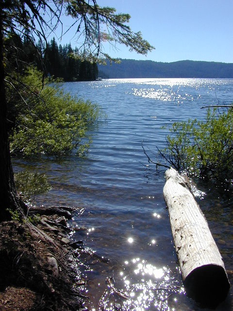
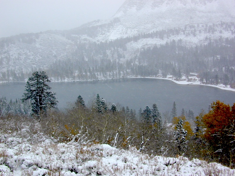
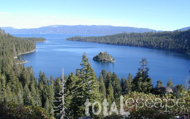
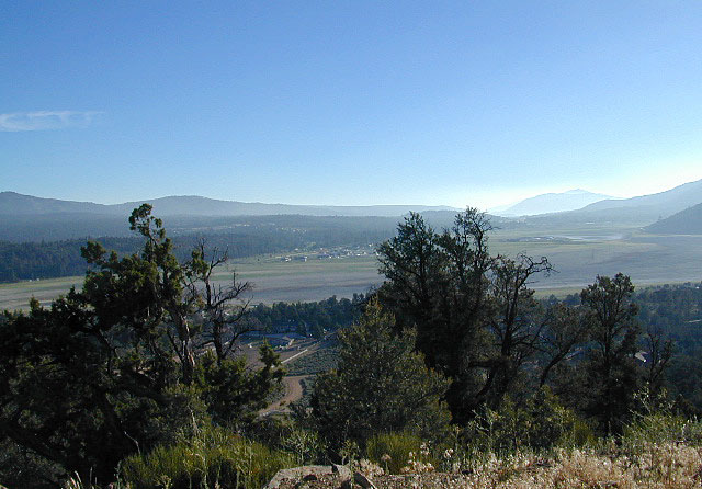
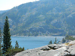
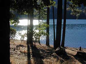
This hidden gem is a hike-in only lake – and well worth the effort. A somewhat short hike, great ridge line views to the east, although the last half mile of this route is a doozie (moderately strenuous).

The main trailhead departs from Silver Lake and climbs a ridge line that heads over to the PCT (Pacific Crest Trail). An off-shoot trail goes another mile to the miniature Gold Lake, a granite bowl of sheer beauty. A great day hike for those wishing to see the backcountry. Pack your picnic lunch, camera, and make a whole darn day of it!

Swimming & skinning dipping seem quite natural at this alpine lake, since it is a pretty remote location (without a lot of visitors) and there is absolutely no swimming allowed at neighboring Silver Lake.

bucks trailhead

The steep, overgrown, rocky shoreline leads one to bush whack through old trails, only to be met by a rock slide. Many dead ends and obstacles to climb around, or over. Some way… maybe, or maybe not!

Boulder and rock scrambling is the key phrase to remember, once you reach this lake. Knees may be sore from climbing, up and over the boulder ledge surrounding the lake bowl.

goldshore

Bucks Lake Wilderness Map

A few primitive camp sites are scattered about on the edge of the lake for those backpacking in, but be warned – they can be very difficult to reach. Much more suitable campsites can be found scattered throughout the area.

Warning: there are no flat, lush meadows to lounge in up at the lake, so pick yourself a side route (on the walk in) to find real seclusion and privacy.

view to Quincy

This mile-long-ridge hiking trail to mini Gold Lake has some amazing views down to the east side – Jacks Meadow right below; then Meadow Valley & Quincy off in the distant hills. RURAL CALIFORNIA – Plumas County from above.

jacks meadow
jacks meadow, way below

Sierra Nevada Lakes

High Sierra Gold Lakes in California

hike-in only lakes

hike

Golden Bear Lake
(Tulare Co)
12,000′ elev

High Sierra – Kings Canyon National Park
Center Basin / Center Peak 12,760′
PCT – Pacific Crest Trail
North of Mount Whitney
Eastern Sierra, Independence, CA

hike

Golden Trout Lake
(Inyo Co)
11,500′ elev

Trail #3306 from Onion Valley Campground
North of Mount Whitney
Eastern Sierra, Independence, CA

goldentroutlakecanyon
onion valley trail views
Eastern Sierra Lakes
Alpine Lake above Onion Valley, Eastern Sierra

Yosemite Topo

merceddownriver

Yosemite Topo Maps

ti_yosemiteYosemite National Park, in California’s Sierra Nevada mountains, is the most visited of all the National Parks. Tourists, visitors and campers fill the main valley all year long, with the crowds peeking in mid summer. Autumn is gorgeous, winter is snowy, spring is glorious and summer is grand.

The park has numerous alpine lakes, granite domes, meadows, Sequoia groves and a snow ski resort. Backpacking is popular here, hiking all over, bike rentals w/ miles of paved trails. Plus, the best in big wall climbing. Waterfalls and granite cathedrals tower above the lush, glacier- carved valley. Mighty MERCED RIVER, right through the middle of granite and forests.

Storms of recent have rearranged the landscape inside the valley with a number camping facilities wiped out by the river. Yosemite lost half of the campsites, which dramatically reduced the amount of camping available inside the main valley. Older cabins at Yosemite Lodge are gone. Less camping, but more people means you should make camp reservations early as possible; or search for camping just outside the National Park boundary.

Sightseeing and hiking should be part of your visit to Yosemite Valley. Bring your raft for a float down the river. Stay away from the crowds and take the back roads, with our great selection of Yosemite backcountry maps.

We now have links to digital maps for download!

Topographic maps for Yosemite National Park – and the outlying regions:

Teneja Lake, Hwy 120. Yosemite National Park
Eastern Sierra Camping

Inyo National Forest

Sierra National Forest

Stanislaus National Forest

Yosemite Lakes

Yosemite Lodging

Yosemite National Park

Mariposa County CA
Ahwahnee
Bass Lake
Coarsegold
El Portal
Fish Camp
Groveland
Lee Vining
Mariposa
Midpines
Nipinnawasee
Oakhurst
Wawona
Vogelsang: High Sierra Camp

th_half_dome_d

Backpacking
Day Hikes
GRANITE TERRAIN
Topographic
Yosemite Trail Maps

TuolumneMdws

Sunrise Lakes
Sunrise Lakes, Yosemite HSC Loop Hike


California Mountain Maps

The Mountains of California

Camping El Dorado NF, on the Consumnes River

If you know you wanna head up in elevation, higher altitudes – to the pine forests of California, but have no clue where to start, this page may be very helpful in determining your ultimate destination. We have hundreds of pages on adventures & locations throughout the golden state. We sell all California maps for outdoor recreation, hiking topos to off road routes.

Wanna camp under the stars this weekend – and avoid the crowds too? You will need a good back road map to find this awesome camp site, guaranteed. Need a hammock spot, small swimming hole & total seclusion? Or how about a large family camp w/ Sequoia grove nearby? Total Escape has something for every ones budget & lifestyle. See below for an extensive breakdown of California mountain regions.

#1
SoCal mountains have tighter restrictions on campfires, larger number of people camping in a smaller amount of space, minimal primitive camping options in the forests, more fees to access these lands.

#2
The Sierra Nevada mountains are the prime outdoor destination for many in the Central California region. High elevations w/ granite slabs to lower country reservoirs & riverside oak flats. Folks come from all over the world to visit parks and lakes within this mountain range. Indeed, 4 National Parks call the Sierras home: Lassen, Yosemite, Kings Canyon and Sequoia NP – not to mention the 10 National Forest and 15+ Wilderness Areas.

#3
You want big water? Cabins next to a prime fishing river or camping near lakes, creeks with dense forests, then you will have to drive to the mid Sierra or even NorCal to find ’em.

Wilderness maps

California Mountain Regions Defined –
find the details on specific region for California mountains

saabaru_forest
Mountain Home Sequoias

epic finds

Find little known parks, camps and forests within our vast California BACK ROADS data base. Below is a small sampling of our picturesque mountain pages, where you can find the best seclusion: hiking, camping, fishing, mountain biking trails, rivers, creeks and peaks.

NFSlogo

Sierra Buttes
The Sierra Buttes, Northern Sierra near Gold Lake

sierra National Forest map

Outdoor Recreation Maps of California:

inyohighroad
Inyo high roads, of the Eastern Sierra


Bucks Lake Campgrounds

indian rock
Indian Rock is a beach (day use only) on the west side.

Bucks Lake, California

Below is a list of all the developed campgrounds & RV Parks surrounding the Bucks Lake region of Plumas National Forest in the Northern Sierra Nevada mountains. The infamous Pacific Crest Trail (PCT) runs through Bucks Lake Wilderness, so there are also trailhead camps and backcountry camp sites that are not in this list. This high elevation region closes the campgrounds for winter: NOV- APRIL

campgrounds RV campgrounds fishing lakes campgrounds launch lake camping hiking lakes

Campgrounds at Bucks Lake

campground elev spots veg toilet water
Hutchins Group Camp 5200′ 10 pines flush piped
Lower Bucks Campground 5200′ 6 pines vault piped
Mill Creek Campground 5200′ 10 pines vault piped
Sundew Campground 5200′ 19 pines vault piped

NFS camps

NFS Camps nearby

campground elev spots veg toilet water
Deanes Valley Campground 4400′ 7 mixed vault creek
Grizzly Creek Campground 5400′ 8 pines vault piped
Silver Lake Campground 5800′ 9 pines vault lake
Snake Lake Campground 4200′ 14 mixed vault lake
Whitehorse Campground 5200′ 20 pines vault creek

USDA
Plumas National Forest

Oroville Ranger Station NFS
530-534-6500

Quincy Ranger Station NFS
530-283-0555

Bucks Lake CA

PG&E Campground @ Bucks Lake

Haskins Valley Campground
16731 Bucks Lake Rd
530-283-0256

Grizzly Forebay Campground
CLOSED in 2013 by PG&E
530-896-4263 (for more info)

RV Parks @ Bucks Lake

Bucks Lake Camp & RV
280 Bucklin Road
530-283-2221

Bucks Lake Marina
16469 Bucks Lake Rd
530-283-4243

Lakeshore Resort
16001 Bucks Lake Rd
530-283-2848

grizzly creek

Group Campgrounds El Dorado

Group Campgrounds in El Dorado National Forest

camp

group campground elev sites veg toilet water notes
Bear River Campground @ Lower Bear Reservoir 6000′ 3 pines vault piped boating, fishing
Black Oak Campground @ Stumpy Meadows Lake 4400′ 4 oaks vault lake boating, fishing
Loon Lake Group Site 6500′ 3 pines vault lake equestrian
Middle Meadows Campground near Hell Hole Reservoir 4700′ 2 pines vault piped fishing
Red Fir Campground @ Loon Lake 6500′ 1 pines vault pipd handicap access
Wench Creek Group @ Union Valley Reservoir 4900′ 2 oaks flush piped fishing

hiker canoe    fish

see more about El Dorado National Forest, California

nearby towns –

El Dorado Forest Maps –

Klamath Fire

Klamath Fire

InciWeb: California Fires 2018

NorCal – Klamath River: 2017 fire season provided significant firefighting challenges. In order to meet future challenges in the most effective way possible, the NFS will continue to use prescribed burning as a tool in our mission to reduce build-up of hazardous fuels, restore forest ecosystems, and improve resiliency and safety of communities within the wild-land urban interface.

Planned projects include burning piles of stacked materials and low to moderate intensity understory burns of vegetation on the forest floor. The main goals of these projects are to reduce the severity of future wildfires and provide added protection for communities in the wild-land urban interface. In addition, the burns will promote a diverse and more resilient forest, and improve habitat for wildlife.

NorCal River Camping, Fishing, Kayaking, Rafting, Recreation.

Klamath burns will take place on the Salmon River, Scott River, Happy Camp, Oak Knoll and Goosenest Ranger Districts between April and June 2018. The actual dates of ignition will depend on local weather and fuel conditions.

Expect smoke in the Klamath for spring time!

Great Camping all summer long. June – September

https://totalescape.net/shop/marble-mountain-wilderness-map/

Kirch Flat Campground

Kirch Flat NFS
Camp Kings River

kirch flat

Low elevation Western Sierra: a big river at the beginning of Kings Canyon. Fishing, biking and hiking. The Kings Cyn National Park is directly east, upriver.

Oak woodlands, steep granite canyons, waterfall hikes, rock beaches, river fishing, mountain biking and wildflowers. Day time temperatures get triple-digit in summer months, so best time to visit is the rest of the year. Small RV accessible, paved road, river close – and best of all, open all year long!

flora west sierra

Kirch Flat Campground

Due EAST of Fresno, California in a large river canyon, Western Sierra Nevada
Located 18 miles up Trimmer Springs Road (paved), 5 miles above Pine Flat Lake. Sierra National Forest; River rafting take-out spot for Middle Kings River.

• Elevation: 1100′
• Number of Sites: 17
• Camp Fee: No
• Vehicle Accessibility: RV 22′ max
• Campsites Reservation: No
• Length of Stay: 14 Days
• Season: Open Year Round
• Trailheads: Kings River

lowerkings

see also Kings River Camping

nearby destinations –

Big Creek Rd #9
Blackrock Reservoir
Dinkey Creek
Dinkey Lakes Wilderness
Fresno, CA
Kings Canyon NP
Monarch Wilderness
Pine Flat Reservoir
Reedley, CA
Shaver Lake, CA
Sierra National Forest
Sequoia NP
Wishon Reservoir

Sierra NF – Road #9

sierra10S69

Sierra National Forest
Big Creek Road #9

aka. Rd #10S69

Connects Pine Flat Reservoir @ Lower Kings River, to upper elevation Sierra forests near Dinkey Creek Road. McKinley Grove of Sequoia

Sierra Road number 9 is a north turn off of Trimmer Springs Road. Marked as National Forest Rd #10S69, as well as just plain NINE. Big Crk. canyon is after the Maxson Road junction, and before the Balch Camp / Blackrock Reservoir turn off on #11S12. The area is known for abundant wildflowers in the early season.

dirt road climbs 25+ miles thru Sierra NF

sierra9

  • back road exploring
  • camping
  • fishing
  • hiking
  • hunting
  • kayaking
  • picnic areas
  • swimming
  • wildflowers
Tall White Lupine
Tall White Lupine

Big Creek Rd 9

A popular dirt road drive for the western Sierra – Pine Flat Lake region. A forested, south facing canyon in the Southern Sierra Nevada Mountains. Big Creek, wide, graded, dirt road w/ primitive camp sites. 4×4 could be needed in wetter months.

The higher you go on this route, the more pine trees you will experience. Winter weather can close this route. A campfire permit is required to camp along this road.

The lower part of the canyon has rock features, small waterfalls, swimming holes, picnic spots and sometimes cattle grazing. Several prime unmarked, primitive camp sites along this road – but few and far between. High clearance or 4WD may be needed, depending on road conditions.

sierra hiker

Soaproot Saddle Road is a not-so-obvious left fork (dirt, without signs) that leads steeply up away from main road. Climbs a steep hillside, way up above and along Rush Creek; continues for many miles. Less people back this way, if you are seeking seclusion. Few primitive camp sites on right side of road, near where the creek breaks away from road. Good for stargazing way back here. 4×4 may be needed. Road may or may not connect through to desired destination.

The mid-route climbs into pine forest and the dirt road switchbacks, steeply, with a few more camp sites available; usually found on short side roads off the main road.

sierra creek camps

At Sierra #9, a major junction w/ dirt road #10S69, called Dinkey Trimmer Road. This leads way off through the rugged terrain, many miles, over to the pavement at Dinkey Creek Jct – Campground, Trailhead and Dinkey Lakes Wilderness.

Big Creek will turn left (north), and follows the large Big Creek Canyon. Several steep miles climb up into the dense pine forest, following the creek the whole way. Several prime creekside camp sites fill up fast in this stretch. Great views, steep dirt roads. GPS waypoint these camp driveways – so you can find it next time, (first, before everyone) on Friday, Thursday before midnight.

Peterson Mill Road is Rd #10S02, found on the left (west) side of Sierra #9. That westbound route becomes pavement half way back to Highway 168. This way is the quickest way from Fresno, out to the developed NFS Bretz Campground.

Sierra #9 Big Creek Road arrives in the densest of forests. Many camp sites and side routes to explore. Dark, upper elevations, snow lingers long in the shade. 4WD may be needed in wet areas. Mud is quite common MOST of the year in this spot, so know your vehicles capabilities before you get yourself stuck (or stranded). It’s a very long walk to any kinda civilization!

Hunters like to use these upper camps during hunting season. A camp fire permit is required, so bring your shovel and bucket; self-sufficient campers enjoy the back roads most often.

wild sierra flora

Bretz Campground NFS is up here on the main road, number nine. Clock it w/ dash trip meter; 15 miles from the road start @ Pine Flat Lake. Popular with OHV and 4×4 groups. Max RV or trailer length = 24′
Open all year long; No fee.

Sierra Forest Road #9 the far north end, enters Blue Canyon @ #10S18, but the Rd #9 route continues NE as Providence Creek Road. Eventually intersecting @ Dinkey Creek Rd w/ Rock Creek & Dinkey Dome closeby. Great granite 4×4 Trail @ Bald Mountain (elev. 7832′) overlooking Shaver Lake.

Jeepers on granite @ Bald Mtn, above Shaver Lake, CA

Kings River Camping

2 tone lupine

SIERRA MAP
sierra National Forest map

places nearby –
shaver lake map

Balch Camp (utility & NFS)
Black Rock Reservoir
Courtright Reservoir
Dinkey Creek
Huntington Lake
Lakeshore, CA
Pine Flat Lake
Shaver Lake, CA
Trimmer Springs
Wishon Reservoir

4S12 – Inyo NF

rockcreekroad

Rock Creek Road

Rock Creek Lake, Eastern Sierra, California

Inyo Forest Road #4S12
also known as Inyo Road 12, and also Rock Creek Rd.

Majestic mountain scenery. Popular paved route that leads from US 395 up to Rock Creek Lake, on the edge of granite wild lands; lake is situated above 9000′ elevation and the hiker trailheads are further up, beyond the lake at over 10,000 feet. Steep canyon, large canyon, rocky granite canyon, high elevation.

Super scenic drive, but open less than half the year, due to deep snow. Eastern Sierra Nevada mountains. Inyo National Forest

North of Bishop, CA
South of Mammoth, CA
SW of US Highway 395

hikes horse camp bike

backpacking
camping
fishing
hiking
horseback
trailheads
wilderness

A popular and favorite place for summer camping, fishing and hiking. Backpacking, horse trails, high elevation lakes, mountain passes, peaks, wilderness areas. RV campgrounds, tent camping, car camping. Mountain biking in vast canyon, near campgrounds and creek. No bikes in the Wilderness (up and above Rock Creek)

Autumn colors, aspen groves usually best in early October. Snow closure in winter months (Nov-May).

snowyautumn

elevation 7072′ @ Tom’s Place, CA (US Hwy 395)
elevation 9682′ @ Rock Creek Lake
elevation 10,272′ @ Trailhead Parking (end of road)

UP, UP, HIGHER & AROUND LAKE
One lane, paved route gets narrow, but keeps on climbing. Road #6S05 continues up – past Rock Creek Lake and ends at hiking trailheads, paved parking lot and a few picnic spots.

iris meadow
Iris Meadow Campground NFS

12 NFS Campgrounds in this region, starting with one at the highway, several along the way and the campgrounds at Rock Creek Lake.

No campfires are allowed in this canyon – outside of a developed campground. Not much in the way of primitive car camping options either, except for strapping on a backpack and heading into high elevation wilderness.

rockcreeklake

Rock Creek Lake

Rock Creek Campgrounds

Inyo National Forest
John Muir Wilderness

Trailheads along Rock Creek Road #4S12

  • Upper Hilton Lakes
  • Tamarack
  • Lakes Valley (Little Lakes)
  • JMT – John Muir Trail

Rock Creek NFS Hiking Trailheads (download PDF)

Eastern Sierra Maps:
Inyo National Forest Map USDA
John Muir Wilderness Maps
Mammoth Lakes Map by NatGeo
Mono Divide High Country Map


rock creek lake
Rock Creek Lake, first snowfall (Autumn)


looking for another place called ROCK CREEK in California? (we are working on that)

6S05 – Inyo NF

6S05bridge

Paved, one-lane extension of #4S12, Rock Creek Road.
Up above Rock Creek Lake, East Sierra Nevada, California

High elevation 10,272′ at roads end and parking lot

Little Lakes Valley Trailhead
Mono Pass
Morgan Pass
John Muir Trail (JMT)
Pacific Crest Trail (PCT)

Mosquito Flat Picnic Area

Restrooms, paved parking lot, nature trails, fishing creeks, horseback, wilderness trails.

hikes NFS camp horse camp

Mosquito Flat Walk-In Campground is intended for backpackers departing overnight into the backcountry the following day. Single night stay ONLY. Please camp down canyon if you plan to stay for more than one night. Bear lockers are provided at campgrounds for proper storage of food items, so use them!

No campfires are allowed outside of developed campgrounds. Day use does not require a permit. Wilderness permits are required for overnight trips into the John Muir Wilderness. Bear containers are required for backpackers. Permits for these trails are issued at Inyo National Forest ranger station in Mammoth, or the Eastern Sierra Visitors Center (ESIA) near Olancha.

littlelakesvalley

John Muir Wilderness (JMT) trails, Pacific Crest Trail (PCT), epic scenery, alpine lakes, high elevation. Eastern Sierra

Rock Creek NFS Hiking Trailheads (download PDF)

Rock Creek Pack Station provides wilderness pack trips on horseback, and day rides too.

Road and canyon is CLOSED for winter snow approx. NOV-MAY

snowlane

Peaks and passes surrounding Rock Creek Canyon, in the Eastern Sierra Nevada Mountains –

Red Mountain 11,472′ (elevation)
Mount Morgan 13,748′
Morgan Pass
Mt Huntington 12,405′
Mono Rock 11,554′
Mono Pass
Mt Starr 12,835′
Mt Mills 13,451′
Mt Abbott 13,704′
Round Valley Peak 11,943′

Hike or horseback ride to these alpine lakes from Rock Creek Rd trailheads –

Davis Lake
Hilton Creek Lakes
Patricia Lake
Golden Lake
Pioneer Basin Lakes
Trail Lakes
Summit Lake
Ruby Lake
Mills Lake
Gem Lakes
Treasure Lakes
Dade Lake
Upper Morgan Lake
Lower Morgan Lake
Chickenfoot Lake
Little Lakes
Box Lake
Heart Lake
Marsh Lake
Serene Lake
Eastern Brook Lakes
Tamarack Lake
Buck Lake
Francis Lake
Dorothy Lake
Kenneth Lake

1S25A – Inyo NF

parkercreek

Parker Lake Road
Inyo Forest Road #1S25A

This dirt road is a side canyon route; access to a whole mess of aspens @ Parker Creek. Fish the creek. Day hikes and backpackers trails; Picnic in the aspen groves.

Parker Lake Rd turn off is signed @ Road #1N17. All this is north of Highway 158 @ Grant Lake, on the June Lake Loop #1S63.

Primitive camping options only. No facilities, No developed campgrounds back here. Minimal camp sites and clearings, so have a backup plan B in case these few canyons are already occupied.

MUD NOTE: Dirt roads here can turn to mud, especially near creek beds – anytime in between October and May. Region is also prone to summer thunderstorms; Maybe even flash floods. Weather changes for June Lake and Lee Vining can be sudden so keep tabs on the current forecast.

Inyo National Forest
Ansel Adams Wilderness

nearby towns:

June Lake, CA
Lee Vining, CA
Mammoth Lakes, CA

campaccess

area maps:
Inyo National Forest USDA
Ansel Adams Wilderness Maps
Mammoth Lakes Map by NatGeo

Spicer Reservoir

spicer terrain


Spicer Meadow Reservoir

Spicer Meadows, Spicer Reservoir, Rd #7N01
Spicer Lake, Stanislaus National Forest

lake elevation 6418′
227 surface acres

public boat ramp
hiking trail around lake
more lakes nearby

Ebbetts Pass Sierra Hwy 4

Ancient volcanic peaks mix with Sierra Nevada granite rock, pine forests and fresh, clear, clean mountain water! California, of course.

Stanislaus Forest Road #7N01 leads down from Highway 4 to this popular series of alpine lakes and reservoirs. Camping, fishing, hiking and mountain biking. Sailing, canoeing, kayaking, swimming, floating and fishing are also popular water activities.

Rules of the Reservoir:
10 mph speed limit on Western Arm.
No motorized boating in Eastern Arm.
Camp only in developed Campgrounds.

NFS
2 NFS Campgrounds at west end of lake:

  • Spicer Campground (60 sites)
  • Spicer Group Camp (75 people max)
  • Campgrounds only open June-September. Some campsites at the campground are wheelchair accessible.

    Additionally, Stanislaus River Campground w/ only 8 sites, is located just off the main access road #7N01, right near the river.

    spicer lake shore

    Spicer #7N01

    Numerous smaller lakes in the region make this a hot spot for summer vacations. Union and Utica Reservoirs (both with dirt road access) are good for kayaking and canoes, while power or sail boats prefer the larger Spicer Lake. Summit Lake and Elephant Rock Lake are perfect for quite picnics and day hikes. Trails (many unmarked) connect the lakes to each other. Area gets buried with snow in winter, so these roads are generally only open half the year.

    More reservoirs and lakes nearby:
    Highland Lakes
    Mosquito Lakes
    Lake Alpine, CA
    (all along Hwy 4)

    Stanislaus National Forest Map USDA
    Stanislaus National Forest Map USDA

    Nearby mountain towns:
    ARNOLD, CA
    BEAR VALLEY, CA
    Lake Alpine, CA

    Sequoia Cabins

    Sierra Cabins near Sequoia Groves

    Sequoia trees naturally grow in the Sierra Nevada mountains, on the west side of the range. Several parks & forests make up what is known as “the Sequoias” – in the Southern Sierra, Sequoia National Forest; Giant Sequoia National Monument; Mountain Home State Forest; Central Sierra is home to Sequoia National Park & neighboring Kings Canyon NP; Sierra National Forest & Yosemite NP. Yep, all those areas have Sequoia groves!

    See all the Sequoia & Redwood Groves in California!

    California Cabin Rentals near to Sequoia groves –

    Sequoia cabin rentals

    TOPO MAPS of California Redwoods –

  • Sequoia Maps by NatGeo
  • Yosemite NP Maps
  • NorCal Redwoods Map
  • If you are searching for tallest species, the Coastal Redwoods located on the shores of Northern California, then you can find them over here – NorCal Redwoods

    Tahoe Maps

    Lake Tahoe Maps

    Tahoe Trail Maps / Tahoe National Forest

    tahoe hiking maps

    keep tahoe blue

    towns around Lake Tahoe –

    Homewood
    Hope Valley
    Markleeville
    Meyers
    South Lake Tahoe
    Squaw Valley
    Tahoe City
    Tahoe Vista
    Tahoma

    hope valley

    Off-Road Maps PDF

    Off Pavement California

    PDF Off-Road Maps for California

    Printable, downloadable
    “Portable Document Forms” collected from various sources.

    Anza Borrego Ocotillo Wells Map
    https://totalescape.com/tripez/PDFs/ocotillowells.pdf

    Burney Falls Back Roads
    https://totalescape.com/tripez/PDFs/burneyfalls.pdf

    Death Valley Overview Road Map
    https://totalescape.com/tripez/PDFs/DEATHVALLEYmap.pdf

    Eagle Lake Off Road Map
    https://totalescape.com/tripez/PDFs/eaglelake.pdf

    Hat Creek Off Road Map
    https://totalescape.com/tripez/PDFs/hatcreek.pdf

    Kern Plateau OHV Road Map
    https://totalescape.com/tripez/PDFs/kernplateauOHV.pdf

    Lake Almanor Off Road Map
    https://totalescape.com/tripez/PDFs/almanor.pdf

    Lake Mohave NRA Map (South)
    https://totalescape.com/tripez/PDFs/LakeMohaveNRA_S.pdf

    Lassen Forest Off Road Map
    https://totalescape.com/tripez/PDFs/lassenpark.pdf

    Pozo Off Road Map
    https://totalescape.com/tripez/PDFs/pozo_map.pdf

    Rock Front Ranch OHV Map
    https://totalescape.com/tripez/PDFs/rockfrontOHVmap.pdf

    Shasta Chappie Off Road Map
    https://totalescape.com/tripez/PDFs/Chappie_Map_Side.pdf

    Westwood Susanville Off Road Map
    https://totalescape.com/tripez/PDFs/westwood.pdf

    Horse Meadow Campground

    Kern Meadows Camping

    Horse Meadow Campground

    Salmon Creek, Kern Plateau –
    Sequoia National Forest

    horse camping National Forest Camps Mountain Biking Kern Hikes fish Trailer access camping
    Looking to stay away from the masses camping at the Kern River?

    Horse Meadow Campground can be found on the east side of the Kern River, up on the Kern Plateau. Up the infamous, steep and rugged Shermans Pass Road. How exciting!

    Steep Grades

    Climb the hill slowly and cautiously, no guardrails. Up the grade, Shermans eastbound – out of the dryness of the Kern canyon. Find Cherry Hill Road, that is also the Big Meadow turn off: Forest Road# 22S12, a long, narrow dirt road leads from paved Shermans Pass Road, 10 miles out to this ideal campground. Far enough off the main road, so you won’t see much of a crowd out here.

    22s05 sherman pass

    Hunters, horse campers and hikers really like this spot. Mountain bikers are known to frequent the region as well. Forest, meadows, trails, creeks, nature, all around. Dome Land Wilderness is close by; Waterfalls hikes, swimming holes, viewpoints. Fishing, hunting, horseback trails. Dirt roads and single track trails all over – all within the vicinity of Big Meadow.

    Kern Meadows Camping

    From the main Rd #22S12, the camp access road #23S08 will lead out to the NFS Campground – HORSE MEADOW. Located at higher elevation forests – 3000′ feet higher than the Kern River!

    Nice forested, high country camp spots in a developed campground. The long, access road is worth it for all the scenery and seclusion. Vault toilets, piped water, maybe a small fee. Open summer into autumn, closes for winter months.

    Horse Meadow Campground

    • Elevation: 7600′
    • Number of Sites: 41
    • Vehicle Access: RV 23′ max
    • Campsites Reservation: No
    • Camp Fee: Yes
    • Length of Stay: 14 Days
    • Season: June – November
    • Trailheads: Salmon Creek

    33e36trailhead
    Developed Campground @ Salmon Creek Trail #33E36. Hiking trailheads lead off to various destinations like, Salmon Creek Falls, Big Meadow, Cannel Meadows and Dome Lands.

    Sequoia Kern Map

    Sunny Campsite

    SUMMERTIME: If you are coming in from Kennedy Meadows on the EAST (or the Mojave desert US 395) – first verify that the Sherman Pass is OPEN for through traffic. Ask road conditions with local rangers ahead of time. ANY amount of snow will close this whole paved route for the winter season, up until June sometimes.

    Over 30 miles (one way) to the nearest general store for supplies. Pack ‘block ice’ in the cooler, instead of cubes.

    nearby towns:
    Fairview
    Kennedy Meadows
    Kernville
    Lake Isabella
    Mojave

    Big Meadow is closeby. Check it out!

    Big Meadow Kern

    California Off Road Areas

    4x4 Sierra

    The list below is of awesome California locations that do have off-road trails surrounding them. Some destinations listed are heavy use off-road – with OHV parks or camping nearby, while others are simply scenic dirt backroads or forest roads for easy driving. Topographic maps can be found for most areas, and should have all roads displayed, dirt and paved routes, as well as campgrounds, hiking trails and trailheads.

    SoCal 4x4 Big Bear

    This California “off road towns” list was originally part of the California Off Road Maps page, but it surely deserves it’s own unique post, since it is an ever expanding list. Ongoing.

    Searching for Off Road Parks inside California?

    Try these links –
    State Vehicular Recreation Areas
    California OHV Parks

    OHV Yields To All

    Borrego Valley

    Sierra Nevada Lakes

    Crystal Clear Faucherie

    California Sierra Lakes
    Sierra Lake Destinations
    Sierra Lake Campgrounds

    One of the best physical features about California is the amount of lakes and reservoirs it holds – in the mountains, foothills and the canyons, throughout the state.

    recreational lakes – Huge, dammed reservoirs to the secluded, alpine lakes in the high country and all the variations in between.

    bowman

    There are literally thousands of lakes located within the Sierra Nevada mountains and it would be ridiculous to try to list them all here. Many of them can only be reached by hiking into Wilderness.

    Most California lakes are popular and well known recreation spots, but others are secluded – if you drive far and long enough back on the dirt road. Some do not allow motorized boats and most do allow fishing and swimming. Some have campsites on the waters edge, while other camps are up on a hill over looking the lake.

    Below listed are some Sierra lakes that allow camping on the lakeshore or nearby. Most campgrounds are suitable for RVs, tent camping, and some may require 4 wheel drive to reach them. bass lake

    huntington lake

    Total Escape has several hundred more lakes & obscure camps listed under Almanor, Lakes Basin, Secluded Lakes, Yosemite Lakes, Tahoe & the Eastern Sierra Lakes page.

    Or just check the tag for Lakes & Reservoir

    sierra lakes