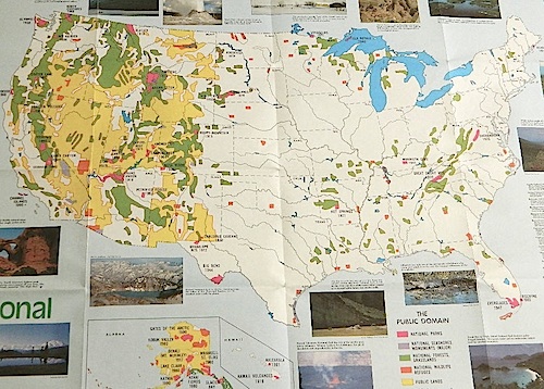
Access to wild land, open spaces, parks, forests, lakes, mountain peaks, public land – USDA National Forests, National Parks, State Parks, BLM. There is more public land available in the west half of the U.S., than anywhere else in the nation. This is one of the top reasons people relocate to the West Coast.
California’s Public Lands for Recreation
Federal lands, government managed parks, USDA National Forests, National Parks, National Wildlife Refuge, BLM, State Parks, State Forests, County Parks, Regional Open Spaces
California National Parks– most National Parks are so crowded you can’t even enjoy the experience in the summer time. Try the off-season times for your best stay. Neighboring National Forests are a much better bet for abundant space, privacy & less taxing on the wallet for fees. These popular (NPS) parks are subject to federal budget cuts and closures.
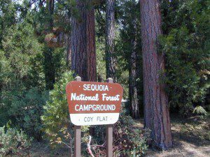
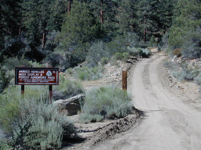
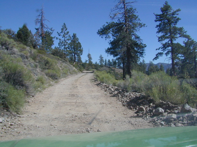
California National Forests– protected wilderness areas throughout state are surrounded by National Forests (NFS), and most National Parks (NPS) are surrounded by National Forests. Tons of small campgrounds & primitive spots for real seclusion. Get a free fire permit & camp almost anywhere you want. Use that SUV exploring the many dirt backroads & find that perfect camp spot (for free).
California State Parks – local California parks with a lot to offer the day hikers, picnicking family, tent camper or RV camper. From warm dry deserts soaking in a hot springs to the foggy coastal redwoods, these state run parks encompass a large section of California terrain. These parks are subject to state budget cuts and closures.
BLM: Bureau of Land Management – mostly desert regions on the east side of California. A few coastal redwoods, some river canyons in the Sierra Nevada, many off road areas (OHV) in various mountain ranges. These federal lands are open spaces, generally a free for all on recreation. Allowable = off roading, target shooting, open camping, campfires, bonfires. Geared toward OHV use, RVs and hunting.
Coastal California – Southern California beach camping is crowded & sparse, because of developed cities. Central Coast & Northern California offer many more choices in this category.
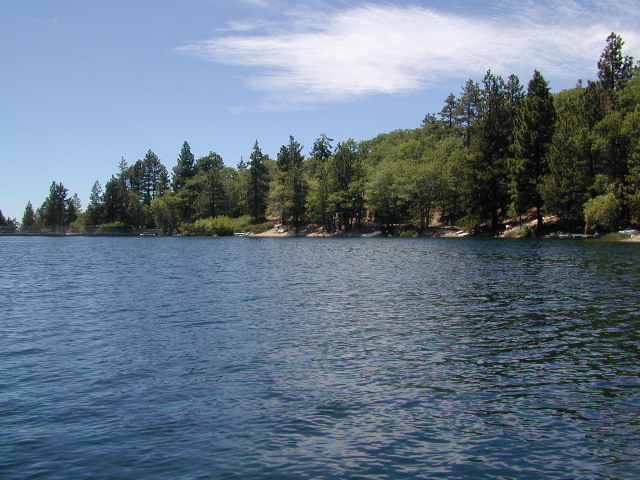
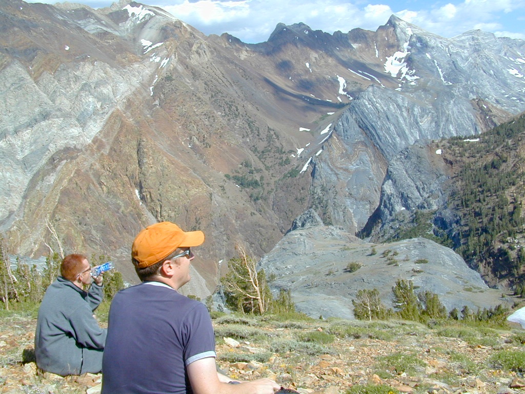
California Mountains – pine forest, mixed oaks & a variety of vegetation. Water sources such as lakes, stream & waterfalls make this choice the perfect camping spots. Granite peaks, high elevations wilderness areas throughout state & surrounded National Parks. Plenty backpacking options & dirt road primitive spots for the ultimate in privacy.
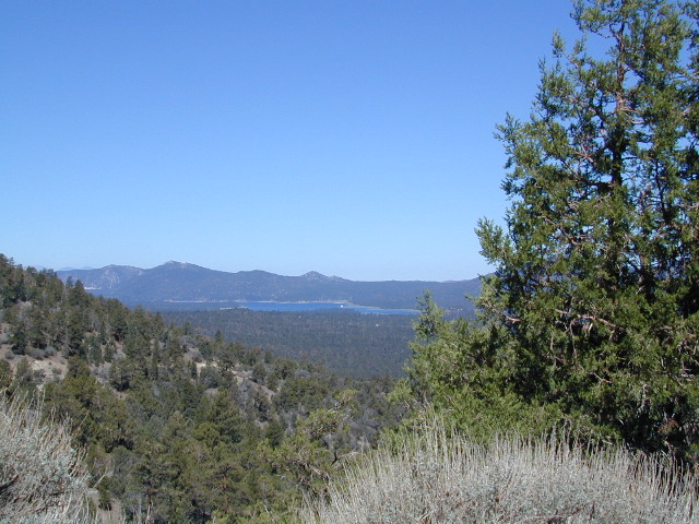
Countryside in California – coastal hills or mountain foothills. These rolling hillsides offer small creeks, oak trees & plenty of wide open spaces. Lakes & Reservoirs are located within these regions. Most campgrounds are fairly close driving distance to towns or cities. Wine country or gold country, California has it.
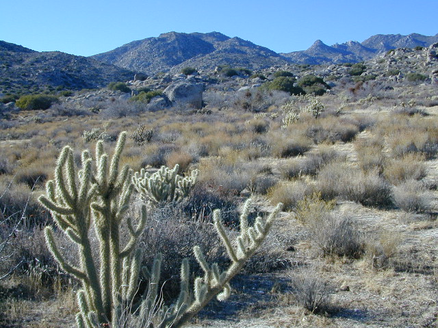
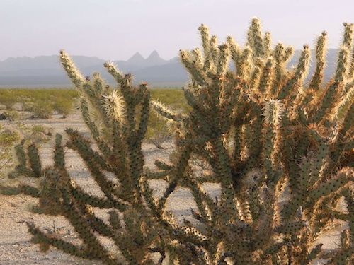
California Deserts – perfect for every season except summer, these vast spaces will humble just about anyone. Primitive camping galore & designated areas for real off-roading.
City CA / Urban Villages – not the best for really getting away from crowds, but can be an excellent opportunity to visit a city without spending big bucks on lodging. Or could just be a perfect one-nighter for getting familiar with camping. Most campsites are located in the foothill area behind suburbs, in county parks or even coastal.
California A to Z: Small Towns – 700 and counting; extensive list of destinations, focusing primarily on the back roads and outdoor recreation hubs
California by County – Find every county on Cali, and which towns are located inside of them
Small campgrounds and secluded camps, accessible by dirt bikes or 4-wheel drive vehicles. Numerous dirt roads, sand dunes and canyons to explore, some with developed campgrounds, other areas w/ primitive camping. Self sufficient campers will enjoy this list.
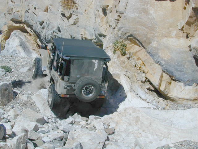
4×4 camping in California
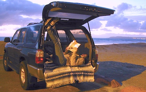
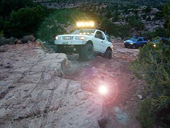
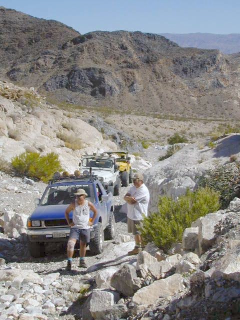
Okay, you got your 4 wheel drive vehicle dirty, it is now several years old & maybe you even have a scratch or two. Now is the time to finally start using that beast for real off road adventures. The real edge-of-wilderness trips you dream about when your sitting in your cubical wondering what life is really about. Fishing, camping, off roading and enjoying nature, of course!
4×4 camping in California is plentiful. California has trails for OHV use – which means ‘off highway vehicle’, that can accommodate your machine. These remote camps are always primitive camp sites, with picnic tables, fire rings & maybe a pit toilet (if you are lucky). You can find total seclusion on these back roads & trails, well away from the developed campgrounds & RV parks.
Anza Borrego Desert 4×4 Trails – pretty much everywhere in Borrego desert is off road heaven. Minimal pavement and maximum desert means dirt roads galore, white sandy washes, slot canyons, badlands, wind caves, wildflowers, petroglyphs, boulder outcroppings, old railroad trestles and so much more. The San Diego desert elevations range from near sea level to 4000′ on the eastern slopes of Laguna Mountain.
San Bernardino National Forest – has a few trail camps for 4×4 enthusiasts. John Bull Trail (near Holcomb Valley) has one real awesome camp spot with great views over the desert night lights. Holcomb Creek Trail also has a few spots near the creek. Overall this area is somewhat crowded for wheelin’ (especially on the weekends), as the population is so dense nearby.
Los Padres National Forest – the most 4×4 camping, readily accessible to Southern California. This is truly the best kept secret for Angelinos wanting an escape. The southern portion of the forests has Tecuya Ridge #9N22, with several camps only minutes from I-5. Cherry Creek 4×4 Camp, with a few other campsites tucked way back in there. Dome Springs Campground is located off Lockwood Valley Road, while Nettle Springs Campground is over near Highway 33.
Out west, Cerro Noroeste Road has the Blue Ridge w/ Marion and Caballo Camps. Red dirt high desert wash Quatal Canyon #9N09, is right next to the Chumash Wilderness.
2 OHV parks in the Los Padres Area: Hungry Valley & Ballinger both serve the off road crowds and have ample facilities, large camp spots to accommodate RVs and trailers.
The northern section of Los Padres (near Big Sur) has plenty of dirt roads & primitive camps, but none are truly 4×4 routes, as most can be accessed easily with a passenger car. See more on Big Sur Camping and Big Sur BackRoads.
Sequoia National Forest– Southern Sierra Nevada area has 4×4 camping right along the Kern River @ Keyesville, at the junction where Hwy 178 meets Hwy 155. Also, further up the river, Forest Rd#22S82 leads to primitive Camp 4, where there are several spots near granite pools, that can only be accessed by 4 wheel drive. The Big Meadows area also has some gorgeous forested back roads worth exploring. Kern Plateau has hundreds of miles of OHV trails near Troy Meadow.
High elevation Monache Meadows is a prime fishing & hiking destination on the south fork of the Kern River, accessed by an authentic “Jeep Road”.
Sierra National Forest– central Sierra forest has plenty of 4×4 routes that lead to granite rock gardens & mighty fine, secluded, forested camp sites. Gorgeous Red Lake & Coyote Lake are popular spots that require some technical skills & much patience to access. Both are frequented by fishermen & horses. Bald Mountain trailhead has awesome creekside camps on Rock Creek. Up near Wishon Reservoir is the dead end trail of Spanish Lake. Onion Springs Meadow is awesome back behind Edison Lake. Near the granite wonderland Courtright Reservoir is the infamous Dusy Trail signed #28E34 (aka #7S32, the Dusy Ershim), second only to the Rubicon Trail for high Sierra granite.
Stanislaus National Forest– camping in the Crandall & Niagara Creek OHV section of the forest, right off Hwy 108. Elevations range from 5000′-7000′. Higher up on the other side, Levitt Lake (access road near Levitt Falls) on the east end of the mountain range, east of the Sonora Pass sign.
El Dorado National Forest – has an area called Rock Creek for off roading in the Gold Country. Plus the ever popular Rubicon Trail starts hear (near Georgetown) & leads 20 miles across the High Sierra Nevada granite slabs to Lake Tahoe. Tons of camping back here in the National Forest.
Lakes Basin Recreation Area – Northern Gold County, just above the Yuba River. Gold Lake has many campable lakes. The area sees a lot of snowmobile traffic during winter snows, but warmer months are the time for fishing and camping. Most of the big lakes have small developed campgrounds, some are minimal, or primitive style camp sites on dirt roads without facilities. Maybe a picnic table at most.
Smith Lake is a place that fishermen and 4×4 enthusiasts love. It is small, secluded and kinda hard to find. You’ll need a good topo map of the region. Situated on the border of Tahoe and Plumas National Forest off the Gold Lake Hwy (aka Road #24). The PCT cuts thru this Lakes Basin area w/ Sierra Buttes There are dirt roads and off road trails leading deep into the backcountry from the Packer Lake and Gold Lake areas. Snag Lake is a free camp right on the main road.
Snake Lake Campground has numerous dirt roads and trails leading out to Butterfly Valley. Horse campers use this popular camp spot, so no loud vehicle activity inside the campground. No shooting up the bear locker either!
Milsap Bar is a long, narrow 9 mile dirt road which leads from Bald Rock Road in Berry Creek, down to the Middle fork of the Feather River. NFS Campground on the big river without fees!
China Gulch Road #60, a very long and winding dirt road, leads from Oro-Quincy Highway down to the Little North Fork. Although the NFS Campground is closed due to a landslide (1 mi before camp) there still is primitive camping at the second bridge. Be warned: the campsite at the first bridge is often over run with giant, juicy slugs at night.
Out there east of Quincy, somewhere off the historic, long and winding La Port Road, a few decent 4WD trails thru forest, access ridge lines or the big river below. Great fishing, amazing scenery & very secluded.
(north of La Porte Road)
– Feather River access
@ Cleghorn Bar Campground, 4 campsites (Road #23N24)
@ Stag Point Campground, 5 campsites (Road #22N80Y)
@ Hartman Bar NRT to Dan Beebe Camp (Road 94 to #22N42Y)
(south of La Porte Road)
– Poker Flat Camp near Sawmill Ridge & Table Rock (Road 800)
Sly Creek Reservoir is a super popular NFS Campground with trailheads and dirt roads leading deeper into the forests. The camp area is a favorite amongst the off roaders and dirt bikers that migrate up to the mountains for the weekend, to escape from the heat of the summer in the Sacramento Valley. LGVR is another body of water back in these parts and is more scenic and peaceful than the Sly Creek.
This coastal range is dirt road heaven, graded dirt roads, ridge routes, hiking trails, equestrian trails, big lakes, small lakes, creeks, meadows, forests, wilderness and 4×4 routes. Snow can be the most fun and challenging for the 4WD crews. Mud, snow, some road closures seasonally.
2019 WILDFIRE: Ranch Fire – wiped out most of this area. South of Snow Mountain Wilderness, plenty off road trails leading to peaks and ridge lines. Numerous small campgrounds to choose from, trailheads everywhere, acres and acres of wild mountainous areas, and a lake resort nearby. Lake Pillsbury is kinda the center of all the 4×4 action in Mendo.
Fouts Springs – Numerous NFS Campgrounds catering to the off-road types a portion of the year, but mostly quiet other times.
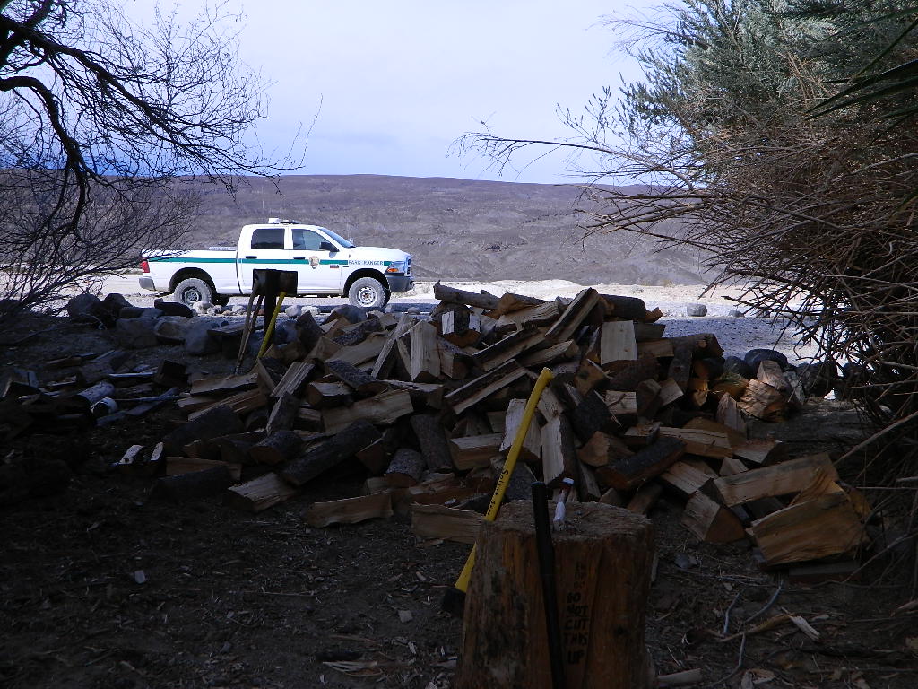
Heart Bar to Big Bear Lake, via the dirt road
San Bernardino National Forest
Big Bear Back Roads
Highway 38, East of Heart Bar @ Road #1N02
Southern California
alt big bear
This 8 mile long forested, dirt road begins right off Hwy 38, just east of Heart Bar Campground and is an easy turn to miss. One tiny, brown sign is all that is found (on the guard rail). Driving too fast, you are bound to miss it.
The unimproved route heads north through the National Forest, up and over and around SugarLoaf Mountain (elev 9952′), then down to the Big Bear Lake region.
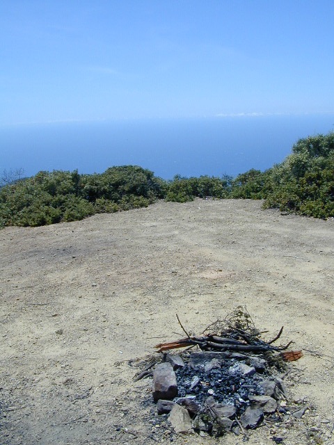
Several primitive sites – yellow post camp sites – can be found way back in here, but you might NOT be able to have a campfire (depending on fire restrictions). Check w/ local rangers before you head out.
Forest roads are often closed (gated) during the winter, when snow and rain make a muddy mess of the terrain. Rock slides are also common in wetter months. Call the local rangers to inquire on road conditions or if this route is open.
The whole Big Bear Mountain area is a SoCal favorite forest destination, for weekenders and travelers alike. Mountain biking, hiking, backpacking, horseback riding, camping and 4-wheeling.
Plus the recreational lake is full of more water recreation w/ tourist shops and restaurants. Stay away from the crowds and take the back roads for adventure and recreation. Spend less money, stay outta town and camp for free.
Tucked way back in the granite high elevations, near Donner Pass is a wilderness water flow called Canyon Creek. Connecting small lakes and big reservoir, this creek is part of the Nevada District water supply. The Sierra Nevada region is Tahoe National Forest and the terrain is abundant rock.
Campground is perched on the edge of rock overlooking the impressive whitewater; sounds of crashing water at certain campsites is deafening. Half of the campsites are located in a forest loop and the rest are out in the open, with much granite and fewer trees, perfect for star watchers.
Canyon Creek California
Lake Faucherie is a mile up the creek and Sawmill Lake is a mile down stream, so it’s a great fishing location, as well as hiking, kayaking and canoeing destination. The Pacific Crest Trail (PCT) is also routed close by. A hiking trailhead at the north end of Sawmill Lake leads to a loop hike of small lakes.
roughest roads in the region
Campground loop is paved, but the 12+ mile access road is NOT.
Twenty plus miles of paved & gravel backroads in boulder-hopping bliss, leads to granite lined lakes and forested campsites. Two different driving routes into this canyon:
One is the longer way Road 18 – paved access off of Gold Country Highway 20, which becomes an 8 mile long, rocky, rough, one-lane road around Bowman Lake.
The other is slightly shorter, county road #843 that comes in the back way from Jackson Meadow Reservoir (off Hwy 89, N of Truckee).
Both of these primitive roads join at Jackson Creek Campground, a favorite among off-roaders.
Canyon Creek Campground is another few miles up Road ##843-037, a rugged canyon route towards Lake Faucherie, where the road comes to a dead end.
Don’t let the old maps fool you: these National Forest Roads are labeled as gravel roads, but boulders and rock slides are quite common. 4×4 would be nice, but high clearance is recommended.
Minimal signs designate trails, roads and lake access; What signs that do exist are old, faded and broken. No warning signage reading ‘high clearance’ or ‘4WD recommended’ – so obviously Tahoe NF won’t be installing new signs anytime soon.
backpacking
camping
canoeing
fishing
hiking
kayaking
stargazing
Faucherie, Sawmill and Bowman Lakes are all along this waterway called Canyon Creek.
National Forest Campground Latitude: 39.436863 Longitude: -120.579564
Canyon Creek Campground
• Elevation: 6600′
• Number of Sites: 20
• Toilet: Vault
• Vehicle Access: High Clearance Vehicle, no trailers
• Campsites Reservation: No
• Camp Fee: No
• Length of Stay: 14 Days
• Season: June – October
• Trailheads: Faucherie & Sawmill Lakes
• Managing agency: Nevada Irrigation District
530-265-5302
Canyon Creek Campground is an excellent campground for staying away from the crowds, which seem to focus more around Bowman Lake & Jackson Meadows Reservoir.
All campsites at this campground have steel bear boxes – for proper food storage in black bear country.
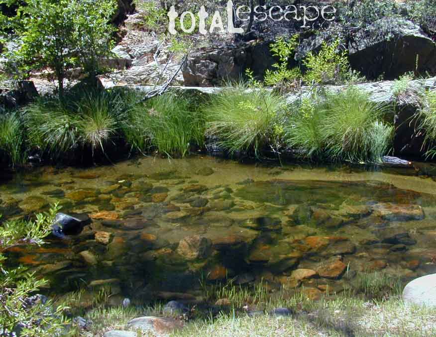
Prefer camping outside of developed campgrounds? then the primitive camp sites that line Canyon Creek will be a welcomed surprise. Most are clearly marked with small signs and some may require 4×4 to access. When fire restrictions are tight, campfires are only allowed in the developed campgrounds.
Clear cool stream waters flow from snow melt at 10,000′ elevation, down to these pristine camps at under 4000′ on both sides of the Sierra. The further you drive up the mountain, the better it gets. Where the Eastern Sierra side tends to be more dramatic desert like with sage brush, the western range is much more lush with ferns & dense trees.
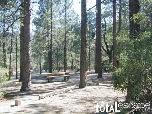
Everyone dreams of it. The perfect camp, along the creek. Maybe a waterfall or two, a shady hammock spot & plenty of trees, a flat tent spot, maybe a view. A big, sturdy, rock fire ring (without a bunch of broken glass in it).
This dreamy camp isn’t only in your imagination, nor is it at the local county campground a few miles from home. This kinda beauty & rare finds are out there, deep in the back woods, the mountains. You gotta know where to look & what to bring in order to have a good, easy, relaxing time.
These secluded sites really are around in your favorite forest, way back there. Best of all, they are free.
Having the opportunity to camp in your very own private, secluded spot, along dirt roads, outside of the annoying rules and fees of a developed campground is a privilege. Use these lands wisely and be a responsible camper. Camp eco-wise! Respecting the land, knowing some basics and following fire safety precautions is all mandatory. A topographic hiking map or a National Forest map is optional, but highly recommended.
Creek water can make an easy refrigerator if the cooler is full. Chill that bottle of wine, keep the watermelon cool .. just don’t forget about it. (cuz that kinda litter maybe a welcomed good surprise for the next camper.) Secure your wet creek valuables. Even a heavy watermelon can float! Put some rocks around items or tye them in a mesh bag, with rope, something to keep them from getting away in the swift water.
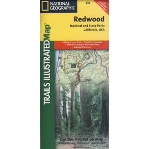
There is nothing that beats a good detailed forest map of where you are going. If you are the type of person who can never make a straight B-line for home on Sunday afternoon, and find yourself wandering just for the sake of wandering – then it’s best to have a larger state wide map like this beauty from Benchmark Maps.
If you are the kinda sport who can really rough it, you may learn to love it. After your first real back woods camping experience, the privacy, serenity and beauty of the land will inspire and relax you so much, that the drawback on the lack of toilet won’t bother you.
Make a new hobby of learning how to stay away from the crowds. The less cars you see at camp, the better. Learn to be immersed within nature and enjoy your space outside. Unwind, next to the creek in the shade, with a chair and read for hours, or bring the sketchbook, or just daydream as butterflies go floating by.
Remember to be camp clean, California is black bear country.
capable vehicle – SUV or Truck, high clearance is best. 4×4 is NOT required. AWD wagons should be more cautious when venturing out on the back roads. 2WD is fine for most graded dirt roads, but way out exploring dirt roads, deep mud and snow is quite possible.
destination – Pick a locale. A general area you wanna check out. Not a quickie overnight deal, but an enjoyable lazy multi-day camping trip.
exploration – Narrow down a canyon or river that you have always wanted to explore. The Sierra Nevada & NorCal is the place to concentrate your efforts, as SoCal is near desert climate w/ way too much development.
The more homework you do before hand, the better chances of finding that secret camp spot, especially on holiday weekends. Go ahead & call the forest rangers. Have your decent topo maps handy, along with pen and paper. That’s what they are there for. Have a list of questions on specific areas you want more info on. If you do the prep work well in advance, it makes a more enjoyable camp trip. Cuz you’ll be less worried about finding the ultimate places (before dark, or before the other guy does). With your new profound Wilderness Vision, you will have not only a plan B ready, but a plan C as well.
what to look for:
getting permits – If you really wanna camp like this, all secluded on the dirt back roads without the hordes of other campers nearby…. you’ll need a capable vehicle, a camp fire permit & the understanding of the concept “totally self sufficient campers”. This means bringing your own water, a bucket, a shovel, maybe some firewood, plus packing out all your own garbage, plus any litter left over by the last campers. It’s the least you can do, not having to make reservations. Visit the FireSafe page
it’s on your map – After you have a general area narrowed down, some place you always wanted to go, then it’s time to get your maps out & start reading them. Or at least staring at them – maybe over a meal, whenever you have free time to study it. Look for dirt roads, the further off the paved roads is not necessarily the better. Some of the best camp sites are within a few short miles from the pavement, so get them maps out & start visualizing.
gas up – Make sure you fuel your vehicle before you head into remote areas (like the ones we are mentioning). Maybe even an extra can of gasoline too, just in case.
the blue lines – You’ll know a decent road when you see it. When you start planning at home, you need to concentrate of what dirt roads are along what water sources. And will these streams be flowing at this time of year? Many are seasonal creeks & can dry up in summer. The most likely place to find great water flow is to look for the streams flowing directly into a major river or Lake/ Reservoir.
Are you willing to clean up your camp, before & after, leaving it pristine?
Yes indeed, it is free to camp outside of developed campgrounds.
Mount Pinos Fire Circle Camp SpotGold Hill Campground (which is now closed) – right next to Piru Creek.
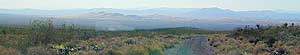
Frazier Park and neighboring towns, like freeway-close Lebec and Gorman, is where the Los Angeles hills meet the Kern County mountains. Mojave Desert meets to Coastal Range. EXIT I-5 @ Tejon Pass (elev 4144′)
Wildflower hills, seasonal creeks, forested peaks, high desert canyons. Bike trails, hike trails, off road routes. High elevation backpacking, hang gliding, mountain biking and camping in every direction.
Mountain Bikers love the trails at Mount Pinos.
High desert washes, oak creeks, pinyon pine forests, mountain meadows and numerous peaks – Frazier Peak, Reyes Peak, Alamo Mountain, Mount Pinos, Mount Abel (Cerro Noroeste) and north facing San Emigdio ridge.
Many dirt roads are gated seasonally for wet weather or snow. Call rangers to find out which routes are open before you plan your weekend. Or have a plan B and C camp site ready if route is closed. Flashfloods, thunderstorms, and erosion means you may all-of-a-sudden need to use your 4WD. This is the mountains after all. UNpredictable weather is common.
Primitive Camping in Quatal Wash, next to the OHV Route and the Chumash Wilderness
Peak-to-Peak Hike: the toughest climb you’ll do, this decade.
Canon Sin Nombre – Anza Borrego
Mud Caves and Slot Canyon Hikes
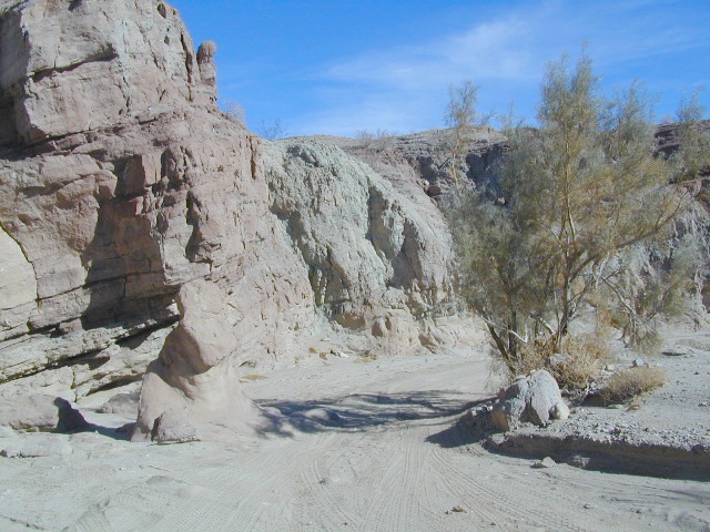
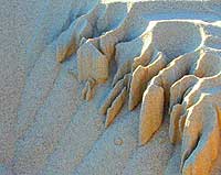
Desert Slot Canyons – South Anza Borrego State Park region, just off County Road S-2 east of the ‘badlands overlook’ view point is a whole network of narrow walkways & skinny canyon trails to explore. Some are so tight you have to turn side ways to fit through. There are more than one of these sandstone topless caverns. Finding a new one each time you visit is a fun challenge. Just north in the Diablo canyon there are dry mud tunnels & trails as well. Explore & be careful not to get lost. And don’t camp at the canyon openings during the threat of heavy rains…duh.
Drive down steep, sandy road into Canon Sin Nombre entrance (the dirt road just to the north of Badlands Overlook). A high clearance vehicle is recommended and 4WD may be required in soft sand. 2WD SUVs/trucks should keep their speed up through the soft sandy areas & try not to turn or stop suddenly. Go slow in narrow sections of the canyon & slow over the rocks to save your oil pan.
Clock your mileage 1 mile exactly from the paved road (s2) & park out in desert wash, pull over between the smoke trees. Hike over to the left side & look for an opening in the canyon walls to a deep secluded trench. A campsite may exists here.
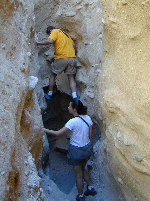
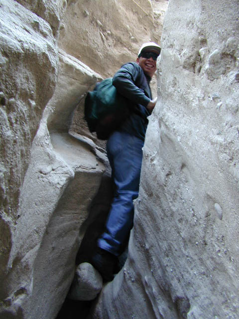
Hike up the first canyon which does require some rock scrambling. The gorge lets you out at the very top with an impressive view over the Sweeney Pass area. The canyon walls are so tight in some spots you may have to turn sideways to fit through. Upper body strength is needed to climb high ledges & boulder scramble through this natural maze.
Once on top, wander on the ridge & check out the views; keeping to the right & then follow the next wash down to start the much longer & easier exit. Hike down in the main slot canyon which leads out to a big camp site & clearing. Exit slot area and turn right, walking back to the vehicle in the big wash.
This particular hike is a blast on a full moon night, but not for a first timers try.
Best time to visit: October – April
HIGH CLEARANCE VEHICLE access to reach trailhead. Moderate hike, boulder scrambling w/ dangerous mud walls. Flash floods here are possible during rains.
Plenty of 4×4 roads, SUV trails, & box canyons in the desert region.
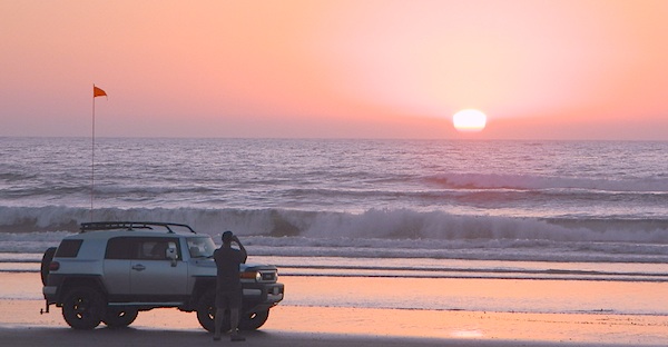
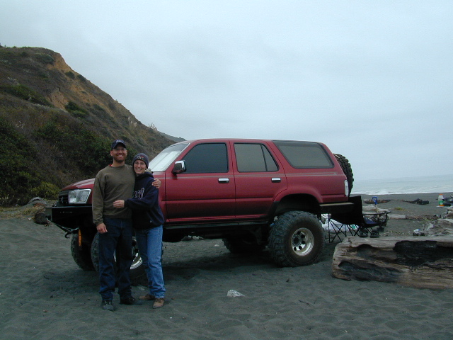
Gone are the days of ‘beach blanket bingo’ where film crews glamorized California – the beautiful people, the nice vehicles, the sport of surfing and the glorious beaches. There are very few places left on the California coast that you can actually drive a vehicle on the sand, right next to the ocean. The military bases, oil corporations and the utility companies have the front row seats to the Pacific genocide, and the rest of the population is restricted with extreme limited access.
Baja California has minimal regulations on coastal access with a car. No pavement, no signs, no cell phone signal, and no help for miles – something to consider if you get stuck south of the border in Mexico. Baja has numerous places to explore below Ensenada, but asking locals is always a favored approach. Pay attention to private property signs and always close the cattle gate (if you found it closed).
Southern California, no beaches allow vehicle traffic. San Diego offers a sliver of sand @ Silver Strand SB, which is a developed campground for motorhomes and car campers, located right on the beach south of Coronado, CA. Fiesta Island in Mission Bay, San Diego allows driving on sand and a favorite among active dogs, but not camping is allowed. In Los Angeles you can park a motorhome at a sandy, paved campground for a hefty overnight fee. Dockweiler Beach, right near the Chevron plant and LA sewage treatment facility. Sounds delightful, not.
Ventura & Santa Barbara Coastal Regions have many awesome State Beaches, but none allow vehicles on the sand.
Central Coast California:
Oceano SVRA – off road sand dunes and open camping on the beach. Day use or overnight camp fee required; near Pismo Beach, CA
Red, White and Blue Beach – nude beach w/ campground (now closed); north of Santa Cruz, CA
Northern California:
Lost Coast
Usal Beach Campground – redwood creeks and forests meets coast and cliffs. Camp fee for overnight use. Long dirt road access. No RVs!
Black Sands Beach (OHV 4×4 trail, now closed to all vehicles) near Shelter Cove, CA
after-the-fun maintenance tip:
Salt water and sand is very corrosive to metal – which will rust your truck or car badly. Now that you’ve had fun on the beach, we remind you to clean the underneath of your vehicle ASAP. Spraying powerful hose in your wheel wells and all underneath the vehicle. You might need to lay on the ground and get wet to do this job properly. Some car wash places might be able to do this service for you, but it will cost ya.
SOUTHERN CALIFORNIA MTS:
Big Bear Area Camping; Crabflats is on dirt road – Road# 3N16
North of Green Valley Lake, off Hwy 18. Between Big Bear Lake & Lake Arrowhead, California.
OHV trails abundant in this region, so expect some 4x4s, dirt bikes and engine noise. Looking for peaceful camp, try Heart Bar Camp.
Crab Flats Campground
• Elevation: 6,200′
• Number of Sites: 28
• Camping Reservations: Yes
• Sites Available: 3 first come
• Vehicle Accessibility: RV 15′ max
• Length of Stay: 14 Days
• Water: No Piped; seasonal creek iffy
• Toilet: Vault
• Season: Open APR-NOV
• Fee: Yes
• Operated By: National Forest Service
• Closest Town: Lake Arrowhead, CA
San Bernardino National Forest
Big Bear Discovery Center
Big Bear Lake, CA
909-382-2790
When people hear the phrase “off road” a hundred things can come to mind. Granola types envision rednecks, guns & beer cans tearing up the wilderness; while teen boys may like dirt bikes or motocross races; your co-worker digs the rock crawling rigs (on TV); your lesbian pals like to do desert & ghost town exploring in their Jeep & a million families like to camp out with RV & toys in tow. The quads, the sand rails, the rock crawling machines, the custom built buggies. Trophy trucks, rally racing Subies, 4WD camper vans, dirt bikes, the standard stock SUV, some w/ 4-wheel drive and who can forget the ever-freaking-popular jeaps. Sunday drivers sightseeing or hard core dare devil racers can be found in the realm of off-road: Off pavement.
They are ALL off roaders! And they are all unique, custom & no two created equal. There is certainty of it & the passionate fans will tell you. The off roading interest has gained popularity as more & more recreation vehicles become available to the main stream market. And TV shows promote these awesome rigs, the sport of dirt racing, rock crawling & the fantastic terrain. (And if you still watch television, that will soon change!)
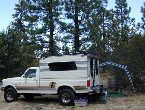
Baby boomers seek retirement vacations: compact 4WD camper vans, or smaller RVs capable of trailering an off-road machine; Fathers look for ways to entertain family out of doors, or escape on solo trips (for sanity sake). The off-road sport and interest has literally exploded over the past 20 years w/ media, hobby, competitions & after market products – along with the rising gas & tire prices.
Plan better trips, learn to really read a topographic map, depart for your trip over-prepared and find new, amazing destinations all over California. Use Total Escape often and get a bumper sticker for your rig!
Many folks drive dirt roads just to get to a trailhead and go hiking, mountain biking or rock climbing. Many backpackers trailheads are indeed located miles off pavement on forest dirt roads.
Some outdoor enthusiasts crave seclusion: peace and quite, away from city life, city folks, all noise… well away from the crowds. Preferring to camp outside of developed campgrounds, which means free camping (mostly on dirt roads). Campfire permits are always required. Many excellent, hidden camp sites can be found on rugged, unpaved back roads – some requiring 4 wheel drive, others not.
Gear Heads: those who value ‘vehicle time’ over ‘real nature’ will literally SIT inside their rigs (almost all day) – enjoying scenery from a safe distance. Picnic spot, viewpoint, yes, but rarely ever seeking out a hike, or a waterfall. Should a break-down occur, these dedicated guys will have their heads under the hoods or crawling underneath, for hours if needbe. Always be prepared with food in the cooler.
And believe it or not, some off-roaders will not even tent camp! They do not sleep on the ground. They prefer a local lodge in the nearest small town or they could own a luxury RV (towing a trailer w/ the overbuilt Jeep). Talk about gas guzlers.
Backcountry routes may be signed – high clearance needed, or not. Black diamond, double diamond trail. Yikes 4×4 required, what! Did we miss a sign or take a wrong turn?
SIGNS are not always reliable on the back roads.
Small Signs: get shot at, run over, blown over and washed away with erosion… so best have a hard copy map (at all times).
In Trinity, locals have been known to remove forest road signs to confuse tourists and prevent traffic in certain directions. I can’t imagine why. Cough, cough, Hyampom!
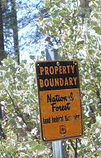
PVT – private property
This brings us to private ROADS & LAND. Just because a dirt road is located in a forest or rural region doesn’t mean it is open to the public. Generally private lands are well marked w/ ‘No Trespassing’ notices, some fenced and gated. In Baja and in ranching areas in general, public access may be allowed to pass through. Inquire at a local ranger stations for the area you wish to explore.
Litter removal 101 should be the norm; Don’t Trash California! Teach your children well. Respect the land and always Tread Lightly! Find more about ECO – CAMPING
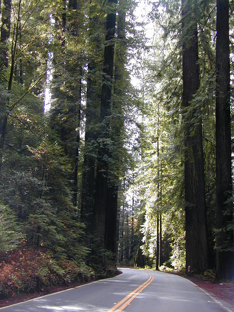
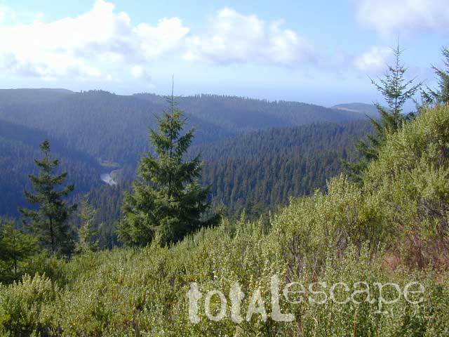
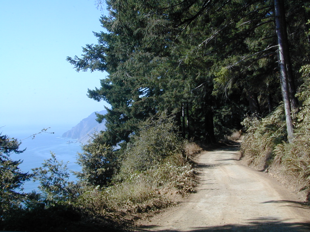
There are a few special places in California where redwood trees grow right down to the shore, but it is rare. Searching for place to pitch a tent (under the redwoods at the coast) is possible, but a bit harder to find than you might imagine. State Parks usually offer the standard paved camp site. Maybe need to drive dirt roads to find redwood seclusion.
If you are seeking free or dirt cheap, primitive camping on the coast, then LOST COAST CAMPING on the Mendocino border is one option. Or head east, inland to the abundant National Forest. Dirt roads of the Six Rivers National Forest offer old logging roads, creeks, and secluded places to pitch a tent. Campfire permits are needed for dispersed camping, or ‘boondocking’ as some call it.
Dirt back roads can get muddy during the wet season, so know your vehicles capability and if you are unsure, check with the local rangers over the phone (preferably a ‘field ranger’) before venturing out. Remember that rain and mud are the norm, most of the year.
Fog is typical of the region. Enjoy the sunshine – when you can!
California has so much land and sheer beauty, it’s hard to wrap your mind around the vastness, much less the amazing and awe inspiring scenery. Snow skiing, kayaking, horseback, snowmobile, sleigh rides, dinner cruises, beer trains, wine tasting and so much more.
Drive California top to bottom (from Shasta to Baja) and you could be looking at months of prime vacation time. If you have that kinda luxury free time. If not, you might be looking for a local weekend of adventure, cave history or sightseeing. Total Escape has been featuring California tours for decades. We have something perfect just for you!
San Diego Deserts, San Ysidro Mountains
Montezuma Grade Montezuma Highway, Hwy S-22
High desert elevations, large boulders, highway w/ primitive campground. No trees, but much vegetation; flat parking, large tent spots, picnic tables, vault toilet. High desert mountain pass, with boulders, canyons and many dirt roads to explore.
• Elevation: 3,350′
• Number of Sites: 10
• Vehicle Accessibility: all
• Campsites Reservation: No
• Camp Fee: No
• Length of Stay: 10 Days
• Season: October – May
• Trailheads: Grapevine Canyon, Pena Springs, Anza Borrego & PCT (Pacific Crest Trail)
hike highcountry borrego
Culp Valley Trail, Grapevine Canyon, Montezuma Valley, Pena Springs, San Ysidro Mountains.
Dirt roads, backroads, desert trails, OHV routes, single tracks, dunes, fire roads, gravel roads, 4×4 roads
When you wanna explore a new area, California has plenty of public land to offer. Off Road Maps can get you away from the crowds & the main staging areas. Maps can show you prime areas to ride & camp that you may not have ever imagined. Secluded, wide open, or freeway close. Terrain – the endless deserts, the mountain foothills, the higher hills , way above the city. The choice is yours.
Whether you seek secluded stream side camp sites, with some fishing or a dusty, long, desert trail that spans the entire Mojave desert, you can find these secret spots with good old fashioned topographic maps. Hard copies! The real deal. No cell signal? No problem.
4×4 Panamint Valley has numerous canyons & ridges to conquer
The most trusted full-state book-atlas that Total Escape recommends. When you must have a (hard copy) map for local road trips – Benchmark Atlas is the best one by far.
NFS, USDA
Forest Atlas: National Forest Topo Atlas
Spiral bound book of all topographic quads, of select National Forests in California.
Awesome California locations w/ off-road trails nearby. DanaMite has compiled a list of first-hand knowledge information, links, photos, campsites, maps, all revolving around rural California. Check out the ever growing list and get ready to explore the back roads, like never before.
OHV area, motor vehicle use, 4×4 camps, dirt trails, forest routes; Download maps for various off-roading areas in California.
What the heck is it ???
4WD = 4 wheel drive
4×4 = (same as above)
2WD = 2 wheel drive
4×2 = (same as above)
AWD = All wheel drive
SUV = Sport Utility Vehicle
MTB = Mountain Bike
MX = Motocross (dirt bike motorcycle)
SNOMO = Snow Mobile (sled machine)
GAS-POWERED RECREATION: The past two decades have emerged with vehicle redesigns from well known brands, creating a number of new “utility vehicles” for the sport of off-roading (otherwise known as, burning gasoline while recreating in the outdoors). Here is a breakdown on the acronyms, but they all basically refer to much of the same “off road type vehicles”.
ATV = All Terrain Vehicle (quad)
MOHUV = Multipurpose Off-Highway Utility Vehicle
ROPS = Roll Over Protection System
ROV = Recreational Off-Highway Vehicle
RUV = Recreational Utility Vehicle
SxS = Side by Side Vehicle (2 seated)
SSV = (same as above)
UTV = Utility Task Vehicle
Common abbreviations for off-road on public lands:
OHV – Off Highway Vehicle SVRA – State Vehicular Recreation Areas BLM – Bureau of Land Management NFS – National Forest (USDA) MVUM – motor vehicle use map (NFS)
PVT – private land / keep out
MTR – motorized
RD – road
CO – county
RTE – route
SR – state route
FR – forest route / road
EXT – exit
CK – creek
EL – elevation
MT – mountain
STA – station (ranger/fire station)
PO – post office
Around 2012 the National Forest Service printed up a bunch of nice off-road maps for various popular regions of California. Oddly, they told me not to sell them and I never heard anything about them again after that. Not even sure if these above are available to the public, but if you dig around you might find ’em. Call the rangers, they might know.
If interested, you could call the ranger station and ask about any local off-road maps, and availability. Mostly they have freebie one page print-outs, black & white — to keep the crowds where they want them. Other times they might have real color, printed maps for sale at the station. Maps that can get you deeper into the terrain, with wild edges of reality nearby. 4×4 maps, OHV map, MVUM
BLM Maps (Bureau of Land Management)
Government agency that manages large amounts of California land. Public lands that do not fall into the National Forest or National Park or State Park realm. BLM oversees some mountain areas, river canyons and primarily, desert regions within California. Visit a local BLM office to see the selection of area maps.
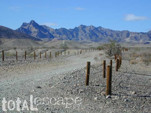
Turtle Mountain Road
Decent & FREE: dirt road maps can be found at BLM ranger station, south of NEEDLES, on US Hwy 95. Explore Turtle Mountain and find free camping IN ROUTE; Eastern California Desert.
Rumor has it this lake basin could be the ancient super volcano of the region. MonoLake is located on the north end of the Long Valley Caldera, a volcanic ridge which stretches down to Bishop and parallels Mammoth Mountain & US 395.
Huge shallow lake with a very turbulent history. Signs and plaques throughout the lake shore give info on ancient history of the lake, the wildlife, and regional detail. Majestic views of the Sierra Mountains, with sparse vegetation, lunar type landscape. Eerie with storm clouds; Beware of bad weather. Kayakers love this lake too!
Canoeing
Hiking
Hot Springs
Kayaking
Picnic Primitive Hot Springs
Stargazing
Volcanic Landscape
Mono Lake Camping
Camping is closeby, but not located on the fragile lakeshore.
Dispersed camping (FREE) is allowed in Mono Basin National Forest Scenic Area, the region that surrounds the Tufa State Natural Reserve. Campfire permits are required. Contact the park listed below for all the details on the camping policy.
Camps include National Forest Campgrounds in Lee Vining Canyon (8 miles), June Lake Loop (15 mi), Lundy Lake (12 mi). Private RV parks can be found in nearby Lee Vining and further south, at Lake Crowley.
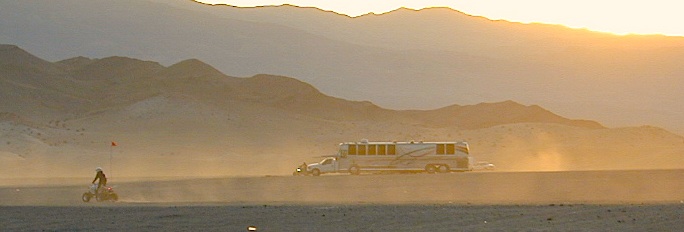
Fortunately, those places do not allow driving on the dunes, which is exactly what the off-road boys want to do. Sand flying, motors screaming, music blasting, bon fires blazing and no silence found until the wee hours of early morning.
Autumn, Winter & Spring are the busy months for ‘froaders in the deserts, since summer temps can soar into triple digits heat daily.
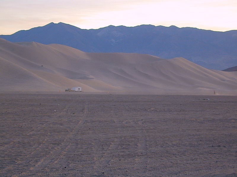
Camping out near “the dunes” is usually a big, freaking, free-for-all, outdoors with the latest in motorized toys. Recreation Vehicles encircling bonfires (camp formation for a large group), toy box haulers, trailers, families, and maybe a massive BBQ setup.
OHV (off highway vehicle) Vehicular Recreation Area
California BLM Desert Sand Dunes
Below is a list of California Sand Dunes overseen by the Bureau of Land Management.
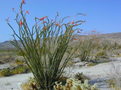
Arroyo Salado / Ocotillo Wells
Motorcycle, 4WD, ATV, Dune Buggy / Sand Rail
Located 10 mi. west of Highway 86 on Highway 78. Rolling hills and sand washes. Designated “Open Area” consisting of 4,800 acres. Adjacent to Ocotillo Wells Vehicular Recreation Area. Near Split Mountain, Anza Borrego Desert
Dumont Dunes Mojave
Motorcycle, 4WD, ATV, Dune Buggy / Sand Rail
Located 30 mi. north of Baker on Hwy 127, off Dumont Dunes Rd. Steep and tall sand dunes. Designated “Open Area” of 8,150 acres. South of Death Valley National Park.
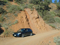
Dumont w/ the Saabaru AWD
Glamis / Gecko Road
Motorcycle, 4WD, ATV, Dune Buggy / Sand Rail
Holiday weekends = NUTS!! Approximately 22,000 acres. Located 25 mi. east of Brawley on HIGHWAY 78. Sand Dunes. Designated “Open Area” Danger: Adjacent to military bombing range. Contact the El Centro BLM
Imperial Sand Dunes / Buttercup Valley
Motorcycle, 4WD, ATV, Dune Buggy / Sand Rail
Approximately 11,000 acres. Located 10 mi. southeast of Niland on the Niland Glamis Rd. Sand Dunes are designated “Open Area”. Watch for closed area boundary at south end of area. CA Highway 78 near Brawley. Contact the El Centro BLM
Mojave El Mirage / Shadow Mountains
Motorcycle, 4WD, ATV, Dune Buggy / Sand Rail
Located 10 mi. west of Adelanto on Crippen/El Mirage Road. Dry lake Bed. Heavy use area. many non-motorized and motorized recreation – including aircrafts. Area consists of 24,000 acres.
Plaster City / Yuha Basin
Motorcycle, 4WD, ATV, Dune Buggy / Sand Rail
South side of Anza Borrego Desert State Park. 15 mi. west of El Centro. Located on county Highway S-80. Consists of 41,000 acres of rolling hills and desert flats. Military bombing range north of area is closed to entry. Contact the El Centro BLM
Superstition Mountain
Motorcycle, 4WD, ATV, Dune Buggy / Sand Rail
Located 15 mi. NW of El Centro via Highway S-8, Huff, and Wheeler Roads. Varied terrain consisting of 13,000 acres; dry lakes, badlands, rocky mountains, and sand dunes. Military bombing range north and south of area is closed to entry. Contact the El Centro BLM
Rasor OHV Recreation Area
Motorcycle, 4WD, ATV, Dune Buggy / Sand Rail
Located 45 mi. northwest of Barstow, CA on Rasor Road. Sand washes and dunes, mesquite thickets. Designated “Open Area” consisting of 22,500 acres. Contact theBarstow BLM
Rice Valley Dunes
Motorcycle, 4WD, ATV, Dune Buggy / Sand Rail
Located 5 mi. south of Rice Valley off of Highway 62. Access is Santa Fe Road. Sand dunes. Designated “Open Area” consisting of 3,770 acres. Area of little use. Danger: Contaminated with unexploded ordinance.
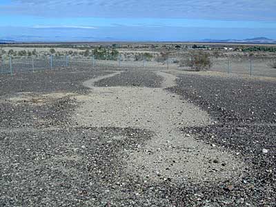
Giant figures INTAGLIOS, on desert floor, near Blythe, CA
Camping while traveling. The east-west corridors across the California deserts are well traveled routes. If you plan to camp, get to know areas managed by the California Bureau of Land Management.
BLM lands in California are often known as the ‘free camping’ option. No charge camp sites, convenient, in-route locations, many areas along major highways or interstates. Campfire permits are always required for any open fires, BBQs and campfires.
DESERT WILDFLOWERS can be found annually, February – April in most of these areas. Springtime blooms draw the crowds, but few visitors actually camp out overnight.
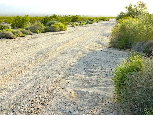
When searching out premium camp sites – drive slower than 50 mph & look for the brown recreation signs. Since people like to drive fast in the desert, make sure to put your hazard lights or blinkers on, so traffic knows you are slow poking. Typically dirt roads are only marked with small, thin reflectors, maybe numbers or letters, if you’re lucky.
Traffic noise will be minimal if you camp away from the main drag at least ONE mile or more. Motorhomes may not have the luxury to travel that distance; they often prefer to stay in large, level, flat pull outs, right near the pavement.
If daring to venture more than 2 miles from the pavement, be prepared for rough conditions. 4WD drive may be needed in certain spots, or in the wettest of weather. Wind is always a factor in desert regions, so keep that in mind. Deep sandy washes, tow strap anyone? No facilities, no services, no toilet. Spotty cell phone coverage. Basically – the boonies!
BOONDOCKING is the latest phrase for “open, free camping”
SEEKING QUIET CANYONS? stay away from the off-roaders. They usually congregate in dunes and specified OHV areas. Trails and dirt roads are for multi-purpose use, so a variety of recreation can be had. Many people use these public lands, so leave them clean and better than you found it. Boulder coves, palm gardens, primitive hot springs. There are plenty of hidden camp spots within the vast desert region of SoCal.
Several BLM lands are near Wilderness Areas. Camping is allowed close by, mountain biking & hiking are usually abundant. Off roading prohibited within Wilderness boundaries.
URLs within the official BLM site keep changing, which is why we are rebuilding our BLM pages. So you can find what you need, easily.
The mysterious topographic map maker, Landon Crumpton, is gone. Although his Baja Almanac book of the Mexican peninsula is still as popular as ever.
The Total Escape crew has been using this amazing topo map for Baja Mexico since our the very first excursions in 1990. Click below to read more about the famous, hard-to-find Baja Almanac publication.
jeepers, gear-heads, wheelers, ‘froaders, dirt bikers, anything with a motor
Here at Total Escape we love driving on dirt back roads so much, DanaMite created a whole freaking web site about it! Whether you like to “wheel” your Jeep, truck, SUV, ATV, UTV, or an all-wheel- drive sportwagon – we have the California terrain covered. Detailing the dirt – from basic gravel roads and forest routes to High Sierra rock climbing routes; Trailheads, campsites, maps and much more. Mountains to deserts and everything in between.


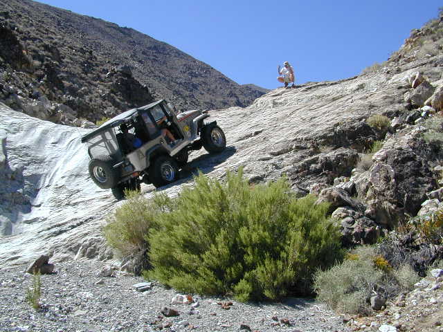
 Desert Slot Canyons – South
  Hike up the first canyon which does require some rock scrambling. The gorge lets you out at the very top with an impressive view over the Sweeney Pass area. The canyon walls are so tight in some spots you may have to turn sideways to fit through. Upper body strength is needed to climb high ledges & boulder scramble through this natural maze.
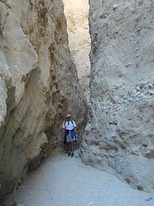


