Tag Archives: outdoors

Cheap Trips California

CA Road Trip / Staycation California / Cheap Vacation California

point reyes

Staycation: this is the newest media catch phrase for ‘traveling close to home’. Local travel in California. We know it well, cuz Total Escape has been featuring this kinda travel for over 2 decades. Right here on this web site you can find thousands of ideas for weekend getaways, honeymoons, spring breaks & summer vacations.

Spend less money, travel local, stay longer, see more, and really relax. Drive less miles & get to know your own backyard. We have everything from independent lodges in the most remote destinations, to free primitive camping sites on Sierra creeks.

woods

No amusement parks, no casinos. All California, all outside. We feature waterfalls, local hikes, swimming holes, hot springs, fishing creeks, campgrounds, museums, lakes, rivers, wilderness & most all outdoor recreation. Deserts, mountains, country, coast. Beaches to Bristlecones, we have the state covered for local travel.

A good place to start is our extensive A-Z list of all California destinations & small towns.

California Places & Vacation Ideas

California Camping Lakes

California Road Trips

California Maps & Topos

Giant Sequoias

San Diego Picnic

Picnics San Diego – Picnic Area San Diego

IBbeach


picnics

CITY & BAYS & BEACHES:

  • Balboa Park, San Diego – 5 square miles of beautiful city park with lots of gardens
  • Bayview Park, Coronado Island – Small city neighborhood park with great view of downtown skyline
  • Silver Strand State Beach near IB or Imperial Beach, S of Coronado
  • Harbor Island Park, near San Diego airport – facing SD Bay with views of downtown skyline
  • Shelter Island, near San Diego airport – facing SD Bay with views of downtown skyline
  • Mission Bay Park, San Diego, CA – maze of bay front parks & trails; picnic areas, bonfire pits, bike trails & playgrounds
  • Soledad Park, La Jolla, CA – small neighborhood park atop a Mount Soledad, great views of county & ocean
  • Presidio Park, San Diego Mission – park like setting surrounding mission w/ gardens & trees
  • Tidelands Park, Coronado Island – large park with great view of bay, bridge & downtown skyline
  • Mission Trails Park – Mission Gorge – SD river & historic dam, hiking, biking trails
  • Sunset Cliffs, Point Loma – sit on cliff edge or take stairway to beach
  • Torrey Pines Cliffs, Del Mar, CA

San Diego picnic parks

laguna mountains
View east from Laguna Mountain PIcnicgrounds

BACK COUNTRY MOUNTAINS & DESERTS:

vcampoutpinyonwsh

Maps Mountains / San Diego Maps

Camping Inyo

Primitive Camping Inyo National Forest – Eastern Sierra Car Camping

395 Sign

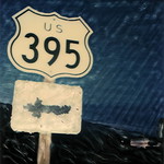
The mighty US Highway 395 runs from the Mojave Desert north through the eastern side of California, where the state line of Nevada meets. Mount Whitney and the tallest peaks run on the western range @ 14,000’+ the highest in elevation.

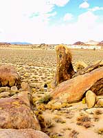
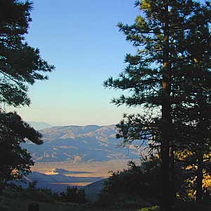
The Inyo Mountain range sits @ 11,000′ to the east side of the Sierra Nevada. Major elevations but little vegetation, when compared to it’s neighboring Sierra range. The Inyos lay in the rain shadow of the taller western mountains – but still get snow. Plenty of primitive SUV camping on the dirt roads throughout this desert area north of Death Valley.

camp sites
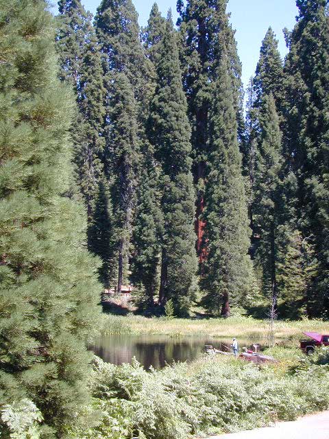
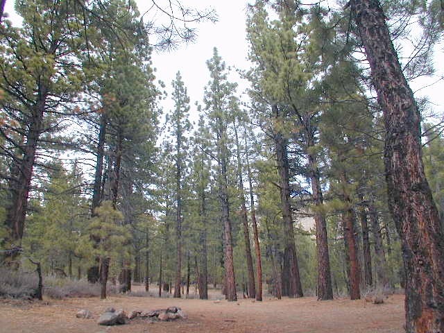
A more forested part of the Inyo National Forest is the Eastern Sierra region. Encompassing Mount Whitney & Mammoth Mountain area, plus the entire Hwy 395 corridor. This side of the Inyo National Forest is quite different that the desert range of Inyo.

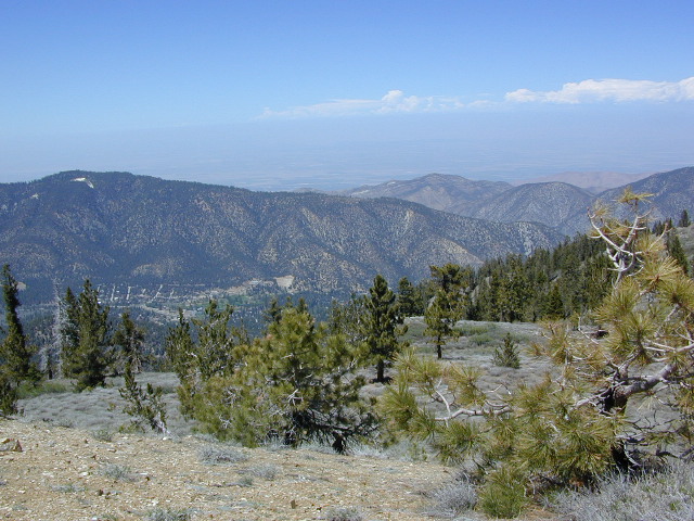
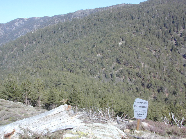
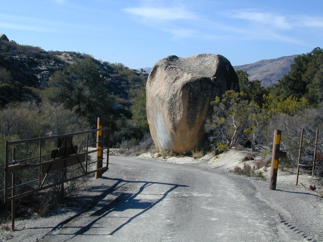
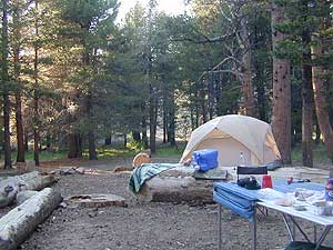
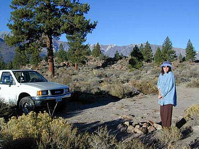
Eastern Sierra back roads lead all over the place & may require 4WD. A high clearance 2WD can still get you to some awesome viewpoints & scenery. No picnic tables or toilets are available out in the boonies, but plenty of seclusion & vast open space wilderness. INYO Forest Service Map is highly advised for this area. There are many dirt roads for dispersed primitive camping w/ no fees. See the Camping Checklist to make sure you’ll have what you need.

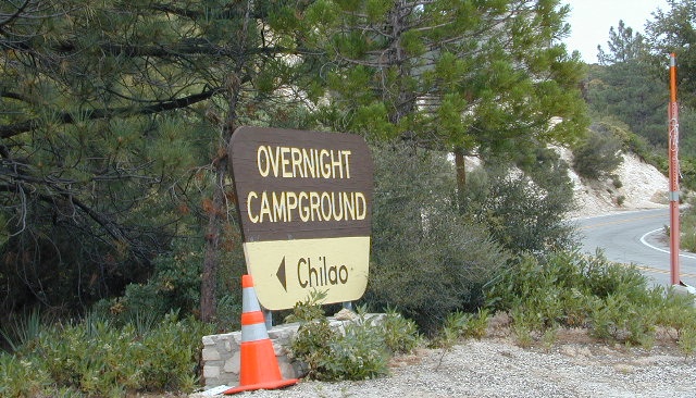
Open (free) Camping along Hwy 395

Monache Meadows – This high elevation (8000′) south Sierra Meadow is accessible by 4WD truck or SUV. Near Kennedy Meadows CA

Walker Creek Rd – quick camp in the lowlands; an easy in route camping near oaks & creek. Southside of Olancha CA, look for turn off & follow dirt road up into the tight canyon. No RVs whatsoever.

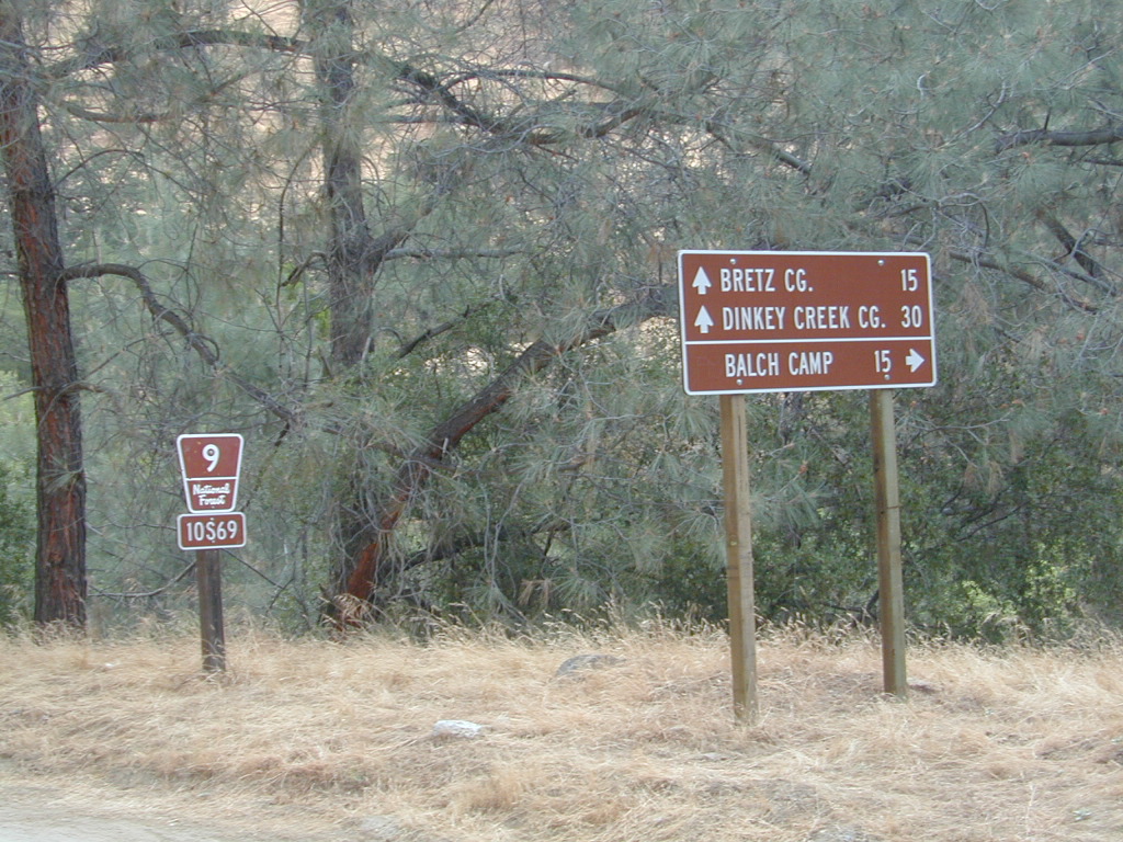
Fish Slough Road – open desert camping w/ popular bouldering & rock climbing areas; near Indian Petroglyphs. N of Bishop, CA

Road# 6S16 – Pine Creek Road – Camp on creek, no facilities. NW of Bishop behind Rovana.

Lower Rock Creek Road – signed turn off US Hwy 395. Only a couple good camp spots tucked away in the trees. Small creek, very overgrown, traffic noise minimal. Nearby Round Valley @ Sherwin Pass had a big wildfire in wintertime (dry) FEB 2015!

crowley camps

Road# 4S02 – Owens Gorge Road – N of Bishop behind Lake Crowley. Free RV camping w/ boulders & pines

Road# 4S86 – Laurel Lakes Road – Camp in aspens @ small lakes, high elevation; no facilities. SE of Mammoth

Road# 2S05 – Deadman Creek – Camp in pine forest on creek; no facilities. N of Mammoth

Road# 2S07 – Owens River Road – Camp in pine forest, near hot springs; no facilities. N of Mammoth

Parker Lake Road – Camp along aspen creeks or in pine forest, near lakes; no facilities. E of Grant Lake on June Lake Loop (Hwy 158)

Coyote Flat 4×4 Bishop – just west of Bishop CA is a 4 wheel drive paradise, Coyote Creek – This steep dirt road is quite a climb. A true off-roaders dream of open space, great views, large meadows, & alpine lakes. Great primitive camping along creeks, in pine or aspen forest or near small secluded lakes. Real remote Sierra high country, usually only reached by backpackers, is accessible to those who dare to venture off the beaten path of Highway 395.

At the golf course keep your eyes peeled — from the highway take Schober Ln. / Underwood Ln. due west through a residential neighborhood to the backside of the town. Find the electrical power station to the left at the base of the hills. Veer onto the slightly paved /dirt road to the right of the station & continue straight up the sandy wash. 4×4 is recommended, since the lowest gears are needed for the careful climb. The road will begin to get steep & gain in elevation fast. The area up here changes with the mileage: passing pinyon pines on cliffs, topping off to high meadows & aspen lined creeks, finally reaching large towering pines & small alpine lakes with snow melt still visible. Basically TREE LINE. This region is most likely open only half the year, due to its high elevation of 8000’+ and winter snow.

  • BISHOP PASS TRAIL MAP
  • INYO Forest Service Map
  • PALISADES TRAIL MAP
  • WHITNEY MAPS
  • Small Campgrounds on Creek

    Road 10S69

    California Small Campgrounds on Creeks

    campground region town
    Beaver Creek Klamath NF Happy Camp
    Grider Creek Klamath NF Happy Camp
    Trout Creek Shasta NF McCloud, CA
    Bear Creek Mendocino Ukiah, CA
    Mokelumne Eldorado NF Jackson, CA
    Dark Canyon SanBerdu Idyllwild
    Grays Meadow Inyo NF Independence
    Limekiln SP Los Padres NF Big Sur, CA
    Patrick Creek 6 Rivers NF Crescent City
    Rock Creek Sierra NF Bass Lake
    McGee Creek Inyo NF Tom’s Place
    Camp Wishon Sequoia NF Springville

    Creekside Camping in California

    HIdden Falls
    creekside cabins

    Wanna do day-trips to this kinda place, fishing or sightseeing, but sleep indoors? Then check out lodging in these fine California river towns.

    Ishi Wilderness

    Bridge and Chute from top of Black Rock

    NorCal Ishi Wilderness

    41,840 acres
    20 miles N of Chico, CA
    Lassen National Forest

    • Barkley Mountain (elev. 4488′)
    • Black Rock Campground
    • Deer Creek
    • Flat Iron Mountain (elev. 4400′)
    • Iron Mountain (elev. 3274′)
    • Indian Ridge Campground
    • Mill Creek
    • Peligreen Place
    • Pine Creek
    • Pinnacle Peak (elev. 3293′)
    • South Antelope Campground
    • Twentymile Hollow

    Up in the mountains behind Chico sits a rugged landscape of deep canyons lined with bizarre rock formations and roaring mountain creeks. Wilderness encompasses lower elevations – ranging from 1500′ – 3500′  – making this outdoor destination a winter haven, when the rest of the backcountry is covered in several feet of snow. One of the most historic wilderness areas in the state, as the aboriginal existence of the Native Americans came to an end in this area.

    COHASSET ROAD climbs up the volcanic fin of Cohasset Ridge into the pine forests high above the valley floor. The paved road becomes dirt and the road name changes to Ponderosa Way (Lassen Road# 28N29). The Ishi Wilderness can also be accessed from the north side via Highway 32, near the Tehama State Game Refuge.


    View Larger Map

    • backpacking trails
    • hiking trails
    • fishing creeks
    • horseback trails
    • wildlife viewing


    Ishi Wilderness mapIshi Wilderness Map

    Ishi Wilderness


    Eeeew Bugs

    LadyBugs

    Spiders and Bugs

    terrachula 
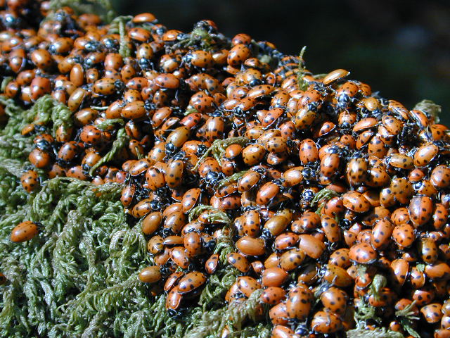
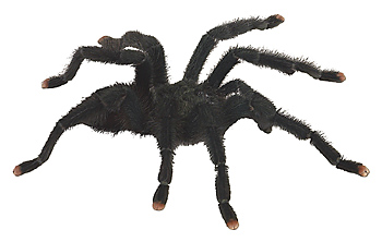
If insects are your biggest concern when camping, then consider yourself totally “spoiled rotten”. Grasshoppers, ladybugs, beetles, butterflies, dragon flies, damsel flies, bumble bees and honeybees are usually not feared, but other bugs are more frightening looking or just extremely annoying.

    Some of the most common pests you will experience in California –

    • mosquitoes (warm weather & near water sources)
    • yellow jackets (they want meat or sugar)Alabama Hills Lone Pine
    • horse flies (near coast & in the mountains)
    • small black flies (near oak groves and pinyon forests)
    • no-see-ums (tiny gnats, zip the tent up)
    • moths (@ night, attracted to lights)
    • scorpions (up to 6000′ elevation)
    • terantulas (painful bite, but harmless to humans)

    Follow these tips:

    • Do not camp near any still or stagnant water
    • Do not camp next to meadows
    • Do not wear perfumed products; the less scent the better
    • Build a small fire, smoke will keep most bugs away
    • Zip up tent door (always). Even if you’re just inside for a minute
    • Turn off flashlight before entering the tent. Moths may follow the light in with you
    • Camp in the cooler months, Spring & Fall

    HELPFUL ITEMS to PACK:Coleman Tents

    • Scented Options

      • Candles w/ citronella scent
      • Citronella incense sticks
      • Tiki torches with citronella fuel
      • Green Mosquito Coils (toxic to water sources)
    • Insect Repellent Spray

      • All Terrain Bug Repellent (non-toxic)
      • Deet is simply Poison
      • Citrus scents are effective
      • Combo sunscreen insect repellents are new
      • Avon’s Skin So Soft Lotion is well known for keeping bugs away

      Screen Room – large tent with open walls. Staking this structure down properly is key. Then park your picnic table and chair inside to enjoy a meal in peace.

      Ponds and Meadows
      Ponds and Meadows are areas in the forest where water collects, and mosquitoes are common. When the low temps dip into the 30’s at night, they usually die off.

    Chumash Wilderness

    Chumash Wilderness
    Los Padres National Forest

    38,150 acres
    Mount Pinos – 8831′ elevation
    Cerro Noroeste – 8286′ elevation
    Los Padres National Forest

    Terrain consists of high mountain peaks, badlands of Quatal Canyon Wash & Lockwood Valley; Steep slopes of forests, rock outcroppings, sparse forest areas, on border of Kern County & Ventura County. This area is sacred to the native California Chumash tribe.

    Quatal Canyon Rd #9N09

    DSCN0042Mount Pinos, Mount Abel, Cerro Noroeste, Westside Park, Hudson Ranch Road, Mil Potrero Highway, Lockwood Valley Road, East Dry Canyon, Apache Canyon, Cuyama River

    campgrounds nearby –

    The Peak to Peak Hike is a 7 mile, high elevation, ridge line day hike that traversed 2 of the tallest peaks in Kern County – Mt Pinos (elevation 8831′) and Mt Abel (8286′). Day hikes, equestrian trails, backpacking, mountain biking areas nearby. Steep, granite, chaparral, lightly forested w/ ponderosa and Jeffrey pines. From this ridge trail you have a 360 degree view over the entire region. The cabin community of Pine Mountain Club is to the north side (and IF the skies are really clear, you can see the Sierra Nevada mountain range too); Lockwood Valley & Ozena Valley are located to the south; Cuyama Valley to the west and the Tejon Pass w/ Frazier Park to the east.

    Off road use 4×4, dirt bikes, ATVs, and quads are common in Quatal Canyon, Apache Canyon, East Dry Canyon leading up to the wilderness edge. Rangers will ticket if they find you on the Chumash side of Quatal wash. The secluded yet inviting, wide, white sandy washes are just too tempting for some bad boys.

    Chumash trailheads are located

    • about a mile before Camp-O-Alto Campground (Mount Abel)
    • along lower end of Quatal Canyon Wash (OHV areas parallel)

    nearby towns –


    DSCN0060


    View Chumash Wilderness Area in a larger map

    Sturtevant Falls

    Santa Anita Canyon, Sturtevant Falls

    a day hike in the San Gabriel Mountains

    Day hikes near Los Angeles, CA

    Santa Anita Canyon, Angeles National Forest
    From the 210 freeway, in San Gabriel Valley. East of Pasadena, exit Santa Anita Ave.
    Head North/East, through neighborhood, where road becomes Chantry Flats Rd (aka, Forest Road #2N40)
    proceed up the mountain to paved parking lot @ Chantry Flat. Falls Trailhead #11W14

    • 5 miles RT hike
    • 4600′ elevation
    • steep canyon w/ creek crossings
    • falls and creek subject to seasonal dry up; water flow varies
    • backpack camping only, no developed campground


    more photos on trailhead


    View Larger Map

    Indian Flats Campground

    Temecula Camping / Warner Springs Campground

    San Diego Mountains – Cleveland National Forest

    Indian Flats Campground

    Indian Flat Campground is located on the seasonal San Luis Rey River in rural North San Diego County.  From I-15 @ Temecula, CA travel eastbound on Highway 79. Look for the tiny turn off  (on left side) for forest road #9N05, sorta near glider airport located west of Warner Springs. This poorly paved backcountry route (half dirt/mud at times) is also known as both Indian Flats Road or Lost Valley Road.

    Graded dirt road (paved in some portions) travel is approximately 6.5 miles to campground, look for gate and turn off on the left side. When you see the giant boulder near the entrance, you’ll know you’ve made it to the right place.

    Oak trees and a few pines, plenty shade, boulders and mountain scenery, this is a great small campground that is well away from everything in Southern California.  Seasonal creek-sized river and boulder waterfall often dries up in late summer. This means a wet spring is the best time to visit this camp. Hiking, mountain biking trails and hammock spots. Pacific Crest Trail access.

    Cleveland National Forest
    Palomar Ranger District
    760-788-0250

    ClevelandMap_07

    Elevation: 3,600′
    Number of Sites: 17
    Camping Reservations: None
    Sites Available: First come, First serve
    Vehicle Accessibility: Length 15′ max.
    Length of Stay: 14 Days
    Water: No Piped; Seasonal creek nearby
    Toilet: Vault
    Season: Closed for mud & snow during winter months
    Fee: Yes
    Operated By: National Forest Service
    Closest Town: Warner Springs, CA

    Indian Flat
    Indian Flat Campground Entrance

    Agua Tibia Wilderness

    Agua Tibia Wilderness Area

    • 15,900 acres
    • chaparral & oak at lower elevations
    • pine & fir forest at high elevations
    • elevations range 1,700′ – ­5,000′
    • 25 miles of trail
    • summer temperatures exceed 100°F
    • occasional snow in winter
    • best in winter through spring
    • wood fires prohibited
    • portable stoves permitted
    • water scarce
    • no overnight use of pack or saddle stock
    • groups limit – 15 people
    • visitor permits required
    Agua Tibia lies right on the RIVERSIDE
    & SAN DIEGO COUNTY border

    Cleveland National Forest
    Palomar Ranger District
    1634 Black Canyon Road
    Ramona, CA 92065
    760-788-0250

    Agua Tibia Map

    Agua Tibia Trailhead

    This is the trailhead for Agua Tibia Wilderness located at Dripping Springs Campground on Highway 79, near Temecula CA.

    See more: Agua Tibia Mountain hike details

    hiking SoCal

    Angeles Campgrounds

    Camping Los Angeles – Angeles Crest Camping

    Angeles Crest Hwy CA 2

    campground elev spots veg toilet water notes
    Appletree Campground 6,200′ 8 pines vault piped Big Pines Hwy
    Basin Campground 3,400′ 15 CLOSED
    Bear Campground 5,200′ 15 vault no
    Big Rock Campground 5,000′ 8 vault crk sm RV, 4WD
    Blue Ridge Campground 8,000′ 8 pines vault no May-Nov, sm RV
    Buckhorn Campground 6300′ 40 pines vault no May-Nov, sm RV
    Cabin Flat Campground 5,300′ 12 vault no CLOSED
    Cienaga Campground 2,100′ 12 oaks vault no May-Dec
    Coldbrook Campground 3,350′ 22 vault piped sm RV
    Cottonwood Campground 2,600′ 22 vault no
    Guffy Campground 8,300′ 6 vault no May-Nov, 4WD
    Horse Flats Campground 5,700′ 25 pines vault no April-Nov
    Jackson Lake Campgr 6,100′ 8 pines vault summer May-Dec
    Live Oak Campground 2,000′ 7 oak CLOSED
    Manker Flats Campground 6,000′ 21 flush piped sm RV
    Messenger Flats Camp 5,500′ 10 pines vault no Corrals, April-Nov
    Millard Campground 1,900′ 5 oaks vault no Altadena, Chaney Trail
    Monte Cristo Camp 3,600′ 19 oaks vault piped RV, Hwy 2, N3
    Mount Pacifico 7,100′ 7 pines vault no May-Nov
    Mountain Oak 6,200′ 17 oak flush piped May-Nov
    Peavine Campground 6,100′ 4 vault piped Big Pines Hwy
    Prospect Campground 2,100′ 22 CLOSED
    Rocky Point Camp 3,400′ 3 vault summer
    Sage Campground 3,400′ 4 vault no Cheseboro Rd
    Sawmill Campground 5,200′ 8 vault no sm RV
    Soledad Campground 2,000′ 6 CLOSED
    South Fork 4,500′ 21 oaks vault no May-Nov, sm RV
    Spring Camp 4,700′ 3 vault no Rincon-Shortcut Route
    Spunky Campground 3,300′ 10 vault no
    Streamside Campground 2,500′ 9 vault no poison oak
    Sycamore Flats 4,200′ 11 vault summer sm RV
    Upper Shake 4,400′ 18 vault no May-Dec.
    Zuni Campground 1,700′ 10 vault no

    Chilao Campground

    tunnel angeles crest

    nearby towns –

    Angeles Maps – hiking, OHV & mountain biking –

    Baja RV Parks

    Baja California RV Parks

    RV Camping Baja / RV Park Baja

    baja camping RV

    RV Camping in Baja California Mexico can be quite a challenge, especially if you do not know where you are going. Best bet is to get a good road map, and choose your destination wisely. Travel times are much longer in route in Baja than on modern US freeways, so plan accordingly. Below are some popular Baja destinations for camping, outdoor recreation, sightseeing cities, beaches & villages.