Tag Archives: peaks

Chumash Wilderness

Chumash Wilderness
Los Padres National Forest

38,150 acres
Mount Pinos – 8831′ elevation
Cerro Noroeste – 8286′ elevation
Los Padres National Forest

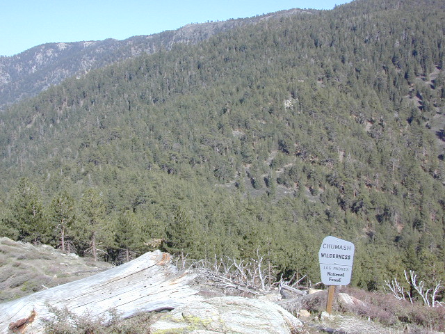
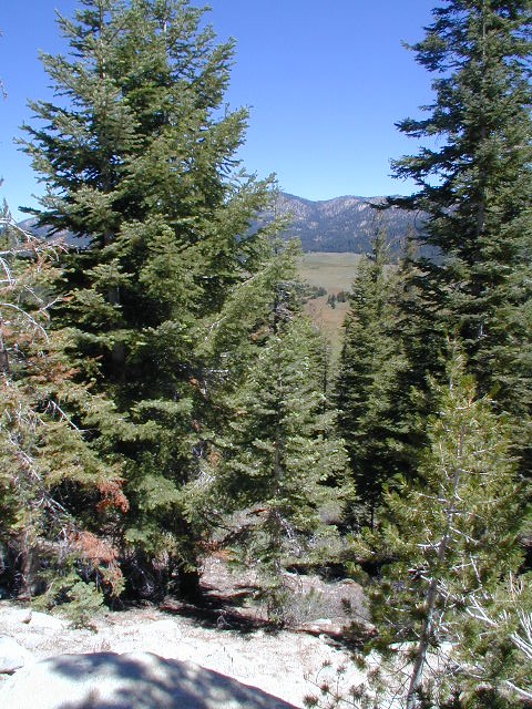
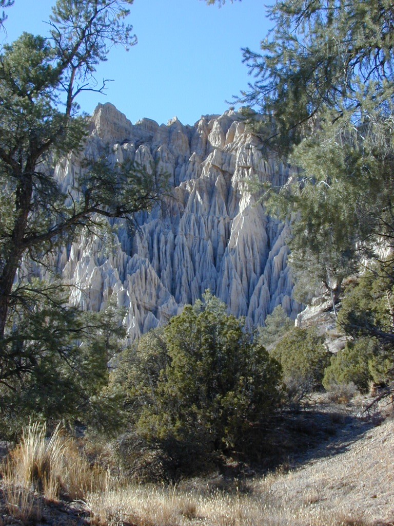
Terrain consists of high mountain peaks, badlands of Quatal Canyon Wash & Lockwood Valley; Steep slopes of forests, rock outcroppings, sparse forest areas, on border of Kern County & Ventura County. This area is sacred to the native California Chumash tribe.
Quatal Canyon Rd #9N09

DSCN0042Mount Pinos, Mount Abel, Cerro Noroeste, Westside Park, Hudson Ranch Road, Mil Potrero Highway, Lockwood Valley Road, East Dry Canyon, Apache Canyon, Cuyama River

campgrounds nearby –

The Peak to Peak Hike is a 7 mile, high elevation, ridge line day hike that traversed 2 of the tallest peaks in Kern County – Mt Pinos (elevation 8831′) and Mt Abel (8286′). Day hikes, equestrian trails, backpacking, mountain biking areas nearby. Steep, granite, chaparral, lightly forested w/ ponderosa and Jeffrey pines. From this ridge trail you have a 360 degree view over the entire region. The cabin community of Pine Mountain Club is to the north side (and IF the skies are really clear, you can see the Sierra Nevada mountain range too); Lockwood Valley & Ozena Valley are located to the south; Cuyama Valley to the west and the Tejon Pass w/ Frazier Park to the east.

Off road use 4×4, dirt bikes, ATVs, and quads are common in Quatal Canyon, Apache Canyon, East Dry Canyon leading up to the wilderness edge. Rangers will ticket if they find you on the Chumash side of Quatal wash. The secluded yet inviting, wide, white sandy washes are just too tempting for some bad boys.

Chumash trailheads are located

  • about a mile before Camp-O-Alto Campground (Mount Abel)
  • along lower end of Quatal Canyon Wash (OHV areas parallel)

nearby towns –


DSCN0060


View Chumash Wilderness Area in a larger map

Dome Land Wilderness

Southern Sierra Nevada Mountain / Domeland / Dome Lands
Kern Plateau, Sequoia National Forest

Dome Land Wilderness

130,081 acres

55 miles of trails (hiking & horseback)

Located at the southern end of the Kern Plateau about 20 miles east of Kernville, granite domes give this area its name. Domeland Wilderness is a unique geologic area with semi-arid to arid mountainous regions. Elevations ranging from 3,000′ to 9,730′ – it is surrounded by National Forest, where the Sierra mountains meet the North Mojave Desert. The Wilderness is the southernmost habitat for the Golden Trout. The South Fork of the Kern and tributary streams attract many fishermen. Vegetation is mostly mixed conifer and piñon (pinyon pine).

The Domeland Wilderness is located at the southern end of the Kern Plateau. This land was first protected by the Wilderness Act of 1964 as a 62,695 acre wilderness and was later expanded to 130,081 acres in 1984 to include the delicate transition ecosystems that meet to the east, south, and north of the original wilderness. These new additions, now jointly managed by the Bureau of Land Management and Sequoia National Forest, are rugged and dry.

Though it is considered within the Sierra range, the Domeland Wilderness includes the overlap of several ecosystems to form unique plant and animal communities. The banks of the South Fork of the Kern River offer important riparian habitats of cottonwoods and meadows which stand in sharp contrast against the characteristic smooth domes and bold granite outcroppings. Domes that range from the size of a cottage to football fields across and spear-like jagged spires can be found in the Domeland. This range is one of the driest in the Sierra with the semi-arid mountains of the north and east crumbling into desert.

Notable Wildfires: Dome Fire 1996. Manter Fire in 2000.

Dome Land trailhead locations:

East side access near Rockhouse Meadow and at the Long Valley Campground (BLM). Access is via Nine Mile Canyon Road (J41) from US Highway 395 or Chimney Peak Road (graded dirt road) via State Highway 178 , the main route that passes Lake Isabella.

West side trailheads are at Big Meadow and Taylor Meadow. Two trails from Big Meadow can be reached from Kernville via Tulare County Road M99, Sherman Pass, and Cherry Hill Roads. Leading to Manter Meadow, the upper Big Meadow Trail is a rugged hike while the lower Big Meadow Trail follows more gentle terrain. The trail from Taylor Meadow (southeast of Big Meadow) also leads to Manter Meadow. North side access is available from the Blackrock/ Sherman Pass Road via the Dark Canyon and Woodpecker trails.

dome land mapManter Meadow is popular along with other camp sites located at Little Manter Meadow, Woodpecker Meadow, Rockhouse Meadow, and in the Bartolas Country at the south end of the Wilderness.

Dome Land Wilderness Map USDA


surrounding lands & forests –

Sequoia National Forest
Ridgecrest Desert BLM

nearby towns –

National Forest & Wilderness Permits –

USDA Sequoia NF

More Dome Land Wilderness Info & Links –

sierrawild.gov/wilderness/domeland
summitpost.org/domeland-wilderness
Dome Land Wiki

Mokelumne Wilderness

Central Sierra Nevada Mountains, California

Mokelumne Wilderness Area

topo mapsMokelumne Map

Mokelumne (pronounced moo-ka-la-mi)
Backpacking, Camping, Fishing, Hiking, Kayaking Mokelumne River / Mokelumne Fishing / Mokelumne Trail / Mokelumne Wilderness Topographic Map

Vast alpine ranges located in the middle of the Sierra Nevada, between Highway 88 (Carson Pass) & Highway 4 (Ebbetts Pass). The Mokelumne Wilderness is a 105,165-acre federally designated wilderness area located 70 miles east of Sacramento, California. It is within the boundaries of three national forests: Stanislaus, Eldorado and Toiyabe. First protected under the Wilderness Act of 1964, the Mokelumne’s borders were expanded under the California Wilderness Act of 1984 with the addition of 55,000 acres. The wilderness takes its name from the Mokelumne River, which was named after a Mi-wok Indian village located on the riverbank in California’s Central Valley.

The wilderness encompasses an area of the Sierra Nevada mountain range between Ebbetts Pass to Carson Pass. There are two sections separated by the Blue Lakes Road and an Off-Road Vehicle corridor. Elevations range from 4,000′ to 10,381′. The highest point is Round Top 10,364′, a remnant volcano from which the wilderness area’s volcanic soils are derived from and is located on the east side of the Sierra crest.

recreation –

  • backpacking
  • camping
  • creeks
  • fishing
  • hiking
  • ice climbing
  • kayaking
  • lakes
  • mountaineering
  • rivers
  • wildflowers

surrounding forest lands –

National Forest & Wilderness Permits –

USDA Stanislaus
Lake Tahoe Basin Management

More Mokelumne Wilderness Info & Links –

sierrawild.gov/wilderness/mokelumne
summitpost.org/mokelumne-wilderness
Mokelumne Wiki
Mokelumne River

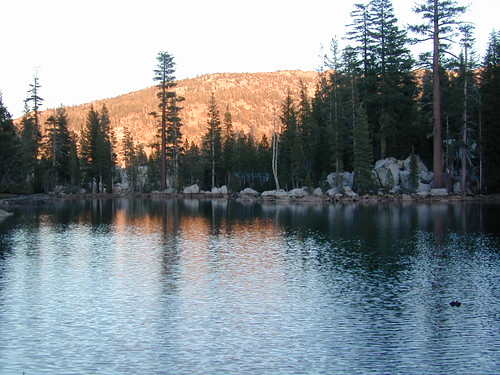
Sunset at Mosquito Lakes

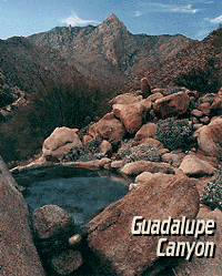
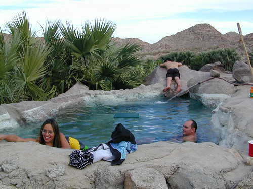
Guadalupe Canyon Hot Springs

Guadalupe Canyon Baja Hot Springs

Canon de Guadalupe

Baja Hot Springs Camping Resort


Baja California Hot Tub

40 miles SW of Mexicali – Laguna Salada off Mexican Highway 2

Guadalupe Canyon Oasis
Palm Canyon Hot Spring Camping Resort
619-639-7597


Off road destination, palm canyon in Baja California Norte
East of San Diego
SW of El Centro / Mexicali

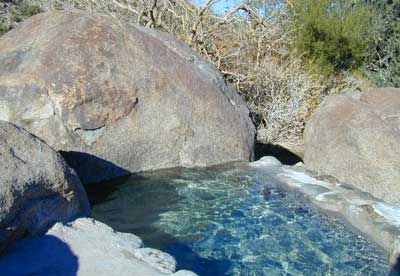
Imagine a palm oasis canyon in a remote area of the Baja desert; Cool springs that feed the lush landscape with huge boulders & cliff diving waterfalls. With each campsite featuring it’s very own custom hot springs tub. This place was a paradise 20 years ago, but is now over-developed w/ large groups, parties and camping families. If you can handle the 30+ miles of unimproved dirt roads, this spot is worth a visit mid-week. Winter months are prime time to visit the desert. Temperatures are moderate, days are pleasant & midweek has minimal tourists. Avoid holiday weekends as crowds a can get rowdy and disrupt the peaceful setting. Summer is triple digit heat for months. This canyon is hard to reach and inside a third world country, but well worth the distant journey.

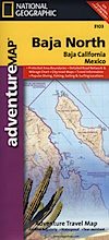
Baja MapsPlenty of great hiking and petroglyph canyons, cool pools and waterfalls, granite boulders, soothing warm waters & gorgeous desert scenery. Summers are usually roasting out here, so plan your vacation accordingly. Palalpas (built for shade) add to the charm & unique look. Each campsite is unique & has a different lay out. Reservations are recommended.

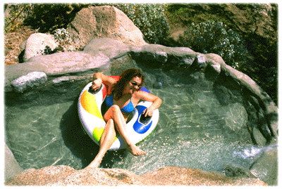
A family run set of campgrounds within a steep palm canyon. Hot Springs are piped to individual pools at each campsite for a maximum of privacy. A cold creek runs through the canyon as well, feeding the palm grove below & waterfalls way up canyon. A desert oasis set upon the slopes of the Sierra Juarez Mountains in Baja.

getting there is a journey –

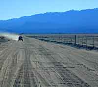
Recommended high clearance vehicle, sport utility vehicle, or truck. The last 35 miles of the trip is through rough & rugged sandy roads.

nearest towns –

Guided tours to Guadalupe Canyon can be booked thru Baja Trek. We are no longer offering Baja California trips with Total Escape Adventures

Baja hot spring photos from Total Escape Adventures trips –
FEB 2000
NOV 2000
APR 2001
NOV 2001
NOV 2002

Lazy Afternoon in Baja

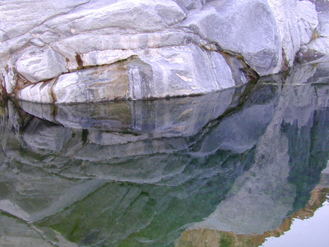
Pool Reflections 5

Mount Charleston Vegas

Mt Charleston Las Vegas NV

Mount Charleston Las Vegas NV

Mount Charleston Resort

Mt Charleston cabin rentals, vacation homes and 2 mountain lodges are located near the Spring Mountain Recreation Area, just outside of the Sin City limits. The tall alpine mountains behind RedRock SP, NW of Las Vegas, Nevada are virtually unknown by many non-locals. Great hiking, mountain biking, camping and waterfalls, plus a small seasonal ski and snowboard resort are some of the highlights. Imagine snowboarding Vegas!

Mt Charleston Hikes
Red Rock Canyon Map

Las Vegas Forest Hikes

Vegas means “the meadows”, but it sure seems more like desert these days. The forest is just up the hill, past the red rock and tract homes, well past the Joshua Trees. Conifer forests, snow and high elevation, less than an hours drive from the Vegas strip. Toiyabe – Humboldt NF is this public land managed by the US National Forest system. Toiyabe also covers Eastern Sierra slopes. Get California Toiyabe NF maps. Get the Nevada State Park map here!

Camping Vegas

Due to extreme dry conditions and wildfire danger no open camp fires are allowed from mid-April to mid-November in the Mount Charleston region. Several developed campgrounds, plus a primitive (dirt road) camp area off Lee Canyon. Cabin rentals are located at the Charleston Lodge.

  • Vegas trails
  • Hiking in Vegas
  • Mount Charleston skiing
  • Mt Charleston hikes