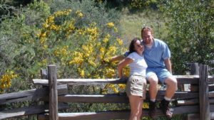
It was another one of those long and tiring days in the office and all I wanted to do was find myself on a open highway heading out of town. So right after the time clock struck five, I raced home, picked up my bags which were packed with my clothing and gear the night before, stopped at my girlfriends home to rescue her from the mundane existence of the apartment, we found ourselves finally on our way into snow country of the Sierra-Nevadas.
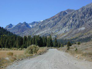
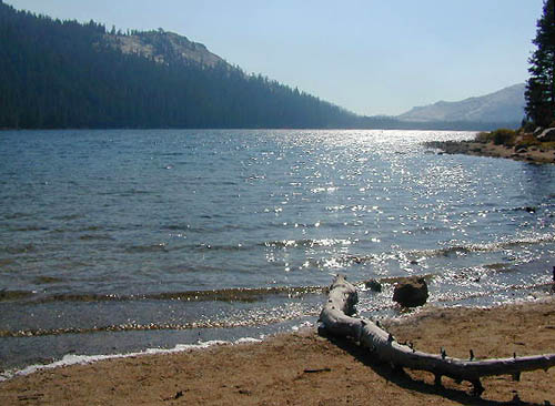
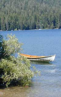
Our destination was a small resort community called Lakeshore CA, situated on the shore of Lake Huntington between the Ansel Adams and John Muir Wildernesses in the Sierra National Forest. The drive up the mountain at dark was breath taking and clear, a night in March with a full moon out and a fresh blanket of snow gracing our presence all around us as we drove our truck through the winding mountain road. The temperature must of been in the teens that night but that didn’t faze us as we looked out of our car windows at the spectacular sight Mother Nature had in store for us. Soft snow pillows hung on tree limbs everywhere, glistening moonlight bounced off the gentle lake as we drove along side and huge snow drifts towered on the road shoulder as we traveled to our resort lodge destination.
At first we thought it would require more map insight in finding the lodge under such wintery conditions. But to our surprise, the road we had been traveling on, Highway 168, just dead ended at our weekend getaway. The check into the lodge was fast and simple, soon we found ourselves settling into a decent rustic cabin with drifts of snow twelve feet high all around. Thanks to the constant plowing of roads, everything was accessible within reason due to El Ninos erratic behavior.
The next day we became captivated by the raw beauty of waking in a wintery wonderland, hardly hours away from the hustle and bustle of the big cities of Los Angeles and San Francisco. After a bit of exploring around the frozen lake, we took off on a rented snowmobile for the back country where we became amazed by gorgeous mountain lookouts.
Untouched wilderness full of snow-capped mountains, lost tranquil valleys, and frozen pools and streams locked in a time zone of raw beauty.
I wanted to stay gazing for hours but our destination was deep in the wilderness valley about twenty miles away. There after passing through woodsy trails and snowy spectaculars we arrived at our place of relaxation, the Mono Hot Springs. This out of the way spot has been frequented over the years by naturalists like ourselves who have pulled off the trail to dip into the eighty degree plus waters that caress the body with mineral rich fluids.
Never have I been so relaxed in an environment with no one around for miles, white snow all around with a trickling stream close by for awe and amazement. If it wasn’t for the deadline for the snowmobile return, we could of stayed at this place til sundown. The ride home on the machine, my body seemed to be thanking my mind for bringing it to such an inspiring place. My mood was calm and invigorated by the mountain waters & scenery.
epic views over snowy Sierra
Back at the lodge after freshening up, my girlfriend and I discussed how lucky we were to be able to experience activities like these that really don’t require throngs of urbanites to complicate and mettle up our space. That night we enjoyed and excellent meal inside the lodge dining room which didn’t weight us down. Then over to the saloon we went to indulge in spirits, a small wedding party was happening were participates graced our presence with drunken humor. Even though they looked like the stereo typical yuppies, this didn’t bother us as we knew that they had come to the same spot to be enveloped by the sheer beauty and splendor of Lakeshore, California.
Spring 1998, by Chris DiNenna
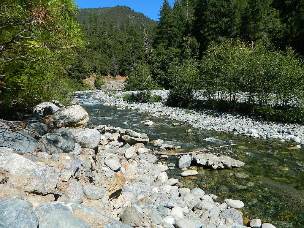
Large portions of the Sierra Nevada were greatly affected by recent wildland fires. This area was burnt by forest fire 2020 Creek Fire
From Mammoth Pool to Edison Lake, huge, old growth forests ignited in a major wildfire along the upper San Joaquin River, inside Sierra National Forest. Military helicopters rescued stranded campers by the hundreds, as seen on the nightly news.
BEWARE: this land may not look anything like the photos
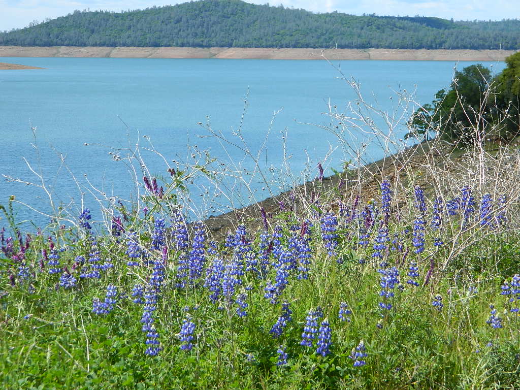
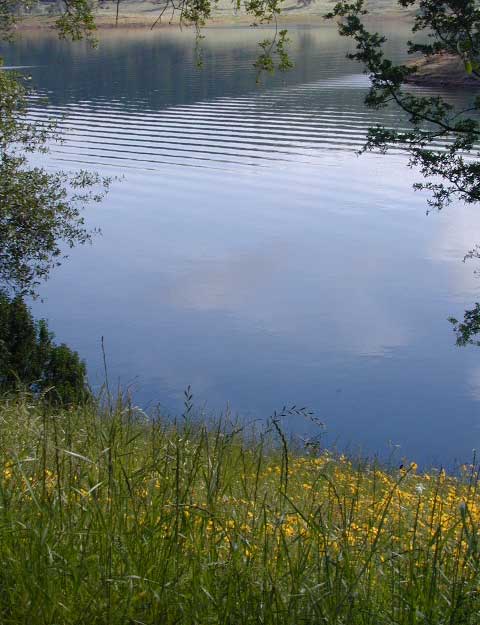
Black Butte Lake, West of Chico, CA
On the west side of Interstate 5. Campgrounds, boating, wildflowers and hiking trails.
Clear Lake Area
Bear Valley Road (long dirt road) which connects Hwy 20 to Stonyford. Look for small dirt road turn off (north) off of Highway 20. NE of Clear Lake, CA
BLM Glen Eden Trail
Lakeport @ Clear Lake, CA
w/ California Fawn Lilies and camping
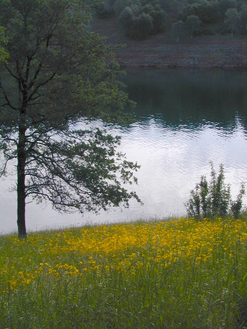
Mill Creek, California
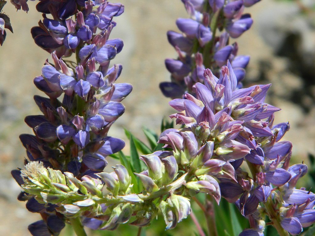
Giant, curly lupine on a big creek, just south of Lassen National Park. Park along Hwy 172 on the east side, about a mile before the Mill Creek Resort and hike along creek to find large lupine. Great picnic area.
Curly Lupine @ Mill Creek, CA
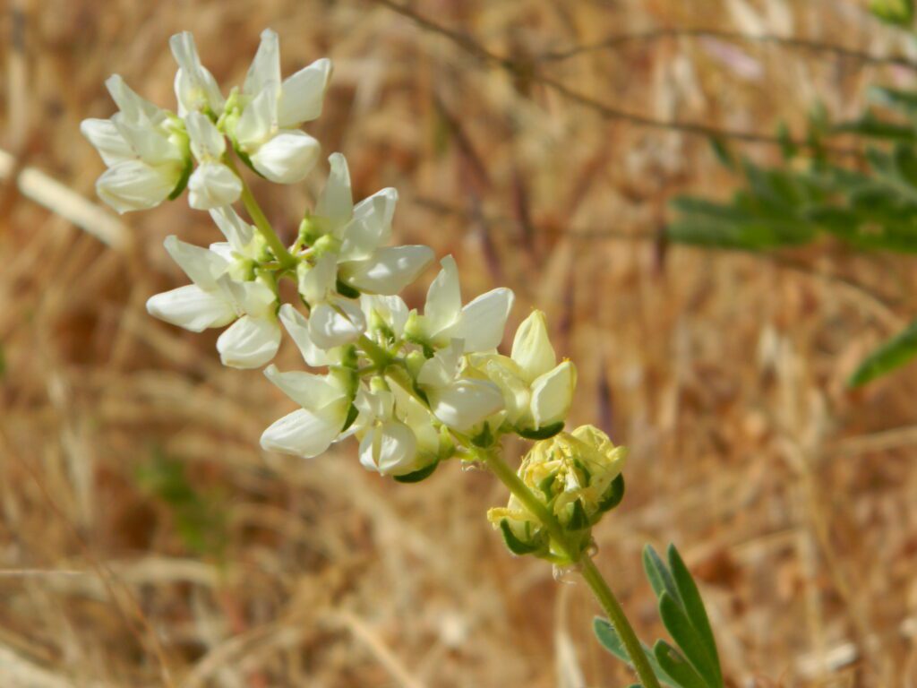
wildfire note: burn scars are excellent spots to find wild flowers
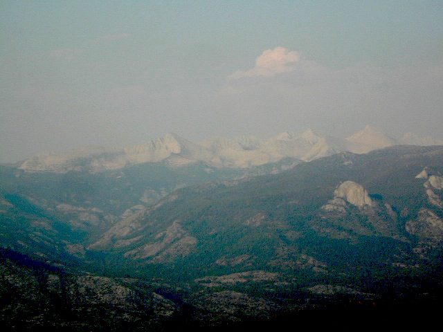
North Sierra Nevada Mountains
Bald Rock Road Loop, Berry Creek, CA
Granite dome above Lake Oroville SRA
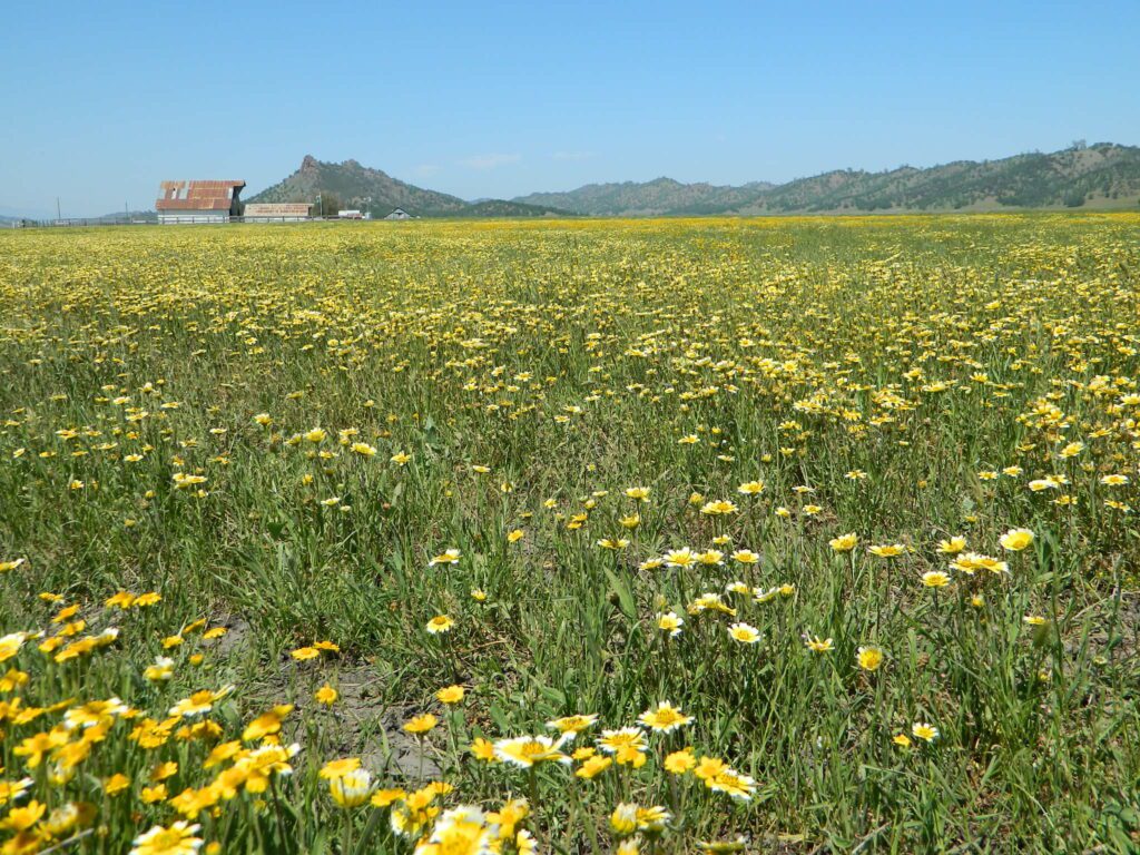
Hiking trailhead, Scenic drive loop. Lupine, poppies, monkey flower, dogwoods. Wildflower drive through a recently burnt forest (2020) #BearFire
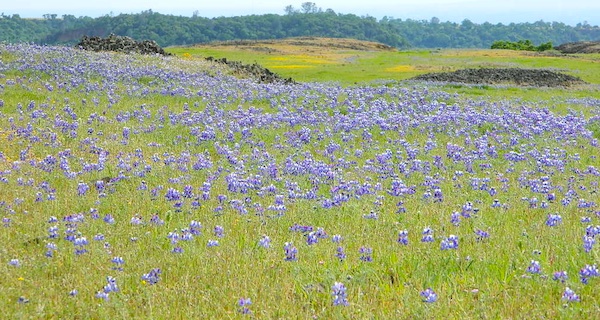
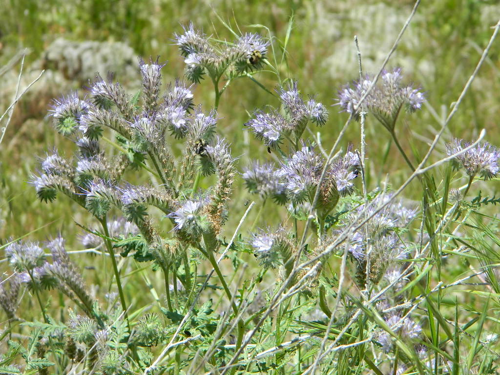
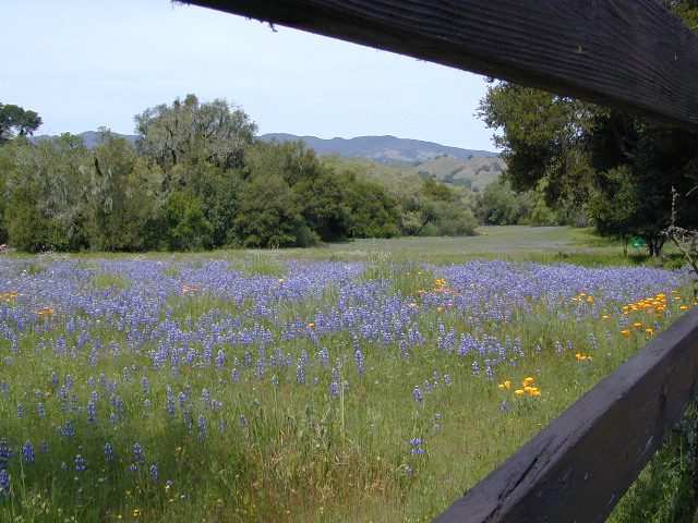
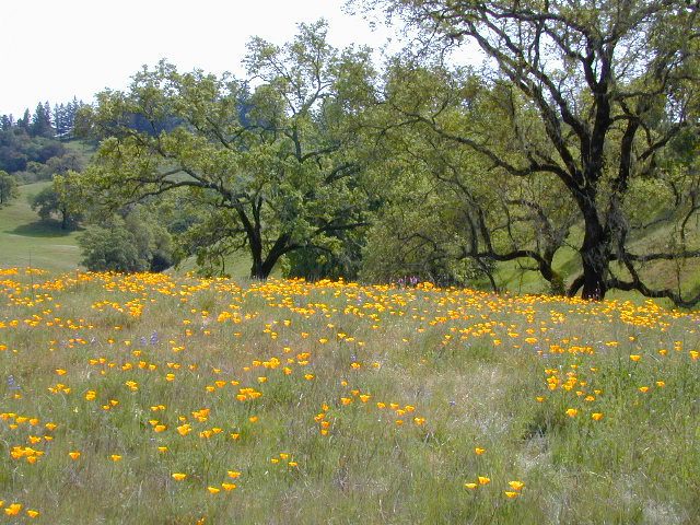
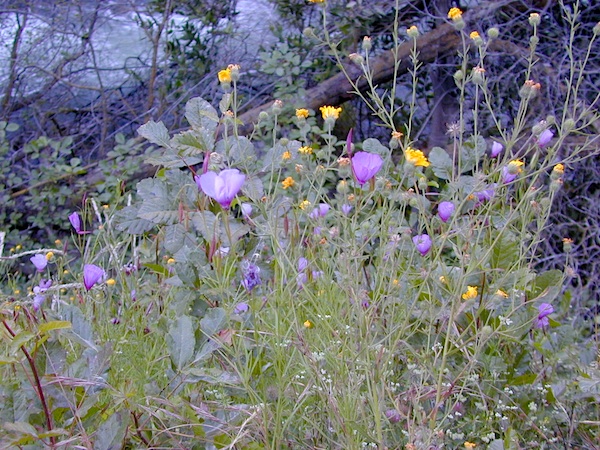
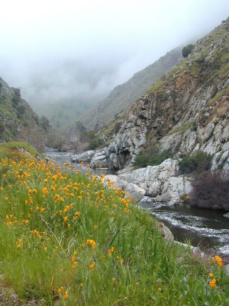
West facing canyons of the Sierra Nevada mountain range are prime spots for wild flora, especially in Springtime. Lots of rain means a great show can usually be found. Rivers exit the mountains and carve deep into the landscape. Lush green hills, oaks, boulders. Perfect picnic spots everywhere.
wildflowers bloom: March – July
make a whole day of it
Lower elevations bloom first in the year. Remember if the Central Valley is blooming fruit trees, the mountain foothills are starting up too. Mid-elevations, above 3000′ bloom in summer months, but below that – plenty of river canyons and reservoirs are superb locations to search for wild flowers.
High Sierra wildflowers start to bloom after the snow melt (and roads open) usually JUNE – JULY
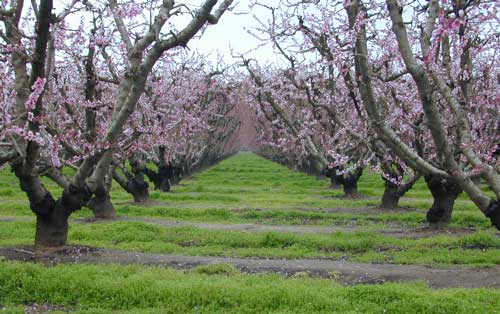
Orchards Blooming, San Joaquin Valley, California
The steep Eastern Sierra canyons near US 395, do have some wildflowers in Spring. Rocky, higher elevations bloom in mid-summer. And what Eastern Sierra may lack in wildflowers, they make up for in Autumn Colors (best in the state)
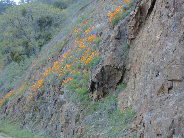
One of the premiere counties for wildflowers inside California. Kern offers amazing displays (blankets of flowers) along roadways, on hillsides, and in the numerous canyons.
Obvious I-5
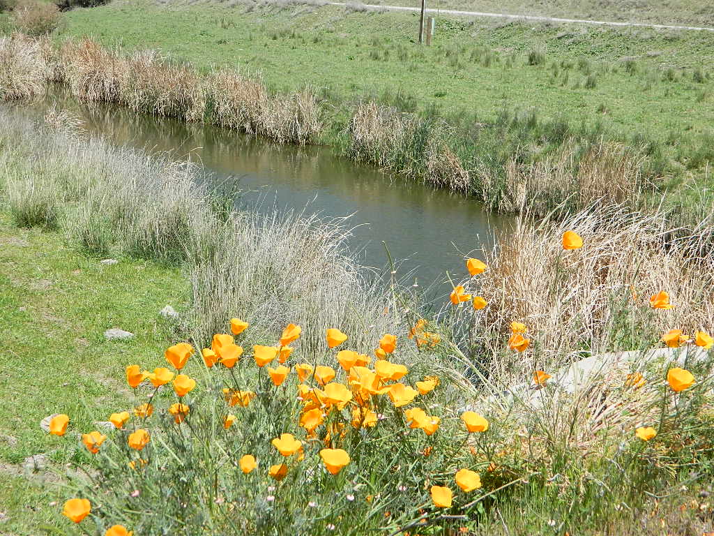
Interstate 5 – from the Grapevine up past Tejon Ranch, and over to Gorman is epic blooms of poppy and lupine. Annually in April and only if the previous winter was wet or snowy. For safety sake, please exit the freeway to view the flowers!
The famous high desert Poppy Preserve is located off of I-5, east on Hwy 138, way before the town of Lancaster, CA
But all this mentioned above is not technically the Sierra Nevada mountains, so we will move on…
CALIENTE ROAD
Off of Hwy 58 west (below Tehachapi) Often called Caliente exit, or Caliente Creek Road – the Bodfish-Caliente Road is a narrow, paved, back road that connects Highway 58 to the Lake Isabella area.
Driving this countryside route is long and curvy, but there are numerous pull-outs and places to see wild flora. Plan for half a day to reach Hwy 178. Gold Pan Canyon and rolling oak hills. Dirt roads lead into National Forests, but watch for private property and no trespassing signs. NOTE: You may need to stop the car. Get out and walk around to find these little beauties.
Historic Havilah has an old schoolhouse and a museum.
LewisHillPreserve (559) 738-0211
Along N Plano Street. North of Porterville, CA
NOTE: Lewis Hill Preserve is not open to the public except for special tours and events.
Lake Kaweah @ Three Rivers, CA
south of Sequoia National Park has wildflower displays along the lake shore, and with snow capped mountains in the background, it can make for excellent photos.
Sequoia Road J21 – HOMER RANCH Dirt back road on the north side of the Lake Kawaeah which connects to Sequoia National Park (the long way). Dry Creek Preserve, McKee Canyon, Ragle Canyon, Indian Canyon. Homer Ranch Preserve, open to the public weekends only, from November 1st – June 1st
Calif Gold Country
Foothills & River Canyons
American River Canyon – Hwy 49, South of Auburn, CA
22,700 acres
Kaiser Pass Road
Sierra National Forest
2020 wildfire: CREEK FIRE has burnt the majority of this wilderness, roads, trails, lake shores and most campgrounds
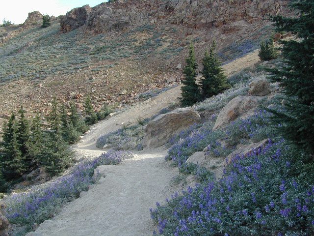
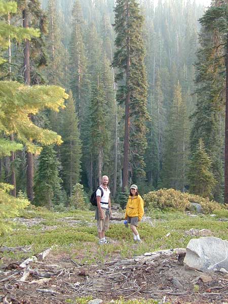
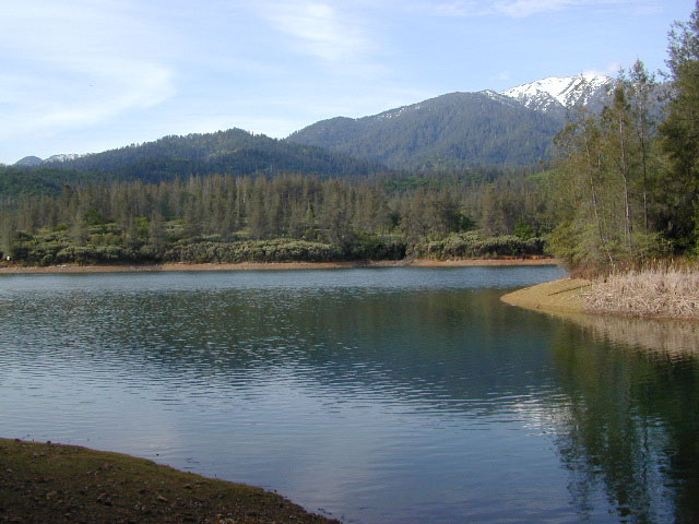
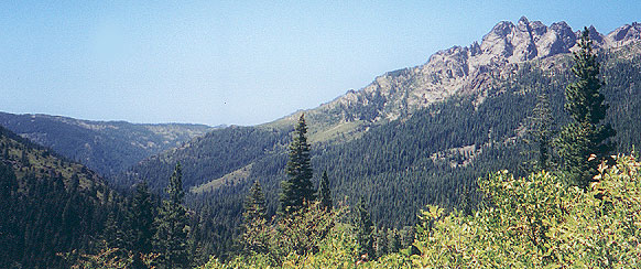
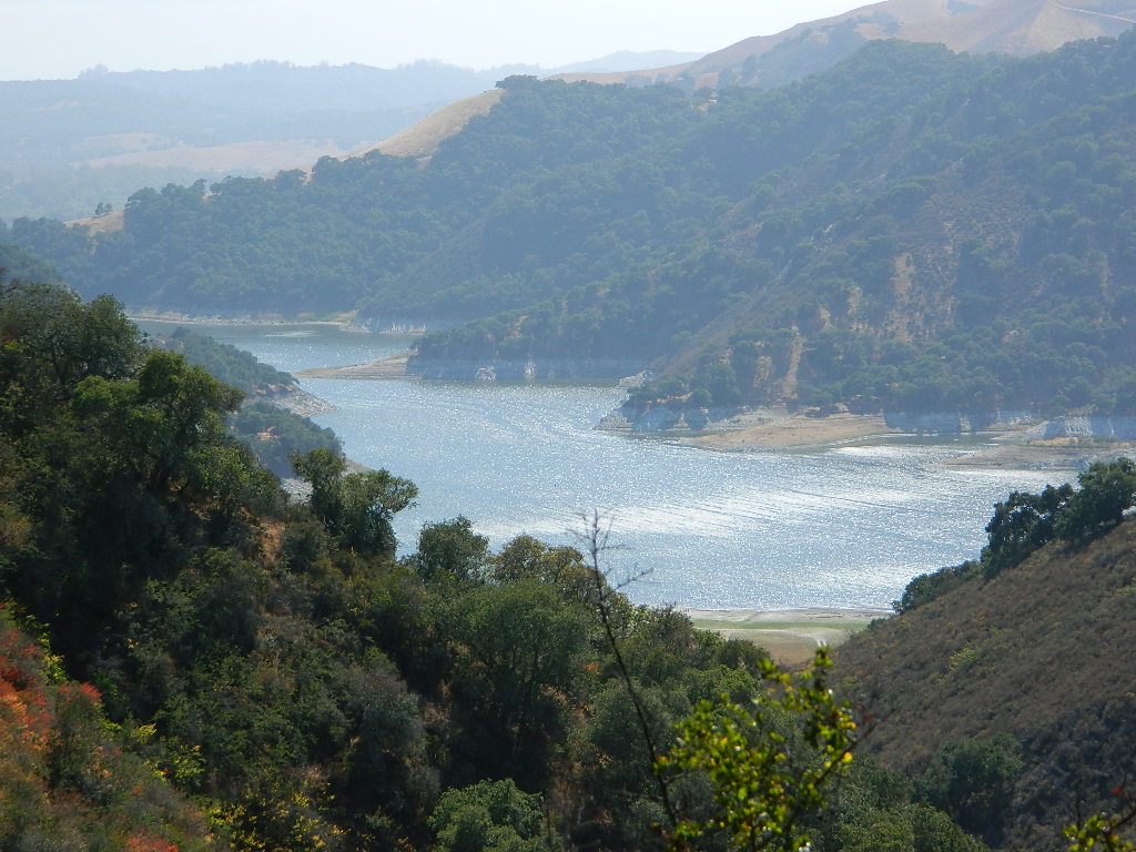
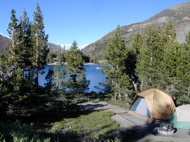
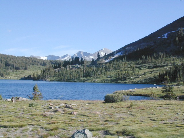
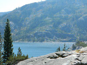
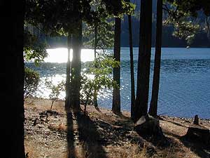
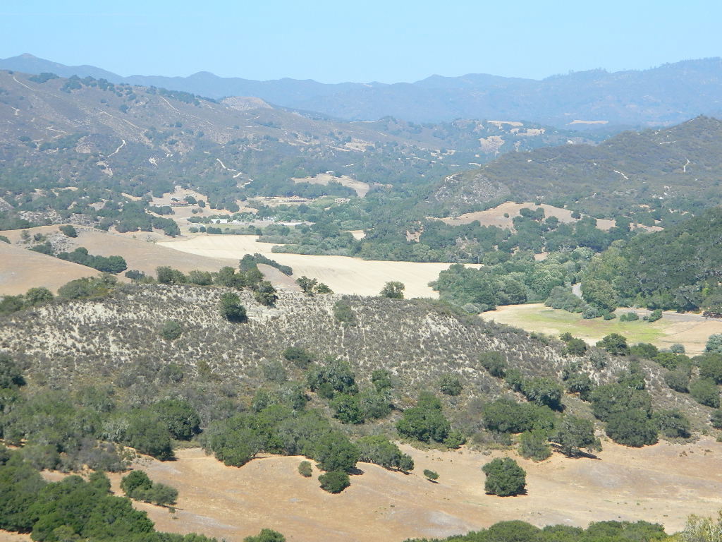
Central Sierra Nevada Mountains/ Kaiser Pass & Kaiser Peak / Highway 168
One of the best cell phone coverage areas for any California Wilderness location, this central Sierra region is located south of Yosemite National Park and known primarily for Shaver Lake.
California Hwy 168, along with Dinkey Creek Road (southward) and Kaiser Pass Road (northward) leads off in all splintered directions to secluded campsites, rivers, creeks, lakes, developed campgrounds and amazing forest scenery. Off road trails and hiking trails, everywhere back here! But it is best to have several good maps for cross reference.
Dusy Ershim Trail 4×4 travels past Kaiser Peak and the cell phone towers. Several primitive camp sites with views on ridge. Numerous developed NFS Campgrounds out this way along Kaiser Pass Road.
Trailheads for horseback, hiking, backpackers, mountaineers, rock climbers. Snowmobiles love this amazing route when the snow is deep; some west coast winters can be better than others. Know before you go!
Kaiser Wilderness are granite mountain peaks, near Huntington Lake & the China Peak ski resort, formerly called Sierra Summit Ski; One lane narrow backcountry paved roads: Kaiser Pass Road 80 (east of Huntington Lake) and Stump Springs Road 5 is West Kaiser (west of Huntington Lake)
Sierra Views in 2002White Fir CampsiteChina Peak Hike w/ Map
Oak foothills of the Historic Gold Country, at the edge of the Sierra Nevada mountains.
boating
canoe
camping
fishing
hiking
houseboats
kayaking
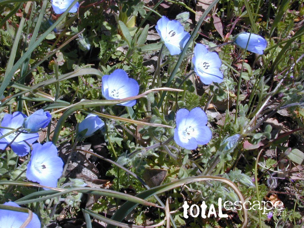
wildflowers
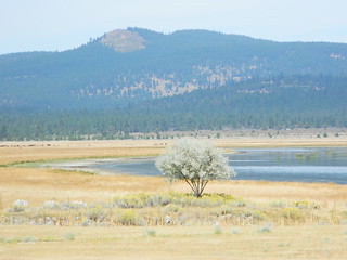
Most Central Valley Reservoirs have blooming wildflowers in early springtime. Summer heat can measure triple digits for months as most of these lakes are located below 1000′ elevation.
Lassen Volcanic Park is surrounded by beautiful mountains and lakes, some inside the National Park boundary, but most outside. Lassen National Forest, Thousand Lakes Wilderness, Lake Almanor, Hat Creek and Burney Falls encompass this pristine water wonderland of NorCal. Outdoor recreation all over – rivers, fish, hunt, camp, mountain bike, off road.
Backpack camps, RV campground, fishing lakes, day hikes, off-road and lake side camp sites, we have it all listed on Total Escape.
Hiking, camping, fishing all over this region! Mountain bike, kayak, or relax all day in the hammock – in a shady spot with a view. Water flows freely and annual snow melt is abundant in this part of California. Some locales may not open until July 4th weekend. Always check with the Lassen NFS rangers to make sure.
(lakes on the trail)
Crumberg Lake
Twin Lakes
Jakey Lake
Snag Lake 6076′
Horseshoe Lake
Willow Creek
Long Lake
Lassen National Forest lakes:
Majority of these lakes require dirt road driving to reach them. Often forest roads close for snow, usually during winter months (DEC-MAY)
Wilson Lake 5267′ Crater Lake ^ 6800′
Echo Lake
Widow Lake
Star Lake 6362′
Rising River Lake
Baum Lake
Murken Lake
Haynes Reservoir
Heart Lake
Willow Lake
Shotoverin Lake
Killer Camp @ Echo Lake
Caribou Wilderness:
Campsites with hiking lakes and wilderness trailhead access, right next to Lassen Volcanic National Park.
Echo Lake ^
Caribou Lake ^
Silver Lake ^ – Silver @ Lassen
Triangle Lake
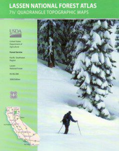
Find Lassen Maps, NFS Topo Atlas
Thousand Lake Wilderness:
North of Mount Lassen is the less-popular Wilderness Area w/ many miles of dirt roads to travel.
North Battle Creek Lake ^ 5571′
Logan Lake
Buckhorn Lake 4776′
Lake Eiler
Terry Lake
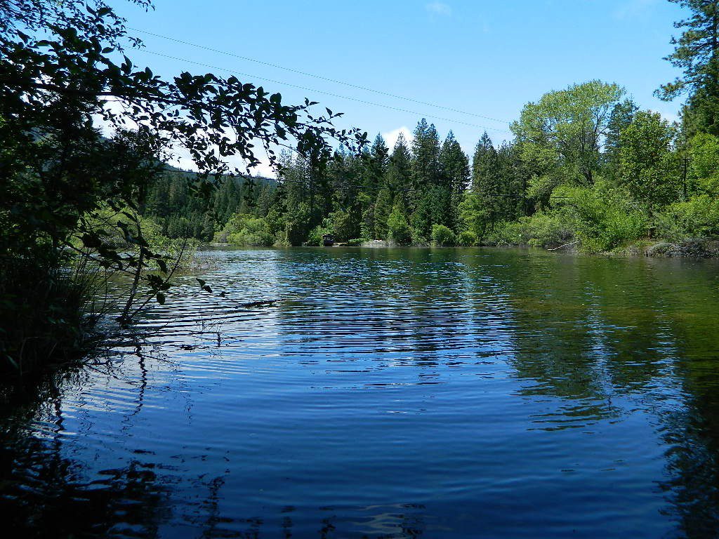
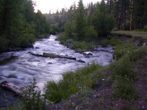
Tucked way back in the granite high elevations, near Donner Pass is a wilderness water flow called Canyon Creek. Connecting small lakes and big reservoir, this creek is part of the Nevada District water supply. The Sierra Nevada region is Tahoe National Forest and the terrain is abundant rock.
Campground is perched on the edge of rock overlooking the impressive whitewater; sounds of crashing water at certain campsites is deafening. Half of the campsites are located in a forest loop and the rest are out in the open, with much granite and fewer trees, perfect for star watchers.
Canyon Creek California
Lake Faucherie is a mile up the creek and Sawmill Lake is a mile down stream, so it’s a great fishing location, as well as hiking, kayaking and canoeing destination. The Pacific Crest Trail (PCT) is also routed close by. A hiking trailhead at the north end of Sawmill Lake leads to a loop hike of small lakes.
roughest roads in the region
Campground loop is paved, but the 12+ mile access road is NOT.
Twenty plus miles of paved & gravel backroads in boulder-hopping bliss, leads to granite lined lakes and forested campsites. Two different driving routes into this canyon:
One is the longer way Road 18 – paved access off of Gold Country Highway 20, which becomes an 8 mile long, rocky, rough, one-lane road around Bowman Lake.
The other is slightly shorter, county road #843 that comes in the back way from Jackson Meadow Reservoir (off Hwy 89, N of Truckee).
Both of these primitive roads join at Jackson Creek Campground, a favorite among off-roaders.
Canyon Creek Campground is another few miles up Road ##843-037, a rugged canyon route towards Lake Faucherie, where the road comes to a dead end.
Don’t let the old maps fool you: these National Forest Roads are labeled as gravel roads, but boulders and rock slides are quite common. 4×4 would be nice, but high clearance is recommended.
Minimal signs designate trails, roads and lake access; What signs that do exist are old, faded and broken. No warning signage reading ‘high clearance’ or ‘4WD recommended’ – so obviously Tahoe NF won’t be installing new signs anytime soon.
backpacking
camping
canoeing
fishing
hiking
kayaking
stargazing
Faucherie, Sawmill and Bowman Lakes are all along this waterway called Canyon Creek.
National Forest Campground Latitude: 39.436863 Longitude: -120.579564
Canyon Creek Campground
• Elevation: 6600′
• Number of Sites: 20
• Toilet: Vault
• Vehicle Access: High Clearance Vehicle, no trailers
• Campsites Reservation: No
• Camp Fee: No
• Length of Stay: 14 Days
• Season: June – October
• Trailheads: Faucherie & Sawmill Lakes
• Managing agency: Nevada Irrigation District
530-265-5302
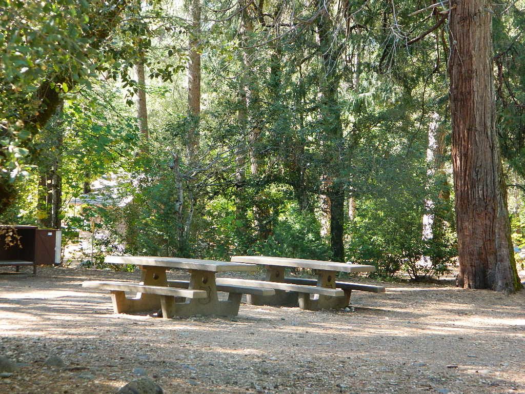
Canyon Creek Campground is an excellent campground for staying away from the crowds, which seem to focus more around Bowman Lake & Jackson Meadows Reservoir.
All campsites at this campground have steel bear boxes – for proper food storage in black bear country.
Prefer camping outside of developed campgrounds? then the primitive camp sites that line Canyon Creek will be a welcomed surprise. Most are clearly marked with small signs and some may require 4×4 to access. When fire restrictions are tight, campfires are only allowed in the developed campgrounds.
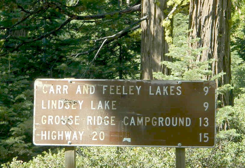
EB from Fresno, Hwy 168 up to Shaver, w/ another 30+ miles on paved backroads
(Dinkey Creek Rd & then McKinley Grove Rd)
Way, way back, beyond Dinkey
You gotta really wanna BE at places like this. Magical High Sierra mountains – California’s finest. Sheer beauty surrounds this lake w/ granite domes, granite cliffs, granite trails, forests, peaks and plenty hiking, fishing, water and boating. It does take planning (way ahead) to make it out here, cuz the area is only accessible during summer months. Typical of high altitude lakes, snow buries them annually and the roads get closed off to the public (usually NOV-MAY is winter). Some backcountry routes become snowmobiling trails during winter, and the Sierra National Forest has plenty of great snomo action (if snow is deep).
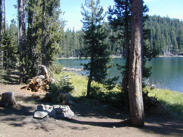
Wishon Lake, California
elevation: 6600′
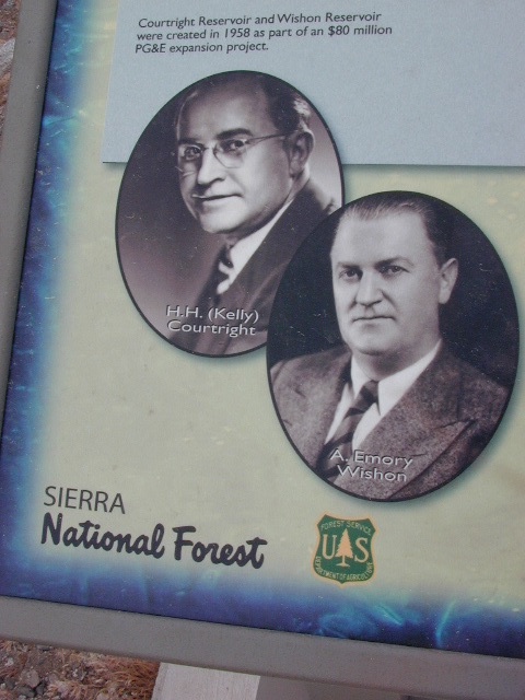
High Sierra Granite Reservoir with pines trees and rocky, granite shoreline. Not nearly as amazing as its cousin w/ the domes to the north, Courtright, Wishon has less granite & less wind, but more accessible backroads to explore, plus more car camping options. Both lakes are part of the Helms Creek hydro-electric project (dams) that make up the PG&E water infrastructure out in these parts – The Kings River Drainage System.
Backpacker trailheads, Woodchuck, Rancheria & Crown Valley all lead to dead end dirt roads – with nothing but solitude for miles & miles. Some might be passenger car accessible. Winter weather changes dirt road conditions (often).
The Kings River Geological Area is nearby, as well as both the John Muir Wilderness & Dinkey Lakes Wilderness.
Large Reservoir with 8,000-10,000′ high sierra mountain peaks surrounding. Pine forests, views, fishing, camping, hiking in every direction, secluded dirt roads. Perfect high elevation trailheads, next to John Muir Wilderness. Great for backpackers!
All boating, but no waterski or jet ski.
One public boat ramp. Fishing boat rentals available.
Wishon is a summer vacation paradise for trout fishing, hiking, backpacking and back road exploring.
CLOSED FOR WINTER: NOV-APRIL = Snow closes the road for winter. For all you hardcore campers and hikers, you must call ahead to see if roads are open. It is rural forest, well traveled, but snow storms will shut everything down out here (for many months). Although, in some mild winters you can drive as far as Dinkey Creek on pavement. Gates are locked beyond that.
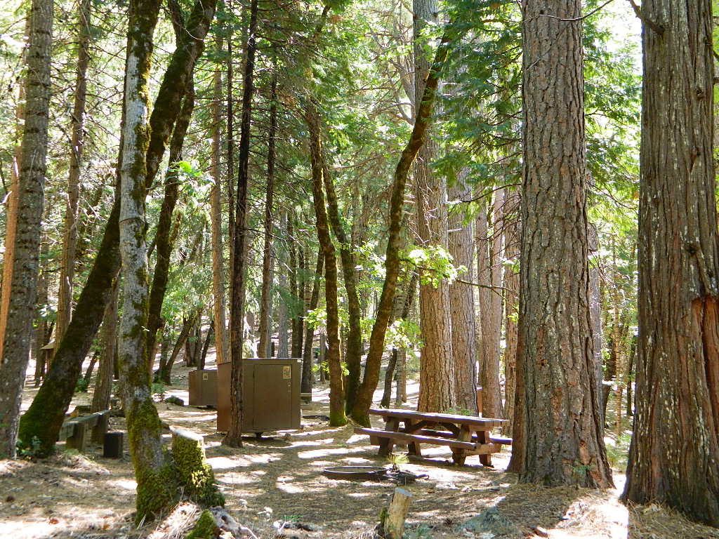
Dinkey Creek Campground
Dorabelle Campground
Gigantea Campground McKinley Sequoia Grove
Sawmill Campground (dirt road)
Free, primitive or open camping abundant on the dirt backroads in Sierra National Forest. 4 wheel drive is not required for most routes, but a high clearance rig would help. Some gravel roads are graded annually and suitable for passenger cars – during summer months and only for about the first mile or two, off of the main road (pavement). Mud and snow are common on backroads!
Unbeknownst to most California tourists, the “Shasta” region encompasses most of the northern part of the state. From the majestic Trinity Alps to raging Burney Falls; the huge, snow capped peak of Mount Shasta can be seen by half of NorCal. From the high country on the north side, to the Sacramento Valley on the south side. Shasta dominates this region all around Redding and I-5.
Northern California has numerous camping lakes, most of which are very RV friendly. Boating, fishing, hiking, kayaking & even houseboat rentals are available at Lake Shasta.
The Big Lake you see from Interstate 5 is named Shasta Lake, the main drain from the northern reaches of Oregon. The big reservoir in the middle of the North State.
Whiskey Town Lake is west of Redding, with Trinity Lake tucked way back up in the hills – N of Weaverville.
You could spend a lifetime exploring all the lakes in the Shasta area. On foot, by bike, with a fishing pole and a pack llama. Maybe just an old funky motorhome.
alphabetically listed; cross reference by lake or campground name. reservations may be accepted for certain locations; follow links.
Developed Lake Campgrounds
inside California
Most of the lake campgrounds listed below are traditional style campgrounds with easy access: paved driveways, toilets, tables, maybe piped water. Various agencies manage these park campsites and additional links are provided.
Some of the campgrounds may be more primitive than others, with long dirt road access, gravel driveways, and minimal facilities. This list includes a wide range of lakes, from reservable group camps, to private RV resorts to back road beauties. Even a few campgrounds without fees!
Higher elevation locations close-up for the seasonal winter snow, which can last from NOV-MAY (or later, depending on snowmelt).
no motor boats?
no RVs?
wilderness lake fishing?
trailhead access?
Each lake camp is different, so know what is available at the location before you get out there. Many spots do not have a boat ramp. Some lakes do not allow swimming. Some might be 4×4 access only, w/ hairy granite rock road, 12 miles long. If you require a general store within walking distance, then get the maps out, follow links and make sure.
Listed below are developed camp grounds and RV camps around Lake Tahoe, run by various agencies. Most require reservations and are only open half the year (or less).
Lake Tahoe campgrounds: blue links lead to camp info.
All Tahoe Campgrounds will charge a fee for day use or overnight stays; Many require advanced reservations. Nightly rates vary per park, but tend to be expensive in this region. Most campgrounds are closed during the winter due to the big snow. Check with the ranger districts listed here.
Sawmill Lake 4×4 Camp
Tahoe National Forest encompasses a large region of the Sierra Nevada mountains surrounding the north portion of Lake Tahoe. areas included – Donner Pass, American River, Yuba River, Northern Gold Country; Lakes Basin Recreation Area; Small lakes and reservoirs with excellent fishing, all surrounded by lush forests.
Campgrounds with mid (5000′) to high-elevation (8000′) locations close annually for winter snow. Many are open for a few short summer months.
Listed below are Tahoe Campgrounds located away from the Lake Tahoe Basin; Inside Tahoe National Forest Smaller camps are on a first come, first serve basis. blue links lead to camp info.
The Great Central Valley of California – the San Joaquin Valley (on the south side) & the Sacramento Valley (on the north) together make up some of the most fertile farmland on the whole West Coast. Agriculture thrives, water flows & smog settles.
This huge valley, bordered by the Pacific Ocean on the west & the Sierra Nevada mountain range on the east side, is the one of the biggest farm land regions of the U.S. The food that feeds the world is grown right here in the Center of California. Vegetables, rice, fruits, citrus, garlic, onions, nuts, you name it.
Since the capital city of Sacto has a “port of entry”, the California Delta & surrounding waterways, make for excellent fishing, boating & camping.
Unfortunately this low lying area is one of the worse smog basins on the west coast. The upper & lower Central Valley see the worst of it, as wind pushes the emissions right up against the mountains. Triple digit temperatures are common throughout the summer months. The super heat just magnifies the poor quality of air.
California Stream Fishing California Creek Camping
Since SoCal is more of a desert terrain, big water in California can be found elsewhere throughout the state. Natural waterways flow primarily from NorCal and from the backbone of the west coast, the Sierra Nevada mountain range. Determining the region to explore is a first step, then narrowing it down to several possible camp spots after you’ve found a good printed map (a hard copy, non digital, non electricity, the old fashioned kind).
California Rivers are popular destinations for the outdoor vacationer. The most desirable streams or creeks in California flow into a reservoir, not out of. The wilder scenery above the lake, deeper up the canyons are the secluded places we seek. Some accessed only by dirt back roads. 4×4 camps are commonly positioned near creeks. Wilderness trail heads can lead to even more privacy if you are willing to huff it.
look for the tiny blue lines, the bolder the better
– is your choice a main blue line?
– does this one creek feed into another larger stream?
– is it a creek that will be flowing strong?
– how far from a paved road is it?
Forest Service Back Roads are usually one lane dirt roads and have strange long numbers attached to them. Maybe signed, but don’t count on it. In the illustration: Look Road #22S59 is right along a creek, and maybe 22S08 has some water sources, but has a developed campground w/ possible fee. 22S59 is very likely to have some dispersed sites along it. You always have options open when you have a good map; make your back up choices when planning your destination. Have a few plan B roads chosen, just in case your first choice is too steep of a slope, or packed with RV families, or totally muddy and impassable with your vehicle.
Creekside Camping in California
4WD needed?
Spring snow melt is when the dirt roads are still closed (gated) and often quiet muddy. Some primitive camp sites may be best access with a 4-wheel drive, but each river or creek side camp spot is unique at different times of the year, due to the snow depth and land erosion process. For easy-going exploring purposes, small all-wheel-drive vehicles work well too, but clearance can be a limiting factor. You wouldn’t believe what passenger cars we see on the back roads of Baja. Almost anything goes anywhere, slowly, as long as it runs and rolls.
last tip – mosquito, where?
Screen room tents may appear unsightly, but those hungry, annoying mosquitoes don’t really care what flavor you are. Them lil suckers are abundant in areas with water, standing or still water, meadows, creek beds, especially active in the warmer summer months. Beat ’em before they hatch – camp in the springtime. By autumn their numbers seem to dwindle with the night time chilly temps, but make sure to come prepared for those colder nights.
These are picnic lakes, hiking lakes and camping lakes that are located inside Yosemite National Park or the surrounding areas bordering the granite wonderland.
California Sierra Lakes Sierra Lake Destinations Sierra Lake Campgrounds
One of the best physical features about California is the amount of lakes and reservoirs it holds – in the mountains, foothills and the canyons, throughout the state.
recreational lakes – Huge, dammed reservoirs to the secluded, alpine lakes in the high country and all the variations in between.
There are literally thousands of lakes located within the Sierra Nevada mountains and it would be ridiculous to try to list them all here. Many of them can only be reached by hiking into Wilderness.
Most California lakes are popular and well known recreation spots, but others are secluded – if you drive far and long enough back on the dirt road. Some do not allow motorized boats and most do allow fishing and swimming. Some have campsites on the waters edge, while other camps are up on a hill over looking the lake.
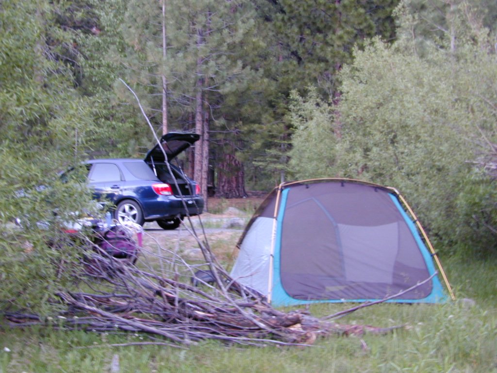
Below listed are some Sierra lakes that allow camping on the lakeshore or nearby. Most campgrounds are suitable for RVs, tent camping, and some may require 4 wheel drive to reach them.
A small developed campground along forested Highway 89, with raging creek, fishing spots, and hiking trails and mountain biking trails nearby. Paved, level camp sites, small RVs okay w/ access to the numerous Sierra Nevada destinations with several lakes and reservoirs nearby.
This is a popular overnight stop “in route” for many campers and bikers traveling further on to the Northern Sierra Nevada mountains. You can exit off Interstate 80 @ Truckee, and be at this camp in minutes. Car camp, tent camping, a few spaces for small motorhomes. Plenty hiking and mountain biking trails.
Cold Creek Campground, California
on the Cold Stream;
Campground open May-October
(depending on snow)
High Sierra / Tahoe Truckee Camping
13 camp sites on Cold Stream @ 5800′ elevation; vault toilets, river and piped water, bear boxes; first come, first served camping
Max Camper Length: 22′
Rangers Office: 530-265-4531
The highway traffic noise makes this place a ‘short and sweet’ one nighter top pick, great for those camping in route to another destination. Another developed camp is on the opposite side of the highway, less than a mile north called Cottonwood Campground.
Free Camping nearby.
If you are seeking primitive camping near this area, start with Little Truckee Summit at the lakes turn off road on SR 89 – about 2 miles south of the Cold Creek Campground.
Take Tahoe Forest Road #5, a major paved road, approximately 12 miles back to the big meadows. Look for the unsigned dirt roads on left side of road nearing Webber Lake. The largest lake in the region, Independence Lake, is a paved side route off to the south. Further back on Road #5 the pavement ends at Jackson Meadows Reservoir. Very rough rocky road out to Bowman Lake w/ several developed campgrounds in the vicinity.
Tahoe trailheads lead out to –
alpine fishing lakes
mountain peaks
Treasure Mountain 7085′ Tahoe National Forest
OHV Area @ Prosser Reservoir
Tahoe and Truckee are known for their brutal winters and deep snows pack. Call CalTrans ahead of your departure if you are even slightly expecting any kind of precipitation. Truckee – winter road conditions
18, 679 acres
Central California Mountains
East of Arroyo Grande, CA
US Highway 101
exit #187A – Grand Ave
backpacking, camping, creek fishing, hiking, swimming holes, waterfalls
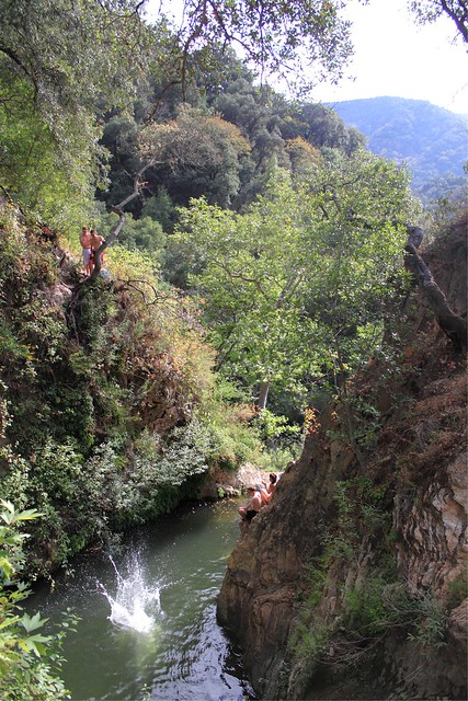
Santa Lucia Wilderness is the mountain range in between Santa Margarita Lake and Lake Lopez inside Los Padres National Forest, in a very remote and rugged portion of San Luis Obispo county. In the hills behind Arroyo Grande, past the Huasna turn off, above the local reservoir, beyond the big ranches – the waterfall trails of Santa Lucia can be found. Super steep canyons with only two dead end roads leading to trails. Waterfalls, swimming holes, way back there behind Piney Ridge.
tallest mountain peak elevations
Bald Mountain – 2834′
Lopez Mountain – 2868′
Black Butte – 2749′
Upper Lopez Canyon can be challenging drive with water in the creek, but it has 3 trailheads back in this canyon.
Pozo Road / Hi Mtn Road (#30S05 on the way to Pozo) will lead to a Santa Lucia trailhead @ Hi Mtn Campground and on to Big Falls trailhead. Locals call the whole route POZO, which leads from Lake Lopez to Pozo.
Road #15E11 Garcia Ridge OHV trail is off this same main route, Hi Mountain Road. The Rinconada trailhead can be found along the paved Pozo Road, west of the Pozo Saloon and east of the KOA Campground.
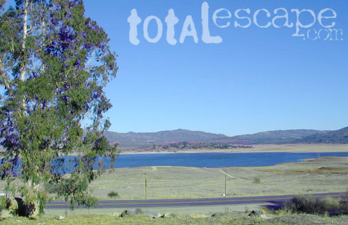
San Diego county has numerous recreational lakes, but only a few that allow overnight camping. Oak filled valleys and pine forests are nearby, but if you are seeking alpine lakes, surrounded by granite peaks and towering forests – then look to north for the Sierra Nevada mountains. Southern California landscape is nearly a desert terrain, with seasonal creeks and minimal rivers, so you won’t find lush greenery with natural lakes down here.


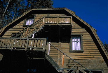 At first we thought it would require more map insight in finding the lodge under such wintery conditions. But to our surprise, the road we had been traveling on, Highway 168, just dead ended at our weekend getaway. The check into the lodge was fast and simple, soon we found ourselves settling into a decent rustic cabin with drifts of snow twelve feet high all around. Thanks to the constant plowing of roads, everything was accessible within reason due to El Ninos erratic behavior.
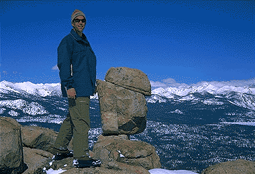


 Oak foothills of the Historic Gold Country, at the edge of the Sierra Nevada mountains.


 Whiskey Town Lake is west of


 All Tahoe Campgrounds will charge a fee for day use or overnight stays; Many require advanced reservations. Nightly rates vary per park, but tend to be expensive in this region. Most campgrounds are closed during the winter due to the big snow.
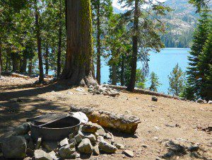


