Tag Archives: rivers

Kern River Campgrounds

limestonerun

Kern River Campgrounds – NFS

canoeSequoia National Forest Campgrounds
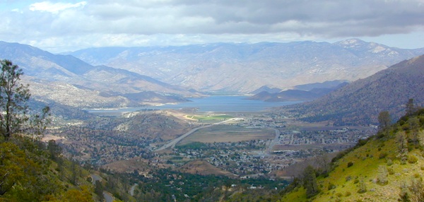
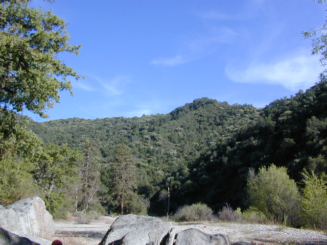
Kern River, Southern Sierra Nevada

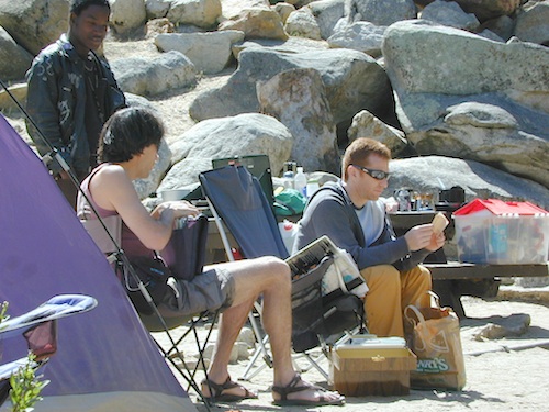
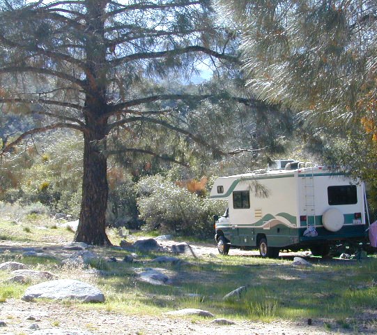
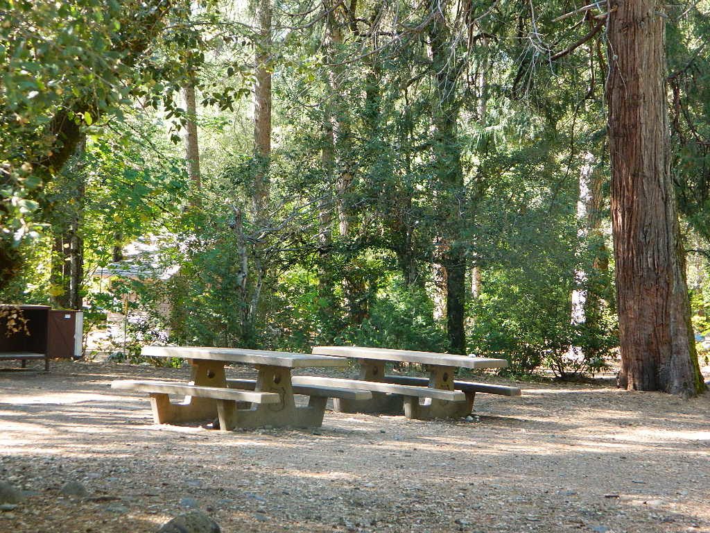
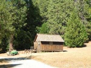
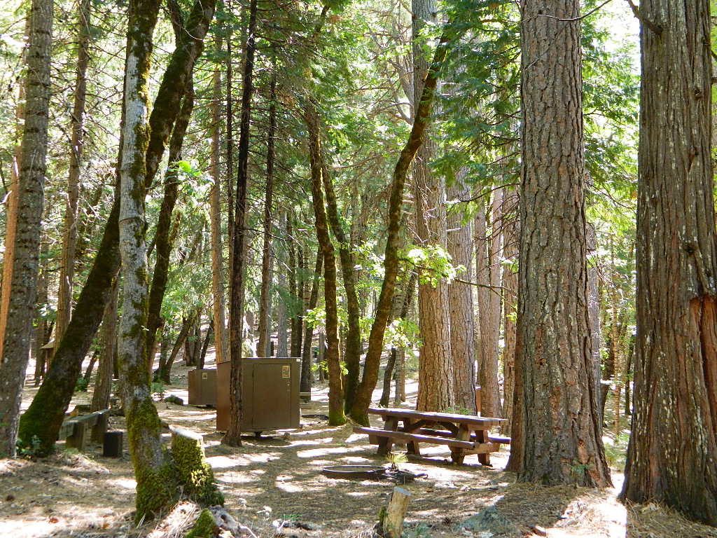
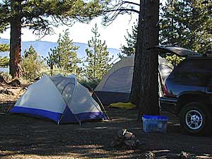
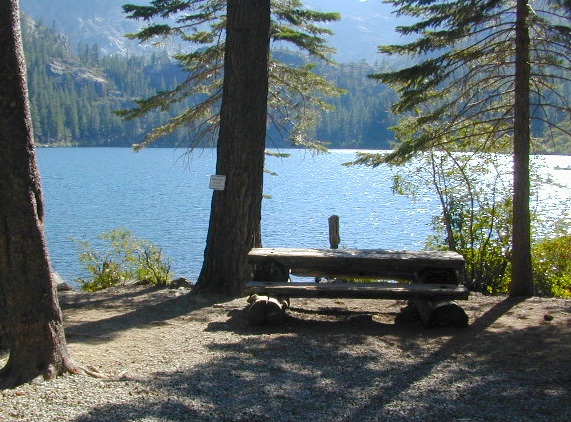
All the developed campgrounds listed below charge an overnight fee. Some are open year round, while others close for winter. Few are walking distance to the market, some may have piped running water, and garbage collection. Most have paved loop driveways and can accommodate large RVs. All campgrounds have bathroom facilities.
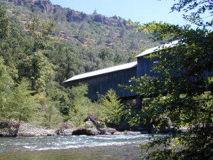
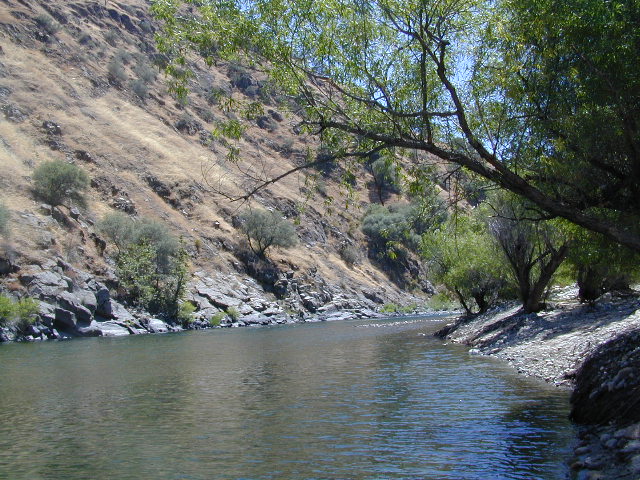
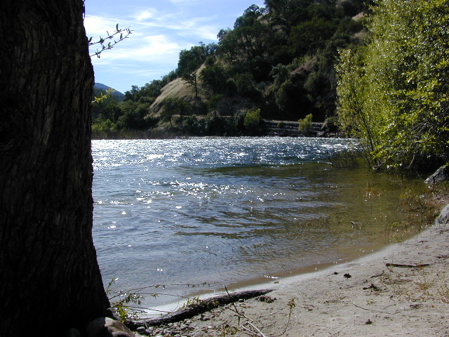
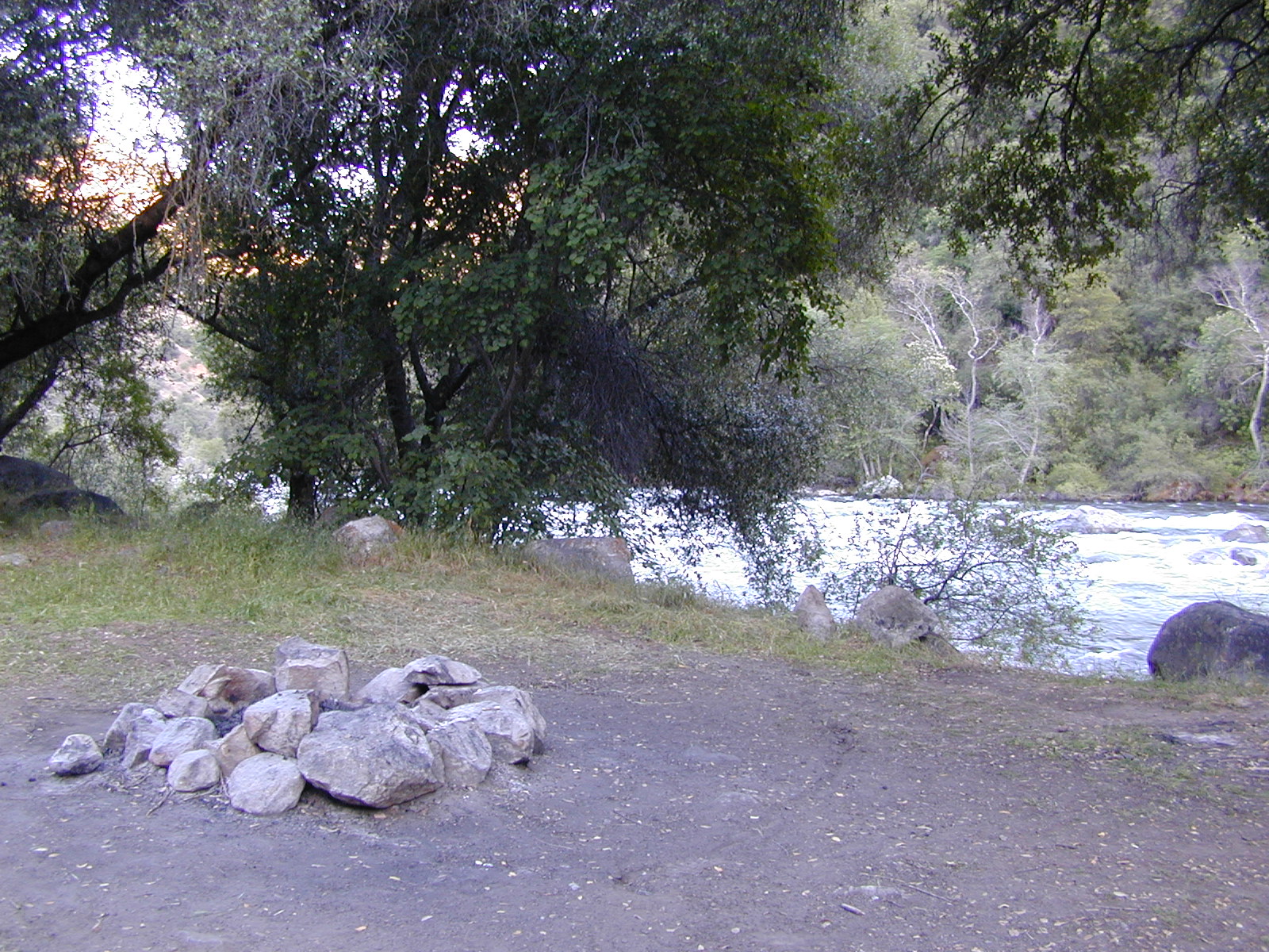
kern campgrounds California NFS Kern RVing

Upper Kern River
North of Kernville, California

campground

elev

spots

veg

toilet

notes

Fairview Campground

3500′

55

mixed

vault

Upper Kern; RV 45′

Gold Ledge Campground

3200′

37

mixed

vault

Upper Kern; RV 30′

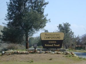
Headquarters Campground

2800′

44

alder

vault

Kern River; RV 27′

Hospital Flat Campground

3000′

40

alder

vault

Kern River; RV 30′

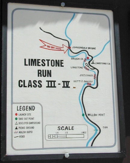
Limestone Campground

3800′

22

mixed

vault

Upper Kern; RV 30′

gold ledge lupine
Gold Ledge – blooming Lupine in Springtime

fish
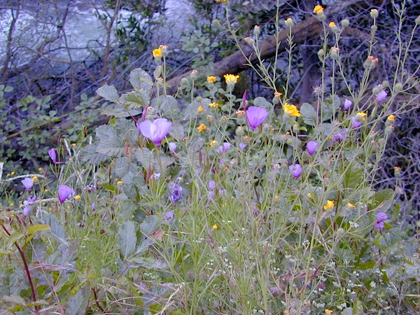
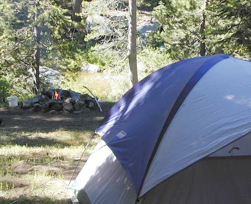
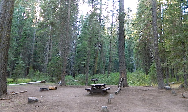
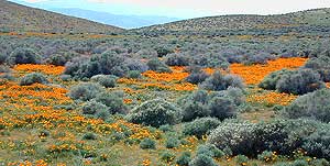
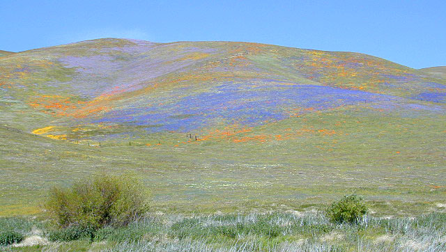
No day use parking lot inside the campgrounds. Park outside the camping grounds for recreation: fishing, hiking, mountain biking, rafting or wildflowers.

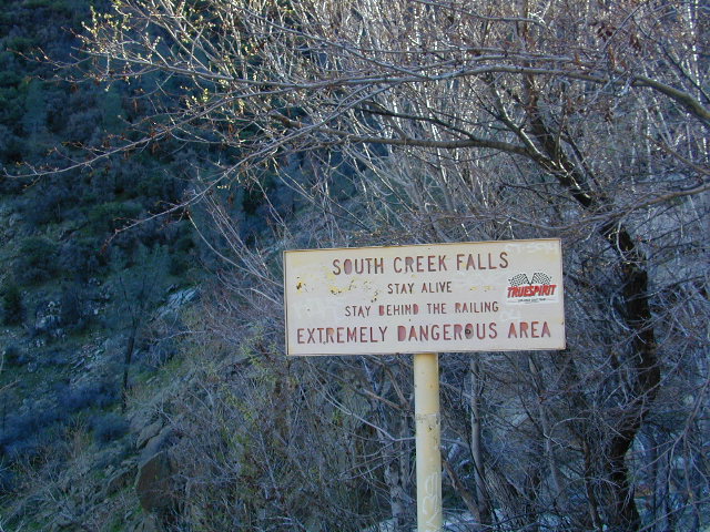
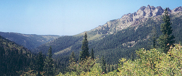
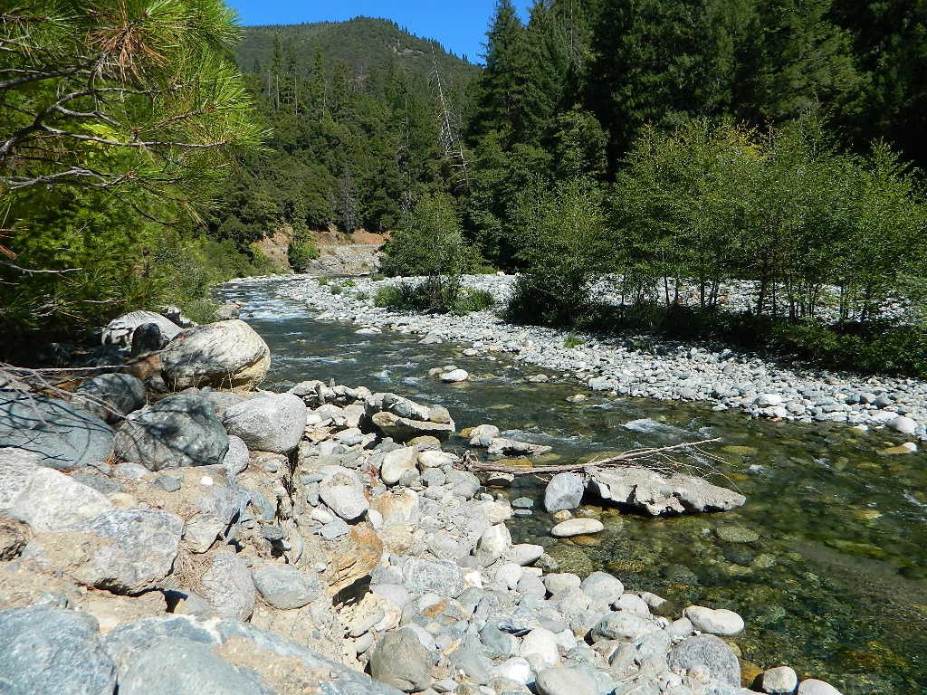
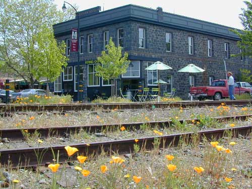
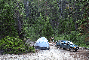
This entire canyon is dedicated to outdoor recreation w/ very few residential streets. Southern Sierra Nevada mountains – the whole Kern River area draws a lot of traffic from its proximity to Southern California.

headquarters kern

eriklovinglife
Outdoors, enjoying lIfe


South Creek Falls
South Creek Falls

RV campgrounds campgrounds hiking fishing campgrounds mt biking campgrounds

Lake Isabella
Lake Isabella, Kern Canyon California

Lower Kern River
South of Kernville, California

Granite Boulders

campground

elev

spots

veg

toilet

notes

Sandy Flat Campground

2300′

38

mixed

vault

open all year

Hobo Campground

2300′

35

mixed

vault

2019 closed due to landslide

NFS
Sequoia National Forest
Kernville Ranger Station
760-376-3781

Additional Info on Kern Camping –

Kern Flats Camping: Free Camps
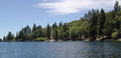
Lake Isabella
Keyesville OHV

North Meadow

Big Meadow Sequoia 

dirtbikescamp hiker

Kennedy Meadows, South Fork of Kern River
Chimney Peak Backcountry Byway
Dome Land Wilderness

Kern River Canyon
Kern River Hot Springs

Road’s End Resort
(destroyed by wildfire 2002)

Forks of the Kern
Lloyds Meadow Road #22S82

kernrvcamper

Plumas Camping

Lil' Northfork Campsite
Primitive (dispersed) camping near Lil’ Northfork

Plumas National Forest Camping – Primitive Camp Sites

Spanish Creek, Quincy, CA

Plumas Forest Camping

NFSlogoNorth Sierra Nevada, Northern California

Listed below are primitive campgrounds w/ minimal facilities or open camping areas in Plumas National Forest. Plumas has excellent fishing as the big rivers & numerous creeks run thru this northern Sierra Nevada landscape. Open camping is allowed on almost any dirt road w/ a current campfire permit

see also – Plumas Campgrounds

driftwood

Brady’s Camp
[on Pine Creek near Argentine Rock]
near Quincy, CA – east on Squirrel Creek Rd. & go 8 mi. to the campground. Elevation 7200′ / Open May – October

pct

Bucks Lake has numerous NFS Campgrounds and PCT access; Overall elevation 5000′ w/ abundant boating, fishing and hiking. Snow in winter closes roads. Cabins, marina, lodge, restaurants. Bucks Lake Wilderness, Gold Lake, Silver Lake

Deanes Valley Campground camp
[along Rock Creek] Hwy.70 Quincy, go 3.5 mi. west on Buck Lake Rd. Head south & 7 mi. to the campground. Elevation 4400′ / Open April – October


35 mph

Ishi Wilderness hiker

Backpacking trails w/ dirt road access. Above Chico, beyond Cohassett; on the border of Tehema Co. and Butte Co. (Lassen NF & Plumas NF)

Inskip, CA – Way up beyond the Ridge, well past Magalia and Stirling City – find dense forests, dirt roads and camping. Philbrook Reservoir w/ West Branch Campground NFS. Elevation 5546′

24N10 – Plumas NF

Lakes Basin Recreation Area

lakesbasinhikers
lakes basin day hikers

Snag Lake California

4x4 dirtbikes fish

Ohio Valley – Seneca Road
[off Hwy 89 to southside] Primitive forest camping near Lake Almanor. ATV trails, hunting. Creeks and river camping closer to Seneca. High clearance or 4WD may be needed on these dirt back roads – depending on snow and mud. There is plenty dirt roads back here to explore.

Snake Lakecanoe
[good fishing area] Hwy.70 Quincy, go 5 mi. west on Buck Lake Rd. Head north & 5 mi. to the campground at the lake. Elevation 4200′ / Open April – October

Snake Lake, California

Taylorsville Campground

Indian Valley - Plumas California

pinetree


digger pines
Bald Rock Road in Berry Creek, CA

see also – Feather River California

foreman creek
Foreman Creek @ Lake Oroville, (maxed out) FEB 2017

nearby towns –

Belden Town
Berry Creek, CA
Bucks Lakes, CA
Butte Meadows
Chico, CA
Greenville, CA
Oroville, CA
Paradise, CA
Portola, CA
Quincy, CA
Twain, CA


Yosemite Topo

merceddownriver

Yosemite Topo Maps

ti_yosemiteYosemite National Park, in California’s Sierra Nevada mountains, is the most visited of all the National Parks. Tourists, visitors and campers fill the main valley all year long, with the crowds peeking in mid summer. Autumn is gorgeous, winter is snowy, spring is glorious and summer is grand.

The park has numerous alpine lakes, granite domes, meadows, Sequoia groves and a snow ski resort. Backpacking is popular here, hiking all over, bike rentals w/ miles of paved trails. Plus, the best in big wall climbing. Waterfalls and granite cathedrals tower above the lush, glacier- carved valley. Mighty MERCED RIVER, right through the middle of granite and forests.

Storms of recent have rearranged the landscape inside the valley with a number camping facilities wiped out by the river. Yosemite lost half of the campsites, which dramatically reduced the amount of camping available inside the main valley. Older cabins at Yosemite Lodge are gone. Less camping, but more people means you should make camp reservations early as possible; or search for camping just outside the National Park boundary.

Sightseeing and hiking should be part of your visit to Yosemite Valley. Bring your raft for a float down the river. Stay away from the crowds and take the back roads, with our great selection of Yosemite backcountry maps.

We now have links to digital maps for download!

Topographic maps for Yosemite National Park – and the outlying regions:

Teneja Lake, Hwy 120. Yosemite National Park
Eastern Sierra Camping

Inyo National Forest

Sierra National Forest

Stanislaus National Forest

Yosemite Lakes

Yosemite Lodging

Yosemite National Park

Mariposa County CA
Ahwahnee
Bass Lake
Coarsegold
El Portal
Fish Camp
Groveland
Lee Vining
Mariposa
Midpines
Nipinnawasee
Oakhurst
Wawona
Vogelsang: High Sierra Camp

th_half_dome_d

Backpacking
Day Hikes
GRANITE TERRAIN
Topographic
Yosemite Trail Maps

TuolumneMdws

Sunrise Lakes
Sunrise Lakes, Yosemite HSC Loop Hike


Lake Tahoe Campground

Indian Valley Campground
Indian Valley Campground, Tahoe National Forest

Lake Tahoe Campgrounds

Cabins

Tahoe Forest Campgrounds

sierra buttes California

Lake Tahoe California

Listed below are developed camp grounds and RV camps around Lake Tahoe, run by various agencies. Most require reservations and are only open half the year (or less).

Lake Tahoe campgrounds: blue links lead to camp info.

campground elev spots veg toilet water notes
Bayview Campground 6000′ 10 pines vault Emerald Bay
Camp Richardson Tahoe 6500′ 330 pines flush piped South Lake Tahoe
Campground by the Lake 6000′ 157 pines flush piped South Lake Tahoe
D.L. Bliss State Park 6000′ 168 pines flush piped Westshore, Lake Tahoe
Eagle Point Tahoe 6100′ 100 pines flush piped California State Park
Emerald Bay State Park 6000′ 16 pines flush piped South Lake Tahoe CA
Fallen Leaf Lake Campground 6737′ 205 pines flush piped South Lake Tahoe CA
General Creek Campground 6000′ 175 pines flush piped Westshore, Lake Tahoe
Kaspian Campground 5800′ 20 pines flush piped Westshore, Homewood CA
Lake Forest Campground 6300′ 21 pines flush piped Northshore, Tahoe Vista CA
Meeks Bay Campground 6000′ 17 pines flush piped Westshore, Tahoma CA
Mount Rose Campground 8500′ 24 pines flush piped in Nevada @ Tahoe
Nevada Beach Campground 6200′ 54 pines flush piped Nevada Lake Tahoe
Pope Beach Campground 6000′ 49 pines flush piped South Lake Tahoe CA
Sandy Beach Campground 6300′ 44 pines flush piped Northshore, Tahoe Vista
Sugar Pine Point SP 6200′ 30 pines flush piped Westshore, Tahoma CA
Tahoe Pines Campground 6000′ 49 pines flush piped Meyers California
Tahoe Valley RV Campground 6000′ 413 pines flush piped South Lake Tahoe CA
Tahoe Campground SRA 6200′ 16 pines flush piped West shore, Tahoe City
William Kent Park 6300′ 95 pines flush piped Westshore, Tahoe City
Zephyr Cove Campground 6200′ 170 pines flush piped boat rentals Tahoe NV

ranger
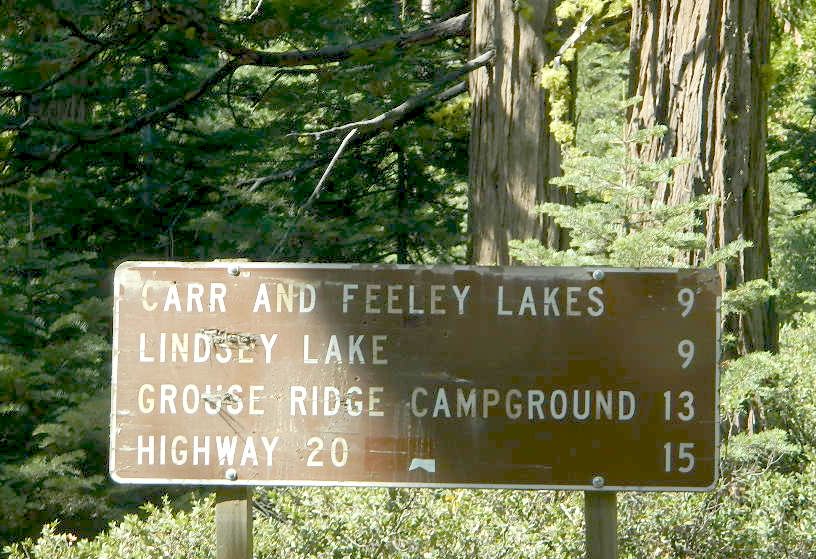
All Tahoe Campgrounds will charge a fee for day use or overnight stays; Many require advanced reservations. Nightly rates vary per park, but tend to be expensive in this region. Most campgrounds are closed during the winter due to the big snow. Check with the ranger districts listed here.

primitive camp spots
Sawmill Lake 4×4 Camp

camp RV camps NFS hikes fishing mountain biking camps river fishing

NFSlogo

Tahoe National Forest encompasses a large region of the Sierra Nevada mountains surrounding the north portion of Lake Tahoe. areas included – Donner Pass, American River, Yuba River, Northern Gold Country; Lakes Basin Recreation Area; Small lakes and reservoirs with excellent fishing, all surrounded by lush forests.

15milesto20

Campgrounds with mid (5000′) to high-elevation (8000′) locations close annually for winter snow. Many are open for a few short summer months.

Listed below are Tahoe Campgrounds located away from the Lake Tahoe Basin; Inside Tahoe National Forest  Smaller camps are on a first come, first serve basis. blue links lead to camp info.

campground elev. spots veg toilet water notes
Ahart Campground 5300′ 12 pines vault American River
Alpine Meadows 5900′ 25 pines vault Martis Creek
Bear Valley Campground 6600 10 pines vault piped OHV trails, Sierraville
Berger Campground 5900 7 pines vault lake Packer Lake, Lakes Basin
Big Reservoir Campground 4000 18 pines vault piped non motor lake, Foresthill
Boca Campground 5605′ 26 pines vault boat launch
Boca Rest Campground 5605′ 25 pines vault piped on Boca Reservoir
Boca Spring Campground 5800′ 17 pines vault piped horses
Bowman Lake 5585 7 pines vault lake Donner area
Boyington Mill Campground 5680′ 12 pines vault Boca Reservoir
Cal-Ida Campground 2000′ 21 pines vault piped Yuba River, Downieville
Canyon Creek Campground 6000′ 20 pines vault creek Donner area
Carlton Flat Campground 2200′ 21 pines vault piped Yuba River, Downieville
Carr Lake Campground 5900′ 5 pines vault lake Carr Feeley Lake
Chapman Creek Campground 6000′ 29 pines vault piped Yuba River
Chute Hill Campground 3400′ 30 pines flush piped Malakoff Diggins SP
Cold Creek Campground 5800′ 13 pines vault piped Sierraville
Cottonwood Campground 5600′ 24 pines vault piped Sierraville
Dark Day Campground 2200′ 16 oaks vault piped Bullards Bar Reservoir
Diablo Campground 5800′ 20 pines vault  Yuba River
Donner State Park Campground 5850′ 154 pines flush Donner Lake
East Meadow Campground 6100′ 46 pines flush piped Jackson Meadows Reservoir
Fiddle Creek Campground 2200′ 15 oaks vault piped Yuba River, Downieville
Findley Campground 6100′ 14 pines flush piped Jackson Mdws Res
Fir Top Campground 6100′ 12 pines vault flush Jackson Mdws Res
French Meadows Campground 5300′ 75 pines vault flush French Meadows Reservoir
Garden Point Campground 2000′ 19 variety vault fishing boats
Giant Gap Campground 3700′ 30 pines vault fishing boats
Goose Meadow Campground 5800′ 24 pines vault piped fish Donner
Grouse Ridge Campground 7400′ 9 pines vault Hwy 20
Hampshire Rocks Campground 5800′ 31 pines vault piped fishing camp
Independence Lake 6900′ 20 pines vault piped fishing
Indian Springs Campground 5600′ 35 pines vault piped fishing, Yuba River OHV
Indian Valley Campground 2200′ 17 pines vault piped Yuba River, Downieville
Jackson Creek Campground 5600′ 14 pines vault creek
Jackson Point Campground 6100′ 8 vault boat access Jackson Mdws Res
Lakeside Campground 5700′ 41 vault boat ramp Prosser Reservoir
Lake Spaulding Campground 5000′ 24 vault boat ramp PG&E Campground
Laiser Meadow Horse Camping 6200′ 11 vault piped High Sierra PCT access
Lewis Campground 5300′ 40 pines flush piped French Meadows Reservoir
Lindsey Lake Campground 5900′ 7 vault lake
Lodgepole Camping 5800′ 18 vault Lake Valley Reservoir
Loganville Campground 6000′ 29 vault piped Yuba River, Sierra City
Logger Campground 6000′ 252 pines flush piped Stampede Reservoir
Long Ravine Campground 2300′ 28 pines flush piped Rollins Reservoir
Lower Little Truckee 6000′ 15 vault piped Truckee River fishing
Madrone Cove Campground 2000′ 11 none Bullards Bar Reservoir
Meadow Lake Campground 7200′ 15 vault Sierra fishing camp
Meadow Lake Shoreline 7200′ 10 vault High Sierra Nevada
Mumford Bar Campground 5300′ 5 vault Foresthill Road
North Fork Campground 4400′ 17 vault piped American River
Onion Valley Campground 2300′ 5 oaks vault Sierra fishing camp
Orchard Springs Campground 2300′ 15 oaks flush piped Rollins Reservoir, Colfax
Pack Saddle Campground 6000′ 15 pines vault pump Packer Lake
Lakes Basin
Parker Flat OHV Camping 3900′ 7 pines vault off roading trails
Pass Creek Campground 6100′ 30 pines flush piped Jackson Mdws Res
Peninsula Campground 2300′ 58 pines flush piped Rollins Reservoir
Pine Aire Campground 2700′ 75 pines flush piped South Yuba River Camp
Poppy Campground 5300′ 12 pines vault French Meadows Reservoir
Prosser Campground 5800′ 29 pines vault Prosser Res.
Ramshorn Campground 2600′ 16 pines vault piped Yuba River, Downieville
River Rest Campground 2700′ 105 pines flush piped South Yuba River Camp
Robinson Flat Campground 6800′ 5 pines vault well
Rocky Rest Campground 2300′ pines vault Yuba River, Downieville
Rucker Campground 5800′ 10 pines vault Rucker Lake fishing
Sagenhen Campground 6480′ 10 pines vault
Salmon Creek Campground 5800′ 32 pines vault fishing
Lakes Basin
Sardine Campground 5800′ 29 pines vault Sardine Lake Lakes Basin
Schoolhouse Campground 2200′ 56 oaks flush piped Bullards Bar Reservoir
Scott’s Flat Campground 3200′ 86 oaks flush piped Scotts Flat Reservoir
Shirttail Creek Campground 3700′ 30 pines vault Sugar Pine Reservoir
Sierra Campground 5600′ 16 pines vault Yuba River, Sierra City
Silver Creek Campground 5800′ 27 pines vault Truckee River fishing
Snag Lake Campground 6000′ 12 pines vault Gold Lake Lakes Basin
South Yuba Campground 2700′ 16 pines vault South Yuba River Camp
Sterling Lake Campground 6500′ 6 pines vault lake
Talbot Campground 5600′ 5 pines vault American River
Union Flat Campground 3400′ 11 pines vault piped Yuba River, Downieville
Upper Little Truckee Camp 6100′ 26 pines vault Truckee River fishing
Webber Lake Campground 6800′ 60 pines vault lake Sierra fishing
White Cloud Campground 4200′ 46 pines flush piped biking, Nevada City
White Rock Lake Camp 7800′ 8 pines none High Sierra Nevada
Wild Plum Campground 4400′ 47 pines vault piped waterfalls, Sierra City
Woodcamp Campground 6100′ 20 pines flush piped
Woodchuck Campground 6300′ 8 pines vault creek
Yuba Pass Campground 6700′ 12 pines vault piped Yuba Pass, Hwy 49
Loganville Campground
Loganville Campground on Hwy 49
Union Flat Campground
North Yuba River @ Union Flat Campground

Tahoe National Forest

Tahoe Topo Maps


California Covered Bridge

Covered Bridges of California

Oregon City Bridge
Oregon City Bridge, off Cherokee Rd, N Oroville, CA

Overland pioneers and miners flooded the Sierra Nevada mountains after 1848, when gold was discovered, transforming the natural landscape and native life of California – in horrendous ways. Industrius, eager and using the abundance of natural resources available to build homes, divert creeks, and construct a new way of life. Mining for precious metals was not a hobby, it was a ‘way of life’ for many who sought westward locales. Most traversed a continent on foot with covered wagons to get out here.

Many early bridges made of wood have disappeared in California. Historic places, such as these few wooden bridges of the West, need to be protected and preserved. So no carving your initials; spray paint (tagging), littering – nor bullet holes.

Felton Covered Bridge
Santa Cruz Mountains & Redwoods
Railway Train Rides
Felton, CA

Bridgeport Covered Bridge
(built in 1862)
South Fork of the Yuba River
Northern Gold Country Hwy 49
Nevada City & Downieville, CA

Honey Run Bridge
on Butte Creek @ Skyway
Historic Landmark from 1894
in between Chico & Paradise, CA

Knights Ferry BridgeState Park
State Historic Park

on Sacramento River
North of Sacramento, CA

oregoncitymarker

Oregon City Bridge
(see photo at top of page)
Oregon Gulch, North Lake Oroville
via Table Mountain @ Cherokee Road
North of Oroville CA

Oregon Covered Bridge
Middle Fork of the Yuba River
Northern Gold Country Hwy 49
in between Nevada City & Downieville, CA

Woodson Bridge SRAState Park
State Recreation Area

Woodson Bridge Campground Campgrounds
on Sacramento River, in betweenRV camping
Chico & Corning, CA

Honey Run Bridge
HoneyRun Bridge of Butte County, California

Volcanic Buttes of Chico
Volcanic Buttes of Chico California

Hiking Lake

Guide to Hiking Lakes in California

lakes Southern California

This is California – the beautiful, where millions flock on vacation. California is crowded: the population & tourists are only increasing each year. Thousands of people are looking for hiking mountains or better, a hiking lake – each weekend. Many are using the web for destinations, like the research you are doing right now. All folks seeking nature, water, cooler temps, fresh air & views. High Sierra, NorCal, SoCal Reservoirs, we list the best of these hiking lakes below.

Some of the lakes have mountaineering routes nearby; equestrian trails, regular hiking trails, campgrounds, some even have sorta level paved (granny) trails for biking, hiking & skating around.

High elevation or alpine lakes can be accessed best in summer months. Mountain bike, backpack, horseback into these hidden treasures. With any Sierra Nevada destination, snow pack deep can be in certain seasons. Major Highways (Sierra Passes) can be closed into June or July, due to rock slides and late snow melt. Snow shoes, snowmobile or 4×4 vehicles may be needed to reach such lakes, any months OCT-MAY (fall to spring). Winter can come early & stay late at these higher elevations of California; Be prepared for true Wilderness experience.

But maybe you are just looking for some easy hiking, loop trails & picnic spots; Or perhaps an overnight stay near a lakeside camp w/ kayak rentals. California reservoirs to alpine lakes, we have a wide variety listed below.

This page contains links to some favorite lakes with hiking trails around the lake, along the shoreline or routes on ridge lines overlooking the lake. If no good lake page could be found, we’ve linked to some photos of the lake on Flickr.

Baja California:

SoCal:

Central California / Sierra Nevada:

NorCal:

Blackrock Reservoir in Sierra Nevada

Lakes California Map: check out all the maps we have for lakes in Cali

Redwood Beach Camping

NorCal Redwood Coastal Camping

Redwood Campgrounds

Del Norte County, Northern California

redwood101

There are a few special places in California where redwood trees grow right down to the shore, but it is rare. Searching for place to pitch a tent (under the redwoods at the coast) is possible, but a bit harder to find than you might imagine. State Parks usually offer the standard paved camp site. Maybe need to drive dirt roads to find redwood seclusion.

Crescent City Camping

redwoodmap

Klamath Coast Camping

blue links lead to State Park pages with camp reservations.

State Park

Redwood Park Campgrounds State Parks

Redwood National Park National Park
Camping 

  • Demartin Campground
  • Flint Ridge Campground
  • Mill Creek Campground
  • Nickel Creek Campground (backcountry)

Eureka RV Campgrounds

redwood camping norcal

If you are seeking free or dirt cheap, primitive camping on the coast, then LOST COAST CAMPING on the Mendocino border is one option. Or head east, inland to the abundant National Forest. Dirt roads of the Six Rivers National Forest offer old logging roads, creeks, and secluded places to pitch a tent. Campfire permits are needed for dispersed camping, or ‘boondocking’ as some call it.

Dirt back roads can get muddy during the wet season, so know your vehicles capability and if you are unsure, check with the local rangers over the phone (preferably a ‘field ranger’) before venturing out. Remember that rain and mud are the norm, most of the year.

Fog is typical of the region. Enjoy the sunshine – when you can!

see more towns nearby –

Smith River
Crescent City
Klamath
Orick
Trinidad
Arcata
Eureka
Scotia
Ferndale
Petrolia
Garberville
Redway
Shelter Cove

California Water Information

California Reservoirs
California Water Resources

water resources / water scarcity / land and water

snow flakes

SNOW PACK

State Snow Depths – Wunderground
SNOTEL Snow Depth Reports
http://www.wunderground.com/StateSnowDepth.asp?state=CA

California Snow Water Equivalents
Sierra Snow Pack Data
https://cdec.water.ca.gov/snow/current/snow/

Eastern Sierra Snow Pack by Sierra Wave
Article published Feb 2014
http://www.sierrawave.net/tag/eastern-sierra-snowpack/

Eastern Sierra Avalanche Center
Snowpack summaries published Dec 2014
http://www.esavalanche.org/content/snowpack-summaries-begin-soon

Sierra Avalanche Center
Sierra Nevada Mountain Snow in California
http://www.sierraavalanchecenter.org/


snow flakes

LAKES & RESERVOIRS

The Lowest Lake Levels in California
List of Reservoirs below 30% full, as reported Jan. 2015


Conditions for Major Reservoirs in California

http://cdec.water.ca.gov/

  • Trinity Lake
  • Lake Shasta
  • Lake Oroville
  • Folsom Lake
  • New Melones Lake
  • Millerton Lake
  • San Luis Reservoir
  • Don Pedro Reservoir
  • Pine Flat Lake
  • Pyramid Lake
  • Castaic Lake

San Diego River & Reservoir Data
Map of San Diego Hydrology, Water Storage
http://www.cnrfc.noaa.gov/

San Luis Obispo Reservoir Data
Lakes on the Central Coast of California
http://www.slocountywater.org/

  • Lake Nacimiento
  • Whale Rock Reservoir
  • Lake Lopez
  • Santa Margarita Lake
  • Twitchell Reservoir

Ventura County Watershed Map
Watershed Protection District
http://www.vcwatershed.net/

snow flakes

RIVER FLOWS

California River Forecast Center Map
Overview for recent rainfall data, snow depths, and ocean temperature
http://www.cnrfc.noaa.gov/google.php

California Current River Conditions
CA.gov Dept of Water Resources
http://cdec.water.ca.gov/river/rivcond.html

California River Forecast
California Nevada River Forecast Center
http://cdec.water.ca.gov/rivforecasts.html
Drought Info
http://www.cnrfc.noaa.gov/droughtInfo.php

Upper Sacramento River Forecast
Northern Sacto River
http://cdec.water.ca.gov/cgi-progs/rivfcast/USACBUL

snow flakes

NEWS & STATISTICS

Irrigated Lands in California – Farming Map

Dry Wells in California – DanaMite’s Map
More than 1,480 domestic well failures in 36 counties have been reported to the state of California recently.

California will need 11 trillion gallons of water to end epic drought by Mashable.com
http://mashable.com/

California Department of Water Resources
http://www.water.ca.gov/

Water in California – Wikipedia
Reservoirs, Water Sources, Aquaducts, Water Distribution
https://en.wikipedia.org/wiki/Water_in_California

Residential Per Capita Water Use across California
Water conservation measures and stats per city
http://www.californiadrought.org/

Aquafornia, the Water Education Foundation
California water news from various news sources
http://www.watereducation.org/aquafornia

Association of California Water Agencies
Largest statewide coalition of public water agencies
http://www.acwa.com/content/water-information

USGS Water Data for California
The United States Geological Survey
http://waterdata.usgs.gov/ca/nwis

EPA – Environmental Protection Agency
California Drinking Water | Local Drinking Water Information
http://water.epa.gov/drink/local/ca.cfm

California Water Impact Network, C-WIN
Advocates for equitable and environmentally sensitive use of California’s water
http://www.c-win.org/

California Drought Map
National Drought Mitigation Center
http://droughtmonitor.unl.edu/Home/StateDroughtMonitor.aspx?CA


snow flakes

PACIFIC OCEAN

Heal the Bay
Volunteer, Beach Cleanups, Santa Monica Pier Aquarium
http://www.healthebay.org/

The Pacific Genocide

  • Fukushima Meltdown
  • Acidification of Oceans
  • Overfishing
  • Pollution & Oil Spills
  • Marine Life Watch

Kirch Flat Campground

Kirch Flat NFS
Camp Kings River

kirch flat

Low elevation Western Sierra: a big river at the beginning of Kings Canyon. Fishing, biking and hiking. The Kings Cyn National Park is directly east, upriver.

Oak woodlands, steep granite canyons, waterfall hikes, rock beaches, river fishing, mountain biking and wildflowers. Day time temperatures get triple-digit in summer months, so best time to visit is the rest of the year. Small RV accessible, paved road, river close – and best of all, open all year long!

flora west sierra

Kirch Flat Campground

Due EAST of Fresno, California in a large river canyon, Western Sierra Nevada
Located 18 miles up Trimmer Springs Road (paved), 5 miles above Pine Flat Lake. Sierra National Forest; River rafting take-out spot for Middle Kings River.

• Elevation: 1100′
• Number of Sites: 17
• Camp Fee: No
• Vehicle Accessibility: RV 22′ max
• Campsites Reservation: No
• Length of Stay: 14 Days
• Season: Open Year Round
• Trailheads: Kings River

lowerkings

see also Kings River Camping

nearby destinations –

Big Creek Rd #9
Blackrock Reservoir
Dinkey Creek
Dinkey Lakes Wilderness
Fresno, CA
Kings Canyon NP
Monarch Wilderness
Pine Flat Reservoir
Reedley, CA
Shaver Lake, CA
Sierra National Forest
Sequoia NP
Wishon Reservoir

12S01 – Sierra NF

12S01kingsriver

Kings River, Sierra National Forest
Road #12S01 – Lower Kings

Located in between Kings Canyon National Park and Pine Flat Reservoir. Graded dirt road w/ trailhead parking & camping; Primitive car camping, vault toilets, some areas accessible by small RV. Campfire permits are required.

Long, (sometimes rough) dirt road, that parallels the north side of the Kings River. Dirt road used by families, fishermen, kayakers, campers, mountain bikers, rafters and rafting shuttle buses, seasonally. May be gated and closed off to the public in wetter months of the year.

Bear Wallow Trailhead
Kings River Trailhead

kingscampsites
click to enlarge

Forest Route 12S01 crosses the river and leads to the south side of the river, near Green Cabin Flat. Mill Flat Campground is back this way.

Road 12S01 gains in elevation, turns to high-clearance, continuing up McKenzie Ridge thru a small slice Sequoia National Forest to the highway Kings Canyon National Park. 4×4 may be needed in wet/snowy weather.

flats of kings

California Countryside Hikes

California Wine Country Hikes, Gold Country Hiking, Sierra Foothills, River Trails

DSCN1649

Camp Clean

Minimal Impact Camping

Camping Tread Lightly

Leave No Trace Camping

Camp Cleaning

  • No Soap in Streams, Creeks or Lakes: Even Biodegradable Soap is not good for the poor fish downstream.
  • Bring a bucket or wash tub – Wash dishes, clothes & yourself 100′ from streams & lakes
  • Food put away & dishes washed up before bed time. Keeping a clean camp will lessen the chances of wildlife or a bear visit
  • Use existing campsite or rock campfire ring to prevent impacting new areas
  • Pitch tent in cleared camp spots only (when primitive camping). No need to trample new spots.
  • Do not set a tent up in a meadow, next to a creek or on a lake shore. It’s too fragile an environment.
  • Bring extra trash bags (heavy duty lawn type is best) for cleaning any litter you might find at your selected camp site.
  • Sometimes you’ll need to shovel out the whole fire pit (full of glass and trash)  to start a fresh new campfire. Building your fire on top of somebody else’s mess means you’ll be inhaling all their left-over garbage.
Always leave a clean camp
always leave a clean camp

leave no trace

Camp Kitchen Outdoors

Try to keep all food, drinks and cooking to one area of the camp. If you plan to cook over the campfire, this choice will make much more sense. Setting up kitchen area in between the tent and the campfire is usually an excellent spot. Having the vehicle close by for proper food storage is also advised, or use bear boxes if available. If you choose to hang your food in the tree, bring adequate ropes and bags.

The last person still up around the campfire at night should double check the cleanlness camp before retiring for bed. Chances are there is a half-eaten snack or left over beverage that could attract the animals. Oh no, the GARBAGE!! Don’t forgot to put your garbage bag away at night, or dispose of it in a proper trash container. Double bag your garbage if you are concerned with it leaking or smelling up the vehicle.

Food Preparation

Potty Breaks in the Outdoors

shovel

  • Bathroom break in the bushes? Don’t leave your toilet paper trash. Dispose of in your vehicle with a plastic bag or back at camp.
  • For human waste – Bring a shovel, dig holes 8″ deep & pack out all toilet paper. Do not bury paper as animals will just dig it up.
  • Certain areas are so sensitive or overused that all solid waste must be packed out, check for the local regulations.

Camp Hygiene in the Outdoors

Spicer Reservoir

spicer terrain


Spicer Meadow Reservoir

Spicer Meadows, Spicer Reservoir, Rd #7N01
Spicer Lake, Stanislaus National Forest

lake elevation 6418′
227 surface acres

public boat ramp
hiking trail around lake
more lakes nearby

Ebbetts Pass Sierra Hwy 4

Ancient volcanic peaks mix with Sierra Nevada granite rock, pine forests and fresh, clear, clean mountain water! California, of course.

Stanislaus Forest Road #7N01 leads down from Highway 4 to this popular series of alpine lakes and reservoirs. Camping, fishing, hiking and mountain biking. Sailing, canoeing, kayaking, swimming, floating and fishing are also popular water activities.

Rules of the Reservoir:
10 mph speed limit on Western Arm.
No motorized boating in Eastern Arm.
Camp only in developed Campgrounds.

NFS
2 NFS Campgrounds at west end of lake:

  • Spicer Campground (60 sites)
  • Spicer Group Camp (75 people max)
  • Campgrounds only open June-September. Some campsites at the campground are wheelchair accessible.

    Additionally, Stanislaus River Campground w/ only 8 sites, is located just off the main access road #7N01, right near the river.

    spicer lake shore

    Spicer #7N01

    Numerous smaller lakes in the region make this a hot spot for summer vacations. Union and Utica Reservoirs (both with dirt road access) are good for kayaking and canoes, while power or sail boats prefer the larger Spicer Lake. Summit Lake and Elephant Rock Lake are perfect for quite picnics and day hikes. Trails (many unmarked) connect the lakes to each other. Area gets buried with snow in winter, so these roads are generally only open half the year.

    More reservoirs and lakes nearby:
    Highland Lakes
    Mosquito Lakes
    Lake Alpine, CA
    (all along Hwy 4)

    Stanislaus National Forest Map USDA
    Stanislaus National Forest Map USDA

    Nearby mountain towns:
    ARNOLD, CA
    BEAR VALLEY, CA
    Lake Alpine, CA

    California Camping Maps

    California Campground Maps

    Maps are the key to finding your very own slice of heaven in the Wilderness. Online map sources can barely get you to your city destination correctly, much less the remote waterfall you desire. You will need a real map for your adventure. A topographical map, with all the details, dirt roads & hiking trails. If you are seeking to stay away from the touristy crowds, this is the best possible place you can be…. on this site, searching for ways to make it happen – this weekend.

    BACKPACKERS BACKPACKING MAPS –

    maps of California
    Mount Whitney, John Muir & way beyond the High Sierra. DanaMite has all the California Wilderness maps on the new map shop. Various brands and types of maps. Most are printed on waterproof plastic now & are tear-resistant.

    CAR CAMPING MAPS –

    El Dorado Camping
    Planning on camping outside of the developed campgrounds & finding that perfect stream side spot without the reservation & the fees? Then you will need a free fire permit (from a ranger station), plus a good map of the forests & a vehicle capable of handling the rugged the back roads. Much of California is prone to wildfires, so make sure campfires are even allowed on the backroads, before you get out there. Call the “field rangers” for back road advice and current recommendations.

    CALIFORNIA OFF ROAD MAPS –

    Wanna take that 4×4 vehicle somewhere really special this season? Camp well beyond the masses, way down that dirt road. We have OHV maps for SoCal, the deserts & all the National Forest maps too.

    CALIF CAMPGROUND MAPS –

    Start your search on the perfect campground or camp site with the destination in mind. Mountains, deserts, coastal. Parks & forests all have their own maps with all nearby camp grounds listed. We feature all the National Forest maps, as well as some State Park & National Park maps

    See all California topo, hiking, camping maps

    Sierra Nevada maps

    coolsprings

  • California A to Z
  • California Camping
  • California Elevations
  • Camp Firewood
  • Camp Potty
  • RV camping deep in the Sierra
    RV camping at it's best in the Sierra; This rig found themselves deep in the alpine lush meadows with towering trees and a view and a very private camp site.
    Big Bend CA
    Big Bend Ranger Station, off I-80

    Northern California Redwoods

    Northern California Coast Hotels & Camps

    redwoods parks
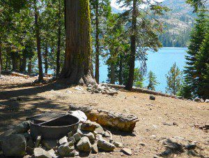
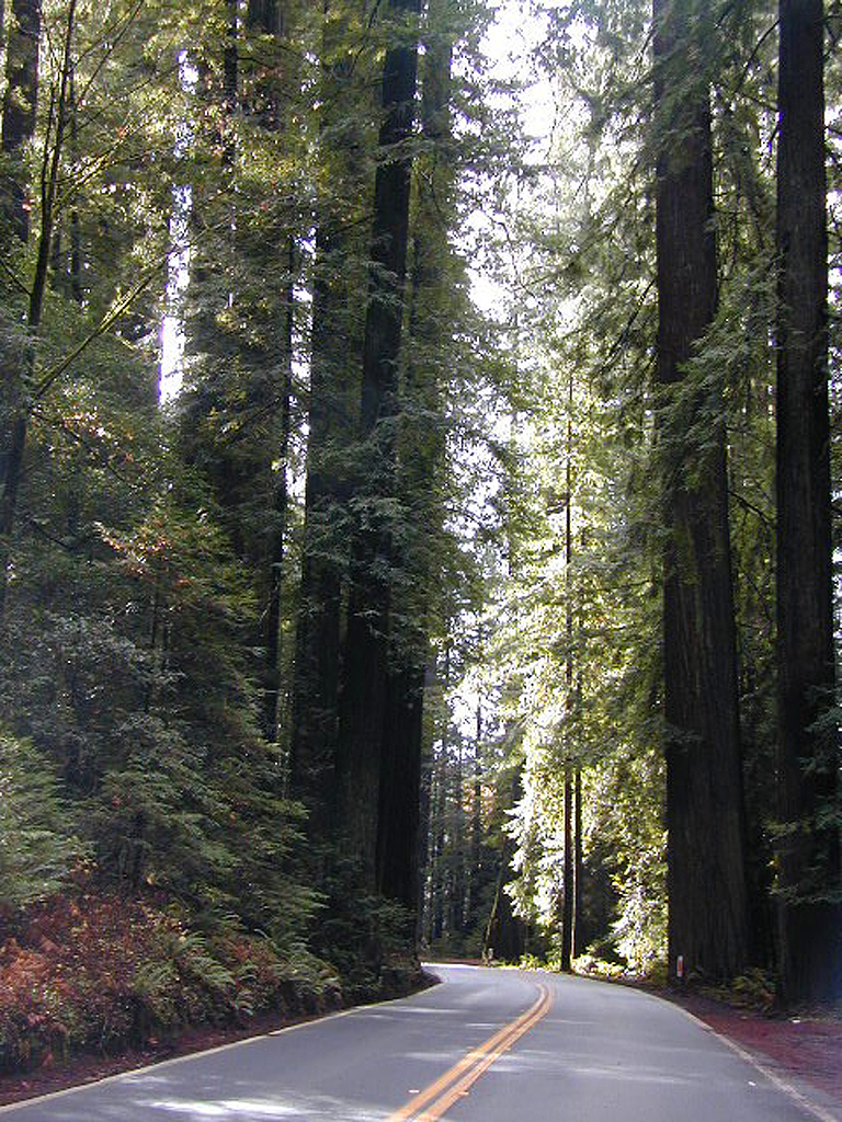
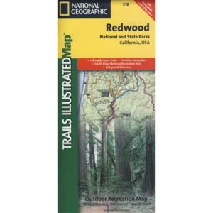
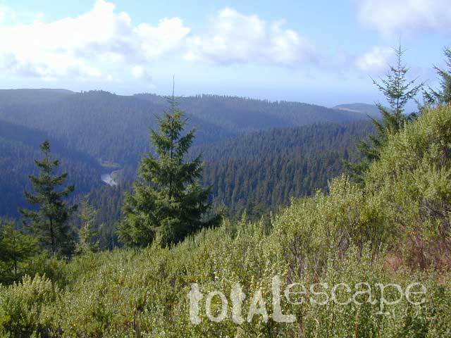
The north coast of California is dubbed the Redwood Empire, and driving north on US Hwy 101 passing the well-known wine country and communities near Clear Lake, means you’ve entered the official redwood region of Cali.

    With over 150 mile stretch between Ukiah & Crescent City, on the Oregon border, coastal redwoods thrive in this wet climate. All along US Highway 101 you can find every assortment of lodging, from standard hotels walking distance to village shops, to small secluded cottages tucked behind a winery. Sonoma & Mendocino vineyards merge on ridge lines, at the edge of oak countryside, with redwood forests & recreational rivers to the north.

    BALD HILLS ROAD: Old logging roads lead way up in elevation, behind Redwood National Park, where you can find free camping spots and firewood piles all over the clearings. A real 4×4 vehicle will be needed in wet or snowy weather conditions. AWD wagons should be cautious of deep mud and know the weather conditions ahead of time. The main gravel/dirt route traverses the Bald Hills range at 3000′ elevation and ‘epic view’ campsites are abundant. Pine Creek Road drops east into Klamath River Canyon down to Klamath Hwy 96.

    Bald Hills Rd

    USAL BEACH: In the olden days, USA Lumber Company had a prime place on the Lost Coast. Now it is a wonderful destination w/ remote beach campground hidden in the trees, next to the redwoods and creek, and the cliffs – and a big sandy beach w/ giant driftwood!

    Towns w/ Redwood Lodging in NorCal – 

    Redwood Parks in NorCal –

    (from south to north, with closest town)

    REDWOOD MAP


    Redwood Map Topo

    Topographic hiking and camping maps of the NorCal Redwood region –

    Where is your favorite place to camp?

    tent camping

    This is one of those silly questions that has no real definitive answer from DanaMite. If you have camped California at all, you know it can be awe inspiring around every corner, especially the Sierra Nevada & the Coastline.

    Most California transplants get so wrapped up with city life, college & new careers, that they rarely venture past the county park, much less the county line.

    When they finally do break away, they are often misled to crowded campgrounds with steep reservation fees and too many RVs, walking distance to a mini mart. Often they assume camping in California is not what they thought it was going to be. Not like the photos they once saw, not the dream-like places of wildness, not the privacy they had envisioned. They may even give up on the whole ‘camping experience’ all together.

    It does not have to be like this. Information is power. This web site Total Escape was made for YOU, the avid Escaper, who desires the best camping options available. One who will respect the land & care; Those that will teach their children to clean up litter & respect our precious public lands.

    The California deserts are just as magnificent as the alpine meadows; The mountain peaks, the hot springs, coastal cliffs to the forests, and the river canyons!

    It’s all good.

    There cannot be one favorite camp spot, when you find yourself camping every month. Each site is a new destination, a place to explore, with usually a reason to return. Each season your favorite spot will change & be more desirable some months over others. From aspen trees changing color in the Eastern Sierra to wildflower meadows of the High Sierra, every place has its own unique flavor.

    Drive further for less people and more nature!

    National Forest Service

    California National Forests are a great place to start.

    Highland Wildflowers

    Collections of California Camping Lists

    sierra camps

    Specific Places to Camp in California

    Sierra Nevada Campground

    Poppy Stompers

    California Golden Poppy

    The official state flower of California is the POPPY

    Spring usually means it’s warming up, to a great wildflower season in California. Time to get outdoors more! Hike, bike and picnic near the wildflowers and see some poppies.

    poppy fields

    California Golden Poppies can be found throughout the state, in small patches near the roadways, rolling hills behind vineyards, in high desert flats (where wind gets whipping) or even out near a ranch, with oak hills and fields of golden orange.

    POPPIES can blanket hillsides, resulting in a show stopping event – which can be deadly on freeways? N of L.A. interstate 5 (the Grapevine) TEJON PASS (Lebec, Gorman, Junction 138) >> Please pull to nearest exit and stop the car. (It will be safest and well worth the 10 minute stretch break.)

    Golden poppies can be found all over California. Flowers like lupine and owls clover can often be found nearby. Wildflowers may only last a few weeks, so go enjoy them while they last.

    Bright yellow, gold, deep orange – or any shade in between!

    best places to find poppies

    NORTHERN CALIFORNIA

    Table Mountain @ Cherokee Road
    North of Oroville, CA

    wine country

    Wine Country NorCal

    Alexander Valley Road

    Railroad Tracks @ Santa Rosa, CA
    Napa County
    Sonoma County

    Santa Rosa Tracks

    CENTRAL CALIFORNIA

    Kern County

    Fort Tejon State Historic Park @ I-5
    Cerro Noroeste Road & Klipstein Canyon
    Carrizo Plain National Monument BLM
    Kern River Canyon
    S of Walker Basin @ Caliente Bodfish Rd
    North of Tehachapi, CA

    Santa Lucia Mountains
    Rock Front Ranch
    Schoolhouse Canyon
    Cottonwood
    Hwy 166, West of New Cuyama, CA

    Figueroa Mountain Road
    Los Padres National Forest
    East of Santa Ynez, CA

    Pine Flat Reservoir
    @ Kings River, Sierra National Forest
    East of Fresno, CA

    East Bay San Francisco
    The rural hills out east are the best places to find poppies in the Bay Area.

    Mojave Desert Preserve
    Providence Mountain SRA
    Interstate 40
    East of Barstow, CA

    Central Coast California

    Gold Country Hiking

    Gold Country California

    Auburn, CA
    Central California Reservoirs
    Located all around most rivers w/ dams (reservoirs) poppies can easily be found along highways, rural roads and on oak hillsides.


    SOUTHERN CALIFORNIA

    Boulder Creek Road (dirt)
    Descanso to Julian, CA
    San Diego Mountain Foothills

    SoCal poppies

    Lancaster Poppy: Antelope Valley Poppy Reserve

    Poppy Hotline (661) 724-1180

    Remember, stay on the trail!  Getting a picture of that one really nice poppy will crush all the plants along the way, and compact the ground leaving lifeless bare dirt for the next year or longer.  If someone else has started a trail, do not add to the damage.  Please be a responsible park visitor and leave the park as nice as you found it.

    Or you can avoid the crowds & tour buses at the Poppy Park to head off on your own adventure. All along both sides of high desert Hwy 138 you can find fields of California Poppies, from the small town of Neenach, CA east to Hwy 14. Plus the hills of Gorman are usually full of color.

    Gorman @ I-5
    Gorman CA – Interstate 5 @ jct Hwy 138

    California Romantic Resorts

    Ahwahnee Yosemite Valley
    The Ahwahnee, Yosemite Valley

    Favorite romantic places in California. Stay overnight, have dinner nearby & make a night of it, or perhaps a whole weekend. Certain places may require a 2-night minimum stay, especially on weekends or any holiday weeks. A wide variety of destinations are listed below, from rustic mountain cabins, to palm oasis hot springs, to historic lodges located in a spectacular scenic setting.

    Neighboring lodges or nearby small towns could have equally as nice accommodations, perhaps still affordable, quaint, uncrowded, and “undiscovered” by the masses. Call the innkeeper and ask questions. They should be thrilled to hear from you.

    SnowMo CaliforniaWINTER NOTE: Some of these remote locations may not be open year-round, due to snowy weather, so please confirm by phone before you make the drive. Tioga Pass Resort may require a snow-mobile to access.

    romantic holiday vacations

    mid-winter escapes

    valentine romance ideas

    California Romance (starts here)

    desert California

    Hotel Del Coronado near San Diego

    Julian Historic Hotel, Julian CA

    Beachcomber Motel, San Clemente, CA

    Benton Hot Springs, N of Bishop, CA

    Blue Lantern Inn in Dana Point Marina

    Cambria, on Moonstone Beach, Central Coast

    Camp Nelson Lodge, Giant Sequoia NM

    Carmel-by-the-Sea, Monterey Bay California

    Downieville River Inn, N Yuba River, Downieville CA

    Furnace Creek Inn, historic Death Valley NP

    La Fonda Hotel, Baja California

    Laguna Beach – all of it, pretty much

    Lantern Inn, hiking trails, Paradise, California

    Lido Palms Resort Spa, Desert Hot Springs, CA

    Lucia Lodge, Cottages on cliffs, North Big Sur

    cottages miranda

    Miranda Gardens, Redwood Cottages, NorCal

    Panamint Springs Resort, Death Valley, CA

    Rainbow Lodge, granite/river near Donner Pass

    Sardine Lake Resort & Cabins, North Sierra

    Tioga Pass Resort, Eastside Yosemite

    Treebones Resort, Yurt Camping in Big Sur

    Wine Country Towns $$$ – Napa Co / Sonoma Co

    sardineresort

    see also –

    California Lighthouses

    Lodge Resorts

    NFS Rental Cabins & Fire Lookouts

    Redwood Hotels

    This new California Lodge List will grow as DanaMite finds more ideal places, deep in wilds of California.

    Sierra Nevada Lakes

    Dispersed Camping Sequoia

    bone creek

    Sequoia maps

    Open Camping in Sequoia National Forest – Forest Road Camping

    Seeking secluded campsites? This is one of the best areas to camp in pine forest w/ privacy, relatively close to Southern California. Plenty of primitive car camping on the dirt roads throughout this whole Sequoia & Kern River area.

    nfs primitive back roads mountain biking hiking mountains

    No facilities. No picnic tables, no toilet, no fees. Just a rock campfire ring & a clearing. Previously used sites have already been established usually near streams. Try to use these first, if at all possible. It takes a bit of exploring but you will find the perfect spot. Don’t even attempt to try to find these kinds of camp spots at night. They are often buried deep in the forest with no visible markers what-so-ever. But in trade, you will be lulled to sleep by your own private mini waterfall & no RV generators. Many of these back roads are closed & gated during winter months due to snow & rock slides.

    No amenities are available in this neck of the woods, but plenty of seclusion & wilderness. Check official Wilderness rules for proper knowledge of the area restrictions. You must get a free camp fire permit from the ranger station in order to build a fire outside of a developed campground. A large shovel, plus bucket w/ water are a bare minimum for the privilege of camping like this. Certain dry seasons (summers into autumn) have very strict camp fire restrictions. Check with the ranger to see the latest on building campfires on the back roads. camping

    A Sequoia Forest Service Map is highly advised for this area. There are so many dirt roads for dispersed primitive camping on the back roads. Due to weather & erosion, some roads may require 4×4 or high clearance, so come prepared with a plan B.

    Camping Checklist to make sure you’ll have what you need. The drive up from the Los Angeles area averages 3-4 hours and is well worth the trip. Once you’ve found that perfect spot, take detailed note of it, for the next time you visit the area. Then, you will be able to get there easily in the middle of the night, if need be.

    Backroad Camping Sequoia: Follow the forest road numbers with your Sequoia map to discover amazing back road camping options. Your own private stream or meadow. Secluded campsites with your own mini waterfall.

    overview

    see also –
    Sequoia Campground Camping

    monache mdw

    Gold Country California

    Gold Country Sierra Nevada

    historic murphys hotel

    1849:
    California Gold Rush began

    These foothill regions below are the rivers & mountains of the infamous California Gold Rush of the mid-1800’s. Many mountain dirt roads will lead to your secluded, private camp site, near a creek or river. Or plan on camping in a developed Campground near a recreation lake lined with amenities, pine trees & oaks. River rafting & kayaking can be found throughout this area, as well as backpacking, mountain biking and hiking trails. Fishing is very popular as well.

    Waterfalls, back roads, granite features, historic mining camps, big fishing rivers all abound. Wilderness backpacking in the High Sierra can be accessed by Hwy 108 (Sonora Pass) Hwy 4 (Ebbetts Pass) Hwy 88 (Carson Pass), Sierra US Route Hwy 50 & Interstate 80. Numerous small towns populate Historic Highway 49 for every tourists need – meals, laundry, grocery, coffee, lodging & shopping.

    waterfalls Sierra Nevada

    Gold Country California forest & parks –

    Hwy 4 Ebbetts Pass & Hwy 108 Sonora Pass

    Stanislaus National Forest
    Columbia State Park

    Arnold, Columbia, Dardanelle, Jamestown, Long Barn, Mi-Wuk, Murphys, Pinecrest, Sonora, Strawberry, Twain Harte

    Sierra Nevada

    Hwy 4 Ebbetts Pass & Hwy 88 Carson Pass, US Hwy 50

    El Dorado National Forest

    Amador City, Bear Valley, Georgetown, Jackson, Kirkwood, Meyers, Placerville

    Sierra Nevada

    Interstate 80 Donner Pass

    Tahoe National Forest

    Alta, Colfax, Foresthill, Grass Valley, Norden, Sierraville, Soda Springs, Tahoe City, Tahoma, Truckee

    Sierra Nevada

    North Hwy 49 Yuba River

    Malakoff Diggins State Park

    Downieville, Nevada City

    red brick alley