Tag Archives: road

42N13 – Shasta NF

pilgrimcreekroad

Shasta Road # 13
Forest Rte 42N13

aka
Pilgrim Creek Road or Stevens Pass Road
East of
McCloud, CA

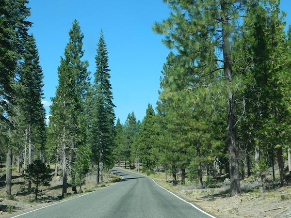
Explore the roads on the backside of Mount Shasta, well off Interstate 5 and miles from Highway 89. This epic paved route will get you away from the tourists at McCloud Falls and all those busy campgrounds.

Shasta National Forest NFSlogo

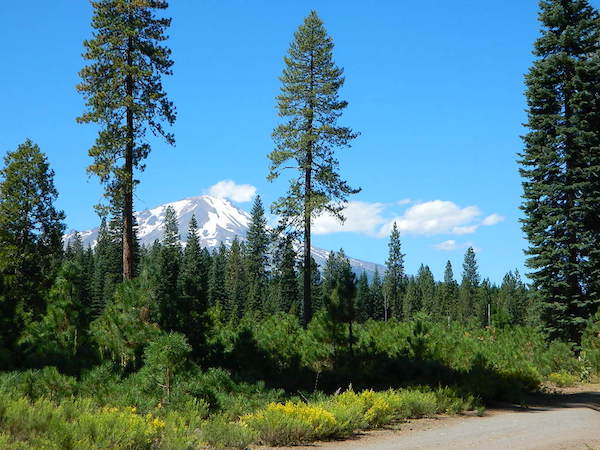
Loggers and lumber trucks on week days; so drive cautiously. Paved road most of the way. Numerous dirt road turn offs lead deeper into seclusion. Wonderful views of Mt Shasta from many locations. So close, you can ‘reach out and touch it’ kinda views.
side roads

camp

2 primitive campgrounds back this way:
Harris Springs Campground &
Trout Creek Campground

And no, we haven’t been to either, cuz the dang boon-docking is excellent, so why would you need a campground?
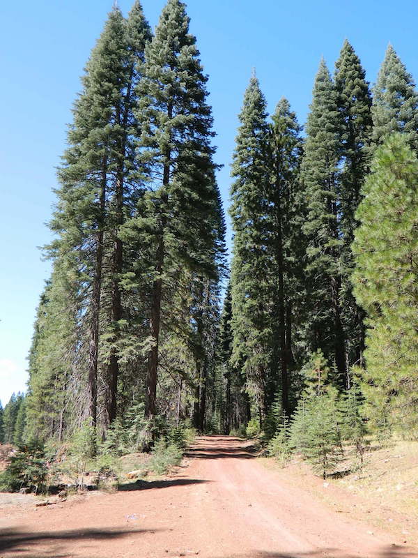
Elk Flat Red Road

Long paved main road has numerous turn offs on to dirt roads on both sides. Timber lands, National Forest, and some private properties. Watch  carefully for gates, fence lines and any signage. The night skies are super dark way back in here, so excellent stargazing!

stars

Great Shasta Rail Esparanza Trail Head

hiker

Pilgrim Creek Snowmobile Park

snowmo

Road #19 Military Pass Road intersects at the snowmobile park and heads NW – behind Mount Shasta.

Past the snowmo parking lot, Road 13 changes from Pilgrim Creek to Stevens Pass Road and continues to gradually climb up in elevation. Eventually Road 13 peters out around the backside of Harris Mountain.

Road #15 Volcanic Legacy Scenic Byway – intersects shortly before Harris Springs, and continues northbound. It eventaully becomes Davis Road (#44N05) which leads up between Pumice Stone Mountain and Little Glass Mountain.

ranger

Little Mount Hoffman Lookout  (historic fire lookout tower) is way back here on Road #43N77 and it is available to rent overnight (by reservation). The lookout is accessible by car, but the last 4 miles are on unpaved roads and difficult for RVs and cars with trailers to navigate. The accommodations of this lookout may be rustic, but the views guarantee that visitors will have a memorable stay.

camptruck

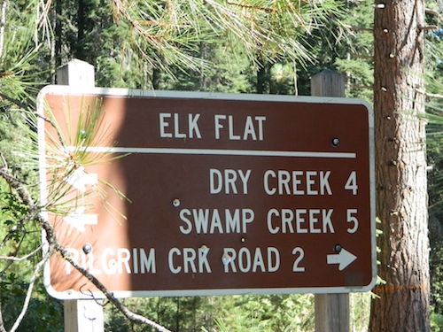
ELK FLAT is an area worth exploring for the meadows and view of Mount Shasta. Stealth camping back in here on dirt roads with a passenger car.
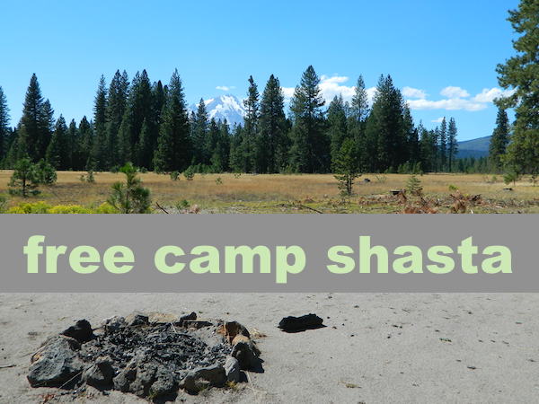
free camp meadow

elk flat sign

see also –

Algoma Campground

Chuchupate Campground

Lockwood Valley Campgrounds: Chuchupate

Los Padres National Forest, Mount Pinos Ranger District

chuchupate
Forested campground, paved access; Up behind the Lockwood ranger station

campground  elev.
spots
 veg toilet water comment
Chuchupate 6300′ 29 pines vault no open year round

open year round; campground reservations 805-434-1996

Chuchupate Views

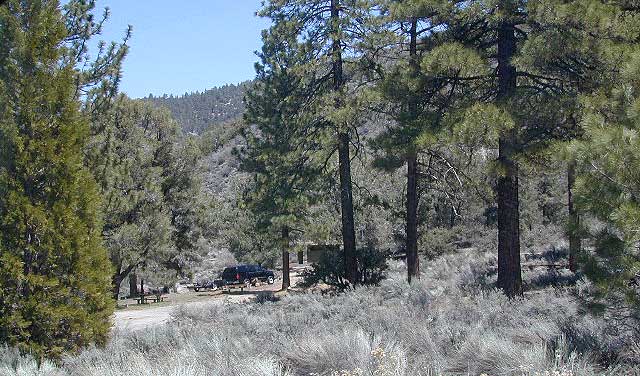
Pinyon w/ jeffrey pines, a high desert feel to this mountain side ideal camp – where the Mojave desert merges with the coastal ranges in Lockwood. Up high near the Tejon Pass @ Gorman. Sage brush slopes w/ forested campground is approx. 6 mi. off Lockwood Valley Rd. via paved road #8N04 (also called, Frazier Mountain  Road).

Adequate for RVs, small creeks around this camp provide
decent vegetation. The sites on the outside back loop are best
for shade & seclusion. Good for a base camp for the weekend
& drive out to see the rest of Los Padres National Forest.
For the mtn. biker, this is a prime spot for hitting up the dirt
back roads on Frazier Mtn. Plenty of hiking and nice views
of the valley around too.

chuchu 21
Small campground w/ fee. On forested slopes of Frazier Mountain.

The easy to reach USFS campground can accommodate motorhomes, RVs, camper trailers up to 26 feet long. Paved access road is narrow and curvy and climbs the hill behind the large ranger station on Lockwood Valley Road.

Mt. Pinos Ranger District
34580 Lockwood Valley Rd
Frazier Park, CA
661-245-3731

  • backpack

  • camp

  • hike

  • horseback

  • mountain bike

  • off-road

  • picnic

  • stargaze

8N01
Paved road #8N04 FRAZIER MTN RD – starts @ Lockwood Valley ranger station

also nearby –

lockwood valley snow
Attention fair weather campers: Snow is possible in this location from DEC-APRIL. Call head for local conditions and know weather forecast before you climb the I-5 (Grapevine).

11S12 – Sierra NF

engineering_x

Black Rock Road #11S12
– Sierra National Forest

North Fork of the Kings River, Blackrock Rd

connects Kings River @ Pine Flat to Blackrock Reservoir.
Road closed seasonally for winter; call ahead.

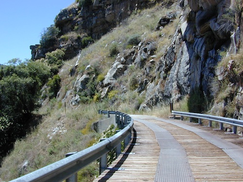
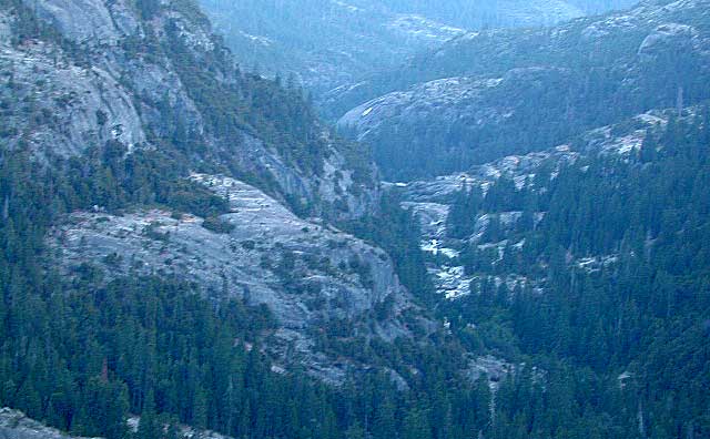
This impressive Sierra Nevada route literally climbs a granite cliff high above the Kings River, near Pine Flat Lake north of Sequoia Parks, inside Sierra NF. This granite gorge is due east of farm city Fresno at the edge of Kings Canyon National Park.

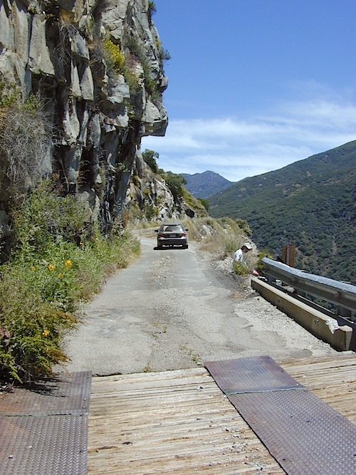
If you are a nervous, inexperienced driver and scared of heights – be forewarned: this is not the road for you. The views are amazing, but the terrain can be unforgiving, even deadly.

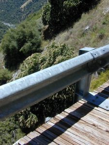
Paved, narrow, one lane, giant rock overhangs, no guard rails (except on the bridge) the route skirts the North Fork of the Kings, coming down from Wishon Reservoir.

Blackrock Road

Click image above to enlarge and see the tiny Kings River far below the road.


Black Rock Lake

Blackrock Reservoir, located up the road – has a PG&E campground in a secluded canyon, with lake fishing and hiking, so it is well worth trouble to take this crazy road. Granite rock canyon, steep mountains, minimal roads.  Seclusion can be found, up this way.

Utmost safety should be taken on this road due to the extreme terrain. When driving one lane roads always keep an eye out for possible turn-outs and oncoming traffic. Forest and lake personnel have living quarters at the base of this road @ BALCH CAMP, so keep driving when passing thru. Follow signs to Blackrock.

breaktime

Above Blackrock Reservoir, further up the canyon, the road becomes DIRT when the pavement stops; this continues to Sawmill Flat Campground and eventually on to Dinkey Creek Road. This whole upper (dirt road) portion is gated for winter and closed during the wetter months. Call ahead to the ranger station at Trimmer to find out if this road is open.

Sierra National Forest
Trimmer Ranger Station
559-855-8321

Sierra Kings River Camping

Sierra National Forest Map USFS

northkings
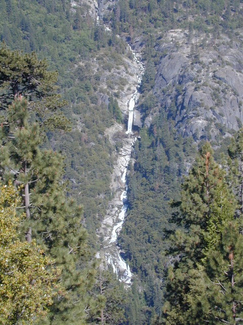
North fork of Kings River

gorgeview
Road #11S12, gorge view

Anza Borrego Wildflowers


Desert Wildflowers / Anza Borrego SP

Anza Borrego Flowers / Borrego Springs CA

Wild Flowers of Box Canyon, Mecca
East San Diego County, Borrego Springs CA

San Diego Backcountry
600,000 acres of SoCal desert

BLOOM: February thru MaySan Diego desert maps
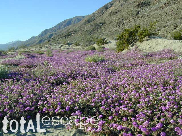
Anza Park elevations range from low to high. Lowest near eastern border of park (next to the Salton Sea) to the upper reaches of the western slopes @ 4000′ of the Laguna mountains. Lower elevations sprout up first; Micro flowers, Easter-egg-color splendor in the dry washes. Higher elevations bloom later (along w/ areas on San Diego County Rd S-2, the Great Overland Stage Route)

Drive from Temecula to Warner Springs, and then proceed east – out to the Salton Sea via Back Road Highway #S22 (Montezuma Grade). A great route to take thru the Borrego State Park – for the full gamut in vegetation & altitude. Grapevine Canyon is an alternate off road route down a scenic canyon. Culp Valley has a small campground, plus lots of boulders and decent views to the Borrego Valley. Off the highway, on dirt, one-lane side roads lead to many primitive spots. Perfect for private picnics, stargazing or overnight camping.

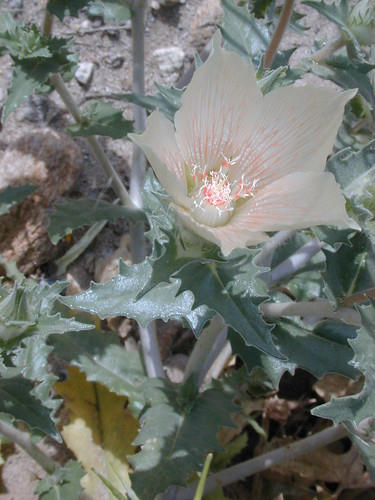
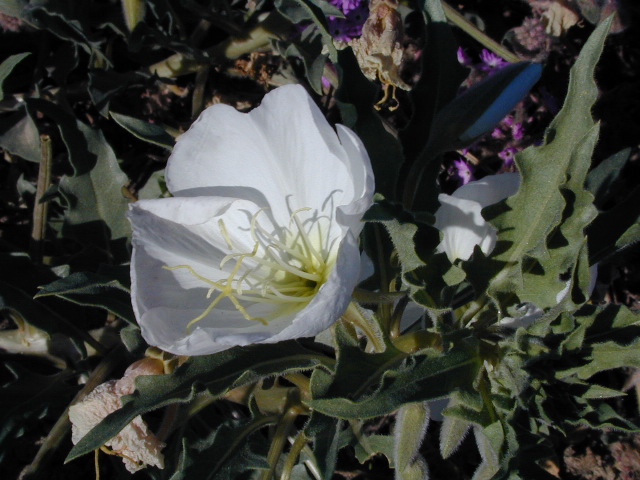
anza wildflowers include – Arizona Lupine, Barrel cacti, Brittlebush, California Primrose, Cheesebush, Creosote, Desert Chicory, Desert Apricot, Desert Hibiscus, Desert Lavender, Desert Pincushion, Fiesta Flower, Fishhook Cactus, Gold-Poppy, Ghost Flowers, Ground Cherry, Fagonia, Prickly Pear, Monkey Flower, Ocotillo, Rigid Fiddleneck, Rock Daisy, Sahara Mustard, Sand Verbena, Short-Wing Deerweed, Spanish Needles, Spectacle Pod, Trailing Windmills, Turpentine Broom, Whispering Bells, Wishbone Bush

Anza Borrego Camping: Palm Canyon and RV Resortscamp


BORREGO MAPS

Wilderness Anza Borrego Map
Wilderness Press Anza Borrego Map


Hot Springs of the Southwest

Anza Borrego Flora

__________________________________________________

Annual California Wildflower Reports


anza flower links:

Anza-Borrego National History Association
Anza Borrego Desert
Anza Borrego Desert State Park
Borrego Campfire Restrictions
Desert USA Reports

blurflwr

nearby towns:

Borrego Valley Flora

Turtle Mountain Road

Turtle Mountain Rd

Turtle Mountain Road
BLM Road # NS477

off U.S. Highway 95
in between Needles & Blythe, California

BLM: Bureau of Land Management – Desert Camping

Several miles south of the town of Needles numerous desert washes cross the highway with dirt roads leading off into both directions. Turtle Mountain is just one dirt road to explore in this region, but there are many more unmarked, secluded roads. This region is perfect for “campers in-route” traveling who need a quick overnight camp spot (off the freeway).

Turtle Mountain Road is a one lane dirt road that runs next to a wash, in between Turtle Mountain Wilderness and Stepladder Mountain Wilderness. Leading approx 12 miles from US Highway 95 to the northern edge of the desert wilderness. The Turtle Mountain route continues westward to meet Water Road with Old Woman Mountain Wilderness nearby. Sunflower Springs Road continues north to Essex @ Interstate 40

BLM signage along US Hwy 95 is minimal. Look for vertical brown markers w/ reflectors, numbers or names. Driving slower than typical traffic, coast at 50 mph and keep your eyes peeled to the west side. Turtle Mountain Rd is marked at the pavement, but the marker is very small.

Eastern California Desert Wildflowers

Exploring the eastern side of Southern California, one can find the Colorado River and Arizona border region an excellent destination for winter camping. Springtime offers wildflower blooms, open camping and decent weather with sunny 70 degree days. Wildflowers and BLM beauty awaits those who venture off the paved routes.

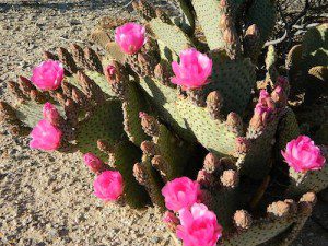
Pink Cactus Bloom

Palo Verde trees line the washes and much vegetation can be seen throughout this remote region. Cacti include the cholla, ocotillo, barrel, beavertail, just to name a few. Wildflower blooms here are just as good as Anza Borrego Desert SP.

MARCH & APRIL are both prime months for the desert bloom

BLM Desert Camping

Drive more than a mile from the highway if you plan to camp in peace and quiet, as the overnight truck traffic goes all hours.

RV accessible camp spots are few and far in between. They can be found in large, level pullouts close to the main road, but you will be hearing traffic zoom by. Some dirt roads are in better shape than others; Seasonal storms in the low desert can wash out even paved roads. 4×4 may be needed in some areas.

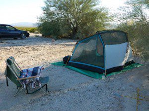
Open camping in this desert is free and there is plenty of room to spread out. Imagine not seeing anyone pass by your camp or drive down your road for days. Camping in a sandy wash may seem appealing, but you best know the weather forecast and if rain is at all predicted nearby, be prepared to break camp (in the middle of the night) before a flash flood hits.

The Needles BLM Rangers Office is located on US Hwy 95, on the south edge of town and they can provide maps and more information. BLM California Deserts

Needles BLM Office
1303 S. US Hwy 95
Needles, CA 92363
760-326-7000

Lake Havasu BLM Office
2610 Sweetwater Avenue
Lake Havasu City, AZ 86406
928-505-1200

Sierra Road Conditions

Sierra Nevada Road Conditions – Highway California

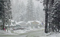
Snowy RoadsWinter Snow/ Winter Roads Sierra Nevada:

On rare occasions the Golden State freeway – Interstate 5 can be closed due to snow; N of Valencia on the Grapevine (near Lebec) or more likely up in NorCal (near Shasta).

Interstate 80 (aka Donner Pass) is often closed during big storms. Luckily there are hotels in Auburn or Truckee.

Highway conditions on mountain passes higher than 4000′ elevation can be unpredictable in winter months (Oct-May). It may be fine & just sprinkling @ 2000′, but a few miles up can be a white out. Ask anyone who’s ever driven the infamous Donner Pass in winter time. (more on Donner Party)

Annual Sierra Highway Closures

Ski mountains

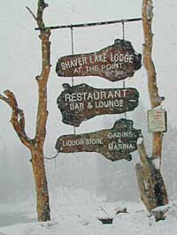
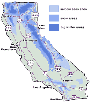
shaver lakeWhere does it Snow in California ?
Okay, okay ….so it’s nothing like those dreaded East Coast winters, but hey, some parts of California do get some serious snow. (see elevations) And the newbies who don’t prepare for it will be sorry. On the winter vacation travels, be prepared for almost anything, especially in the Sierra’s & Northern California.
Snowy towns in California

See California Weather & Road Conditions

California Winter: When does winter actually ‘set in’ for California?

Eastern Sierra CA: OCT- MAY
Western Sierra CA: NOV- APR
High Sierra CA: SEPT- MAY
North Coast CA: OCT- MAY
Northeast CA: OCT- APR

The following mountain roads are partially closed or totally closed during winter months. Please check road conditions before you leave for your trip. Chains may be required in most mountain areas of California.

CALTRANS web site

Highway CA County Region Connecting Towns
Hwy 155 Kern Southern Sierra Alta SierraWofford Heights
Hwy 190 Tulare Western Divide Hwy Camp NelsonPonderosa CA
M 375 Tulare Sequoia NP Hammond – Mineral King
Hwy 180 Tulare Kings Canyon NP Hume Lake – Cedar Grove
Whitney Portal Rd Inyo Eastern Sierra Lone Pine – Mount Whitney
Onion Valley Road Inyo Eastern Sierra Independence – Onion Valley
Glacier Lodge Rd Inyo Eastern Sierra Big Pine – Glacier Lodge
Lake Rd Hwy 168 Inyo Bishop Area Hwy 168 – South Lake
Hwy 120 Mariposa Yosemite NP Yosemite Lee Vining CA
Hwy 120 Mono Mono Lake Lee ViningBenton Hot Springs
Hwy 108 Mono Eastern Sierra DardenelleSonora Jct. Hwy.395
Hwy 89 Alpine Eastern Sierra MarkleevilleLake Topaz
Hwy 4 Alpine South Lake Tahoe Lake Alpine – Hwy 89
Hwy 44 Shasta Lassen Volcanic NP Manzanita Lake – Mineral CA

Old Kane Spring Road

Kane Spring California

Quartz Wash Anza

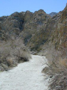
Old Kane Spring Road parallels California SR Highway 78 a few miles from Ocotillo Wells, in east Anza Borrego Desert. A graded dirt road that can often gets sandy and you might need to keep you speed up certain soft spots. A few dead end canyons lead southward; hidden camp sites can be found out this way if you have the time to look. Harper Canyon, perhaps. See below for more on camp sites.

San Diego Desert Map

Anza Borrego Desert State Park Map

San Diego Backcountry Map

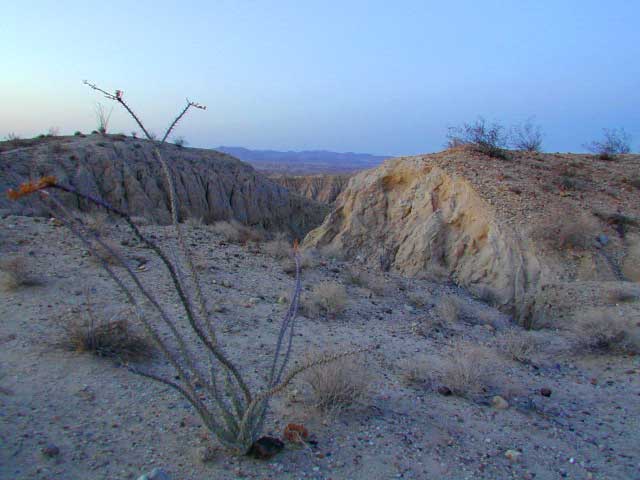
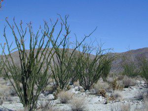
Spring Wildflowers can be quite spectacular out along this desert trail. Towering red-tipped ocotillo in some canyons serve as great backdrops to a perfect picnic lunch.

Ocotillo California

The Kane dirt route peels off the highway about a mile east of an area known as The Narrows. Marked on the highway as a small hiking trail, the highway curves at a narrow section of the canyon, as San Felipe Creek wash carves its way through the harsh landscape.

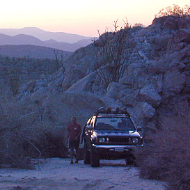
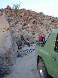
primitive campThe best primitive camping in this area is actually west of The Narrows. You might need a high clearance vehicle to reach some spots and a good map with the creek/wash names. Make sure to look for these – Free Camping

  • Nolina Wash
  • Pinyon Wash
  • Quartz Vein Wash

pinyonoco vcampoutpinyonwsh

On the opposite the highway is Ocotillo Wells SVRA, where off road enthusiasts can get their kicks. Wind caves can be found in Butte Canyon, where the 4×4 trails abound. Kane Springs intersects Split Mountain Road. The Elephant Trees, Split Mountain and more wind caves are south of the railroad tracks.

Anza Borrego Desert Map


View Larger Map