Tag Archives: Sierra Nevada mountains

Lake Kaweah

wildflowers

Sequoia Foothills Reservoir, CA SR 198
Kaweah Lake

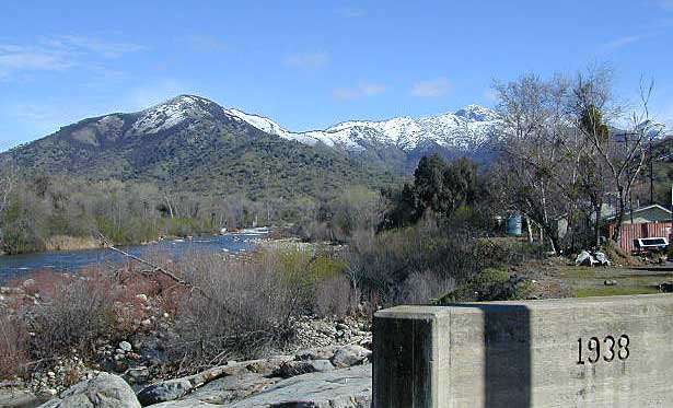
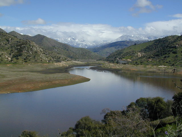
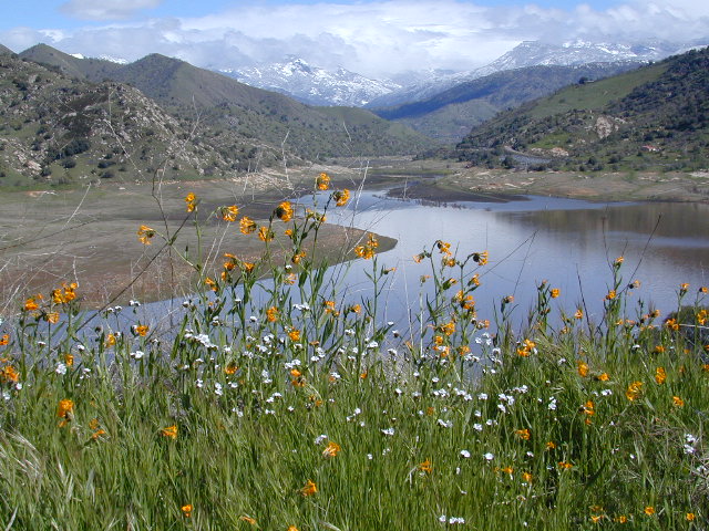
Southern Sierra lake located on Kaweah River, near the mouth of Mineral King Canyon. In between the western Sierra foothills and the agricultural San Joaquin Valley. West of Sequoia NP, east of Visalia, California.

Crystal Cave
Mineral King
Sequoia National Park
Three Rivers
Visalia

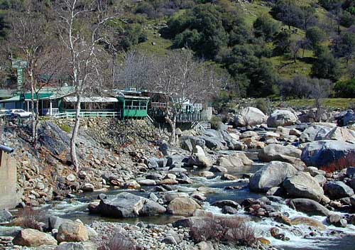
The small town of Three Rivers is just up the road from this small reservoir & their slogan is the ‘southern gateway’ to the Sequoia National Park.

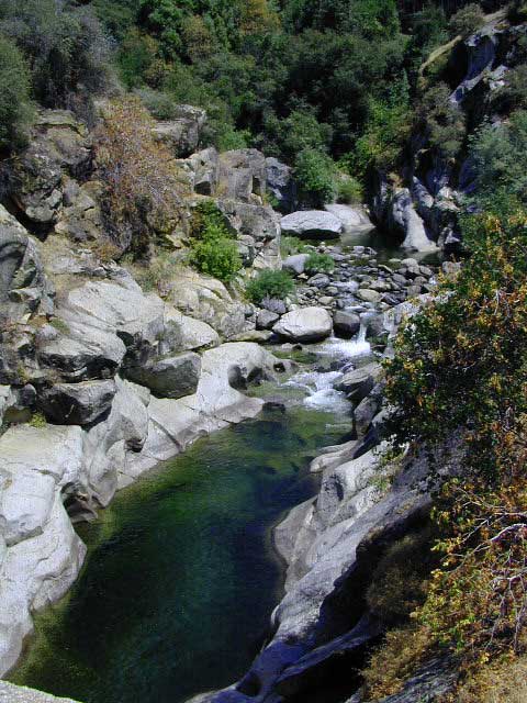
There are several recreational reservoirs that are situated at the base of the Sierras, along the western slopes. The Kaweah River transports snowmelt deep from the Sierra Nevada mountains, down to the San Joaquin Valley (Central Valley), for human consumption, households, and agriculture.

Lake Kaweah California

elevation: 1945′
surface area: 1200′
vegetation: minimal trees, scrub oak, wildflower foothills

fishing –

  • bass
  • bluegill
  • catfish
  • crappie
  • trout

recreation –

  • backpack
  • bike
  • boat
  • camp
  • canoe
  • hike
  • houseboat
  • kayak
  • sail
  • swim
  • waterski

Horse Creek Recreation Area
Horse Creek Campground
76 camp sites

Kaweah Rentals

Kaweah Marina has patio boats, fishing boats, and paddle boards available for rent. Reservations are needed in summer for weekends and holidays. 559-597-2526

Kaweah Houseboats

Privately owned house-boats can be seen on this lake, although none are available at the marina for rent. Some can usually be found for sale on visalia.craigslist.org

Weather: Lake Kaweah Dam

US Army Corps of Engineers
PO Box 44270
34443 Sierra Drive
Lemon Cove, CA 93244
559-597-2301
Gateway

Sequoia Highway 198 has many side routes worth exploring: Mineral King Road will get you to amazing scenery, but there ARE NOT ANY Sequoia groves up that way; Crystal Cave, open for tours is located near the south entrance of the National Park; and a lesser known campground in this area is called South Fork, off on a residential side route canyon – South Fork Drive (Road #348); Located on the quiet South Fork of the Kaweah River.

Sequoia Maps:

North Fork Drive: North Fork of the Kaweah River is a seldom traveled dirt back road that leads from the east side of the lake @ Hwy 198, northbound (along the North Fork of Kaweah River), straight into the backdoor of Sequoia National Park’s ridge line highway @ Dorst Campground. The original town of Kaweah (elev 960′) is along this route. Many small dirt roads to explore up this way and a good topo map is advised.


Eshom Campground (on western border of Sequoia NP), a small slice of Giant Sequoia National Monument land, Redwood Creek and a trailhead called Redwood Saddle are all back up in here.

California Water Information

California Reservoirs
California Water Resources

water resources / water scarcity / land and water

snow flakes

SNOW PACK

State Snow Depths – Wunderground
SNOTEL Snow Depth Reports
http://www.wunderground.com/StateSnowDepth.asp?state=CA

California Snow Water Equivalents
Sierra Snow Pack Data
https://cdec.water.ca.gov/snow/current/snow/

Eastern Sierra Snow Pack by Sierra Wave
Article published Feb 2014
http://www.sierrawave.net/tag/eastern-sierra-snowpack/

Eastern Sierra Avalanche Center
Snowpack summaries published Dec 2014
http://www.esavalanche.org/content/snowpack-summaries-begin-soon

Sierra Avalanche Center
Sierra Nevada Mountain Snow in California
http://www.sierraavalanchecenter.org/


snow flakes

LAKES & RESERVOIRS

The Lowest Lake Levels in California
List of Reservoirs below 30% full, as reported Jan. 2015


Conditions for Major Reservoirs in California

http://cdec.water.ca.gov/

  • Trinity Lake
  • Lake Shasta
  • Lake Oroville
  • Folsom Lake
  • New Melones Lake
  • Millerton Lake
  • San Luis Reservoir
  • Don Pedro Reservoir
  • Pine Flat Lake
  • Pyramid Lake
  • Castaic Lake

San Diego River & Reservoir Data
Map of San Diego Hydrology, Water Storage
http://www.cnrfc.noaa.gov/

San Luis Obispo Reservoir Data
Lakes on the Central Coast of California
http://www.slocountywater.org/

  • Lake Nacimiento
  • Whale Rock Reservoir
  • Lake Lopez
  • Santa Margarita Lake
  • Twitchell Reservoir

Ventura County Watershed Map
Watershed Protection District
http://www.vcwatershed.net/

snow flakes

RIVER FLOWS

California River Forecast Center Map
Overview for recent rainfall data, snow depths, and ocean temperature
http://www.cnrfc.noaa.gov/google.php

California Current River Conditions
CA.gov Dept of Water Resources
http://cdec.water.ca.gov/river/rivcond.html

California River Forecast
California Nevada River Forecast Center
http://cdec.water.ca.gov/rivforecasts.html
Drought Info
http://www.cnrfc.noaa.gov/droughtInfo.php

Upper Sacramento River Forecast
Northern Sacto River
http://cdec.water.ca.gov/cgi-progs/rivfcast/USACBUL

snow flakes

NEWS & STATISTICS

Irrigated Lands in California – Farming Map

Dry Wells in California – DanaMite’s Map
More than 1,480 domestic well failures in 36 counties have been reported to the state of California recently.

California will need 11 trillion gallons of water to end epic drought by Mashable.com
http://mashable.com/

California Department of Water Resources
http://www.water.ca.gov/

Water in California – Wikipedia
Reservoirs, Water Sources, Aquaducts, Water Distribution
https://en.wikipedia.org/wiki/Water_in_California

Residential Per Capita Water Use across California
Water conservation measures and stats per city
http://www.californiadrought.org/

Aquafornia, the Water Education Foundation
California water news from various news sources
http://www.watereducation.org/aquafornia

Association of California Water Agencies
Largest statewide coalition of public water agencies
http://www.acwa.com/content/water-information

USGS Water Data for California
The United States Geological Survey
http://waterdata.usgs.gov/ca/nwis

EPA – Environmental Protection Agency
California Drinking Water | Local Drinking Water Information
http://water.epa.gov/drink/local/ca.cfm

California Water Impact Network, C-WIN
Advocates for equitable and environmentally sensitive use of California’s water
http://www.c-win.org/

California Drought Map
National Drought Mitigation Center
http://droughtmonitor.unl.edu/Home/StateDroughtMonitor.aspx?CA


snow flakes

PACIFIC OCEAN

Heal the Bay
Volunteer, Beach Cleanups, Santa Monica Pier Aquarium
http://www.healthebay.org/

The Pacific Genocide

  • Fukushima Meltdown
  • Acidification of Oceans
  • Overfishing
  • Pollution & Oil Spills
  • Marine Life Watch

Redwood Hotels

Sierra Lodges, Sequoia Cabins & California Redwood Inns

alta sierra

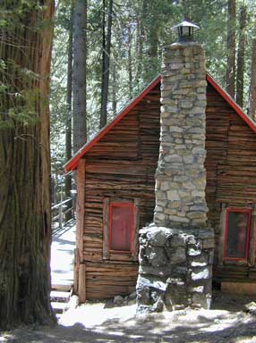
Rent a cabin in the redwood forest of the north coast of California, or get a weekend retreat in the Sequoia, deep in the Sierra Nevada. Redwood inns, cottages & yurts can be found in the Central Coast region. Big Sur redwoods & Santa Cruz redwoods. Rustic hostels, historic Sierra lodges, or mountain cabins can be found in the Sierras, from Alta Sierra near Kernville, to Yosemite National Park.

Places to stay overnight in the Redwoods, or close by –

If you seek big lodges made from redwood timbers, those are the historic inns, located all over California. Redwood was harvested in California since 1850, right after gold was discovered and the masses flooded in. State officials have limited harvesting of ancient redwoods in Northern California in 1988. Logging and agricultural farms have already wiped out 96% of redwood forest that once covered California.

Tehachapi Mountain Festival

Tehachapi Mountain Festival 2013

Mountain Festival in Tehachapi

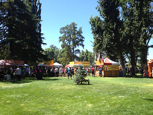
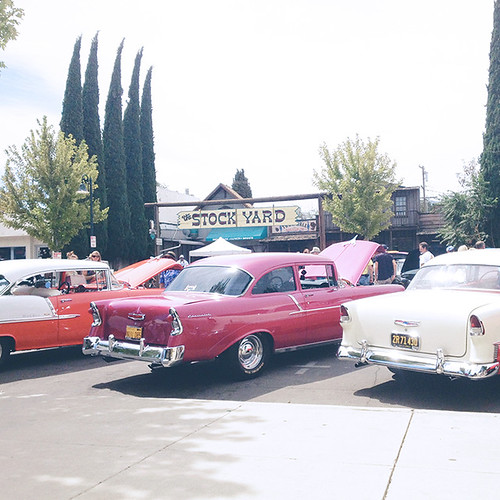
Over 50 years of summertime celebrations in the Southern Sierra town of Tehachapi CA. Festival includes arts & crafts show, food, entertainment, carnival, 5K & 10K run, parades, car show, rodeo, gem & mineral show, quilt show, VFW dinner and dance, pancake breakfast.

Annual event; August
661-822-4180

Tehachapi California

tehachapimountainfestival.com

Tehachapi Mountain Festival 2013

Tehachapi Mountain Festival 2013