Tag Archives: socal

San Jacinto Wilderness

Jacinto Maps

Southern California / San Jacinto Wilderness Area / San Jacinto Mountain / Palm Springs Mountain Hike

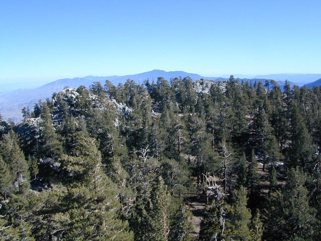
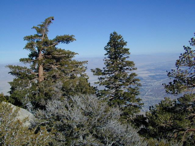
The well-photographed snowy mountain backdrop behind the desert deluxe resort-land known as Palm Springs, Mount San Jacinto is the second tallest peak in Southern Cal.

Mighty San Gorgonio peak, across to the east – on the other side of the valley, is the very highest mountain in this desert region. Granite Jacinto peak is located in between the mountains of Idyllwild and the low deserts of Palm Springs.

32,248 acres
Mount San Jacinto – 10,834′ elevation

San Bernardino National Forest

JACINTO PARK access –

Palm Springs via Tram

Book tickets online!

Nearest towns:
Idyllwild CA
Pine Cove CA

jacinto peak

Day hikes, picnic in the forest, backpacking, horseback rodes w/ SUPER easy access via the fantastic Palm Spring Tram ride, up to 8000′ elevation.

The San Jacinto Wilderness is managed by 2 different agencies: The National Forest Service and California Department of Parks & Recreation.

If you are camping overnight in the forest, you must get your wilderness permit from the agency that administers the area where you plan to spend the night. Day-use permits can be obtained on the day of your trip by visiting one of the ranger stations below. Day-use permits issued by either agency are honored by both, except during the busy summer months when permits to enter the Wilderness via Devil’s Slide Trail can be obtained only from the National Forest Service.

Camping permits can be obtained in advance by mail, in person, or online w/ PDF. National Forest Service accepts requests up to 90 days in advance; Mount San Jacinto State Park accepts them up to 56 days in advance. You can also get them on the day of your trip, if any are available at that time.


USDA National Forest Service
San Jacinto Ranger District
54270 Pine Crest Ave
Idyllwild, CA 92549
951-659-2117

Mount San Jacinto State Wilderness
25905 Highway 243
Idyllwild, CA 92549
951-659-2607

regional trail maps –

San Jacinto Hiking Maps

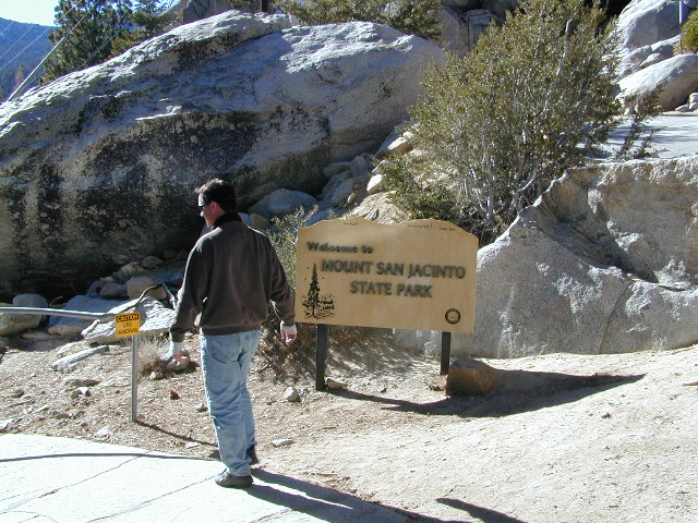
Mount San Jacinto State Park is surrounded by San Jacinto Wilderness

More San Jacinto Wilderness Info & Links –

summitpost.org/jacinto-peak
San Jacinto Peak Wiki
USDA San Jacinto Wilderness
Mount San Jacinto State Park

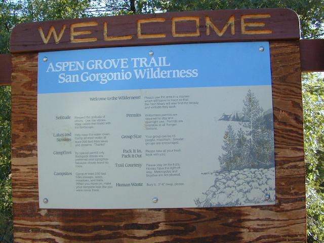
San Gorgonio Wilderness

sangorgonioview
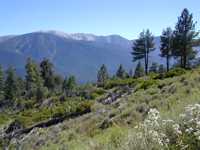
Old Greyback, San Gorgonio Mountain – as seen from forest road #2N93

Southern California /San Gorgonio Wilderness Area / San Gorgonio Mountain Peak Hikes / Backpack Gorgonio

The tallest mountain peak in Southern California towers over the often smoggy basin of the Inland Empire, Riverside & San Bernardino. Coachella Valley lies to the southeast. Joshua Tree National Park lies due east.

Old Greyback is a fitting nickname for the peak. The massive, bald, decomposed granite gravel paves the whole top layer, above treeline (altitude nearing 12,000 feet above sea level) and this impressive peak can be seen from most of the Los Angeles basin and the Palm Springs desert. The expanding view of the Pacific Ocean can be seen 70 miles to the west, but only if the skies are clear. Windy, winter days are excellent conditions for viewing, but plan your hike accordingly as this peak could be covered in deep snow during winter or springtime.

This is a very popular backpacking weekend trip to escape from the big urban populations. San Diegans and Angelinos can easily access this location in a few hours from home, via Interstate 10 and some mountain driving on a 2 lane highway.

tallest peak

94,702 acres

San Gorgonio Peak – 11,503′ elevation

San Bernardino National Forest


Forest & Hiking Maps –

San Gorgonio Topo Maps

  • San Gorgonio Wilderness Map (USDA)
  • San Gorgonio Trail Map (Tom Harrison)
  • San Bernardino National Forest (USDA)

Gorgonio trailheads –peak hiking

  • Hwy 38 @ Angeles Oaks
  • Hwy 38 @ Barton Flats – Jenks Lake
  • Hwy 38 @ Heartbar – Fish Creek & Mission Springs
  • Hwy 38 @ Fossil Falls – Momyer & Big Falls
  • I-10 @ Millard Canyon – East Branch & Middle Branch
  • Interstate 10 @ Cottonwood Canyon – PCT access

nearby campgrounds –

Heartbar Campground (Hwy 38)

Mission Springs Trailhead Camp

Dry Lake Campground

nearby communities & towns –

ANGELES OAKS
BIG BEAR CITY
BIG BEAR LAKE
FOREST FALLS

surrounding wilderness and forest lands –

San Bernardino National Forest
Pipes Canyon Pioneertown Preserve
San Jacinto Wilderness

National Forest & Wilderness Permits –

USDA San Bernardino NF

more San Gorgonio info & links –

summitpost.org/san-gorgonio-wilderness
San Gorgonio Wilderness Wiki
Trails of the San Gorgonio

Gorgonio Trailhead

Equestrian Trails
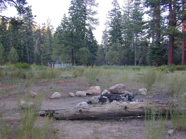
MIssion Springs camp & corrals at trailhead. Dirt road above Heart Bar.

San Diego Picnic

Picnics San Diego – Picnic Area San Diego

IBbeach


picnics

CITY & BAYS & BEACHES:

  • Balboa Park, San Diego – 5 square miles of beautiful city park with lots of gardens
  • Bayview Park, Coronado Island – Small city neighborhood park with great view of downtown skyline
  • Silver Strand State Beach near IB or Imperial Beach, S of Coronado
  • Harbor Island Park, near San Diego airport – facing SD Bay with views of downtown skyline
  • Shelter Island, near San Diego airport – facing SD Bay with views of downtown skyline
  • Mission Bay Park, San Diego, CA – maze of bay front parks & trails; picnic areas, bonfire pits, bike trails & playgrounds
  • Soledad Park, La Jolla, CA – small neighborhood park atop a Mount Soledad, great views of county & ocean
  • Presidio Park, San Diego Mission – park like setting surrounding mission w/ gardens & trees
  • Tidelands Park, Coronado Island – large park with great view of bay, bridge & downtown skyline
  • Mission Trails Park – Mission Gorge – SD river & historic dam, hiking, biking trails
  • Sunset Cliffs, Point Loma – sit on cliff edge or take stairway to beach
  • Torrey Pines Cliffs, Del Mar, CA

San Diego picnic parks

laguna mountains
View east from Laguna Mountain PIcnicgrounds

BACK COUNTRY MOUNTAINS & DESERTS:

vcampoutpinyonwsh

Maps Mountains / San Diego Maps

Agua Caliente Hot Springs

Agua Caliente Springs

Agua Caliente County Park
Agua Caliente Anza Borrego Desert
Agua Caliente Hot Springs

East San Diego County
N of Ocotillo, CA

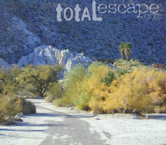
Anza Borrego Desert MapAgua Caliente Hot Springs County Park is a remote 910-acre San Diego County Park next to the Anza Borrego Desert. A developed hot springs, picnic area & a large campground. This desert destination is perfect for California winter recreation, offering a small air strip for small plane pilots.

Located North of Interstate 8 on San Diego Road S-2 on the south end of Anza-Borrego Desert State Park. Local mountain’s seismic forces created the fault that runs beneath this region & forces water up to tRV campground Anzahe desert surface. A decent water supply also supports plant life & wildlife.
For minimal crowds AVOID THIS PLACE on holiday weekends or peak winter months. Spring & Autumn are excellent times to visit here, but watch the weather forecast for any heat waves. Who wants to soak when it’s 100 degrees outside?

2 natural hot mineral pools:

  • large outdoor pool is kept at natural 96 degrees
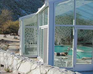
  • glass walled indoor pool is heated & has bubbling jets
  • spring-fed, warm showers are available
  • hiking trails, horseshoe & shuffleboard

Indoor Pool

Agua Caliente Campground

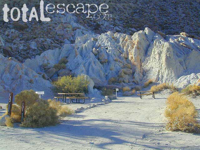
140 campsites – tent sites & RV hookups w/ dump station. Shady trees only at some camp sites. Indoor pool, outdoor pools, maybe a hike-in primitive tub too. Individual campsites may be reserved up to 12 weeks in advance 858-565-3600

  • Anza Borrego Desert Map
  • San Diego Backcountry Map

  • View Larger Map

    Anza Borrego Hot Springs
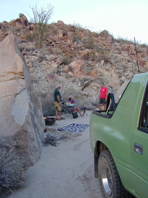
    Several nice camp spots line this canyon on the north side.

    Sespe Wilderness

    Sespe Wilderness & Hiking Trails

    Los Padres National Forest
    Campgrounds & Trailheads

    Sespe Wilderness is located in the mountains W of Interstate 5, North of Los Angeles. The chaparral region lies in between Lockwood Valley and the Santa Clara River Valley (Hwy 126). Higher elevation Mount Pinos lies to north side of Sespe and Ojai Valley to the south. The infamous 4×4 Miller Jeep Trail is located on the north side near Alamo Mountain, which is also accessible via Hungry Valley.

    The 2006 Day Fire burnt a good portion of the Sespe Wilderness, so you can expect to see some black and toasted areas. Sespe Creek is also referred to as Sespe River. and certain waterways may dry up during drier months. Piru Creek, Alder Creek, Aqua Blanca Creek, Tarr Creek, Mutau Creek, Snowy Creek are several worthy of note. Expect heat and high temperature in the summer & fall month, and possible campfire restrictions during extreme wildfire season.

    219,700 acres
    6 areas of hiking trails

    Los Padres National Forest
    Lockwood Ranger Station
    661-245-3731

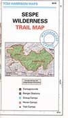
    Sespe Trail Map
    Sespe Trails, Tom Harrison Topographic Map

    Sespe hiking trailheads located at –

    Highway 126 – Fillmore, CA
    Sespe Condor Sanctuary – Dough Flat Trailhead

    Highway 150 – Ojai, CA
    Sisar Canyon Day Hike / Road #4N15

    Highway 33 – Ojai, CA
    Rose Valley Road #6N31, Rose Valley Falls, Day Hike
    Piedras Blanca Trailhead for the National Recreation Trail
    Pine Mountain Rd # – Reyes Peak Trailhead

    Lockwood Valley Road – Frazier Park, CA
    Reyes Creek, Camp Shiedeck – Pine Mountain Trailhead
    Half Moon Mutau Flat Trailhead, Sespe Hot Springs

    Interstate 5 Tejon Pass @ Hungry Valley
    Hard Luck Trailhead


    rd7N03

    Los Padres Campgrounds near Sespe Wilderness

    • Frazier Park Camping
    • Ojai Campgrounds
    • Twin Pines Campground, Road # 18N01
      Alamo Mountain via Hungry Valley OHV
    • Lockwood Creek Campground
    • Half Moon Campground, Lockwood #7N03
    • Thorn Meadows Campground, Lockwood #7N03
    • Dome Springs Campground, Lockwood #8N40
    • Reyes Creek Campground, Lockwood Valley Rd
    • Pine Mountain Road @ Reyes Peak (dispersed)
    • Nettle Springs Campground, Cuyama Hwy 33
    • Ozena Campground (closed)letswalk
    • Tinta Campground, Hwy 33
    • Rancho Nuevo Camp, Hwy 33
    • Rose Valley Campground, Hwy 33
    • Wheeler Gorge Campground, Hwy 33


    nearby parks & lakes –

    nearby towns –

    Backpackers at Sespe Hot Springs

    Indian Flats Campground

    Temecula Camping / Warner Springs Campground

    San Diego Mountains – Cleveland National Forest

    Indian Flats Campground

    Indian Flat Campground is located on the seasonal San Luis Rey River in rural North San Diego County.  From I-15 @ Temecula, CA travel eastbound on Highway 79. Look for the tiny turn off  (on left side) for forest road #9N05, sorta near glider airport located west of Warner Springs. This poorly paved backcountry route (half dirt/mud at times) is also known as both Indian Flats Road or Lost Valley Road.

    Graded dirt road (paved in some portions) travel is approximately 6.5 miles to campground, look for gate and turn off on the left side. When you see the giant boulder near the entrance, you’ll know you’ve made it to the right place.

    Oak trees and a few pines, plenty shade, boulders and mountain scenery, this is a great small campground that is well away from everything in Southern California.  Seasonal creek-sized river and boulder waterfall often dries up in late summer. This means a wet spring is the best time to visit this camp. Hiking, mountain biking trails and hammock spots. Pacific Crest Trail access.

    Cleveland National Forest
    Palomar Ranger District
    760-788-0250

    ClevelandMap_07

    Elevation: 3,600′
    Number of Sites: 17
    Camping Reservations: None
    Sites Available: First come, First serve
    Vehicle Accessibility: Length 15′ max.
    Length of Stay: 14 Days
    Water: No Piped; Seasonal creek nearby
    Toilet: Vault
    Season: Closed for mud & snow during winter months
    Fee: Yes
    Operated By: National Forest Service
    Closest Town: Warner Springs, CA

    Indian Flat
    Indian Flat Campground Entrance

    San Diego Lake

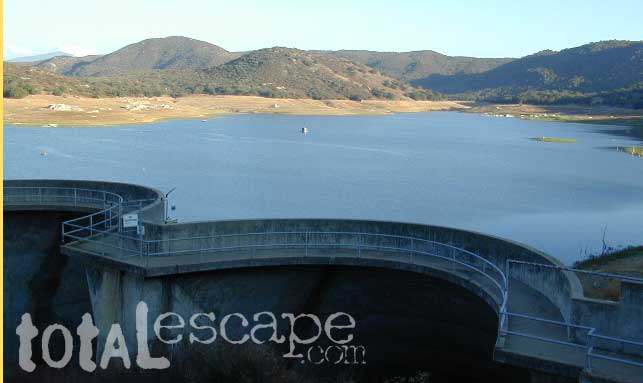
    sutherland Reservoir

    Lakes in San Diego CA
    San Diego County Lakes & Reservoirs

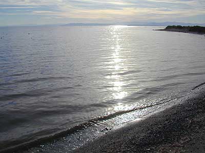
    Salton Sea, way out past Anza Borrego desert is indeed surreal, but nothing too spectacular

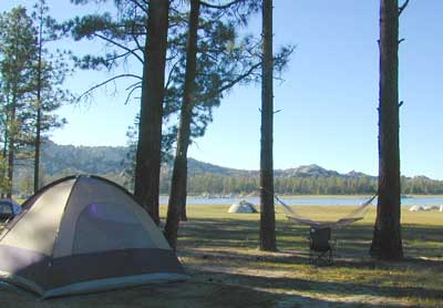
    Baja mountain camping at Laguna Hanson. Baja California Norte
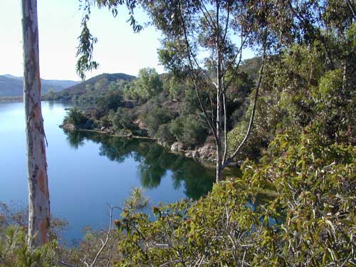
    Lake Dixon in North County San Diego, near Escondido, CA

    Barrett Lake, near Tecate CA
    w/ plenty of off-roading trails @ Corral Canyon OHV Park

        • south of Interstate 8
        • steep slopes & granite boulders
        • vegetation is chaparral & coastal sage
        • elevations range – 1,600′ – 3,681′
        • wood fires prohibited
        • portable stoves permitted
        • groups limit – 15 people
        • visitor permit required
    hikes NFS camping

    Looking for alpine lakes, dense forest and dramatic mountain scenery? 

    Of course you are. That’s why half the population relocated to California, to endlessly search for summer vacation destinations in alpine bliss and stay overnight next to a secluded mountain lake. You’ll need to leave SoCal to find these beauties, but they are out there if you have the time to travel and spend a week enjoying one. Midweek, the fish are all yours. Check out our huge California Lake List.

    San Diego Lakes

    San Diego county has numerous recreational lakes, but only a few that allow overnight camping. Oak filled valleys and pine forests are nearby, but if you are seeking alpine lakes, surrounded by granite peaks and towering forests – then look to north for the Sierra Nevada mountains. Southern California landscape is nearly a desert terrain, with seasonal creeks and minimal rivers, so you won’t find lush greenery with natural lakes down here.

    lakes San Diego

    cleveland National Forest map

    Agua Tibia Wilderness

    Agua Tibia Wilderness Area

    • 15,900 acres
    • chaparral & oak at lower elevations
    • pine & fir forest at high elevations
    • elevations range 1,700′ – ­5,000′
    • 25 miles of trail
    • summer temperatures exceed 100°F
    • occasional snow in winter
    • best in winter through spring
    • wood fires prohibited
    • portable stoves permitted
    • water scarce
    • no overnight use of pack or saddle stock
    • groups limit – 15 people
    • visitor permits required
    Agua Tibia lies right on the RIVERSIDE
    & SAN DIEGO COUNTY border

    Cleveland National Forest
    Palomar Ranger District
    1634 Black Canyon Road
    Ramona, CA 92065
    760-788-0250

    Agua Tibia Map

    Agua Tibia Trailhead

    This is the trailhead for Agua Tibia Wilderness located at Dripping Springs Campground on Highway 79, near Temecula CA.

    See more: Agua Tibia Mountain hike details

    hiking SoCal

    San Mateo Canyon Wilderness

    San Mateo Canyon Wilderness

    • 9,700 acres, South of Highway 74
    • hiking near Temecula, California
    • between Camp Pendleton & Lake Elsinore
    • moderate to steep terrain
    • vegetation chaparral on slopes
    • riparian vegetation in stream channels
    • oak woodland at lower elevations
    • accessible by several routes off Hwy 74
    • accessible by dirt roads
    • some access routes may be closed in wet weather
    • best times to visit are spring & fall
    • wood fires prohibited
    • portable stoves permitted
    • visitor permit required
    Cleveland National Forest
    Trabuco Ranger District
    1147 East Sixth Street
    Corona, CA 91719
    714-736-1811
    San Mateo Wilderness Map

    OC

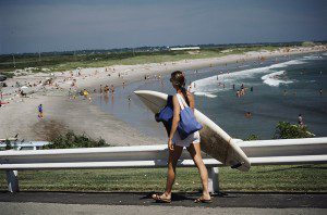
    the OC: SoCal culture – beaches, surf, mountains

    Orange County. North of San Diego & south of L.A.

    surfergirl

    OC hikes

    A wonderful resource for Orange County outdoors is
    ocparks.com

    maps for local weekends, local hikes:

    oretga highway 74
    oretga highway 74

    San Diego Trails

    San Diego Hiking – San Diego County Trails

    horse hiking

    Cedar Creek Falls
    3 mi RT / moderate; off Hwy 78

    From Santa Ysabel on Hwy. 78, drive E 6 mi, turn right on Pine Hills Rd.
    1.50 mi., bear right on Eagle Peak Rd.
    1.25 bear right again (signs point to Eagle Peak Ranch)
    Drive 8 mi. (dirt & paved) to Saddleback, 4 way junction.
    Park & hike the fire road downhill for 1.25 mi.
    At the fork, bear left & continue into the Cedar Creek bed
    Some rock scrambling down to the swimming hole

    Hot Springs Mountain
    5.5 miles RT/ strenuous (elevation gain/loss =1,250 feet)
    Near Warner Springs, 10 miles northeast of Lake Henshaw; Off Highway 79

    From Temecula Interstate 15, take Highway 79 East to Warner Springs
    Drive up Los Coyotes’ Indian Reservations main road, past the intersection of Middle Fork Borrego Palm Canyon (6.1 miles past the entrance gate )
    Turn left (west) and drive up the valley on a sandy road to reach a saddle above the valley 2.2 mi. farther
    At Nelson’s Camp, on the left side of the road, Park at the camp
    Begin hiking southwest up along a small tributary stream that flows north & west into Agua Caliente Creek.
    Follow an old Jeep trail up, gaining more than 500 feet in just over a mile.
    At the top, you’ll meet a better road that runs up the south slope to Hot Springs Mountain
    Turn left (west) on this road and climb another 1.6 miles along the ridge line to the tower.
    Pass through dense forests of black oak, Coulter pine and white fir, and across meadows dotted in late spring with wildflowers.
    Lookout tower, dilapidated and seemingly on its last leg, sits on the west shoulder of the mountain.
    Go a bit higher on the ridge by following a faint trail through thick brush and around boulders to the true summit. A flat concrete platform caps the summit block.
    option – Seven-mile dirt road going up the mountain’s southern slope (drive, hike or mountain bike)

    Maps Mountains / San Diego Maps

    see also – San Diego Anza Borrego 4×4

    Split Mountain Anza Borrego

    Anza Borrego Desert State Park

    Fish Creek Campground

    E of Borrego Springs CA.

    Well off Highway 78, past the busy OHV area, quads at Ocotillo Wells, past all the rural homes & the redneck bar, past the Elephant Trees hike – where the road goes from pavement to graded dirt to a wild desert wash, in a few short miles. If you don’t know where you are, then you’re almost there.

    This is a large wild desert wash with huge unstable walls, several areas for wind caves and a few historic markers. Lots of 4×4 trails beyonf Split Mountain, to the south. No real water in sight, except maybe the puddle you are standing in as it starts to poor. The soft sand can give way to a few heavy rain drops. May not be a great area to be during a serious storm or flash flood possibility, unless you want to get buried alive. Check the weather forecast in advance.

    A ratty, small developed campground of Fish Creek is on the left side, upon the ledge. Fish Creek Campground is picnic tables & a pit toilet – at most. Ya may as well camp out in the open, off road, like the pioneers did. You can do that out here in Anza Borrego. (Just keep it clean & carry a metal fire container.)

    split mountain

    Split Mountain, Anza Borrego Desert State Park

    This portion of the “mountain” is less than a mile from Fish Creek Campground. Fossils can be found in these walls. Shade is good in summer months, when day temps reach 100+. The rest of the year is ideal weather. This mountain split from water, erosion, mega force. High walls, wind caves, desert washes, great primitive camping & 4×4 routes.

    This desert scenic drive will require you to get that SUV dusty. 4 wheel drive not required. No RVs past the campground. All low lying passenger cars are warned, there are uneven areas, soft sand & boulders.

    Duh, do not attempt this one when desert flash floods are possible.

    ANZA BORREGO STATE PARK

    ANZA BORREGO MAP

    SAN DIEGO BACKCOUNTRY MAP

    nearby towns –

  • BORREGO SPRINGS CA
  • OCOTILLO WELLS CA
  • SALTON SEA CA

    splitmountain

    Great desert back road exploring out here. A zillions washes & canyons.