Tag Archives: southern

Remington Hot Springs

lower kern river
hike-in hot springs

Remington Kern River

Remington Kern River

This place was the alternate choice to Miracle Hot Springs, but since that one is now closed – this is the main attraction out here, along the lower stretch of the Kern River.

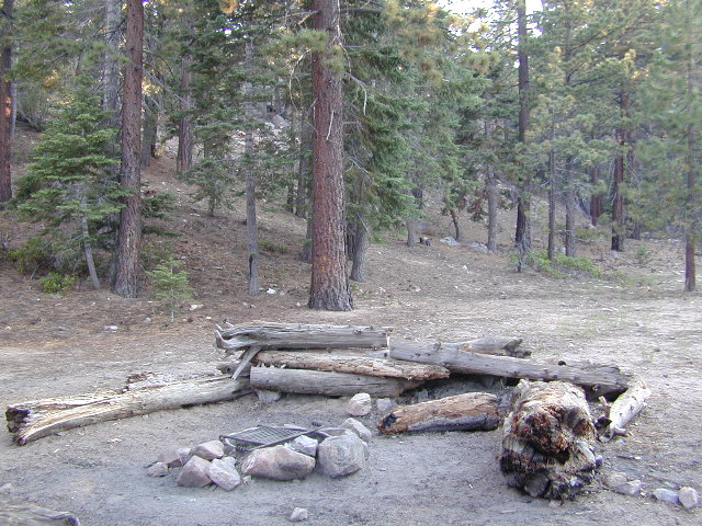
USFS Forest Hobo Campground is about a mile away and it may be closed due to landslide repairs. There is also plenty primitive style camping options if you so choose.

Remington is by far, one of the nicest primitive hot tubs in the whole region and easy to access. If you can find it, the rewards are great!! Can be crowded on weekends. If the dirt parking lot is totally full, come back later or wait it out. You can find travelers, mountain bikers, dirt bikers, hikers, backpackers, campers, off-roaders, RVers, burners, desert rats, military boys, local kids, LA couples,  techno DJs from Russia – a wide variety of people soaking at this not-so-secret spot.

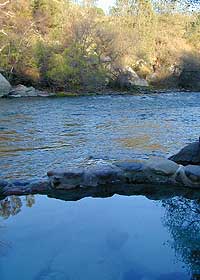
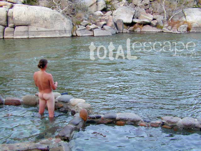
These unique hand-crafted stone tubs are located on the Lower Kern, overlooking the big river and the fish. 3 volunteer built cement & river rock hot spring pools sit adjacent to the Kern River. There is also another small cooler tub on the trail perched above the thick brush.

This prime recreation spot is located a few miles west of Hobo Campground (old Miracle Hot Springs) is sometimes busy: dirt parking lot, minimal sign & the tubs are not viewable from the road. From parking area you must hike down a steep grassy trail for about a mile.

Bring towels, beverages & everything you will need from the vehicle, as turning around to go back & get everything half way down will prove to be a challenging trail up. Boulders & oaks on steep hillsides. A few campsites down along main trail. Wildflowers here are wonderful in Spring (April-May). Please pick up litter & keep this place beautiful.

West of Kernville & Lake Isabella, CA
along Kern River in the Lower Kern Canyon Gorge, Southern Sierra Nevada mountainsSequoia Kern Hot Springs

Remington primitive hot springs are located inside the lower Kern Canyon, southwestern part of Sequoia National Forest. Take Highway 178 east to the 4 lane portion, look for Borel Road right turn which climbs a steep hill up to Old Kern Canyon Road. At this stop sign you will see a sign for Remington Trail (3.5 miles) pointing to the right.

NFS

Remington Trailhead (signed) & dirt parking lot across from trail, is located on Old Kern Canyon Rd, which runs parallel to the 4-laner  Hwy. 178 on the opposite side of the Kern River. The well known Kern Canyon Road is also labeled as “Cort 214” on GoogleMaps.

Remington Ridge Trail #32E51 – Mountain bike, hike and horseback trail

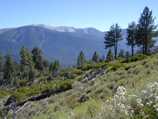
Breckenridge Road #28S06, access via Havilah, CA. Breckenridge has pine forest at higher elevation, and is the tallest mountain to the south of Kern River.

lower Kern hikes

clothing optional is the norm

Ardell’s Tip: Remington is one of the few spots in California that you can fish a major river from inside a hot tub.

Best Naked Fishing
click on the photo for more

lodging in nearby townsRiver Path

camp

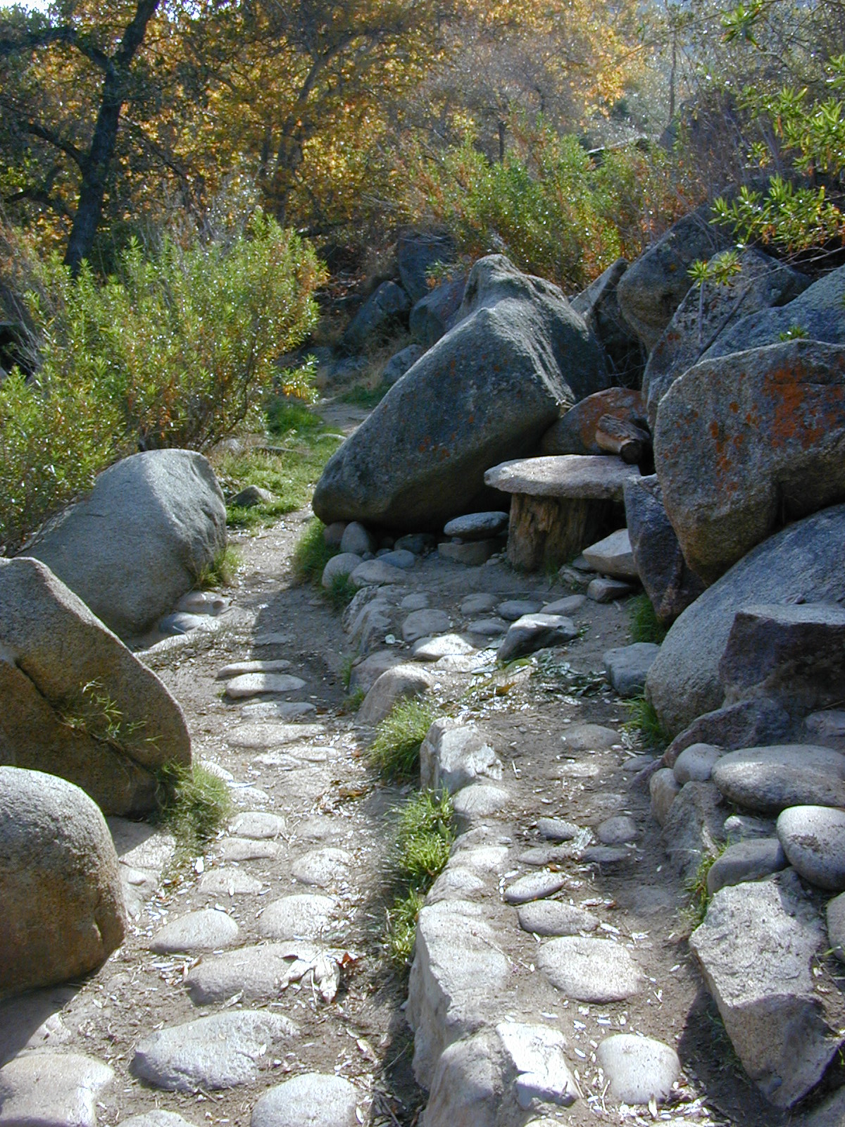
Minimal camping spots with very little privacy at the main dirt parking lot at Remington Hot Springs. The best tent camping is located down on the trails, so you may choose to hike-in to the secluded oaks to the sandy beach camps below. No facilities at Remington, no tables, no toilets, no electricity, so come very prepared to “rough it”.

Primitive Camping in California

USFS Sandy Flat Campground and Hobo Campground are a few miles away (to the east), on the same Kern Cyn Road; Breckenridge Campground is on a tall pine forested ridge just to the south, but requires a long drive around the mountain, or a super rugged 4WD vehicle for a steep dirt road.

Folks seeking more seclusion can choose to primitive camp along the narrow paved road leading to the west. Motorhome campers like the option of road side boondocking with great views; several level pullouts can accommodate most any camper. 4×4 camping is closer to Lake Isabella @ Keyesville or BLM River Camping. Primitive camp spots on numerous dirt roads are located in this Lower Kern River area, but you will need to check with Sequoia National Forest ranger for gate closures, fire permit & fire current restrictions.


View Remington Hot Springs in a larger map

San Gorgonio Wilderness

sangorgonioview
Old Greyback, San Gorgonio Mountain – as seen from forest road #2N93

Southern California /San Gorgonio Wilderness Area / San Gorgonio Mountain Peak Hikes / Backpack Gorgonio

The tallest mountain peak in Southern California towers over the often smoggy basin of the Inland Empire, Riverside & San Bernardino. Coachella Valley lies to the southeast. Joshua Tree National Park lies due east.

Old Greyback is a fitting nickname for the peak. The massive, bald, decomposed granite gravel paves the whole top layer, above treeline (altitude nearing 12,000 feet above sea level) and this impressive peak can be seen from most of the Los Angeles basin and the Palm Springs desert. The expanding view of the Pacific Ocean can be seen 70 miles to the west, but only if the skies are clear. Windy, winter days are excellent conditions for viewing, but plan your hike accordingly as this peak could be covered in deep snow during winter or springtime.

This is a very popular backpacking weekend trip to escape from the big urban populations. San Diegans and Angelinos can easily access this location in a few hours from home, via Interstate 10 and some mountain driving on a 2 lane highway.

tallest peak

94,702 acres

San Gorgonio Peak – 11,503′ elevation

San Bernardino National Forest


Forest & Hiking Maps –

San Gorgonio Topo Maps

  • San Gorgonio Wilderness Map (USDA)
  • San Gorgonio Trail Map (Tom Harrison)
  • San Bernardino National Forest (USDA)

Gorgonio trailheads –peak hiking

  • Hwy 38 @ Angeles Oaks
  • Hwy 38 @ Barton Flats – Jenks Lake
  • Hwy 38 @ Heartbar – Fish Creek & Mission Springs
  • Hwy 38 @ Fossil Falls – Momyer & Big Falls
  • I-10 @ Millard Canyon – East Branch & Middle Branch
  • Interstate 10 @ Cottonwood Canyon – PCT access

nearby campgrounds –

Heartbar Campground (Hwy 38)

Mission Springs Trailhead Camp

Dry Lake Campground

nearby communities & towns –

ANGELES OAKS
BIG BEAR CITY
BIG BEAR LAKE
FOREST FALLS

surrounding wilderness and forest lands –

San Bernardino National Forest
Pipes Canyon Pioneertown Preserve
San Jacinto Wilderness

National Forest & Wilderness Permits –

USDA San Bernardino NF

more San Gorgonio info & links –

summitpost.org/san-gorgonio-wilderness
San Gorgonio Wilderness Wiki
Trails of the San Gorgonio

Gorgonio Trailhead

Equestrian Trails
MIssion Springs camp & corrals at trailhead. Dirt road above Heart Bar.

Silver Peak Wilderness

Hiking the Southern Big Sur Coastline

faded public lands
Sun-bleached, wooden Los Padres sign – near Salmon Creek trailhead.

Silver Peak Wilderness, Big Sur Coast

Central California Coast

31,555 acres

8 miles South of Gorda, CA
along Pacific Coast Hwy 1
near Big Sur, CA
Los Padres National ForestBig Sur Wilderness Map

Backpacking and hiking trails on the Pacific Coast, steep terrain next to ocean. Coastal redwood canyons, oaks hills, great views. The neighboring Ventana Wilderness is located just north of Silver Peak hiking trails.

Southern Redwood Botanical Area

Silver Peak –3,590′ elevation
Alder Peak –3,744′

trailheads

  • Salmon Creek Trail #5E09
  • Hwy 1 @ connection Trail #5E10
  • Alder Creek Trail #5E09

mm

mile markers along Pacific Coast Highway 1
(Monterey County)

  • Cruickshank Trailhead – 6.5 mm
  • Soda Springs Trailhead – 3.8 mm
  • Buckeye Trailhead – 2.4 mm
  • Salmon Creek Trailhead – 2.2 mm

developed campgrounds nearby –

nearby towns –

Ocean View Hikes Big Sur


View Larger Map

Oak Foothills

Golden Trout Wilderness

Golden Trout Wilderness Area

granite Upper Kern River is Mount Whitney snow melt
  • 303,511 acres
  • elevation range 1,000′ – ­13,000′
  • pine forest, chaparral
  • granite walls, domes
  • 379 miles of trail
  • summers are busy
  • snow in winter
  • best in early spring
  • wood fires may be restricted
  • portable stoves permitted
  • water plentiful
  • rock climbing & mountaineering
  • fishing
  • backpacking
  • primitive hot springs
  • waterfalls, swimming holes
  • wilderness permits required for overnight
Golden Trout Wilderness surrounds the mighty gorge of the Upper Kern Canyon, south of Mount Whitney.
Inside

TULARE COUNTY

bordering

Inyo National Forest

Sequoia National Forest

Eastern Sierra Interagency Center
760-876-6200

Golden Trout / South Sierra Wilderness Map USDA

Golden Trout Trail Map

Located in the South Sierra Nevada mountains alongside the Southern Sierra Wilderness. Inside the remote rugged peaks of a deep, granite crevasse known as the Upper Kern River with ancient Sequoia forest to the west and to the eats, some of the tallest peaks in the Sierra range. This wild land area is home to the California golden trout and is the main water flow southward from the tallest peak in the lower 48  – Mount Whitney on the Eastern Sierra front.

Sequoia National Forest
Monache Meadows
Inyo National Forest
Mountain Home State Forest
Sequoia National Park
Mineral King

Golden Trout Wilderness

Roads, campgrounds and trailheads surrounding Golden Trout Wilderness

Eastern Sierra –

Horseshoe Meadows Road (paved) leads up to high elevation meadows from the high deserts of Lone Pine, CA. Pacific Crest Trail (PCT) access; Mount Whitney and John Muir Wilderness are to the north. Equestrian corrals and horse trails. Camping is limited to a one night stay at any of the 3 campgrounds up here.

Golden Trout Trailhead Campground: elevation 10,000′ / 12 walk-in sites / closed winter
Horseshoe Meadows Campground: elevation 10,000′ / 18 walk-in sites / closed winter
Cottonwood Equestrian Camp: elevation 10,000′ / 10 horse corrals / closed winter

Forks of  the Kern –

Fork of the Kern / Loyds Meadow Road #22S82 – This main paved road connects the Kern River (Sierra Hwy Road #99) to the lower elevation, granite slopes of the Western Divide, and the route dead ends at Jerky Meadow parking lot. Camp 1-6 are primitive camp areas located on dirt side roads and 4×4 might be required on some of them. Obtain a campfire permit from rangers in Kernville. Fishing, camping, waterfalls and swimming holes are popular in this region. The big developed camp along this road, is located 10 miles up, in a pine filled valley on Peppermint Creek on the west side of the street and is within the Giant Sequoia National Monument.

Lower Peppermint Campground: elevation 5300′ / 17 camp sites / open year round

Lloyd Meadows @ Sequoia Forest Road# 20S67 – is the Forks of the Kern Trailhead & the dirt road that accesses it, is very popular among equestrian campers.

Western Divide Highway –

Road #20S79 leads from Western Divide Hwy to Lewis trailhead.
Road #20S50 leads from Western Divide Hwy to 2 hiking trailheads.

Sequoia National Park, Three Rivers, CA –topo maps

South Fork Road leads up Kaweah River at Southfork trailhead.
Mineral King Road is only open seasonally, access to high country lakes and trailheads.


SEQUOIA AREA MAPS –

Golden Trout Wilderness Maps
Sequoia National Forest Map USDA
Inyo National Forest Map USDA
Mineral King Map
Sequoia & Kings Canyon NP Map
NatGeo Sequoia Kings Map

Golden Trout Wilderness trailheads:

east side –
Cottonwood Trailhead (near Lone Pine)
Blackrock Trailhead (Monache Mdws)

south side –
Jerky Trailhead
Forks of the Kern Trailhead
Lewis Camp Trailhead (Western Divide)
Summit Trailhead (Western Divide)
Clicks Creek Trailhead (Western Divide)
Camp Wishon Trailhead (Western Divide)

west side –
South Fork Trailhead (Three Rivers)
Atwell Mill Trailhead (Silver City)
Franklin Pass Trailhead (Mineral King)

List of nearby towns: