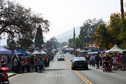
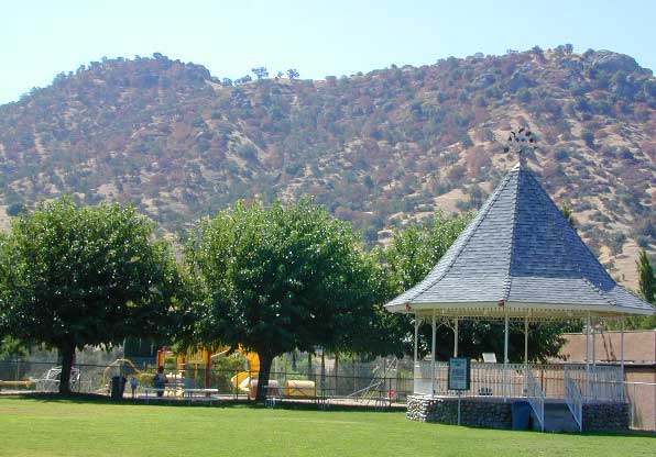
Western Sierra. The sleepy foothills town on Hwy 190, Springville California, holds their annual Apple Festival near the Tule River & the Sierra Nevada mountains. Enjoy apple burritos, apple pies, apple tamales and apple cobblers!
Craft and food vendors, costume contest. 5k & 10k runs (Apple Run) Celebrating 40 years on this local event.
Annual rodeo running 65+ years in the western foothills of the Sierra Nevada mountains. Held before the heat of summer, during the spring. Slogan is the “Biggest Little Rodeo in the West”
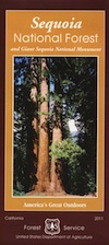
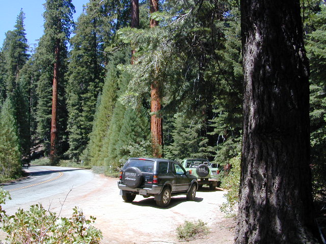
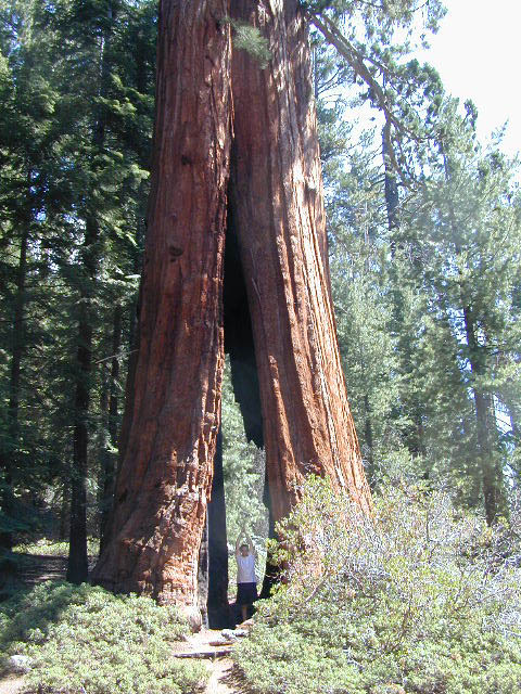
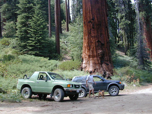
The Western Divide Highway, at 6000 feet elevation, connects the Kern River Valley w/ granite peaks, dome rock, aspen groves & the Giant Sequoia trees! This is one of the southernmost Sequoia groves in the Sierra Nevada mountains. The easy hike is more of a nature trail, wheel chair accessible & approximately 1 mile long. Large Sequoia trees, picnic grounds, near campground.
SEPT 2021: Closed due to the Windy Fire
On busy weekends and holidays the rangers charge a “day use” parking fee, for those wishing to park in the paved parking lots. Avoid this fee by finding additional parking along the highway. Only a few good free parking spots along this busy 3 mile stretch of highway, and don’t forget to park all the way off the pavement.
SOUTHERN SIERRA: Great destination for camping families & sightseers traveling through the Southern Sierra Nevada mountains.
Western Divide Campgrounds
The USDA National Forest Campground across the road from the Trail of One Hundred Giants is called Redwood Meadow Campground. There is also a separate parking lot for the picnic grounds w/ a similar name.
Giant Sequoia National Monument has numerous dirt back roads for free, primitive, car camping. You’ll need a good topo map to find the best ones. Some roads may be muddy, overgrown or extremely rocky, depending on recent weather. Know you vehicles limitations. There is no tow truck service available way back here in the boonies.
BALCH PARK campground is on a first come basis; no campground reservations needed.
2021 – THIS CAMPGROUND IS CLOSED indefinitely, due to the Castle Fire 2020
Balch Park open May to October
Park info # 559 539-3896
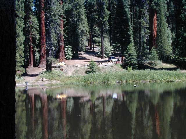
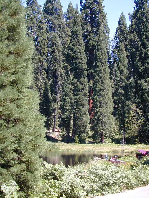
Hedrick Pond lined w/ Sequoia trees
Balch County Park is right in the middle of Mountain Home State Forest, which is within the bigger Sequoia National Forest (aka Giant Sequoia National Monument). But don’t let all the bureaucracy mislead you, this is an ideal park and location, well worth your trip. The campground is the most developed one within the area – with paved roads, RV spaces, flush toilets and a fee to go along with all that. Even gotta fishing pond.
Bears are a big deal in these neck of the woods. Please store all your food properly to avoid a un-welcomed visitor
A Sequoia Grove is nearby with plenty of creeks & meadows.
Trailers not recommended due to the long curvy road leading up the mountain.
Balch Park & Campground NOT TO BE CONFUSED with utility company residences of BALCH CAMP between Pine Flat & Blackrock Reservoirs
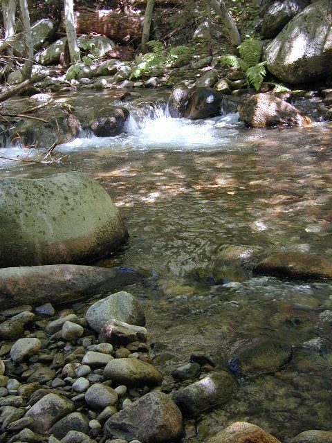
Located right on the middle north fork of the Tule River
Inside an unknown area called Mountain Home State Forest, this small campground has a few spots that fill up quickly on weekends and at anytime during in the summer months. Campground closes seasonally, for winter snow.
Usually open: MAY-OCT
HIDDEN FALLS CAMPGROUND
• Elevation: 6,150′
• Number of Sites: 8 walk-in camp sites
• Reservations: No
• Sites Available: First come, First serve
• Vehicle Accessibility: 20′ max.
• Length of Stay: 14 Days
• Water: River nearby
• Toilet: Vault
• Bear Boxes: Yes
• Season: Closed for winter
• Fee: Yes
• Operated By: National Forest Service
• Closest Town: Springville, California
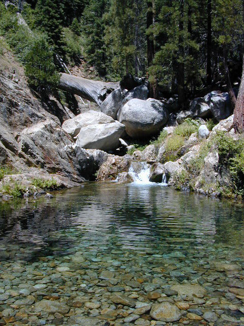
tent camping on river
Motorhome RV campers beware; no hook-ups, no paved roads. This is a primitive style camp, way back on a dirt road – not suitable for large vehicles.
NOTE $ This used to be one of our favorite FREE spots, but they recently started charging an overnight fee for this campground.
Views from Camp
bike
camp
fish
hike
picnic
stargaze
Golden Trout Wilderness trailheads nearby. Plenty of hiking opportunities, great scenery and several Sequoia groves to visit.Mountain biking is allowed on the dirt roads. Single track trails may be overgrown or even off-limits, due to the fragile eco-system around Sequoia trees.
You may actually love this little camp so much, you won’t want to go anywhere else. How ’bout just chillin out: relaxing near the water. Shady swimming holes. Fishing in the Tule River.
Pack a picnic: Back road exploration is a great day trip, for there are many dirt roads weaving in and around this park, near the Giant Sequoia.
Tule River, North Fork
Hidden Falls is accessible via a long, narrow, paved mountain road; then a dirt road, leading 3 miles back to two very secluded campgrounds: this one & neighboring Moses Gulch Campground.
western south sierra
North of Springville on Highway 190, turn left (north) on to J37, some call it Balch Park Road (Google Maps has it as Wagner Drive) and follow it up 3.5 miles to Bear Creek Road (#220). Drive 17.5 miles on curvy Bear Creek Road, turn right and follow signs to campground.


 bike
bike