Tag Archives: State Parks

Gold Country California

Gold Country Sierra Nevada

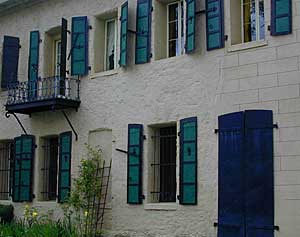
historic murphys hotel

1849:
California Gold Rush began

These foothill regions below are the rivers & mountains of the infamous California Gold Rush of the mid-1800’s. Many mountain dirt roads will lead to your secluded, private camp site, near a creek or river. Or plan on camping in a developed Campground near a recreation lake lined with amenities, pine trees & oaks. River rafting & kayaking can be found throughout this area, as well as backpacking, mountain biking and hiking trails. Fishing is very popular as well.

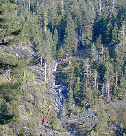
Waterfalls, back roads, granite features, historic mining camps, big fishing rivers all abound. Wilderness backpacking in the High Sierra can be accessed by Hwy 108 (Sonora Pass) Hwy 4 (Ebbetts Pass) Hwy 88 (Carson Pass), Sierra US Route Hwy 50 & Interstate 80. Numerous small towns populate Historic Highway 49 for every tourists need – meals, laundry, grocery, coffee, lodging & shopping.
waterfalls Sierra Nevada

Gold Country California forest & parks –

Hwy 4 Ebbetts Pass & Hwy 108 Sonora Pass

Stanislaus National Forest
Columbia State Park

Arnold, Columbia, Dardanelle, Jamestown, Long Barn, Mi-Wuk, Murphys, Pinecrest, Sonora, Strawberry, Twain Harte

Sierra Nevada

Hwy 4 Ebbetts Pass & Hwy 88 Carson Pass, US Hwy 50

El Dorado National Forest

Amador City, Bear Valley, Georgetown, Jackson, Kirkwood, Meyers, Placerville

Sierra Nevada

Interstate 80 Donner Pass

Tahoe National Forest

Alta, Colfax, Foresthill, Grass Valley, Norden, Sierraville, Soda Springs, Tahoe City, Tahoma, Truckee

Sierra Nevada

North Hwy 49 Yuba River

Malakoff Diggins State Park

Downieville, Nevada City

red brick alley

California Campground Maps

California topo mapsWhen you go camping, you wanna explore the area. That’s why you are camping there, right? Hiking & biking trails, equestrian trails, off road routes, river, streams, waterfalls & the closest trail heads. If you prefer primitive camping, outside of developed campgrounds without all the amenities, topographic maps of the back roads give you a perfect overview on where to begin your search. The ultimate creek side camp spot awaits.
The California maps we carry have developed Campgrounds featured for that region. These camps could be managed by any government agency, BLM, NPS, NFS, SP or perhaps a private campground. Below is a list of gorgeous regions that have excellent Campgrounds:

CA National Forest Maps

grover hot springs

Joss House Weaverville

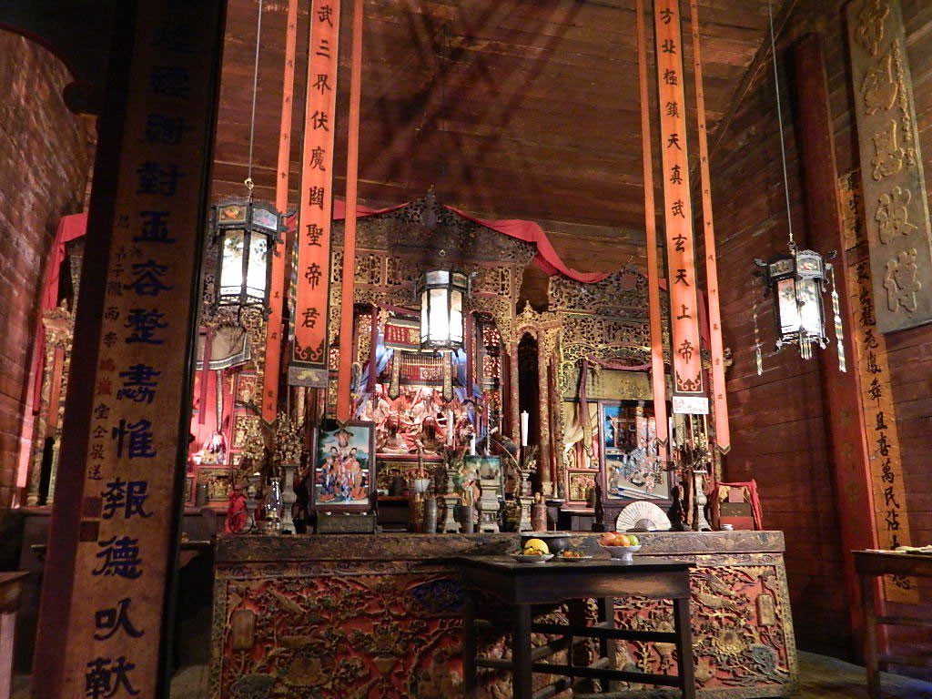
joss_house_interior

The Joss House

Historic Chinese Taoist Temple

A small but impressive State Historic Park located in downtown Weaverville, a small Northern California town located near the Trinity Alps Wilderness and the Trinity River. State Park

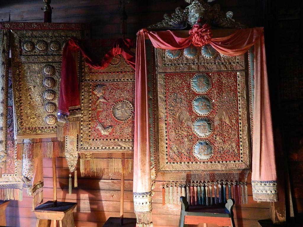
DSCN8505This darling park is only open Thursday through Sundays (mid day) and tours can be arranged. A one room museum tells the story of the Chinese miners who came to the Trinity River region in search of gold. The neighboring temple is a historic masterpiece and has been preserved for all to enjoy. The wooden building has withstood deep snow falls and logging trucks rumbling by on the highway a block away. Neighboring museums, outdoor displays and lush creek side parks make for ideal picnic spots.

parks.ca.gov/?page_id=457

Moon Festival, Weaverville, CA

Annual “Moon Festival” at this park location in October.

joss_decore

Weaverville Joss House.
Not to be confused w/ the Chinese Josh House in San Francisco.

Partington Cove Hike in Big Sur

Big Sur – Partington Cove

DSCN3026
Go west to & visit the oceans edge or head east to explore a deep redwood canyon.big

Approx. 5 miles South of Big Sur State Park and just north of Julia Pfeiffer Burn State Park, this unmarked dirt turnout area on Highway 1 is a rare find. Rocky shorelines at the historic point, plus the scenic tree lined waterfall & cross the highway & head east for a shady Redwood canyon forest with plenty of backpacking options into the Big Sur back country of Los Padres National Forest. From bright sunny ocean view hillsides to dark shady forests.

This portion of the highway cuts into a deep bend along the coast & has no markings to the paradise that lies within. A steep dirt fire road (down to the cove) with metal gate is your only clue. Dirt parking area on both sides of the road indicate that people have parked here before.

This un-signed secluded hide-away has a variety of landscape & sites to see. You could easily kill 6-8 hours just in this canyon alone!! Definitely not a hurry through kind of place. Take your time, enjoy the view, tide pools, bring your swim suits & refresh in the creek. Carry a picnic eastbound into a shady creek-bed canyon & watch the sun dance through the towering pines above.

Driving northbound on Highway 1, look for large hair-pin turn out in canyon area – approx. 3-5 mi. North of Julia Pfeiffer State Park in wide dirt areas along roadside. Located in between Julia State Park & Pfeiffer Big Sur State Park.

Hike down the dusty wide gated fire road in dry brush chaparral. The view of Redwood trees, the royal blue ocean in front of you, the sounds of a water falling creek. The trail forks off in 3 directions:

Right / Rock Beach – this a boulder lined cove where the clear fresh water stream meets the ocean. Small pools & waterfalls can be found just upstream .

Bridge Crossing / Point – through a wooden tunnel to a cliff area with tide pools & wooden structure (an old boat launch?)

Left / Up Stream – a forested canyon w/ a variety of trees; dead ends a few hundred yards up into the canyon

DSCN3021Another option to this canyon is the East side:

Hike up inland (away from ocean) into a densely forested creek area. Redwoods, waterfalls & boulders. Deer sightings are quite common in this area. Shady & dark this trail climbs gradually in elevation. One fork of the trail leads to an old Redwood Grove. A portion of the trail is closed 2.5 mi. up due to a landslide. But overall the is a perfect option for backpackers wanting a short hike.

  • Los Padres Maps (USDA)
  • Big Sur Map (NatGeo)
  • Ventana Wilderness Map w/ Silver Peak