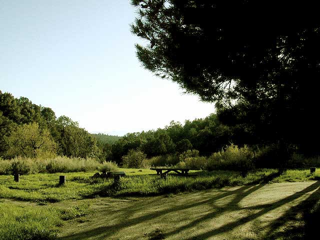
Los Padres National Forest; Toad Spring Campground
Atop Quatal Canyon on Forest Rd #9N09
– less than a mile off of Cerro Noroeste Road; just west of Apache Saddle. Cerro Noroeste Road name has changed to Harris Ranch Road (2015), so make sure to check on several maps before venturing out, just so you know.
5700′ elevation w/ 5 camp sites.
picnic tables, fire rings & no toilet. OHV trails nearby
Red dirt Quatal Canyon, next to the Chumash Wilderness & the Apache Saddle, a small campground is an oasis for the wildlife. A year round drippy, soggy natural springs feeds the meadow & trickles down the dirt road. Great birdwatching, hiking, native wildflowers & hunting.
OHV use is quite common; Quatal Cyn trails, a long desert wash to explore. Short side canyons to the right, off of main road (9N09). Many routes may require a high clearance vehicle, but not 4×4, unless it’s raining or wet or snowy. You’ll need a Los Padres Forest map to get the most enjoyment out of this confusing landscape. The multi-colored, eroded badlands makes great day hikes. Chumash Cliffs & Mount Abel 8286′.
Ballinger Canyon OHV Park is about 20 miles away, via Quatal Cyn & then 5 miles N on Hwy 33
LOS PADRES NATIONAL FOREST MAPS – USDA
LOS PADRES EAST MAP – NatGeo
LOS PADRES WEST MAP – NatGeo
towns nearby:
