Tag Archives: topo

4×4 Rock Crawling

poppin

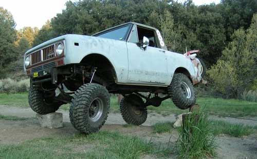
Rock Crawling has gained massive exposure in the two last decade with new suspensions, after market part for nicer rigs & of course, the main stream media. Red Bull, Skyjacker & other corporate sponsors have dug their hands into this new sport & the profits.

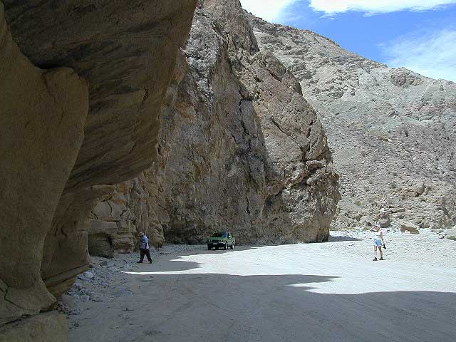
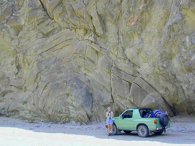
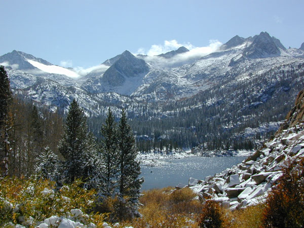
Crawlin’ is the off road hobby of wheelin’ well built rigs over the rocky terrain and obstacles, instead of around it. Sandstone walls, granite boulders of the High Sierra, hand made “rock gardens” in the Mojave, practice runs @ the local OHV parks.

Breaking things is the norm in this game. Expect this past time addiction to cost a bundle – on auto parts & on your free time. On the trail repairs are common, so go prepared w/ your tools, overnight gear & your crawling buddies (as back up).

From the adventure lands of Moab, Utah to the Mojave Desert of SoCal, rock crawling is not about speed, but all about the delicately chosen lines & slowness. The technique, the rigs & preferably no body damage. Just get rid of the body!

How slow can you go? How high can you handle?

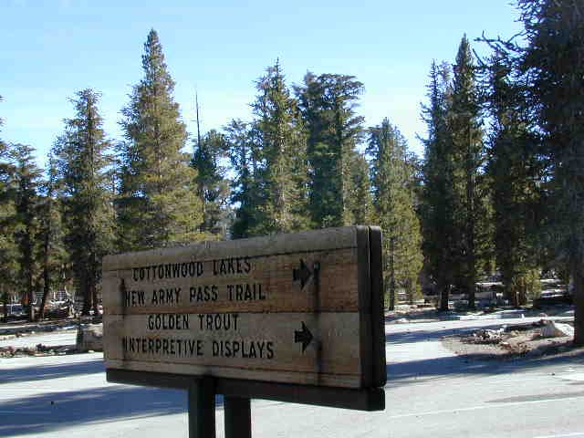
Popular rock crawling areas around the Southwest U.S. –

California OHV Trail Maps

OHV Routes, Motorcross & ATV Maps

local boys Los Padres

Pine Creek Wilderness

Pine Creek Wilderness Area
East of San Diego, California

  • 13,400 acres
  • gently sloping area
  • elevations range – 2,000′ ­ 4,000′
  • vegetation is chaparral & scrub
    oak
  • riparian & woodland vegetation in stream
    bottoms
  • Pine Creek & drain the area north to
    south
  • rainbow trout in Pine Creek
  • streams are dry for parts of the year
  • several trails provide access to area
  • wood fires prohibited
  • portable stoves permitted
  • groups limit – 15 people
  • visitor permit required
Cleveland National Forest
Descanso Ranger District
3348 Alpine Boulevard
Alpine, CA 91901
619-445-6235

Pine Creek Wilderness Map

San Diego Trails

San Diego Hiking – San Diego County Trails

horse hiking

Cedar Creek Falls
3 mi RT / moderate; off Hwy 78

From Santa Ysabel on Hwy. 78, drive E 6 mi, turn right on Pine Hills Rd.
1.50 mi., bear right on Eagle Peak Rd.
1.25 bear right again (signs point to Eagle Peak Ranch)
Drive 8 mi. (dirt & paved) to Saddleback, 4 way junction.
Park & hike the fire road downhill for 1.25 mi.
At the fork, bear left & continue into the Cedar Creek bed
Some rock scrambling down to the swimming hole

Hot Springs Mountain
5.5 miles RT/ strenuous (elevation gain/loss =1,250 feet)
Near Warner Springs, 10 miles northeast of Lake Henshaw; Off Highway 79

From Temecula Interstate 15, take Highway 79 East to Warner Springs
Drive up Los Coyotes’ Indian Reservations main road, past the intersection of Middle Fork Borrego Palm Canyon (6.1 miles past the entrance gate )
Turn left (west) and drive up the valley on a sandy road to reach a saddle above the valley 2.2 mi. farther
At Nelson’s Camp, on the left side of the road, Park at the camp
Begin hiking southwest up along a small tributary stream that flows north & west into Agua Caliente Creek.
Follow an old Jeep trail up, gaining more than 500 feet in just over a mile.
At the top, you’ll meet a better road that runs up the south slope to Hot Springs Mountain
Turn left (west) on this road and climb another 1.6 miles along the ridge line to the tower.
Pass through dense forests of black oak, Coulter pine and white fir, and across meadows dotted in late spring with wildflowers.
Lookout tower, dilapidated and seemingly on its last leg, sits on the west shoulder of the mountain.
Go a bit higher on the ridge by following a faint trail through thick brush and around boulders to the true summit. A flat concrete platform caps the summit block.
option – Seven-mile dirt road going up the mountain’s southern slope (drive, hike or mountain bike)

Maps Mountains / San Diego Maps

see also – San Diego Anza Borrego 4×4

Hauser Wilderness

Hauser Wilderness Area

  • 8,000 acres, south of Interstate 8
  • steep slopes & granite boulders
  • vegetation is chaparral & coastal sage
  • elevations range – 1,600′ ­ 3,681′
  • Pacific Crest Trail passes to the east
  • Barrett Reservoir
  • wood fires prohibited
  • portable stoves permitted
  • groups limit – 15 people
  • visitor permit required
Cleveland National Forest
Descanso Ranger District
3348 Alpine Blvd.
Alpine, CA 91901
619-445-6235

Hauser Pine Creek Wilderness map

PCT Maps

Hiking Trails San Diego

San Diego Mountains

San Diego Mountain / Hiking San Diego / SoCal Camping

hiking San Diego

San Diego forests & parks – 

Cleveland National Forest

Palomar Mountain State Park

Anza Borrego Desert State Park

San Diego maps & trails –

San Diego mountain towns nearby Alpine, Descanso, Julian, Mount Laguna, Palomar, Ramona

mt laguna lodge

Split Mountain Anza Borrego

Anza Borrego Desert State Park

Fish Creek Campground

E of Borrego Springs CA.

Well off Highway 78, past the busy OHV area, quads at Ocotillo Wells, past all the rural homes & the redneck bar, past the Elephant Trees hike – where the road goes from pavement to graded dirt to a wild desert wash, in a few short miles. If you don’t know where you are, then you’re almost there.

This is a large wild desert wash with huge unstable walls, several areas for wind caves and a few historic markers. Lots of 4×4 trails beyonf Split Mountain, to the south. No real water in sight, except maybe the puddle you are standing in as it starts to poor. The soft sand can give way to a few heavy rain drops. May not be a great area to be during a serious storm or flash flood possibility, unless you want to get buried alive. Check the weather forecast in advance.

A ratty, small developed campground of Fish Creek is on the left side, upon the ledge. Fish Creek Campground is picnic tables & a pit toilet – at most. Ya may as well camp out in the open, off road, like the pioneers did. You can do that out here in Anza Borrego. (Just keep it clean & carry a metal fire container.)

split mountain

Split Mountain, Anza Borrego Desert State Park

This portion of the “mountain” is less than a mile from Fish Creek Campground. Fossils can be found in these walls. Shade is good in summer months, when day temps reach 100+. The rest of the year is ideal weather. This mountain split from water, erosion, mega force. High walls, wind caves, desert washes, great primitive camping & 4×4 routes.

This desert scenic drive will require you to get that SUV dusty. 4 wheel drive not required. No RVs past the campground. All low lying passenger cars are warned, there are uneven areas, soft sand & boulders.

Duh, do not attempt this one when desert flash floods are possible.

ANZA BORREGO STATE PARK

ANZA BORREGO MAP

SAN DIEGO BACKCOUNTRY MAP

nearby towns –

  • BORREGO SPRINGS CA
  • OCOTILLO WELLS CA
  • SALTON SEA CA

    splitmountain

    Great desert back road exploring out here. A zillions washes & canyons.

  • Eastern Sierra Mountains

    Eastern Sierra Mountains / Eastern Sierras California

    mount tom

    Wilderness seeker John Muir called the Eastern Sierra, the range of light. It’s desery & drastic. Tons of granite & wild-ness. The impressive, tallest peak in the lower 48, Mount Whitney towers at elevation 14888′ over the Owens River Valley. Death Valley meets mountains. Ancient volcanoes & fresh granite. Creeks are alive throughout summer. Alpine lake hikes & their wild flowers are incredible. Horseback trails, rentals, pack trips are very popular. Total Escape even list high country Inyo 4×4 routes, that overlook Bishop.

    Eastern Sierra forest & parks –
    Inyo National Forest
    Toiyabe National Forest – north (Carson)
    Toiyabe National Forest – south (Bridgeport)

    Ancient Bristlecone Pine Forest

    Ancient Bristlecones

    inyo maps

    Eastern Sierra maps & trails –

    Eastern Sierra towns –
    Aspendell, Big Pine, Bishop, Crowley Lake, June Lake, Lee Vining, Lone Pine, Mammoth, Olancha, Toms Place

    south lake bishop

    cottonwood lakes