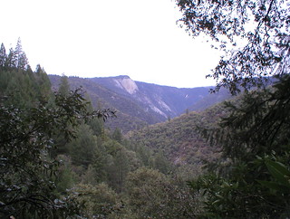
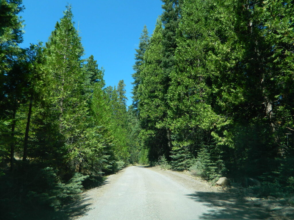
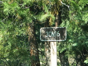
Tag Archives: trail

30N16 – Lassen NF

Nanny Creek Trail
Lassen Road 30N16

30N16 entrance

Lassen Back Roads
Lassen Rd #30N16 – Lassen National Forest
Nanny Creek / McGowan XC
E of Mineral, CA

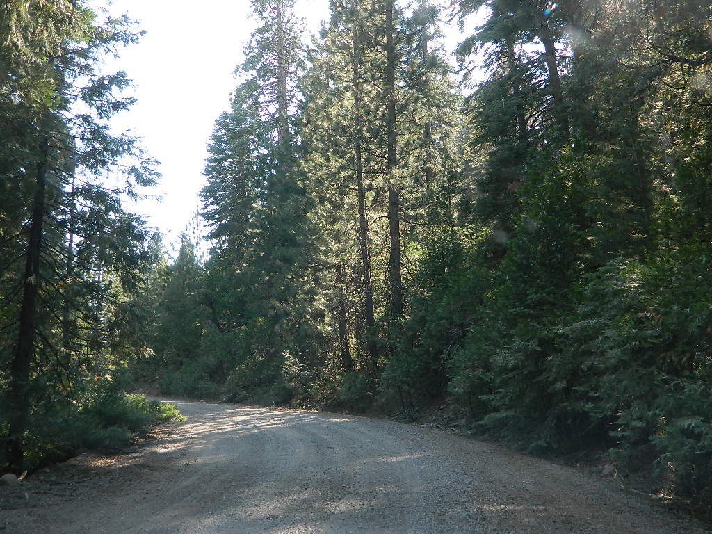
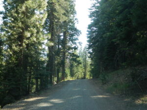
Narrow dirt road thru dense forest, connects Highway 36 to Lassen Route #29N22 (Dry Lake Trail) and then heads west to meet with Lassen Road 17 (aka #31N45)

McGowan at SR 36

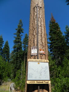
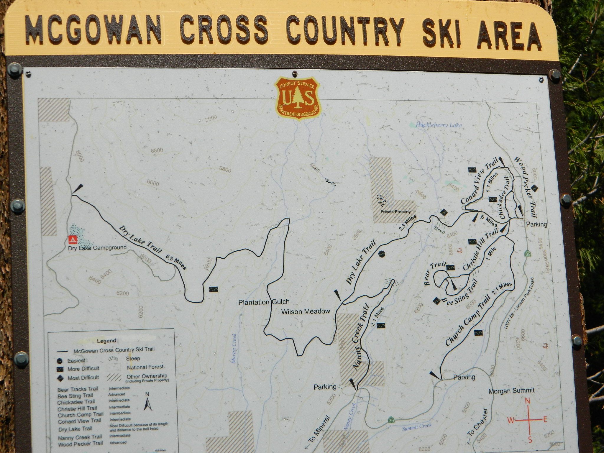
McGowan Cross Country Ski Area (USFS link)

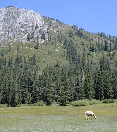
The McGowan Lake Cross-Country Ski Area has been in existence since 1982 and offers 10 miles of trails, 5 miles of which are periodically groomed.

Literally in the shadow of Lassen Peak, McGowan area trails wander through mixed conifer forest and are popular with beginning to advanced skiers. Elevations range from 5,020 to 6,200 feet. McGowan cross-country ski trails are closed to all motorized vehicles.

snow

XC Ski McGowan
click to enlarge map

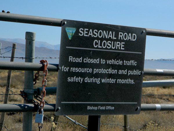
NOTE: No OHV riding, nor snowmobiling on this route!

WINTER – snow fall begins as early as November and lasts thru May. Road can be muddy in late spring.

SUMMER – this dirt road is accessible by automobiles during warmer months only and is not gated.

campfire

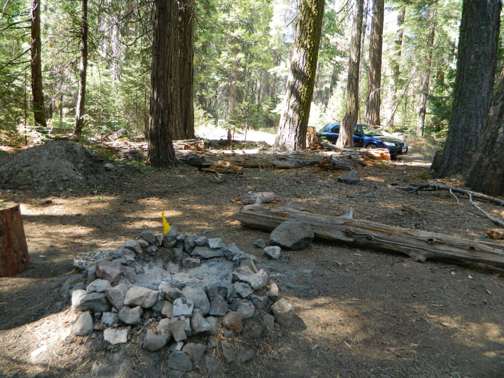
A few dispersed campsites along route 30N16, within the first mile from the pavement (Hwy 32). These precious few camps are usually in high demand during summer months! Head up hill a few more miles, deeper into the forest and find a real secluded site, dispersed style.  Campfire Permits are always required for back country fires; found at nearest ranger station USFS in Mineral, CA

camp

boondock lassen

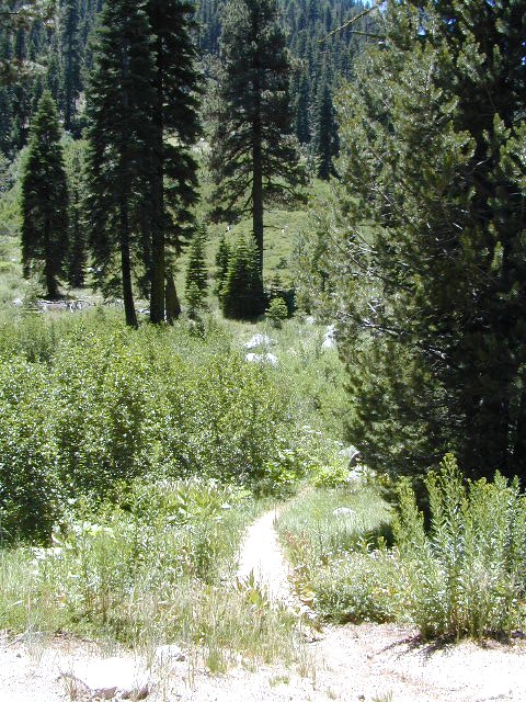
The first portion is a 2.1 mile long dirt road follows Nanny Creek about a mile, then it banks left, uphill to meet with 29N22. Sugar Pine Trailhead is located on this upper section of 30N16; a small wooden sign in a dense thicket can be seen on right side of road.

Sugar Pine Trail on GoogleMaps

gravel road summer

Junction with 29N22
#30N16 @ wide intersection w/ #29N22 – right turn for McGowan Lake, Christie Hill and the Volcanic National Park.

Road 30N16 continues westbound – Left turn for Heart Lake Trailhead, secluded boondock campsites and eventually, this dirt road ends @ Lassen Road 17 (#31N45) which is also a dirt road (and locally known as the Viola-Mineral Road), connecting Hwy 44 to Hwy 36.

DEEP SNOW can keep these dirt roads closed well into summer months, depending on the snow year. Keep this in mind when planning any early season recreation.

hiker

Broke Off Trail Lane intersects this 30N16 road right at the highway (36). It is the hard left that heads steeply up the rocky incline and skirts the highway headed west; Connects to the White Fir Lane road system above the small town of Mineral, CA.

30N16 sign

locations nearby:

Snow Mountain Wilderness

Snow Mtn Wilderness

Mendocino Forest, Lake Pillsbury

North of Wine Country, east of US Hwy 101

2018 (Mendo Complex Wildfire) Ranch Fire
burnt most of this area

Located in the coastal mountain range north of Clear Lake and west of Stonyford, California; in between I-5 and US 101
On the southern half of the Mendocino National Forest.

snow mountains

60,076 acres
East Snow Mountain Peak – 7056′ elevation
West Snow Mountain Peak – 7038′ elevation
Lake Pillsbury – 1818′ elevation
Mendocino National Forest
Eel River
Elk Creek
Cold Creek
Anderson Creek
Corbin Creek
Sheet Iron State Game Refuge

  • backpacking
  • camping
  • hang gliding
  • horseback trails
  • off roading
  • paragliding
  • snowboarding
  • snow shoeing

Snow Mountains MapWilderness permits and campfire permits are required. Check local rangers for up to date weather conditions, road closures, parking and trail conditions.

Dirt Roads M10 and M3 are the major routes around this mountain area. Route M10 is also known as 43A on some older maps. Several 4×4 trails skirt the wilderness boundary near the tallest peaks, so you may see some OHV use in this region when hiking.

ranger stations
NFS

EAST SIDE

National Forest Office
Grindstone Ranger District
Willows, CA
530-934-3316

Stonyford Work Center
530-963-3128

WEST SIDE

Upper Lake Ranger
707-275-2361

Covelo Ranger District
707-983-6118

NFS campgrounds nearby
camping

EAST SIDE

    • North Fork Campground (Road# 18N03)
    • South Fork Campground (Road M10)
    • Fouts Campground (M10)

4x4 trails

  • Grey Pine Campground (M10)
  • Mill Creek Campground (M10)
  • Dixie Glade Campground (M10)

WEST SIDE

  • Lower Nye Campground (Road M3)
  • West Crockett Campground (M3)
  • Upper Nye Camp (M3)
  • Windy Point Campground (M3)

hiking trailheads
hiking

  • Bloody Rock (Road M6)
  • Crooked Tree (Road M3)
  • North Ridge (M3)
  • Windy Point (M3)
  • Upper Nye (M3)
  • Bear Wallow (Road# 18N06)
  • Trout Creek (@ Fouts Springs)
  • Dixie Glade (Road M10)
  • Summit Spring (M10)

2017: a large landslide has closed the dirt road route in between Lake Pillsbury & Alder Springs, CA. Road M6 closed indefinitely.

off road routes nearby


View Larger Map

Hill Top Hot Springs

Hilltop Hot Springs

hill top hot springs

High Desert: Hill Top
primitive hot springs

May also be known as Pulky’s Pool in hot springs books.

Hilltop is a new found favorite and one of the more scenic spots for a soaking tub in this region. Sitting out in the middle of a clearing, surrounded by marsh lands, this remote hot springs is a hike-in destination. No paved road, nor paved trail. The mountain and sky views from this tub are splendid, and if you time it perfect, you may have the place to yourself.

open all year
elevation:
6,900′

Located in the Long Valley Caldera, this area is managed by Bureau of Land Management

North of Bishop, CA
South of Mammoth Lakes, CA

marsh walk

From US Highway 395 @  Benton Crossing Road – drive approximately 3 miles (passing dirt road Whitmore Tubs). Once you’ve crested a small hill, look for a gated dirt road on left, which leads a short ways, back through the sagebrush, to the parking area.

GPS coordinates: 37.6455, -118.8001 

The dirt parking lot is adequate enough to handle a dozen vehicles, and this place is so well known, that it gets a fair amount of traffic at any time of year.

Rumor has it that Hilltop is one of the most visited hot springs near Mammoth Mountain; probably due to the proximity to the paved road. Cars and trucks, camper vans and RVs will be coming and going at all hours of the day and night. So consider yourself warned!

high desert lot

Gate and fence separate the parking from the trail, which leads a quarter mile (often over wooden plank boards) through alkali fields – out to the cement tub.

Only one, small makeshift bench next to the pool – and no tables, no seating, no facilities; Bring tarps, towels, ice chest and camp chairs (if you plan to stay a while).

empty hot pool

Plastic PVC pipes and control valve adjust water flow and temperature. If the valve is left ON (wide open) overnight, the small tub will be too hot to soak in the following morning.

camp

Camping options are pretty limited here. A small clearing for a tent, next to the parking lot; and one decent parking spot, large and private enough to call a camp site (at the dead end, past the parking).

The Eastern Sierra corridor of US Hwy 395 is far enough away that it cannot be heard from this spot.

BLM gate at the paved road entrance reads: road is closed seasonally – assuming you can walk in during snowy winter months.

seasonal gate

Hilltop is one of several primitive hot springs in this immediate region. See Mammoth Hot Springs for more choices.

wildfire smoke 2020
Wildfire smoke in 2020 Creek Fire


Keyesville Classic Bike Race

Jerry in the RACE

Keyesville Classic Race

Mountain bike races are few & far in between, so Total Escape is here to promote them. This is one of the longest running races, near Lake Isabella, along the Kern River.

The All Mountain, Down country, Gravel, Vintage, XC, Downhill, Enduro Event or the year.

Up to 500+ bikes in competition w/ various classes. Downhill, cross country & short track. Presented by the Southern Sierra Fat Tire Association. 30+ years running, so we know it’s very popular. Annual event held in the Springtime.

Annual event; April

LAKE ISABELLA, CA

KERNVILLE CA

keyesvilleclassicmtb.com


CierraKeys1

JDKey1

Footed Rock

Footed Rock @ Bald Rock
Berry Creek, California

Before and After Photo

Wildfire: Bear Fire / North Complex 2020

The Skinny Lone Cedar hangs on with Footed Rock. Bushes on the right side, had the flames licking at this tiny tree.

Footed Swipe

Berry Creek, CAfooted rock 95916

Many thanks to whoever cut/broke the mistletoe off in recent years. I never seem to hike with my loppers.

Bald Rock California

Footed Rock is a part of the popular Bald Rock hike. summer 2021 CURRENTLY CLOSED hiking trail in Berry Creek, CA

Mushroom Rock
Mushroom Rock @ Bald Rock


Lumber for Market
Lumber for Market, just sitting on the side of the road.

Log Truck Drivers make over $100/hour – yet there is still a job shortage in 2021. Go figure!

mountains

see more swipe photos –

Trailhead CA

bike  mountain biking
hike  hiking trailhead
bkrd  4×4 trailheads
horse equestrian trails

Rock climbing, backpacking, fly fishing creeks, snowmobiling, you name it. No matter what kind of trail you seek in California, we have the maps to get you out there, this weekend. If you seek a week long adventure in the Sierra high country, or a weekend getaway destination you’ve never heard of, or a quick after work hike near your home town, we just might have it listed. And we probably have the waterproof, topographical map too.

tentcabinyosemite

DOGS & BIKES on TRAILS:

Dog friendly trails include almost anything within the CA National Forests. Remember that most National Parks & State Parks literally forbid dogs on hiking trails. Mountain bikes can access only certain trails in parks, but in the National Forests nearly every trail or dirt road is up for grabs.

OHV ROUTES:

snomoiMotorized vehicles, such as quads, ATVs, dirt bikes, Jeeps & 4x4s must stick to designated routes signed specifically for OHV (off highway vehicle) & you won’t be finding many of those inside National Parks & State Parks, so it’s best to look for BLM or NF lands. Many regular, forest, back roads close in winter due to heavy snow pack & thus become cross country ski, snowshoe or even snowmobiling trails. The best ones can be found in the Sierra Nevada mountains.

Explore a decent selection of random trail heads within Cali.

hiking in Forest

And if you ever get bored with “reading” text about trails, you can always search the visual database of amazing Cali scenery over at DanaMite’s flickr site

California Fire Road

Dome Trail 3

Dome Trail

Dome Trail Hike
near Bald Rock in Berry Creek

Plumas National Forest Trail #6E21
Access Road #21N51Y
Middle Fork – Feather River
Sierra Nevada mountains @ Berry Creek, CA

On paved Bald Rock Road a rusted metal sign reads “Dome Trail 3” which is where the fun begins, on the dirt.

3 mile drive to trailhead from pavement
4.6 miles RT hike
w/ a 2000 feet elevation drop to the river

Plumas Forest Rd #21N51Y is located in the forested community of Berry Creek – opposite from Upper Zink Road. Road 21N51Y becomes Bean Creek Rd #21N36: The forested route passes a few private properties and gates, the dirt road leads 3 miles down to an old wildfire (2008) burn area and eventually dead-ends at the Dome trailhead. The hiking trail descends down while overlooking the Bald Rock Canyon with the Middle Fork of the Feather River.

Rated as a moderately difficult hike: Steep hillsides, plenty switchbacks, downed trees across trail, boulder hopping, cliff edges, extreme heights and rock slides. Delighted by dozens of wildflowers, the old metal staircase still in use, steel pipe railings and the minimal fencing and of course, the big river deep inside an impressive rock canyon. Sierra Nevada spectacular!

Trailhead Parking

Indian Creek spills down into Curtain Falls up the canyon, sometimes within view. Secluded Milsap Bar Campground is also up the river from here. The stretch of the whitewater river is popular with rafters and kayaks. Rock climbers gravitate to the big walls above. Bring a picnic lunch and water filter for this amazing all day hike.

Granite Domes & Bald Rocks

P4080034.JPG

There are numerous granite domes and bald rocks within the Plumas National Forest, most located near the big river canyons. This particular granite dome is situated overlooking the Middle Fork of the Feather River, and it is called Bald Rock Dome w/ 3509′ elevation.

MIddleForkFeather

Not to be confused with another shorter hike nearby on Bald Rock Road at a well marked trailhead for Bald Rock, which over looks the forest and valley to the west side. The official peak is named “Big Bald Rock” as listed on most maps.


Rock Creek Campground

rockintable
Rock Creek Lake 9600′ elev, Eastern Sierra

Numerous places named Rock Creek exist inside California. This particular Rock Creek page is specific to Camping and Campgrounds!

This compilation of “Rock Creeks” is to help with the confusing lists of similarly named camps and locations (which are many, inside California).

Lakes, rivers, canyons, campgrounds, 4×4 routes and wilderness trailheads. 

Eastern Sierra Campgrounds

List begins with the most well known –

Rock Creek Lake @ Inyo National Forest

Autumn Rock Creek
Rock Creek is a top destination for Autumn Colors in OCTOBER

NFS Campgrounds on Rock Creek Road listed below:

NFSlogo
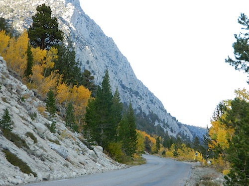
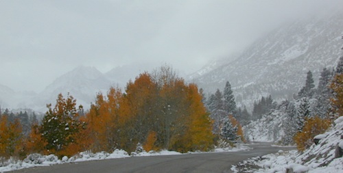
12 NFS Campgrounds are located around Eastern Sierra Rock Creek Canyon. Elevations range from 7000′ at the highway, to over 10,000′ at a trailhead parking lot at the road’s end. Most of these developed campgrounds listed are only open a few months outta the year, due to winter snow closures (NOV-APRIL). On occasion, snow can still be on the roads until MAY.

Tuff Campground ( @ frwy US 395)camp

French Campground (7500′ elev w/ 86 sites)
Holiday Campground (7500′ elev w/ 35 sites)

Aspen Group Campground (8100′ elev)

iris meadow
Iris Meadow Campground NFS

Iris Meadow Campground (8600′ elev w/ 14 sites) NFS
Big Meadow Campground (8600′ elev w/ 11 sites)
Palisade Group Campground (8600′ elev w/ 5 sites)
East Fork Campground (9000′ elev w/ 133 sites)
Pine Grove Campground (9300′ elev w/ 11 sites)

rockcreeklake

Rock Creek Lake Campground (9600′ elev w/ 66 sites) NFS

Rock Creek Lake Group Campground (by reservation) NFS

Mosquito Flat Walk-In Campground (trailhead camp) hikerSome maps may have this one listed as Little Lakes Campground, but that is just the official trailhead name.

Backpackers and horseback riders frequent this Eastern Sierra canyon a lot of the year. Many high country trails lead out to Sierra peaks, alpine lakes and sheer wilderness. Download PDF Map of this canyons hiking trails.

eastern sierra snowline
eastern sierra

More Rock Creek Camps

Rock Creek CampgroundMammoth Pool Reservoir, south of Yosemite National Park, behind Bass Lake, CA inside the Sierra National Forest (18 camp sites)

Rock Creek Campground – US Hwy 101 NorCal Redwood forests, north of Leggett, CA. Camp located on the Eel River, in the Standish Hickey State Recreation Area. (36 camp sites)

Rock Creek Loop Road – Dinkeycamptruck
Sierra Forest Road #9S09, off of paved Dinkey Creek Road. Excellent primitive camping along creek; 4×4 trailheads, as well as hiking & horseback trails. Small RVs okay. Dispersed camp sites, no facilities. Fire permits are required. Near Shaver Lake, CA inside the Sierra National Forest

Similarly named –

ROCK LAKE is located inside Lakes Basin Recreation Area, northern Gold Country @ Yuba River headwaters. Hike-in access only.4x4

And if you want some Central Coast wheelin – 4×4 camping and trails, see the ROCK FRONT RANCH on California Hwy 166, on the way to New Cuyama, CA

lower rock creek road
Lower Rock Creek Road, off US hwy 395

We will continue to add any more Rock Creeks to this page (as we find and photograph them). Stay tuned for more of the very best camping in California.


Marin Camping Point Reyes

Marin County Camping

Point Reyes Peninsula / Pt Reyes Campgrounds

Ocean View CampsitesOne of the most visited coastlines in the world, San Francisco – where 2 peninsulas almost meet – at the mouth of the “hidden bay”.

This is the Golden Gate to California and the Wild West.

So, you wanna escape the tourist masses… and camp out, overlooking an amazing place?

(put on your hiking boots)

lighthouse
Pt Reyes Lighthouse

Nope, the Lighthouse doesn’t have a campground! There are no camping facilities at Muir Woods National Monument, nor Muir Beach. No camping at Stinson Beach, nor Bolinas.

canoe
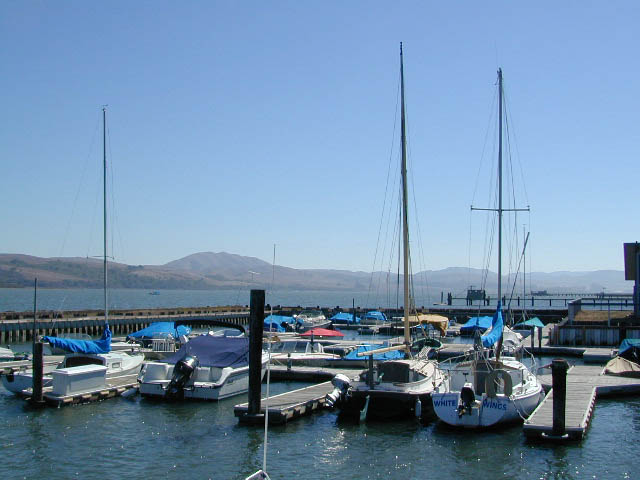
The Tule Elk Reserve has no camping at all. Tomales Bay State Park no longer has car camping or RV camping available; hike-in or boat-in
camping, maybe.

What is available for campground camping on “the Point” is listed below, with phone numbers and links for more info.

foggy seashore

POINT REYES, CALIFORNIA

Point Reyes National Seashore Campground
reservations required
hike-in, bike-in, and boat-in camp sites only
415-464-5100
415-464-5137

Mount Tamalpais State Park Campground State Parks
reservations required
415-388-2070camp

  • Alice Eastwood Campground
  • Frank Valley Campground
  • Horse Camp Campground
  • Pantoll Campground
  • Steep Ravine Campground
  • Steep Ravine Cabins

Marin Headlands Camping
reservations required; no pets & no RVshiker
415-331-1540

Samuel P. Taylor Redwood State Park State Parks
reservations recommended; open year round
415-488-9897

  • Devils Gulch Horse Camp
  • Historic Camp Taylor
  • Madrone Group Camp
  • Car Camping / Tent Camp
  • RV max 27′
  • Cabin Rentals @ SPT

DSCN4484

Cycling, hiking, backpacking, mountain biking, kayaking and boating are all popular outdoor recreation activities.

Small towns located on the Point Reyes peninsula do have a few private campgrounds, some of which can accommodate motorhomes. Follow towns links for those.

RV camping

There are no RV parks, camper trailers or motorhomes allowed in campgrounds on the steep coastal region of Point Reyes. Most of the narrow, winding roads are forbidden for motorhome travels. No shoulder, no guard rails, on many curvy roads. Great viewpoints are best when you STOP to look, off the roadway.

hike NPS

Golden Gate National Recreation Area NPS

Point Reyes National Seashore

Stinson Beach Park

Tomales Bay State Park State Park

Tule Elk Reserve

dockside

nearby towns – 


Gold Lake California

lilgoldlake
Hike-in only Gold Lake, Bucks Lake Wilderness.

California has more than one Gold Lake!

goldsign

Gold Lake, CA

(Sierra Co)
6409′ elev.

The biggest Gold Lake, California is the well-known one, along the Gold Lake Highway in the Lakes Basin Recreation Area. Plumas meets Tahoe National Forest. North of Gold Country Hwy 49, Downieville & the Yuba River. Right where the Sierra Nevada granite meets the volcanic lava rock of NorCal.

Packer Lake

Lakes Wilderness Map

Impressive jagged spires known as The Sierra Buttes (8591′) tower above the stunning lake scenery. This big Gold Lake is surrounded by a dozen smaller alpine lakes which make up the popular region called Lakes Basin. Easy access paved highway, which closes in winter for deep snow and winter recreation. The Gold Lake Highway is also referred to as Plumas County Road #S620

sierra buttes
the sierra buttes

Sardine Peak Fire Lookout lodgeranger rentals
NFS fire tower – no more overnight rentals!
overlooking the Sierra Buttes and the serene Lakes Basin, Yuba River, Northern Gold Country California

see CalPine Lookout near Sierraville, CA

driftwood

USFS

LAKES BASIN RECREATION AREA
Cabins, camping, lake fishing, backpacking, hiking, horseback riding, mountain biking, off-roading, snow-mobiling.

lakesbasinhikers

snowmo

California Lakes

mini gold lake

Mini Gold Lake

(Plumas Co)
6000′ elev.

Another smaller Gold Lake exist on the granite slopes in Bucks Lake Wilderness – E of Oroville & W of Quincy, CA.

gold lake trailhead
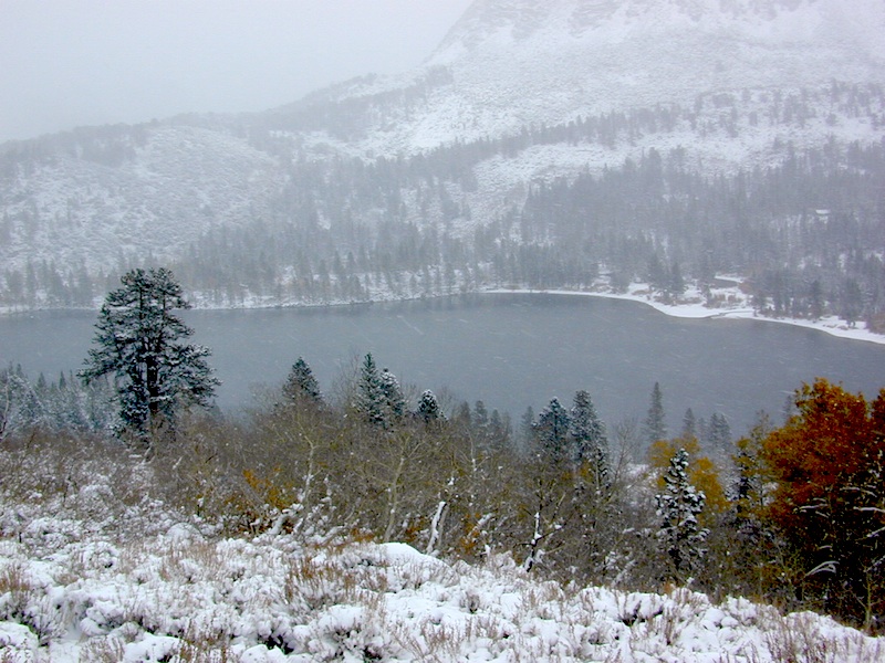
This hidden gem is a hike-in only lake – and well worth the effort. A somewhat short hike, great ridge line views to the east, although the last half mile of this route is a doozie (moderately strenuous).

The main trailhead departs from Silver Lake and climbs a ridge line that heads over to the PCT (Pacific Crest Trail). An off-shoot trail goes another mile to the miniature Gold Lake, a granite bowl of sheer beauty. A great day hike for those wishing to see the backcountry. Pack your picnic lunch, camera, and make a whole darn day of it!

Swimming & skinning dipping seem quite natural at this alpine lake, since it is a pretty remote location (without a lot of visitors) and there is absolutely no swimming allowed at neighboring Silver Lake.

bucks trailhead

The steep, overgrown, rocky shoreline leads one to bush whack through old trails, only to be met by a rock slide. Many dead ends and obstacles to climb around, or over. Some way… maybe, or maybe not!

Boulder and rock scrambling is the key phrase to remember, once you reach this lake. Knees may be sore from climbing, up and over the boulder ledge surrounding the lake bowl.

goldshore

Bucks Lake Wilderness Map

A few primitive camp sites are scattered about on the edge of the lake for those backpacking in, but be warned – they can be very difficult to reach. Much more suitable campsites can be found scattered throughout the area.

Warning: there are no flat, lush meadows to lounge in up at the lake, so pick yourself a side route (on the walk in) to find real seclusion and privacy.

view to Quincy

This mile-long-ridge hiking trail to mini Gold Lake has some amazing views down to the east side – Jacks Meadow right below; then Meadow Valley & Quincy off in the distant hills. RURAL CALIFORNIA – Plumas County from above.

jacks meadow
jacks meadow, way below

Sierra Nevada Lakes

High Sierra Gold Lakes in California

hike-in only lakes

hike

Golden Bear Lake
(Tulare Co)
12,000′ elev

High Sierra – Kings Canyon National Park
Center Basin / Center Peak 12,760′
PCT – Pacific Crest Trail
North of Mount Whitney
Eastern Sierra, Independence, CA

hike

Golden Trout Lake
(Inyo Co)
11,500′ elev

Trail #3306 from Onion Valley Campground
North of Mount Whitney
Eastern Sierra, Independence, CA

goldentroutlakecanyon
onion valley trail views
Eastern Sierra Lakes
Alpine Lake above Onion Valley, Eastern Sierra

Central Sierra Nevada Mountains

Small Camping Lake
Kirkwood Lake Campground

Central Sierra Nevada: Sequoia to Donner

Although Sequoia trees can be found in the southern Sierra, the National Park is located more in the mid-Sierra. From the Kern River to Kings River,  the southern stretch of Sierra Nevada is home to the southern most Sequoia groves, the longest river in California, and the granite dome wonderlands that overlook the Mojave Desert.

The Tehachapi range is on the tail end to the south w/ Hwy 58, while Kings Canyon Park borders more High Sierra Wilderness to the north end. If you are heading up from SoCal, this is the most accessible portion of the Sierra Nevada range.

While the Kern River Valley can get hot in the summer months, the rivers, streams & higher elevations surrounding it, make it a prime destination for folks seeking cooler mountain breezes, creeks and dark skies. Springtime is one of the best times of year to visit the Kern River. While summer is best for the high wilderness areas, since the snow usually doesn’t melt until May.

Mountain Home State Forest is a little known haven for campers & hikers seeking less-crowded Sequoia groves. With the Tule River, fishing ponds, waterfalls, swimming holes & meadows, this place provides a nice solitude to the busier parks to the north. Balch Park is a county park w/ large campground, that sits adjacent to Mountain Home Forest.

Both National Parks (Seqouia & Kings) are both busy in summer & tourists can be seen lining the main road, Highway 198. Crystal Cave & Boyden Cavern both offer daily tours during the warmer months. Sequoia National Park is open during winter months & is popular among winter sports enthusiasts. Kings Canyon National Park & Hwy 180 are also open during winter, with winter sports recreation.

Big Meadows Road (14S11) offers great camping options for those that wish to camp outside the National Park boundaries.

Sequoia groves

Sequoia forest & parks –

Sequoia National Forest
Mountain Home State Forest
Sequoia National Park
Kings Canyon National Park

Sequoia maps & trails –

Sequoia towns nearby –
Alta Sierra, Camp Nelson, Fairview, Kennedy Meadows, Kernville, Lake Isabella, Mineral King, Ponderosa, Springville, Three Rivers, Wofford Heights

Sierra Nevada

Central Sierra Nevada forest & parks –


Sierra National Forest

Yosemite National Park

Stanislaus National Forest

Eldorado National Forest

Tahoe National Forest

Sierra Nevada

Central Sierra Highways –

Central Sierra Nevada maps & trails –

Rancheria Falls
Rancheria Falls, Huntington Lake, CA

Central Sierra Nevada towns nearby –
Bass Lake, Fish Camp, Huntington Lake, Pine Flat Reservoir, Shaver Lake

stanislaus sonora pass

Gold Country California

is located in the western foothills of the Central Sierra Mountains

Historic Highway 49 is the Gold Country Hwy, which begins down near Yosemite and leads north, thru the foothills, up to Sierra Buttes & ends out near Loyalton, CAgold miner

28E201 – Inyo NF

trailsdown

Road #28E201 – Inyo National Forest
also known as Inyo Road #4S86

Laurel Lakes Road
Inyo National Forest
Eastern Sierra, California

Southeast of Mammoth Lakes, CA
West of Crowley Lake, CA

Steep, rocky, gravel road, way up above (and behind) Convict Lake. 4WD may be needed during wet or snowy weather. High clearance is always advised. Locked GATE at the bottom means the NFS rangers have closed the route (seasonally) for deep snow, rock slides, avalanches, or other erosion hazards.

Laurel Canyon, US Hwy 395
Laurel Creek
Laurel Lakes

amigoaspens
Laurel Lake Road, Eastern Sierra

Find more INYO BACK ROADS

  • backpacking
  • camping
  • fishing
  • hiking
  • horseback
  • lakes
  • mountaineering

GenevieveLake

Trailhead to Lake Genevieve (pictured above), hike lake loop, snowy peaks.
NOTE: No easy access to the PCT (Pacific Crest Trail)

Laurel Mountain (elev 11,818′)
Bloody Mtn. (12,544′)

oldestrocks

gnarlyrocks
CLICK TO ENLARGE

Geologic:

Oldest, exposed rock in the Sierra Nevada mountains range. Buckling granite w/ volcanic rocks. Evidence of glacial activity including, terminal, lateral, and recessional moraines, glacial striations and polish, erratic boulders, and of course the numerous lakes. see more

Volcanic Eastern Sierra
Volcanic hikes in the Eastern Sierra

4S12 – Inyo NF

rockcreekroad

Rock Creek Road

Rock Creek Lake, Eastern Sierra, California

Inyo Forest Road #4S12
also known as Inyo Road 12, and also Rock Creek Rd.

Majestic mountain scenery. Popular paved route that leads from US 395 up to Rock Creek Lake, on the edge of granite wild lands; lake is situated above 9000′ elevation and the hiker trailheads are further up, beyond the lake at over 10,000 feet. Steep canyon, large canyon, rocky granite canyon, high elevation.

Super scenic drive, but open less than half the year, due to deep snow. Eastern Sierra Nevada mountains. Inyo National Forest

North of Bishop, CA
South of Mammoth, CA
SW of US Highway 395

hikes horse camp bike

backpacking
camping
fishing
hiking
horseback
trailheads
wilderness

A popular and favorite place for summer camping, fishing and hiking. Backpacking, horse trails, high elevation lakes, mountain passes, peaks, wilderness areas. RV campgrounds, tent camping, car camping. Mountain biking in vast canyon, near campgrounds and creek. No bikes in the Wilderness (up and above Rock Creek)

Autumn colors, aspen groves usually best in early October. Snow closure in winter months (Nov-May).

snowyautumn

elevation 7072′ @ Tom’s Place, CA (US Hwy 395)
elevation 9682′ @ Rock Creek Lake
elevation 10,272′ @ Trailhead Parking (end of road)

UP, UP, HIGHER & AROUND LAKE
One lane, paved route gets narrow, but keeps on climbing. Road #6S05 continues up – past Rock Creek Lake and ends at hiking trailheads, paved parking lot and a few picnic spots.

iris meadow
Iris Meadow Campground NFS

12 NFS Campgrounds in this region, starting with one at the highway, several along the way and the campgrounds at Rock Creek Lake.

No campfires are allowed in this canyon – outside of a developed campground. Not much in the way of primitive car camping options either, except for strapping on a backpack and heading into high elevation wilderness.

rockcreeklake

Rock Creek Lake

Rock Creek Campgrounds

Inyo National Forest
John Muir Wilderness

Trailheads along Rock Creek Road #4S12

  • Upper Hilton Lakes
  • Tamarack
  • Lakes Valley (Little Lakes)
  • JMT – John Muir Trail

Rock Creek NFS Hiking Trailheads (download PDF)

Eastern Sierra Maps:
Inyo National Forest Map USDA
John Muir Wilderness Maps
Mammoth Lakes Map by NatGeo
Mono Divide High Country Map


rock creek lake
Rock Creek Lake, first snowfall (Autumn)


looking for another place called ROCK CREEK in California? (we are working on that)

7N83 – Stanislaus NF

whitehorse

Forest Road #7N83 – Clark Fork Rd
Paved spur road, off Highway 108, Sonora Pass

Stanislaus National Forest
Clark Creek, flows west to Middle Fork Stanislaus River
Horse camping, Campground Camping, close to trailheads

NFS Campgrounds on this road:
NFS

Clark Fork Campground
Clark Horse Campground
Sand Flat Campground

Clark Canyon is a popular horse camping area in Stanislaus, located in between 9000′ – 10,000′ elevation peaks. This Sierra Nevada area is known for volcanic features and nice meadows. A small set of (hidden) cabins and pay phone along highway will be the best landmark for identifying the Clark turn off.

Hiking trailheads on this road:

Iceberg Meadow Trailhead
Carson Iceberg Wilderness Area

Forest Road #6N06, a dirt road to higher elevations and primitive camps, is also close by. Traversing up above the Fence Creek Campground (NFS).

Topo Maps of this Region:

Stanislaus National Forest Map USDA
Carson Iceberg Wilderness Map USDA
Carson, Emigrant, Mokelumne Map NatGeo
Sierra Nevada Topo Map

clarkstrails

Closest towns:

Dardanelle, CA
Pinecrest Lake, CA
Twain Harte, CA

Dirt Street

7S02 up hill

An avenue made of dirt, earthen highways, dirt trails, forest roads, fire roads, jeep road, graded roads. Dirt driving trails that lead into the middle of nowhere. No stop signs, no billboards, no stores, no one else around… for miles. Enjoy less crowds and more open space.

dirt streets
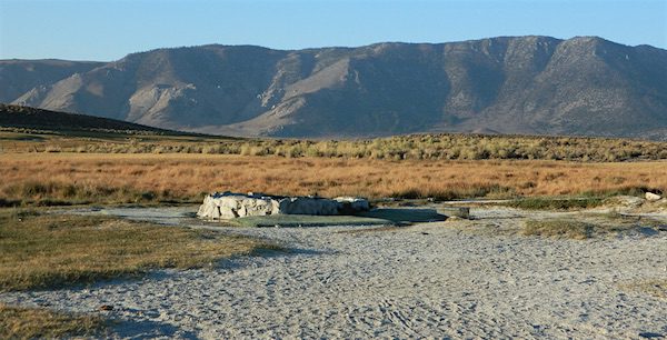
If you are fed up with city life, sitting in traffic & need to vacate your mind among the barren hills of California (if only for a weekend), then Total Escape is your place. You seek solitude, peace, maybe a mini tailgate party & BBQ on a dry lake bed, with the heavenly stars above. Imagine the warm camp fire light reflecting off the high canyon walls, your music echoing, moonlight hikes for a few miles.

California has some awesome spots to drive on dirt, get way back in nature. Right up to the edge of the Wilderness boundary. That’s what this one silly “dirt street” page is all about… helping you get out there, the easiest & best way possible. We even got you the right maps!

Back Roads in California

The End of Dirt Roads

California OHV Maps

Most of this is just dirt road driving, graded, some hills, easy stuff. But on occasion you might come across a 4×4 required sign – or perhaps a triple black diamond trail. Having several good maps on hand will help you enjoy these roads, instead of stressing & wondering if there is a lock gate at the other end – 18 miles in.

Some dirt streets lead to campgrounds, some to waterfalls, some to viewpoints, some have loop options & others are just dead end; sometimes at old mines. Get ready to explore with your truck or SUV. 2WD or low clearance vehicles (such as passenger cars) should be ready to turn back if the road get too nasty. Any decent precipitation can make any unpaved road much worse & may require 4 wheel drive, so have a plan B mud terrainor C as a backup idea.

Best off road areas & parks in California:

Death Valley Roads

Tooling around Goler Wash & Barker Ranch on the very edge of Death Valley

Eastern Sierra Hiking

Eastern Sierra Hiking Trails – Mammoth Hikes

Autumn Bliss Hike

Desert ghost towns to Sierra meadows & waterfalls, Inyo National Forest offers plenty of diversity for scenery. To list all the hikes in the Eastern Sierra would be obsurd, cuz there are so many trails. This side of the Sierra Nevada is all about hiking, fishing & camping.Inyo forest map

No matter where you hike you will probably get a great view over the Owens Valley, Long Valley Caldera or Mono Lake. So that means most of those trails are hiking up a canyon, or a ridge line. Thousands of trails over this region require a good map to make the best decision for your hiking interest.

US HWY 395: The Eastern Sierra is one of the premier hiking destinations of California. Featuring the granite crags of the HIgh Sierra peaks. Mount Whitney, the tallest peak is closest to Lone Pine. Southern Californians love Eastern Sierra destinations, cuz they can avoid Los Angeles Basin and stay outta traffic.

Lone Pine Lake – Whitney Portal is a great, but crowded place for hiking. DO NOT ATTEMPT to hike to Mount Whitney in one day! Leave it to the seasoned pros. The first good stop up the Whitney Trail is gorgeous Lone Pine Lake, a great moderate day hike from there.

Alabama Hills – just below Mt. Whitney and has a totally different landscape than the backdrop granite Sierras behind. Try some boulder hopping & explore the dirt roads. Bring your mountain bike too.

Cottonwood Lakes (Pacific Crest Trail) – day hikes to alpine lakes. US 395 @ Lone Pine, W on Whitney Portal Rd. Left on Horseshoe Meadow Rd & continue up 19 mi. to the Horseshoe Meadow campground. Mostly a trail head camp, way, way up there. Open May – November

Kearsarge Pass – from 9000′ Onion Valley you can access the incredible High Sierra & numerous alpine lakes. The elevation gain makes this a full days hike; rated strenuous. Or continue on w/ backpack into Kings Canyon National Park.

Devils Postpile – back behind Mammoth Mountain, creeks, forest & cool geology awaits. Plenty hiking trails.

FALL COLORS: Autumn is the best time to enjoy the gorgeous aspen groves, as they change colors w/ the onset of winter.

Eastern Sierra Peaks

Topo maps, wilderness hiking maps
Equestrian trails, OHV maps –


Sierra High Country Hikes
Originally uploaded by danamight

Trailhead @ Onion Valley leads up to impressive alpine lakes, Kearsarge Pass & Kings Canyon High Country.

Eastern Sierra communities include:

Alabama Hills
Alabama Hills @ Lone Pine, CA

Tahoe Lake Map

Tahoe Maps: trail maps

lake camp, hike, mountain bike, off-road, ski, snowmobile

Tahoe Trail Maps / Tahoe National Forest

tahoe hiking maps

Numerous State Parks dot the shoreline at Tahoe, while the National Forest lands and Wilderness Areas span most of the peaks above. Camping, backpacking, boating, kayaking, fishing, climbing, mountaineering, mountain biking, snow skiing, snowmobiling are all popular recreation in this Sierra region. US Highway 50 and Interstate 80 are the main western access routes to Lake Tahoe. US Hwy 395 leads to Tahoe, up from the Eastern Sierra and Southern California.

Wanna find every waterfall or every creek to fish? This is the place that will help you find them. Easily, with good old fashion printed maps. Hard copies, some waterproof & tear resistant, most with topographical data and all roads, trails, campgrounds and parks. Whether or not you water ski or cross country ski, these maps will save your ass – when you are way back there in the boonies.

Tahoe’s Rubicon Trail connects the historic Gold Country to the alpine lake via granite wilderness sky ways above 7000′ elevation, but a real 4×4 and overnights are required. The back roads and trails are endless in these parts of the Central Sierra Nevada mountains.tahoe maps

keep tahoe blue

Nearby attractions surrounding Lake Tahoe –

Tahoe National Forest
Tahoe Rim Trail
Rubicon 4×4 Trail
Lakes Basin Recreation Area
Sierra Buttes
Desolation Wilderness
Grover Hot Springs
Blue Lakes
Hope Valley

cabin rentals

Map California Baja

Secret Beaches
Secret Beaches of Baja

2003 Baja Map

Baja Topo Map

Topographic Maps of California Baja
Baja California Almanac

BAJA MEXICO MAP

The mysterious topographic map maker, Landon Crumpton, is gone. Although his Baja Almanac book of the Mexican peninsula is still as popular as ever.

bajaalmaac

The Total Escape crew has been using this amazing topo map for Baja Mexico since our the very first excursions in 1990. Click below to read more about the famous, hard-to-find Baja Almanac publication.

  • Baja California Almanac
  • Topographic Map Book of Baja California

  • National Geographic Baja Maps
  • NatGeo Baja California Mexico Maps

    Baja California Maps

  • Find more Baja Maps
  • Obscure Books & Maps, AAA Maps of Baja

    Baja Snack

    Maxson Trailhead

    If you are a backpacker wanting to easily access the John Muir Wilderness, the paved parking area of Maxson is the trail head for you. The Courtright Reservoir is located at over 8000′ elevation, w/ granite domes & alpine scenery all around. This place is way back behind Dinkey Creek, past the McKinley Sequoia Grove inside a deep granite gorge. The Sierra National Forest is the region, which is south of Yosemite National Park. The paved route is a long one from Shaver Lake, via Dinkey Creek Road, but the rewards are great. An all day adventure and a side trip not to be rushed.

    Warning: You could spend a whole day just driving & sightseeing in this area! Meadows, wildflowers, dirt roads, trails, Big Creek, McKinley Grove of Sequoias, Wishon Reservoir, the list goes on. All the way out to the Wilderness boundary, Courtright Lake is not a quick or easy drive.

    The hikers trailhead is located at the end of Courtright Rd. Cross over the big dam to the right & drive approx one mile; look for signs on the right side of the road. There are minimal areas to set camp at this granite , windswept face. Good luck getting a tent stake in the ground. Rock rules here. There are a few developed Campgrounds on the opposite side of the lake which may be a better choice for car camping. This Maxson parking lot is primarily for backpackers.john muir maps

    nearby locales –

    maps of this Sierra region –


    View Larger Map

    Dusy Ershim 4×4 route start right here too – on the opposite side of the road. It’s second only to the Rubicon Trail, as far as High Sierra rocks & terrain.

    Rock Climbers also love this spot for the granite domes & walls. Hiking all the way around this lake is a full day trip, with lunch and sightseeing stops. A pleasure not to be rushed.

    dusy ershim

    Turtle Mountain Road

    Turtle Mountain Rd

    Turtle Mountain Road
    BLM Road # NS477

    off U.S. Highway 95
    in between Needles & Blythe, California

    BLM: Bureau of Land Management – Desert Camping

    Several miles south of the town of Needles numerous desert washes cross the highway with dirt roads leading off into both directions. Turtle Mountain is just one dirt road to explore in this region, but there are many more unmarked, secluded roads. This region is perfect for “campers in-route” traveling who need a quick overnight camp spot (off the freeway).

    Turtle Mountain Road is a one lane dirt road that runs next to a wash, in between Turtle Mountain Wilderness and Stepladder Mountain Wilderness. Leading approx 12 miles from US Highway 95 to the northern edge of the desert wilderness. The Turtle Mountain route continues westward to meet Water Road with Old Woman Mountain Wilderness nearby. Sunflower Springs Road continues north to Essex @ Interstate 40

    BLM signage along US Hwy 95 is minimal. Look for vertical brown markers w/ reflectors, numbers or names. Driving slower than typical traffic, coast at 50 mph and keep your eyes peeled to the west side. Turtle Mountain Rd is marked at the pavement, but the marker is very small.

    Eastern California Desert Wildflowers

    Exploring the eastern side of Southern California, one can find the Colorado River and Arizona border region an excellent destination for winter camping. Springtime offers wildflower blooms, open camping and decent weather with sunny 70 degree days. Wildflowers and BLM beauty awaits those who venture off the paved routes.

    Pink Cactus Bloom

    Palo Verde trees line the washes and much vegetation can be seen throughout this remote region. Cacti include the cholla, ocotillo, barrel, beavertail, just to name a few. Wildflower blooms here are just as good as Anza Borrego Desert SP.

    MARCH & APRIL are both prime months for the desert bloom

    BLM Desert Camping

    Drive more than a mile from the highway if you plan to camp in peace and quiet, as the overnight truck traffic goes all hours.

    RV accessible camp spots are few and far in between. They can be found in large, level pullouts close to the main road, but you will be hearing traffic zoom by. Some dirt roads are in better shape than others; Seasonal storms in the low desert can wash out even paved roads. 4×4 may be needed in some areas.

    Open camping in this desert is free and there is plenty of room to spread out. Imagine not seeing anyone pass by your camp or drive down your road for days. Camping in a sandy wash may seem appealing, but you best know the weather forecast and if rain is at all predicted nearby, be prepared to break camp (in the middle of the night) before a flash flood hits.

    The Needles BLM Rangers Office is located on US Hwy 95, on the south edge of town and they can provide maps and more information. BLM California Deserts

    Needles BLM Office
    1303 S. US Hwy 95
    Needles, CA 92363
    760-326-7000

    Lake Havasu BLM Office
    2610 Sweetwater Avenue
    Lake Havasu City, AZ 86406
    928-505-1200