Tag Archives: traveling

Go Solo

Traveling Alone
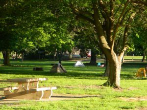
Camping Solo
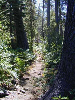
Sierra Hiking Path

it’s the way to go… slow & solo

enjoying quality time alone is not weird, wrong, or unnatural, no matter how many strange looks you get from friends & envious co-workers

Solo Outdoor Trips

Stop waiting for someone to do things with. Quit thinking that your best friend or partner will one day magically suggest an outdoorsy road trip, or day hike, or mountain bike ride. YOU are the one who craves the wildness of the earth, the unexplored, the secluded. The time is now for you to start living the life you want, outdoors, in California – today!

maybe it’s time to leave the city, for good

If you’ve just about had it with the pressures of everyday stresses, the wifi city life and the busy pace of civilized society is starting to get to you. Get a clue fast – before you loose your marbles. It’s time for much needed rest and relaxation. Nature is the best place to relax and reconnect with yourself and mother nature.

Looking to relocate to a more RURAL CALIFORNIA?

hiker

A change in scenery. A fresh perspective. A real break from the norm. No shopping, no errands, no phones, no television, no computers, nobody around. No one, except you.

and they might call you anti-social…
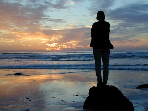
Travel Solo

alone, by yourself

away, distant, solely, detached, free, independent, unique, individually


The Call of the Wild

Unplug yourself from the hectic rat race and go exploring. Give yourself time to fully unwind: time to think, time to enjoy the outdoors and really find that special place of peace that comes only from earth. Yes, all by yourself.

VISION QUEST

Call it an annual primal ritual, or a first time experiment, traveling solo can be a blessing in disguise. Learning to be alone outdoors, become more aware of the physical world and enjoying yourself is an important key to a balanced life. Whether you seek a quick refresher course for the weekend or a full blown month long road trip, seeking a new comfortable destination and the art of basic relaxing is the main focus for this trip.

Camping Alone

slow going

When you travel alone, it’s easy to take your own sweet time. Going slow is something we don’t usually do in our busy city lives. Time is so precious, so you may as well stretch that vacation out as long as possible. Savor the moments.

Take as long as you like for – photography, picnicking, hiking, stretching, yoga, cooking and stargazing. Firewood collection becomes the biggest chore of the day, and it could take hours. Walking from camp, every direction will lead to a new adventure. Driving back roads at 20 mph is luxurious. No one to be your back seat driver. Sleep in every day if you want. No pressures, no schedules, no big worries. Sunlight, food, heat, weather, cooking and cleaning. Sit back and learn to really relax. Enjoy a secluded camp site for a full week, and get to know the wildlife on a first name basis.
Boy Camping

Follow the back roads to seclusion, or reserve several days at a unique campground. Imagine night after night of peaceful rest, with the sounds of nature surrounding you & the stars of the heavens dancing across the darkest skies.

Explore new terrain every day & move to a new camp every night. Or make it a “stay put” week-long meditation, in one spot. Whatever fits your needs. Either way, you’ll enjoy the solitude & the healing powers of nature. Answering to no one but yourself, you may feel guilty or kinda selfish the first few days, but this will fade as you learn to embrace the solo journey.

And it doesn’t hafta be all about roughin it either. While backpacking into the almighty wilds of the true wilderness has its good points – along with life threatening dangers possible every day, a simple quick weekend trip to a nearby small inn, fishing lodge,  or a bed & breakfast could work for the pampered types. Choose something different and unique, yet know your own limitations (on comfort & on a physical level). Make sure your destination choice is surrounded by some nature and preferably wilderness.

You won’t miss the television one bit!


Spend One Full Day a Week Outside in Nature

Good California Maps are a must have! Don’t rely on digital cell service or count on online maps being readily available. The hard-copy versions are always the best back up plan. Old paper maps are the very best, cuz they can often show more hidden waterfalls, trails and old mines than the newer maps.

National Forest maps are best for getting and staying away from the tourist crowds. Visit Destinations to decide what kinda place you wanna explore this season.

AtoZsmalltowns

California has it all – A to Z

which is why the golden state population always seems to be increasing, right? Helping you get away from your normal routine and the masses is what we do best here at Total Escape. Discover thousands of pages, photos and links on this site to create your very own unique retreat.

The mountains, deserts, coastal, rolling oak countryside & even urban escape inside city villages, are perfect starting points for planning your little escape. Desert Retreats California

Desert camping in autumn, winter and springtime months is perfect timing for any kinda soul searching, catching up on a good book, or just gazing out at the vast vistas. Meteor showers fall within the latter part of the year, so stargazing and camping is excellent with the new moon. Temps start to drop come September, so be warned. Mountain cabins drop to their off season rates after summer, but be prepared for chilly temps and get proper outdoor gear.
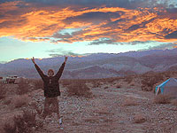
camping destinations
lakes in calif
California State Parks
hiking trails
BLM camping
back roads
usda nfs
mountains of California
California National Parks
stargazer
desert in cali

Desert Sunsets in Winter

SAFETY TIPS: Give your schedule to someone. Any bit of info is helpful. A map or written itinerary given to a neighbor or close friend will help ensure your safety and timely return. Bring your cell phone, plenty maps, bear mace, a firearm and emergency supplies for additional security.

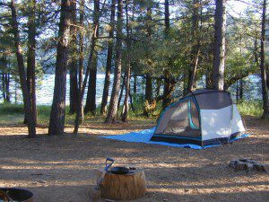
Sacramento River Camping

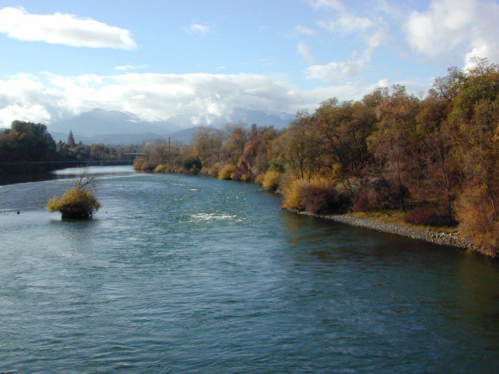
The Sacramento River of Northern California

The main artery from the North; the Big River of California

Sac River California

Mighty Mount Shasta snowmelt flows south, bound to meet the giant Lake Shasta, which merges with the Pit River and numerous other major waterways, becoming the big Sacramento River. Running right down the center of the North Sacramento Valley to merge into the California Delta. Shipping channel links the State Capital city of Sacramento with the San Francisco Bay and the Pacific Ocean. Agriculture and wildlife depend on this river heavily.

tent camping camp sites, campground camping, RV camps, dump stations, marinas, bait, gasoline, public boat ramps, boating, fishing, kayak rentals

Redding Winters

CAMPGROUND PARKS below listed from NORTH to SOUTH

JGW RV Park
Riverland Drive
South Redding, CA

Sacramento River RV Park
Riverland Drive
South Redding, CA

Wildlife Refuge
Sacramento River National Wildlife Refuge
Willows, CA
~ Camping is not permitted on the Sacramento NWR. Along the Sacramento River, camping is permitted on GRAVEL BARS for up to 7 days during a 30 day period. For waterfowl hunting, overnight stay is permitted in a vehicle or RV in designated areas. Tents are prohibited. No person may build or maintain fires except in portable gas stoves.

Orchards

Chico Area

Lake Red Bluff Recreation Area
Red Bluff, CA

Driftwood RV & Fishing Resort
@ Mill Creek Park
Los Molinos, CA

Hidden Harbor Marina & RV Park
Los Molinos, CA

River’s Rest Resort
Los Molinos, CA

Woodson Bridge RV Park
Corning, CA

State Parks
Woodson Bridge State Recreation Area
Historic State Park w/ Campground
South Avenue (A9)
Corning, CA

Bidwell-Sacramento River State Park
Chico, CA

Colusa Landing & RV
Butte Slough Road
Colusa, CA

State Parks
Colusa-Sacramento River State Recreation Area
Colusa SRA Camping

Camping Colusa
Tent Camping Colusa SRA

California Delta Region

State Parks
Brannan Island State Park
Rio Vista, CA

Sandy Beach Solano County Park
2333 Beach Drive
Rio Vista, CA

Vieira’s Resort
California Delta
Isleton, CA

State Parks
Old Sacramento State Historic Park
Downtown
Sacramento, CA

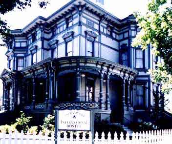
Sacramento Hostel, see more budget lodging

San Diego Beach Camping

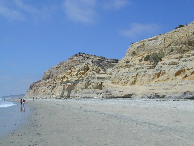
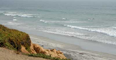
Coastal Cliffs San Diego

San Diego Coastal Campgrounds
Mission Bay & North County
SD Beach RV Parks & Camping

RV camps camp

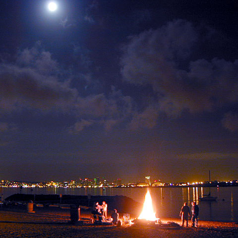
San Diego’s mild climate means camping is available all year round. Winter storms can get windy and rainy, but most campgrounds are still open. From north county where the coastal cliffs overlook the ocean, to downtown bay side marinas w/ RV camping, to camping right on the sand w/ ocean crashing just feet away. Bike paths are common around downtown San Diego, so you can bring your bike or skates.

San Diego has 2 BAYS, both located along Interstate 5: The main bay downtown is called San Diego Bay (one of the deepest on the west coast) and the other a few miles north, is named Mission Bay (a man-made coastal waterway w/ green parks and paved bike trails).

Reservations are required at almost ALL coastal campgrounds, especially around holidays, any 3 day weekends, and all summer long. Tons of tourists flock to Southern California and this is a very popular coastline – with busy little cities and crowded beach towns. Beware: if you are seeking secluded camping – this would not be the place.

Best Beaches

listed from south to north

Carlsbad Cliffs

There are numerous private RV resorts, some quite large, like KOA and GoodSam parks located in and around San Diego county. Most are metro-close and not located on the beach. This list is primarily coastal camping options for the San Diego region.

camping SoCal

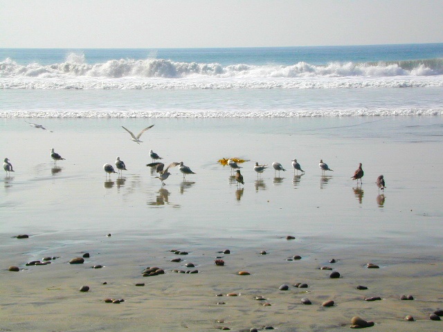
Seagulls at Cardiff

see also
San Diego Campground Camping

see a list of all
San Diego cities & towns

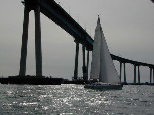
baybridge

San Diego Camping

19S01 – Inyo NF

south sierra ridges

Walker Creek Road #19S01
– Inyo National Forest

Southern Slopes, Eastern Sierra Nevada

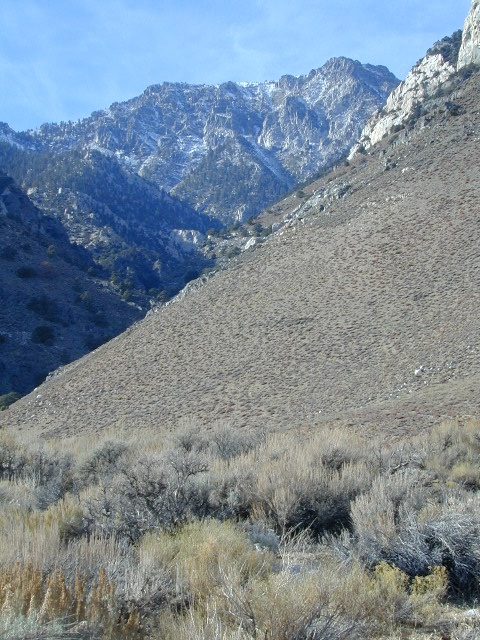
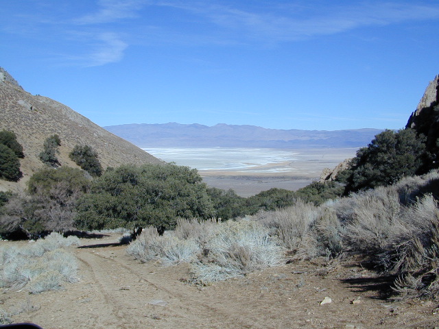
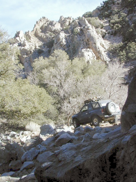
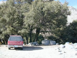
Just south of Olancha, off US Hwy 395 is a dirt road that takes you 5 miles up to an oak canyon lined with rocks. There are several primitive camp sites along the Walker Creek. A high clearance vehicle may be needed in some sections, but 4×4 is not required. Small RVs might attempt this, but if the first mile frightens you, turn around while you’re ahead.

Dirt Road near 395

This private, shaded, creek area is perfect for those traveling Highway 395, looking for a quick and free camp spot near Olancha, CA

nice shady spots
Shady picnic or camp spots above 4000′ elevation.

some granite
Hiking trails at the end of the road lead deep into the mountains. One on the right takes you to waterfalls. The trail on the left will take you to meet up with the Sage Flat Trail, which leads up to Olancha Pass, Summit Meadows & a small lake, in the South Sierra Wilderness. The Pacific Crest Trail runs the ridges here, just west of Monache Meadows, which is at 8000′ elevation, way above here – up on top. 

First Camp

US 395 highway – the dirt road turn off is very close to a gas station, and it maybe be signed, or not. The gas stop may be in business, or perhaps not. This is rural California, wide open desert and things come and go quickly.

On a good topo map, located Olancha Creek and Summit Creek to the south. Walker Creek is the canyon in between those two, just so know where you are going and can visualize. This one is an easy-to-miss dirt road turn off – especially if you are going over 50 mph.

Sierra Road Conditions

Sierra Nevada Road Conditions – Highway California

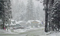
Snowy RoadsWinter Snow/ Winter Roads Sierra Nevada:

On rare occasions the Golden State freeway – Interstate 5 can be closed due to snow; N of Valencia on the Grapevine (near Lebec) or more likely up in NorCal (near Shasta).

Interstate 80 (aka Donner Pass) is often closed during big storms. Luckily there are hotels in Auburn or Truckee.

Highway conditions on mountain passes higher than 4000′ elevation can be unpredictable in winter months (Oct-May). It may be fine & just sprinkling @ 2000′, but a few miles up can be a white out. Ask anyone who’s ever driven the infamous Donner Pass in winter time. (more on Donner Party)

Annual Sierra Highway Closures

Ski mountains

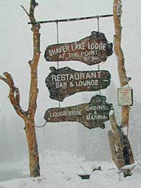
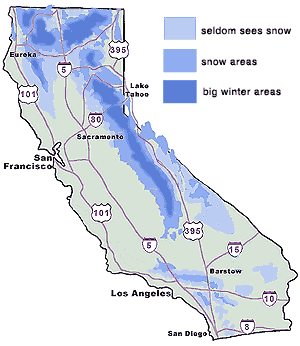
shaver lakeWhere does it Snow in California ?
Okay, okay ….so it’s nothing like those dreaded East Coast winters, but hey, some parts of California do get some serious snow. (see elevations) And the newbies who don’t prepare for it will be sorry. On the winter vacation travels, be prepared for almost anything, especially in the Sierra’s & Northern California.
Snowy towns in California

See California Weather & Road Conditions

California Winter: When does winter actually ‘set in’ for California?

Eastern Sierra CA: OCT- MAY
Western Sierra CA: NOV- APR
High Sierra CA: SEPT- MAY
North Coast CA: OCT- MAY
Northeast CA: OCT- APR

The following mountain roads are partially closed or totally closed during winter months. Please check road conditions before you leave for your trip. Chains may be required in most mountain areas of California.

CALTRANS web site

Highway CA County Region Connecting Towns
Hwy 155 Kern Southern Sierra Alta SierraWofford Heights
Hwy 190 Tulare Western Divide Hwy Camp NelsonPonderosa CA
M 375 Tulare Sequoia NP Hammond – Mineral King
Hwy 180 Tulare Kings Canyon NP Hume Lake – Cedar Grove
Whitney Portal Rd Inyo Eastern Sierra Lone Pine – Mount Whitney
Onion Valley Road Inyo Eastern Sierra Independence – Onion Valley
Glacier Lodge Rd Inyo Eastern Sierra Big Pine – Glacier Lodge
Lake Rd Hwy 168 Inyo Bishop Area Hwy 168 – South Lake
Hwy 120 Mariposa Yosemite NP Yosemite Lee Vining CA
Hwy 120 Mono Mono Lake Lee ViningBenton Hot Springs
Hwy 108 Mono Eastern Sierra DardenelleSonora Jct. Hwy.395
Hwy 89 Alpine Eastern Sierra MarkleevilleLake Topaz
Hwy 4 Alpine South Lake Tahoe Lake Alpine – Hwy 89
Hwy 44 Shasta Lassen Volcanic NP Manzanita Lake – Mineral CA