Tag Archives: USFS

Inyo Forest Roads

Baker Creek
Baker Creek, Inyo NF

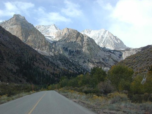
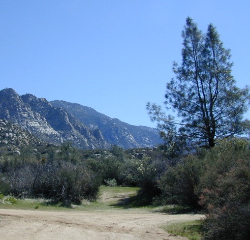
Eastern Sierra Nevada – Inyo Mountains
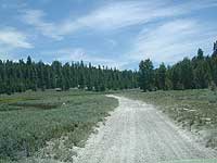
Inyo Forest Back Roads – Mammoth Off Road

Off Road near US Highway 395. Yep, Olancha has some OHV (off-road) areas near the dunes, but this web site is dedicated to the real deal, the scenery, the trail heads, the hot springs, great secluded camping & of course, back road exploring.

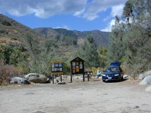
You will need a Inyo National Forest map to discover these back roads. These are minimally traveled routes, un-maintained, sometimes washed out, eroded & maybe even creek crossings (without a bridge). Some gravel two-lane routes, some one lane roads leading deep into dead end canyons.

A few popular routes are paved, but most of these listed are indeed dirt roads. Some may require high clearance vehicle, or even 4×4. Know your vehicles limitations & be prepared to turn back when the road worsens. Cuz more often than not, it’s a sign of what more difficult terrain is to come.

coyote creek route

Watch out for live stock – they are dumber than they look.

Owenyo Rd – Wanna parallel the highway (395) on dirt; Sure, it’s a long bumpy route – from Hwy 136 @ Dolomite to Bend City @ Mazourka Cyn.

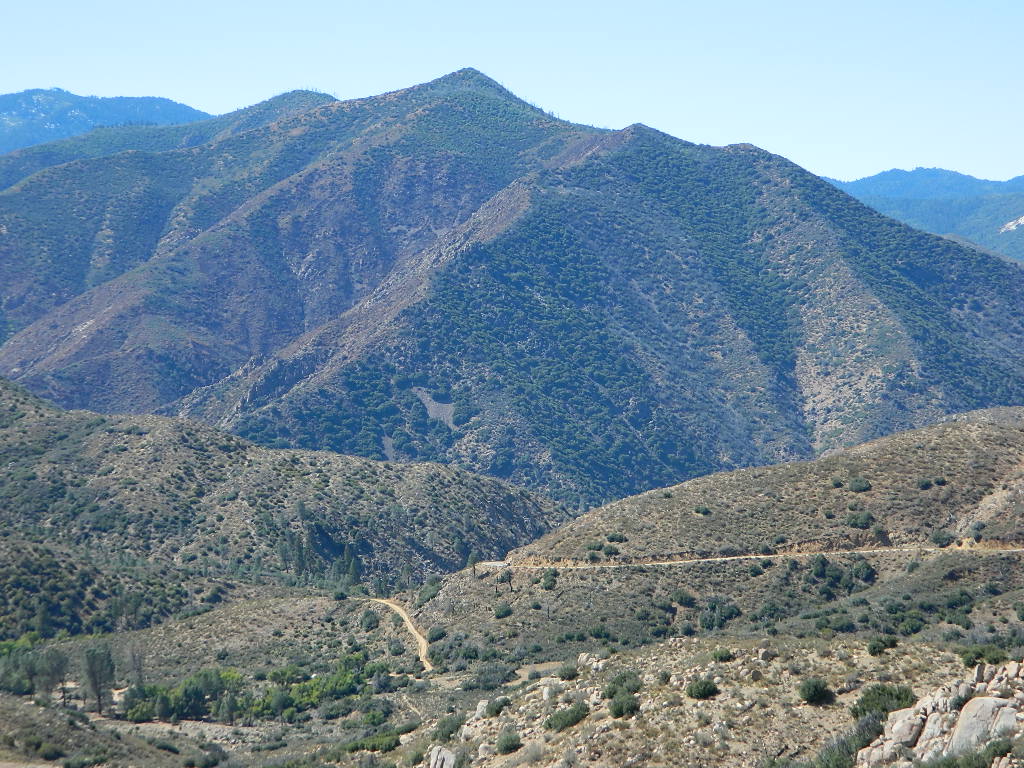
Road# 13S05 – Mazourka Canyon Rd – leads up to some old mining camps & way behind Mazourka Peak (9410′) deep into the Inyo mountains. It’s all desert on this side, but these canyons have pinyons & more vegetation than you would imagine. Road# 9S15 & 9S14 circle Andrews Mountain (9460′) then join back up w/ Death Valley Rd (the North Pass into Saline Valley).

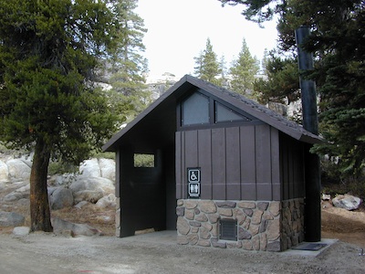
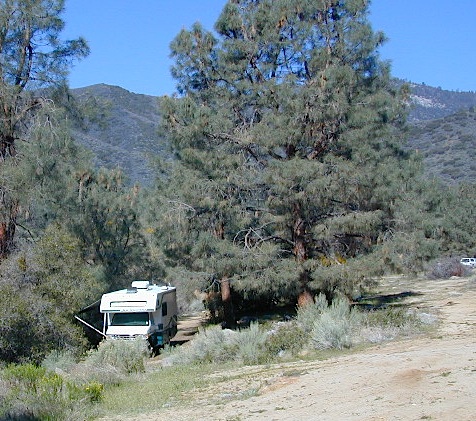
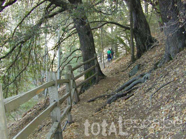
Ancient Bristlecone Pine Forest has some great dirt roads surrounding it. After you are finished with all the touristy sights & you don’t wanna spend the rest of the day in the visitors center or back at camp, try Cottonwood Canyon – full of aspens, camp sites & fishing, not cottonwood trees. 4×4 is required. Crooked Creek has boulders, boulders & more boulders. Plus some amazing camp sites with open sky views. Silver Canyon is for high clearance only, 2WD okay. This will lead you down to Laws Railroad Museum on Hwy 6, on the back side of Bishop, CA

Benton Crossing Rd (green church @ 395)
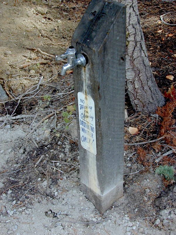
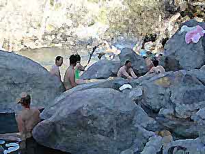
This wide road leads out to multiple dirt roads that peel off in every direction. Many Eastern Sierra Hot Springs can be found out here – on the east side of the highway. No hot spring resorts, no facilities, no clothing & very primitive.

Bishop 4×4 route Coyote Flat
Coyote Wash leads up to Coyote Flat & out to Coyote Lake. This a a spectacular high altitude plateau overlooks the Owens Valley & requires 4 wheel drive just to get up there. Pinyons, junipers, aspens, wildflower meadows, old mines, & yes, lakes at 11,000′ elevation. Views of the High Sierra & South Lake.

Buttermilk Road – This dirt road is north turn off of Hwy 168, W of Bishop, CA. “The Buttermilks” are a popular spot among rock climbers. A great place for indian petroglyphs too!

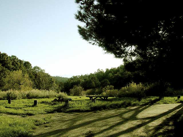
Road# 9S21 – Glacier Lodge Road – Paved road. Creek exploring & fishing. Plenty Campgrounds. W of Big Pine CA

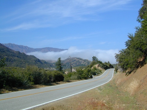
Horseshoe Meadows Rd – Paved route with great views over Owens dry lake bed; access via Lone Pine CA; A nice day trip to meadows & High Sierra scenery. Picnic & day hike!

McMurray Meadows Rd – south off of Glacier Lodge Rd (#9S21) just W of Big Pine CA. You can find ancient cinder cone volcanoes & cave-like lava tubes in between this long dirt road & the highway.

monache
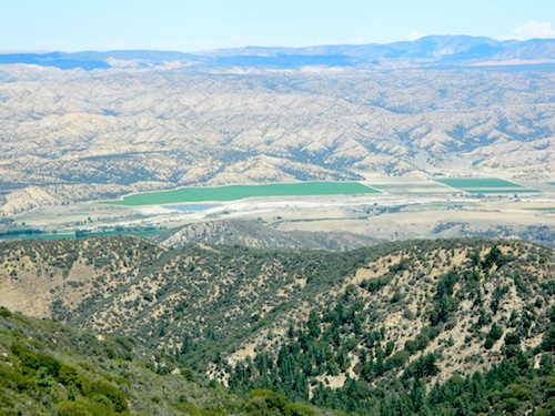
Monache Meadows is a high elevation meadow that takes some time & determination to get to. This area is part of the Inyo National Forest, but can be accessed by either: backpacking thru the high Sierra’s or driving a high clearance vehicle thru Sequoia NF # 22S05 Sherman Pass Road, behind the Black Rock Ranger Station & Troy Meadows Campground. High clearance is needed, 4×4 maybe. Great camping sites near Olancha Peak trailhead. The area is surrounded by Golden Trout Wilderness & South Sierra Wilderness. From US Highway 395 to Kennedy Mdws & then Monache is a full day of exploring, so you may as well stay the night up there. But bring warm gear, a campfire permit & a capable vehicle.

Manzanar Routes – Back behind Manzanar Camp there are miles of dirt roads to explore. Many creeks side camp sites can be found even with a passenger car. Small trees & sage brush. Secluded camping (for free) is possible in the Eastern Sierra.

Mono Craters (Rd# 1N11) – the youngest mountain range on the continent. Just south of Mono Lake, this route skirts the pumice cones & climbs over the Aeolian Buttes, before it meets back up with Hwy 395.

Walker Creek Rd #19S01 – Oaks & creek. South of Olancha CA, look for turn off & follow dirt road up into the tight canyon.

Fish Slough Road (Rd #3V01) – open, high-desert area near volcanic tablelands. Find Indian Petroglyphs. N of Bishop, CA

keough hot tubInyo Road# 6S16 – Pine Creek Road – Creek exploring & fishing. NW of Bishop behind Rovana, also known as Round Valley, CA

Road# 4S02 – Owens Gorge Road – N of Bishop behind Lake Crowley. Camping w/ boulders & pines. Good open sky views for stargazing.

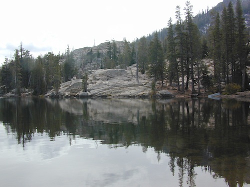
Road# 4S86 (Inyo Rd #28E201) – Laurel Lakes Road – Camp in aspens @ Laurel lakes, high elevation; access to alpine lake trailheads; SE of Mammoth Lakes, CA

Road# 2S05 – Deadman Creek – Creek fishing in forest. N of Mammoth

Road# 2S07 – Owens River Road – Pine forest, near hot springs; no facilities. N of Mammoth

Road# 1S63 – June Lake Loop is CA SR 158 (Hwy 158) paved main route, which is often closed for winter months, due to deep snow.

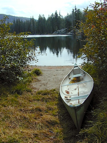
Road# 1N17 North of June Lake Loop; dirt road access to Parker Lakes & Walker Lake trailheads; Side canyon routes offer (unmarked) picnic areas and fishing spots; few primitive camping options.

Road# 1S25A Parker Lakes Road– Aspen & pine forest, near creeks; E of Grant Lake / N of June Lake

Road# 1S23 Walker Lake Road – Pine forest route to Walker Lake; E of Grant Lake / N of June Lake

Impressive Canyons

Dirt Street

7S02 up hill

An avenue made of dirt, earthen highways, dirt trails, forest roads, fire roads, jeep road, graded roads. Dirt driving trails that lead into the middle of nowhere. No stop signs, no billboards, no stores, no one else around… for miles. Enjoy less crowds and more open space.

dirt streets
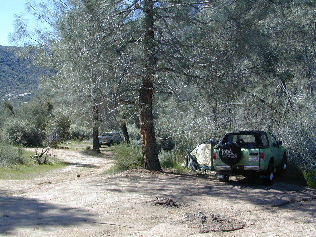
If you are fed up with city life, sitting in traffic & need to vacate your mind among the barren hills of California (if only for a weekend), then Total Escape is your place. You seek solitude, peace, maybe a mini tailgate party & BBQ on a dry lake bed, with the heavenly stars above. Imagine the warm camp fire light reflecting off the high canyon walls, your music echoing, moonlight hikes for a few miles.

California has some awesome spots to drive on dirt, get way back in nature. Right up to the edge of the Wilderness boundary. That’s what this one silly “dirt street” page is all about… helping you get out there, the easiest & best way possible. We even got you the right maps!

Back Roads in California

The End of Dirt Roads

California OHV Maps

Most of this is just dirt road driving, graded, some hills, easy stuff. But on occasion you might come across a 4×4 required sign – or perhaps a triple black diamond trail. Having several good maps on hand will help you enjoy these roads, instead of stressing & wondering if there is a lock gate at the other end – 18 miles in.

Some dirt streets lead to campgrounds, some to waterfalls, some to viewpoints, some have loop options & others are just dead end; sometimes at old mines. Get ready to explore with your truck or SUV. 2WD or low clearance vehicles (such as passenger cars) should be ready to turn back if the road get too nasty. Any decent precipitation can make any unpaved road much worse & may require 4 wheel drive, so have a plan B mud terrainor C as a backup idea.

Best off road areas & parks in California:

Death Valley Roads

Tooling around Goler Wash & Barker Ranch on the very edge of Death Valley

Kirkwood Lake

Kirkwood Lake Campground

kirkwood granite

Central Sierra Nevada mountains
Kirkwood Lake is west of Kirkwood Ski Resort;
west of Silver Lake @ Carson Pass Hwy 88

Kirkwood, CA
El Dorado National Forest

Inside the granite maze of rock known as Caples Creek, you may find this small lake, just off the highway. Paved access camp ideal for quiet weekends – fish, hike, stargaze and relax. Snow is deep in these parts of the Sierra, so the campground closes annually for winter.


No motor boats
No RV or motorhomes
No horse trailers

Small Camping Lake

Kirkwood Campground

• Elevation: 7,600′
• Number of Sites: 12
• Vehicle Accessibility: No RVs
• Campsites Reservation: No
• Campsite Fee: Yes
• Length of Stay: 14 Days
• Season: June – October
• hiking trailheads, fishing, swimming, kayaking, canoe, rock climbing

Bears are active in this region, so use the metal bear boxes provided to store all food items.

Canoe Lakes

Extra precautions should be taken with human waste around fragile eco systems, like lakes and meadows. Use the new bathroom, instead of the bushes (or granite crack).

new toilets
new toilets
pipe drinking water
piped drinking water, a camp luxury

Eastern Sierra Hiking

Eastern Sierra Hiking Trails – Mammoth Hikes

Autumn Bliss Hike

Desert ghost towns to Sierra meadows & waterfalls, Inyo National Forest offers plenty of diversity for scenery. To list all the hikes in the Eastern Sierra would be obsurd, cuz there are so many trails. This side of the Sierra Nevada is all about hiking, fishing & camping.Inyo forest map

No matter where you hike you will probably get a great view over the Owens Valley, Long Valley Caldera or Mono Lake. So that means most of those trails are hiking up a canyon, or a ridge line. Thousands of trails over this region require a good map to make the best decision for your hiking interest.

US HWY 395: The Eastern Sierra is one of the premier hiking destinations of California. Featuring the granite crags of the HIgh Sierra peaks. Mount Whitney, the tallest peak is closest to Lone Pine. Southern Californians love Eastern Sierra destinations, cuz they can avoid Los Angeles Basin and stay outta traffic.

Lone Pine Lake – Whitney Portal is a great, but crowded place for hiking. DO NOT ATTEMPT to hike to Mount Whitney in one day! Leave it to the seasoned pros. The first good stop up the Whitney Trail is gorgeous Lone Pine Lake, a great moderate day hike from there.

Alabama Hills – just below Mt. Whitney and has a totally different landscape than the backdrop granite Sierras behind. Try some boulder hopping & explore the dirt roads. Bring your mountain bike too.

Cottonwood Lakes (Pacific Crest Trail) – day hikes to alpine lakes. US 395 @ Lone Pine, W on Whitney Portal Rd. Left on Horseshoe Meadow Rd & continue up 19 mi. to the Horseshoe Meadow campground. Mostly a trail head camp, way, way up there. Open May – November

Kearsarge Pass – from 9000′ Onion Valley you can access the incredible High Sierra & numerous alpine lakes. The elevation gain makes this a full days hike; rated strenuous. Or continue on w/ backpack into Kings Canyon National Park.

Devils Postpile – back behind Mammoth Mountain, creeks, forest & cool geology awaits. Plenty hiking trails.

FALL COLORS: Autumn is the best time to enjoy the gorgeous aspen groves, as they change colors w/ the onset of winter.

Eastern Sierra Peaks

Topo maps, wilderness hiking maps
Equestrian trails, OHV maps –


Sierra High Country Hikes
Originally uploaded by danamight

Trailhead @ Onion Valley leads up to impressive alpine lakes, Kearsarge Pass & Kings Canyon High Country.

Eastern Sierra communities include:

Alabama Hills
Alabama Hills @ Lone Pine, CA

Reyes Peak

CA 33 N
Ojai Camping
North of Ojai, CA

Camp out among tall pines, well above the coastal fog.
Los Padres National Forest Road #6N06

Ojai, CA – NORTH on HWY 33
a very scenic drive, in North Los Angeles County

Coastal Foothills

Near the Pine Mountain Summit (elev 5080′) on California Highway 33, the small sign only reads PINE MTN and points east, to a rugged side road. By far one of the worst paved roads around.

This Reyes Pine Mountain, should not to be mistaken for the golf course community of Pine Mountain Club, many miles north of here, around the other side of Mount Abel.

This is Reyes Peak, also known as Pine Mountain Ridge “north of Ojai”, on the sorta paved Pine Mountain Road. (Los Padres National Forest Rd # 6N06)

overozena
The view above is from one huge dirt pull out, on the left – over looking Ozena Valley, on the west end of Lockwood Valley Rd. Motorhomes, trailers, off-roaders and hunters like this as a last minute camp site, very close to the highway.

If your vehicle can endure 9 long miles of poor pavement, pot-holed roads, then maybe you can find seclusion back in the woods around here.

Six or more primitive campsites, spread out along a forested ridge line (around 5000′ elevation). Tables and fire rings only. No fees, no toilets. Bring a shovel and plenty water. No pipes, no running water up here.

The scattered camp sites are located far enough away from each other, that the location provides some privacy and still relatively close to town. Some sites are in forested settings, while others have big boulders, but are exposed to wind and sun. Although these few sky view camps are perfect for the stargazers.

Dark night skies can be okay, if the coastal fog stays low. Neighboring Mount Pinos is all paved – usually best choice for RV campers w/ telescopes, who need large areas of flat level ground.

reyespeakcamp

One particular camp site is located at a very decent view spot. Boulders, pine trees and mountain views to the south. Click the image above to expand.

PRIMITIVE CAMPGROUNDS
Campfire permits are required.

Launch Spot

The end of the road is a top destination LAUNCH spot for hang gliders & para-sailers. Watch them jump on YouTube compliments of DanaMite.

Youtube


The hiking Trailhead for Reyes Peak and the Chorro Grande Trail #23W05 are also at the end of this dead end road #6N06. Reyes Peak Trail leads east, out to 7510′ elevation, overlooking the whole lower Los Padres region – Lockwood Valley, Ozena, Piedra Blanca, Sespe Gorge, Potrero Seco.

reyespeaktrail

Get outside this weekend. There are no more excuses!

MAPS: Los Padres National Forest Maps

NEAREST TOWNS:

Kern Flats Camping Free

chamise flat

Dispersed Camping Kern River

boondocking
primitive camping
undeveloped sites

KERNVILLE, CA

Located north of the small community of Riverkern and south of the Johnsondale Bridge, numerous flat camp spots adjacent to the rivers edge can be found.

johnsondale bridge @ KERNAnt Canyon Dispersed Area
Brush Creek Campground
Calkins Flat Dispersed Area
Chamise Flat Dispersed Area
Chico Flat Campground
Corral Creek Campground
Springhill Dispersed Area


Kern River Road
Sierra Way in Kernville travels north along the Upper Kern River & becomes Mountain Hwy 99 – which eventually connects with the Western Divide Highway in Giant Sequoia National Monument.

California NFS Kern RVing kern campgrounds open camping

truckcamping

Dispersed Camping Areas along the Kern River

Open Year Round! These FREE camp areas are called dispersed camping sites. No pavement, no picnic tables, no bathrooms, no piped water. Portable toilets & trash bins may be available in the busier summer months. Campfire permits are required for all campfires, BBQs, and camp stoves. Fire restrictions are common in extreme dry conditions. 14 day limit on camping.

Mountain Biking Kernville kern hiking fishing Kern snow Kern

camping, fishing, kayaking, mountain biking, rafting

Many flats are signed w/ small brown signs, while others are not. Some are actually flat and easy to access, while others are steep, eroded dirt trails unsuitable for RV travel.

Kelly’s Hole, overgrown, unknown, well-known or burnt beyond recognition? Roads End is no more.

Camp sites listed on this page are dispersed camping areas around the Kern River Area. Not all camp spots are listed, cuz many are unnamed. Bring your GPS to mark your favorite camp sites and you can arrive in the dark, late at night, anytime, (avoiding city traffic after work).

chamise pre-wildfire

Several spots known as “dirt flats” are easy accessible right off the pavement of Sierra Way. Primitive river camping, fishing spots and raft launch areas north of town. Vault toilets might be available during busy summer months, but you’re on your own the remainder of the year. Bring a shovel and take a hike, away from the water flow. And if that sounds like too much work for a potty break, maybe you are not cut out for the primitive kinda camping style. No garbage service either: pack it in, pack it out.

Wildflowers are abundant in the Kern Canyon nearly every Spring season (April & May), which is a popular time to enjoy this region. Autumn brings minimal fall colors to this dry, desert mountainous landscape, but the fishing is decent at that time of year.

campfiresCAMPING OUTSIDE OF CAMPGROUND means you must obtain a free fire permit from the local rangers. Sometimes these dispersed spots are fire-safe areas, and you are allowed to have camp fires. Other times campfire restrictions are in place w/ wildfire dangers too extreme and no fires are allowed, anywhere. (Not even inside a developed campground!)

Kern RV spot

river Kern WILDERNESS NOTE: The USDA National Forests web site states that “Camping and campfires within 25 feet of the water’s edge is prohibited due to the Wild and Scenic Designation”, but that doesn’t seem to stop some from setting up right on the fragile rivers edge. Doubtful that this rule is being enforced by the rangers, but consider yourself warned unless they start to get serious about this restriction. Many believe that the free camping along the Kern river is destroying it, so don’t be surprised if these areas get closed or barriers placed at the flats.
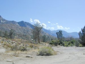
Caulkins FLAT has some new boulder barriers put in place which prevent cars from reaching certain ideal camp spots (right at the waters edge). Tough luck. Now we have to hike more.

California rivers

kern flat camping

Upper Kern River
North of Kernville, CA

all camps below listed from south to north

ALL CAPS = developed campgrounds managed by US Forest Service, w/ links to Kern River Campgrounds. California NFS

HEADQUARTERS CAMPGROUND (NFS)

Both Halfway & Thunderbird used to be dispersed camps, but they were converted to reservation-only Group Campgrounds by the National Forest in 2014

Chico Flat
2500′ elev
Just south of Hospital Flat Campground.
This camp area is known as “Chico Flat Campground” on GoogleMaps.

HOSPITAL FLAT CAMPGROUND (NFS)

Corral Creek
3200′ elev
Hike to Corral Creek Beach & Picnic Area.
This camp area is known as “Corral Creek Campground” on GoogleMaps.

Spring Hill
This camping area is marked as “Upper Springhill Campground & “Lower Springhill Campground” on GoogleMaps.

GOLD LEDGE CAMPGROUND (NFS)

Ant Canyon
Just north of Goldledge Campground, along the Upper Kern River.
South of Salmon Creek; Hike to Salmon Creek Falls.

Chamise Flatchamisespot
12 miles north of Kernville, CA
This camping bluff could be the most forested of all the ‘kern flat’ camping areas, but river is a short hike down a very steep cliff. Fishing is excellent in this stretch.

Calkins Flat
15 miles north of Kernville, along the Upper Kern River. Just south of Fairview (McNalley’s). Sign at the location reads a different spelling of “Caulkins Flat”. Kayak and rafting put-in spot. One of the best sites for large groups. Area is also known as simply “Lower Campground” on GoogleMap.

free kern river camp

FAIRVIEW CAMPGROUND (NFS)

LIMESTONE CAMPGROUND (NFS)

Brush Creek
3600′ elev
Just south of Sherman’s Pass Road turnoff. This place also serves as a Day Use Area, where Brush Creek meets the Kern. Kayaking put in spot. Popular fishing area. Large open dirt parking lot with a vault toilet.


California rivers

Lower Kern River
Southwest of Kernville, CA

Lake Isabella has some shoreline camping with wide open access to the lake. Paradise Cove perhaps?

Historic Keyesville – “off-roaders camping paradise” along the river, but no swimming is allowed due to the extremely dangerous section of river. OHV trails lead (west) down river for many miles. Dirt bikes love the rugged boulder-scapes and steep hills. FREE camping; BLM Kern.

SANDY FLAT CAMPGROUND (NFS) – Open all year long! Terraced & paved hillside with numerous camp sites and plenty of room to spread out. RV campers like this location, due to the proximity to Hwy 178. elev 2300

HOBO CAMPGROUND (NFS)

Remington

Remington Hot Springs can be a zoo at times w/ the amount of people who love to stop here. A busy dirt parking lot, right across from the Remington trailhead sign. Many vehicles park here daily for day hikes, hot springs, fishing – and people also like to camp out, although camp sites are on slopes (not ideal), only a few and they fill up fast (before sunset).

Total Escape TIP: The very best camps at Remington are actually the ones you hafta hike down to. Less than a half mile down to the rivers edge to find a private mini beach. Pack light and arrive prepared to walk several miles (back & forth, several times).

Old Kern Canyon Road parallels Sierra Highway 178 and sits well above the river, so any flat spots you find will have great views w/ minimal river access.

Lower Kern River
Lower Kern River has very limited camping options.

San Jacinto Wilderness

Jacinto Maps

Southern California / San Jacinto Wilderness Area / San Jacinto Mountain / Palm Springs Mountain Hike

The well-photographed snowy mountain backdrop behind the desert deluxe resort-land known as Palm Springs, Mount San Jacinto is the second tallest peak in Southern Cal.

Mighty San Gorgonio peak, across to the east – on the other side of the valley, is the very highest mountain in this desert region. Granite Jacinto peak is located in between the mountains of Idyllwild and the low deserts of Palm Springs.

32,248 acres

Mount San Jacinto – 10,834′ elevation

San Bernardino National Forest

JACINTO PARK access –

Palm Springs via Tram

Book tickets online!

Nearest towns:
Idyllwild CA
Pine Cove CA

jacinto peak

Day hikes, picnic in the forest, backpacking, horseback rodes w/ SUPER easy access via the fantastic Palm Spring Tram ride, up to 8000′ elevation.

The San Jacinto Wilderness is managed by 2 different agencies: The National Forest Service and California Department of Parks & Recreation.

If you are camping overnight in the forest, you must get your wilderness permit from the agency that administers the area where you plan to spend the night. Day-use permits can be obtained on the day of your trip by visiting one of the ranger stations below. Day-use permits issued by either agency are honored by both, except during the busy summer months when permits to enter the Wilderness via Devil’s Slide Trail can be obtained only from the National Forest Service.

Camping permits can be obtained in advance by mail, in person, or online w/ PDF. National Forest Service accepts requests up to 90 days in advance; Mount San Jacinto State Park accepts them up to 56 days in advance. You can also get them on the day of your trip, if any are available at that time.


USDA National Forest Service
San Jacinto Ranger District
54270 Pine Crest Ave
Idyllwild, CA 92549
951-659-2117

Mount San Jacinto State Wilderness
25905 Highway 243
Idyllwild, CA 92549
951-659-2607

regional trail maps –

San Jacinto Hiking Maps

Mount San Jacinto State Park is surrounded by San Jacinto Wilderness

More San Jacinto Wilderness Info & Links –

summitpost.org/jacinto-peak
San Jacinto Peak Wiki
USDA San Jacinto Wilderness
Mount San Jacinto State Park

Sequoia National Forest OHV

Off-Roading Sequoia

Sequoia OHV Trails & Off-Road Areas

Rincon Camp
Rincon Camp & Rincon Trail @ Sherman’s Pass turnoff

Sequoia National Forest covers a large portion of the Southern Sierra, surrounding the Kern River canyon. This trail list is NOT for off-roading in the Sequoia groves!

The regions here are further south, below the Western Divide & Trail of 100 Giants.

If you are looking for more than a leisurely Sunday drive or a self guided back road tour, listed below are areas to “tear it up” on dirt w/ your motor bikes, machines & off road toys. Camping is common in certain spots.

CAMPS: Please be respectful of other campers and hikers; do not ride circles around camp sites, stir up dust or rev up engines at night. Choose a camp away from main roadways and access trails for a more enjoyable experience. Equestrian campers often use these same areas for meadow camping and horseback riding. A campfire permit is required.

sequoia OHV routes

ATV offroad trails, OHV routes & 4×4 Jeep Roads

Mojave OHV Sequoia 4x4

DIRT ROADS in KERN CYN & SEQUOIA

Just looking for some dirt roads to explore – at a more leisurely pace?
Check out DanaMite’s Sequoia Back Roads list, where you can find awesome unpaved roads throughout the Sequoia Forest & Kern Canyon region. Some of these secluded routes lead to great primitive camping sites, waterfalls, fishing holes, or amazing view points, but are not necessarily popular ATV routes.

DSCN0049

DSCN0061

Toad Spring Campground

Toadsprings

Los Padres National Forest; Toad Spring Campground

Atop Quatal Canyon on Forest Rd #9N09
– less than a mile off of Cerro Noroeste Road; just west of Apache Saddle. Cerro Noroeste Road name has changed to Harris Ranch Road (2015), so make sure to check on several maps before venturing out, just so you know.

5700′ elevation w/ 5 camp sites.
picnic tables, fire rings & no toilet. OHV trails nearby

Red dirt Quatal Canyon, next to the Chumash Wilderness & the Apache Saddle, a small campground is an oasis for the wildlife. A year round drippy, soggy natural springs feeds the meadow & trickles down the dirt road. Great birdwatching, hiking, native wildflowers & hunting.

OHV use is quite common; Quatal Cyn trails,  a long desert wash to explore. Short side canyons to the right, off of main road (9N09). Many routes may require a high clearance vehicle, but not 4×4, unless it’s raining or wet or snowy. You’ll need a Los Padres Forest map to get the most enjoyment out of this confusing landscape.  The multi-colored, eroded badlands makes great day hikes. Chumash Cliffs & Mount Abel 8286′.

Ballinger Canyon OHV Park is about 20 miles away, via Quatal Cyn & then 5 miles N on Hwy 33


View Larger Map

LOS PADRES NATIONAL FOREST MAPS – USDA
LOS PADRES EAST MAP – NatGeo
LOS PADRES WEST MAP – NatGeo

towns nearby:

PINE MOUNTAIN CA

VENTUCOPA CA

Miracle Hot Springs

MIRACLE HOT SPRINGS on Lower Kern River is now closed!

Kern Soakers

Hidden well by the dense vegetation, this multi-tub location provides a peaceful setting along the Kern River. Located on the Old Kern Canyon Road, (aka Old Kern Road) that parallels the main 4-laner Highway 178. The broken and dismantled tubs are inside a grouping of granite boulders, overlooking the Lower Kern River.  NFS Campground is walking distance away. Week days you can have the place to yourself for picnics, river fishing and hiking. Mountain biking and hiking trails at Remington trailhead.

DanaMite’s Tip: This place has no operating hot pools unless you plan to physically dam up a tub with a few found rocks. Rangers do not like this practice. If you wanna camp at Hobo Campground you can walk over & hike around to check it out. Worth a look.

Camping available next door at Hobo Campground. A few primitive spots are located on the Old Kern Canyon Rd. Free car camping, and some sites big enough for level RV camping. See the rangers at the Sequoia Mapslake for Sequoia National Forest ranger and fire permit and check fire current restrictions.

Remington Hot Springs is only 2 miles down river, but it does require a short hike and it gets very busy on weekends!

nearby towns:

Bodfish, CA
Kernville, CA
Lake Isabella, CA
Wofford Heights, CA
Alta Sierra, CA

Deep Creek Hot Springs

Deep Creek Hike-in Hot Springs

Deep Creek Canyon

Several hot spring pools line this desert canyon on the SW side of Deep Creek. There are smaller hot tubs, as well a large warm tub that is big enough to swim in. The vegetation around the springs and main creek is fairly lush for this desert terrain. A variety of trees, including willows, plus small meadows and grasslands add to the visual balance of this land. Deep Creek is one of the popular Southern California hot springs due to its proximity to the big, urban areas.

East of Lake Arrowhead; South West of I-15 @ Hesperia & Victorville

Deep Creek Hot Springs is a hike in only site.

San Bernardino National Forest
Big Bear Map

option A: Bowen Ranch, 2 mile hike
Bowen Ranch parking area, pay a fee to the crazy man and have the shortest hike to springs. The word ‘ranch” is used to describe a small shack with some junker cars. No entry after 10PM and the man at this private property is not a friendly ranger, nor is he a pleasant person to deal with (which is why we list 2 other parking options).

Interstate 15, exit Bear Valley in Victorville. Go East on Bear Valley 10 miles to Central. Turn right on Central. Just beyond the top of the hill turn left on Ocotillo, which becomes a dirt road. Turn right on Bowen Ranch Road and continue until you get to Bowen Ranch. National Forest Trail #3W02 the Goat Trail (aka Bowen trail) is 2 miles, the steepest and shortest route into the desert creek canyon.

Bowen Ranch Trail, as seen from opposite side of canyon

option B: PCT Trail Route, 6 mile hike
Interstate 15, exit Hesperia & take Main St. @ Y veer left- Rock Springs Rd., right on Deep Creek Road and follow it up to Mojave River at the Saddle Dike Embankment. Park near the dam; Look for Pacific Crest Trail sign for hike up canyon to the hot springs.

option C: Bradford Ridge, 3 mile hike
Lake Arrowhead hike-in way via the Bradford Ridge Path. Take Highway 173 East, which becomes a wide graded dirt road heading toward the desert. From the shooting (rifle) range where the pavement ends, clock your trip meter on your vehicle 3 miles further down the road. Park at small pull out on the left side. Near the sign that says ‘Narrow Bridge’, where a gated old fire is directly across. Trail head was not marked. If you are into hiking, this option is for you. Narrow sandy ridge trails, single track. Bring flashlights for a successful hike out at night.


View Larger Map


DeepCreek

Deep Creek Forum – deepcreekhotsprings.net
Deep Creek Volunteers – deepcreekvolunteers.com
NFS link – http://www.fs.usda.gov/recarea/sbnf/recarea/?recid=34152

Angeles Campgrounds

Camping Los Angeles – Angeles Crest Camping

Angeles Crest Hwy CA 2

campground elev spots veg toilet water notes
Appletree Campground 6,200′ 8 pines vault piped Big Pines Hwy
Basin Campground 3,400′ 15 CLOSED
Bear Campground 5,200′ 15 vault no
Big Rock Campground 5,000′ 8 vault crk sm RV, 4WD
Blue Ridge Campground 8,000′ 8 pines vault no May-Nov, sm RV
Buckhorn Campground 6300′ 40 pines vault no May-Nov, sm RV
Cabin Flat Campground 5,300′ 12 vault no CLOSED
Cienaga Campground 2,100′ 12 oaks vault no May-Dec
Coldbrook Campground 3,350′ 22 vault piped sm RV
Cottonwood Campground 2,600′ 22 vault no
Guffy Campground 8,300′ 6 vault no May-Nov, 4WD
Horse Flats Campground 5,700′ 25 pines vault no April-Nov
Jackson Lake Campgr 6,100′ 8 pines vault summer May-Dec
Live Oak Campground 2,000′ 7 oak CLOSED
Manker Flats Campground 6,000′ 21 flush piped sm RV
Messenger Flats Camp 5,500′ 10 pines vault no Corrals, April-Nov
Millard Campground 1,900′ 5 oaks vault no Altadena, Chaney Trail
Monte Cristo Camp 3,600′ 19 oaks vault piped RV, Hwy 2, N3
Mount Pacifico 7,100′ 7 pines vault no May-Nov
Mountain Oak 6,200′ 17 oak flush piped May-Nov
Peavine Campground 6,100′ 4 vault piped Big Pines Hwy
Prospect Campground 2,100′ 22 CLOSED
Rocky Point Camp 3,400′ 3 vault summer
Sage Campground 3,400′ 4 vault no Cheseboro Rd
Sawmill Campground 5,200′ 8 vault no sm RV
Soledad Campground 2,000′ 6 CLOSED
South Fork 4,500′ 21 oaks vault no May-Nov, sm RV
Spring Camp 4,700′ 3 vault no Rincon-Shortcut Route
Spunky Campground 3,300′ 10 vault no
Streamside Campground 2,500′ 9 vault no poison oak
Sycamore Flats 4,200′ 11 vault summer sm RV
Upper Shake 4,400′ 18 vault no May-Dec.
Zuni Campground 1,700′ 10 vault no

Chilao Campground

tunnel angeles crest

nearby towns –

Angeles Maps – hiking, OHV & mountain biking –

Los Padres Camping

Los Padres Campgrounds
Big Sur, Mount Pinos, Ojai, Santa Barbara, Santa Lucia

Forests

Los Padres National Forest campgrounds span the length of the California Central Coast, from the Monterey Bay to Los Angeles County. Choose a desired area:

Big Sur Campgrounds

Frazier Park Camping

Mount Pinos Campgrounds

Ojai Camping

Santa Barbara Camping

Santa Lucia Camping

Bottcher Gap Campground
Lush coastal campground is Bottchers Gap near Big Sur, CA

Los Padres National Forest

see also Los Padres Group Campgrounds

maps of the Los Padres regions –

Los Padres nearby towns & cities –

Pine Mountain Club from ridge

San Diego Mountains

San Diego Mountain / Hiking San Diego / SoCal Camping

hiking San Diego

San Diego forests & parks – 

Cleveland National Forest

Palomar Mountain State Park

Anza Borrego Desert State Park

San Diego maps & trails –

San Diego mountain towns nearby Alpine, Descanso, Julian, Mount Laguna, Palomar, Ramona

mt laguna lodge