Tag Archives: Wilderness

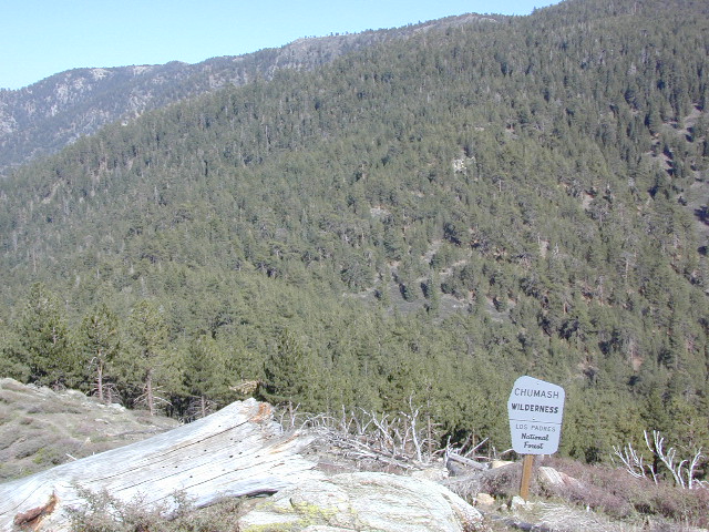
Chumash Wilderness

Chumash Wilderness
Los Padres National Forest

38,150 acres
Mount Pinos – 8831′ elevation
Cerro Noroeste – 8286′ elevation
Los Padres National Forest

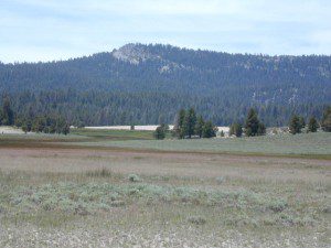
Terrain consists of high mountain peaks, badlands of Quatal Canyon Wash & Lockwood Valley; Steep slopes of forests, rock outcroppings, sparse forest areas, on border of Kern County & Ventura County. This area is sacred to the native California Chumash tribe.
Quatal Canyon Rd #9N09

DSCN0042Mount Pinos, Mount Abel, Cerro Noroeste, Westside Park, Hudson Ranch Road, Mil Potrero Highway, Lockwood Valley Road, East Dry Canyon, Apache Canyon, Cuyama River

campgrounds nearby –

The Peak to Peak Hike is a 7 mile, high elevation, ridge line day hike that traversed 2 of the tallest peaks in Kern County – Mt Pinos (elevation 8831′) and Mt Abel (8286′). Day hikes, equestrian trails, backpacking, mountain biking areas nearby. Steep, granite, chaparral, lightly forested w/ ponderosa and Jeffrey pines. From this ridge trail you have a 360 degree view over the entire region. The cabin community of Pine Mountain Club is to the north side (and IF the skies are really clear, you can see the Sierra Nevada mountain range too); Lockwood Valley & Ozena Valley are located to the south; Cuyama Valley to the west and the Tejon Pass w/ Frazier Park to the east.

Off road use 4×4, dirt bikes, ATVs, and quads are common in Quatal Canyon, Apache Canyon, East Dry Canyon leading up to the wilderness edge. Rangers will ticket if they find you on the Chumash side of Quatal wash. The secluded yet inviting, wide, white sandy washes are just too tempting for some bad boys.

Chumash trailheads are located

  • about a mile before Camp-O-Alto Campground (Mount Abel)
  • along lower end of Quatal Canyon Wash (OHV areas parallel)

nearby towns –


DSCN0060


View Chumash Wilderness Area in a larger map

Mineral King Camping

DSCN0019

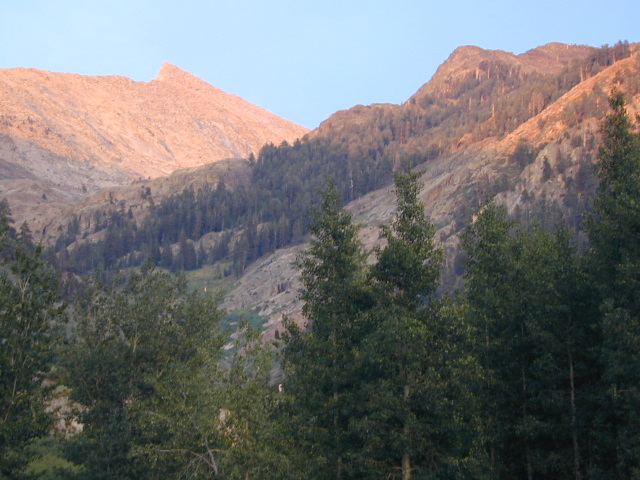
Mineral King is a magnificent canyon in the southern portion of Sequoia National Park, east of  Visalia, CA. So magical indeed that Disney tried to purchase the rugged scenic lands for a wilderness ski theme park in 1960. Thankfully that project never happened, due to strong opposition from preservationists. Mineral King became part of Sequoia National Park in 1978.

Mineral King is the Great Western Divide, where high peaks separate the foothills from the taller Eastern Sierra range. Upper Kern River Canyon lies beneath as the main south drainage from the very tallest peak, Mount Whitney @ 14,494′

sierra topo maps

Mineral King Road is a paved off shoot from Highway 198, just to the east of the town of  Three Rivers, CA. The road is steep and curvy and 25 miles long. No gasoline at all. No RV motorhomes or trailers are permitted to travel this scenic and amazing back road. Certain portions of the road are dirt and usually graded, but most of the route is paved.  Snow closes the road in winter months – NOV-MAY.

We usually get less than a half year to enjoy this special place, so make plans in advance to fit this destination into your schedule JUNE-JULY-AUG-SEPT.

And do not even think of trying to cram spectacular Mineral King into an already packed Sequoia Park weekend trip. The Giant tree Sequoia groves, Hume Lake and Kings Canyon are over an hour north (hwy 198), to other side of the park.

If you have a full week to hang out in the Sequoia National Park area, then obviously Crystal Cave and Mineral King should be on the list, but keep in mind taht each destination will take a full day to drive to and explore.

Driving the distance on Mineral King Road, the wonders abound on every curve. Wildlife, waterfalls, water flowing and the dense forests.

Atwell Mill Campground is located at an old wood mill site and has a good hike to a footbridge at Kaweah River. There is a small cabin community called Silver City which caters to summer crowds and family campers. Only open during the warm season.

At the very end of Mineral King Road is the gravel parking. Step out into high elevation (7830′ above sea level), breathe deep and enjoy the granite bowl of alpine bliss with creeks, meadows, wildflowers, picnic spots, hiking trails and scenery everywhere. Mid day sunshine can be bright. Black bears and marmots are very common.

Cold Springs Campground is the last developed campground, located next to a raging creek. The hike-in sites are the best choice for seclusion at this camp.

South Fork Campground is the smallest of the campgrounds in this area; located in the foothills at 3600′ elevation, open all year. From Highway 198 (W of the town of Three Rivers), take South Fork Drive 13 paved miles to camp.

KaweahFalls

mineral king backpacking

Mineral King is a favorite destination among backpackers as it gives instant access to many high country trailheads with mostly paved road driving. Located deep in the forest at end of a long road, near the center of the Sierra Nevada range gives ample hiking in every direction. The hikes are steep and challenging, but the rewards are solitude, true wildness and grandeur scenery. Although inviting, these steep passes might not be adequate for beginner backpackers, so please keep that in mind when planning. Fishing lakes, day hikes, horseback trails, waterfalls, creeks, and jagged mountain peaks.

From Mineral King you can access the these popular spots – PCT, the Great Western Divide, the Golden Trout Wilderness, Sequoia National Park, Kings Canyon High Country, Keasarge Pass, John Muir Wilderness.

top maps for the region –

Douglas City Campground

Trinity River Campground

Douglas Steiner Flat Camping

douglasbeach

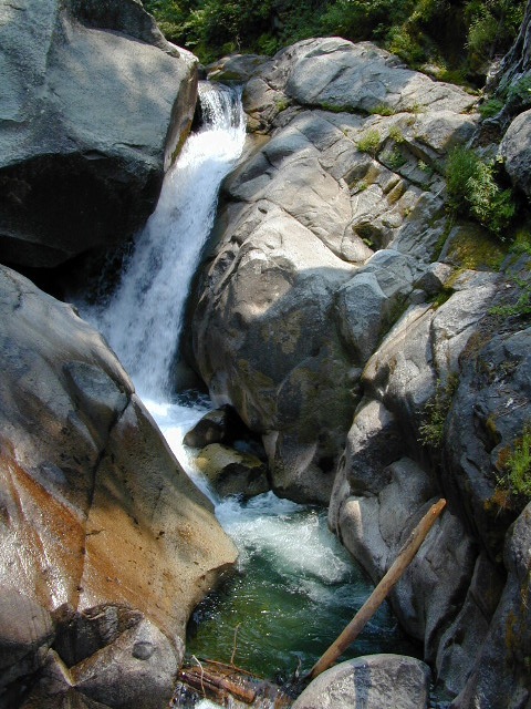
Northern California river camping. Douglas City is hardly even a town much less a city. A post office and a general store is the majority of what makes up this riverfront locale.

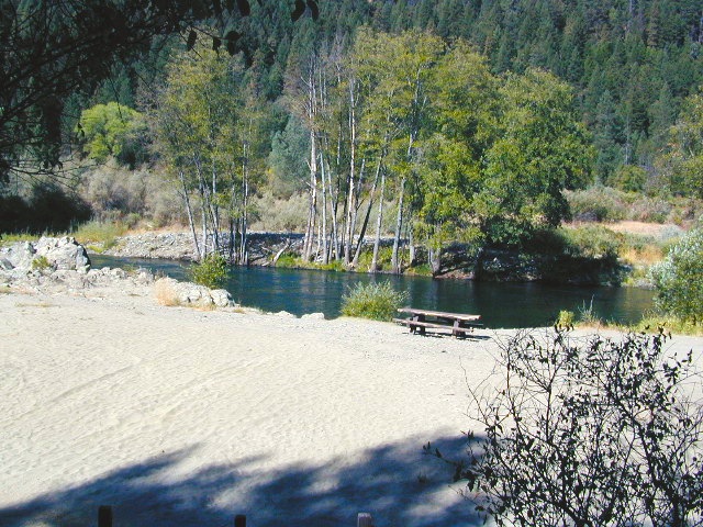
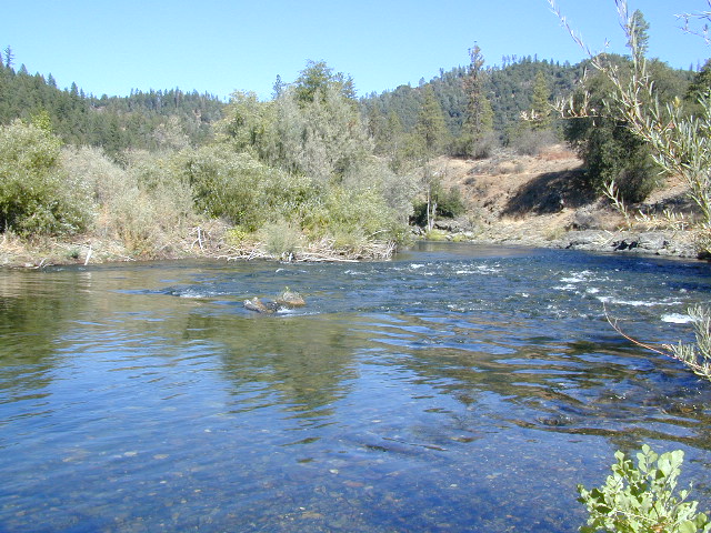
Tucked away on the scenic Trinity River, this small campground is perfect for those wanting to explore the Trinity River, Trinity Lake or the Trinity Alps region. Region is well known for fishing, hiking, kayaking and rafting. A small beach allows for river access. Group picnic area, picnic tables, telephone, beach, paved loop road are just a few amenities.

From Douglas City, drive half mile west on Hwy 299 to Steiner Flat Road. Follow signs to the developed camp. Numerous dirt roads lead to river edge, so there are primitive camping options available along Steiner Flat Road for those seeking free overnight stays.

• Elevation: 1,500′
• Number of Sites: 20
• Camping Reservations: No
• Sites Available: First come, First serve
• Vehicle Accessibility: Vehicle limit 28 ft. max.
• Length of Stay: 14 Days
• Water: Piped; river nearby
• Toilet: Flush & Vault
• Season: Closed for winter, Nov-April
• Fee: Yes
• Operated By: Bureau of Land Management
• Closest Town: Douglas City, CA

BLM Redding Ranger Station
530-224-2100

dscn0001
nearby destinations –
Chanchelulla Wilderness
Chappie Shasta OHV Area
Douglas City, CA
Lewiston Lake
Shasta Trinity National Forest
Trinity Alps Wilderness
Trinity Lake
Weaverville, CA
Whiskeytown Lake NRA

dscn0004

dscn0003

Sespe Wilderness

Sespe Wilderness & Hiking Trails

Los Padres National Forest
Campgrounds & Trailheads

Sespe Wilderness is located in the mountains W of Interstate 5, North of Los Angeles. The chaparral region lies in between Lockwood Valley and the Santa Clara River Valley (Hwy 126). Higher elevation Mount Pinos lies to north side of Sespe and Ojai Valley to the south. The infamous 4×4 Miller Jeep Trail is located on the north side near Alamo Mountain, which is also accessible via Hungry Valley.

The 2006 Day Fire burnt a good portion of the Sespe Wilderness, so you can expect to see some black and toasted areas. Sespe Creek is also referred to as Sespe River. and certain waterways may dry up during drier months. Piru Creek, Alder Creek, Aqua Blanca Creek, Tarr Creek, Mutau Creek, Snowy Creek are several worthy of note. Expect heat and high temperature in the summer & fall month, and possible campfire restrictions during extreme wildfire season.

219,700 acres
6 areas of hiking trails

Los Padres National Forest
Lockwood Ranger Station
661-245-3731

Sespe Trail Map
Sespe Trails, Tom Harrison Topographic Map

Sespe hiking trailheads located at –

Highway 126 – Fillmore, CA
Sespe Condor Sanctuary – Dough Flat Trailhead

Highway 150 – Ojai, CA
Sisar Canyon Day Hike / Road #4N15

Highway 33 – Ojai, CA
Rose Valley Road #6N31, Rose Valley Falls, Day Hike
Piedras Blanca Trailhead for the National Recreation Trail
Pine Mountain Rd # – Reyes Peak Trailhead

Lockwood Valley Road – Frazier Park, CA
Reyes Creek, Camp Shiedeck – Pine Mountain Trailhead
Half Moon Mutau Flat Trailhead, Sespe Hot Springs

Interstate 5 Tejon Pass @ Hungry Valley
Hard Luck Trailhead


rd7N03

Los Padres Campgrounds near Sespe Wilderness

  • Frazier Park Camping
  • Ojai Campgrounds
  • Twin Pines Campground, Road # 18N01
    Alamo Mountain via Hungry Valley OHV
  • Lockwood Creek Campground
  • Half Moon Campground, Lockwood #7N03
  • Thorn Meadows Campground, Lockwood #7N03
  • Dome Springs Campground, Lockwood #8N40
  • Reyes Creek Campground, Lockwood Valley Rd
  • Pine Mountain Road @ Reyes Peak (dispersed)
  • Nettle Springs Campground, Cuyama Hwy 33
  • Ozena Campground (closed)letswalk
  • Tinta Campground, Hwy 33
  • Rancho Nuevo Camp, Hwy 33
  • Rose Valley Campground, Hwy 33
  • Wheeler Gorge Campground, Hwy 33


nearby parks & lakes –

nearby towns –

Backpackers at Sespe Hot Springs

Jennie Lakes Wilderness

horse meadow trails

Sequoia / Kings Canyon / Mitchell Peak

outta print

USDA MAP may be out of print 2017

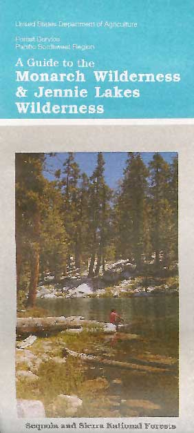
Jennie Lakes Wilderness is located in between two popular National Parks, via the paved back roads off Sequoia Generals Highway 198. Monarch Wilderness is north of Jennie Lakes, bordering Kings Canyon.

10,500 acres
26 miles of trail

Two lakes, Jennie Ellis Lake and Weaver Lake, set among granite outcroppings. Majority of the wWilderness is above 7,000 feet w/ red fir, lodgepole pine, and western white pine forest near treeline; abundance of spring wildflowers fill meadows. The two main lakes and Rowell Meadow are primary destinations for most backpackers wanting to camp overnight.


Sequoia National Park

Kings Canyon National Park

Monarch Wilderness

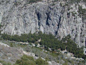
Impressive granite canyons, super steep. LOts of rugged rocky terrain, lower elevation to peaks of 11,000′. KINGS RIVER – Longest raging river in the Sierra, headwaters originating near Mount Whitney.

Road#14S11 – Big Meadows Road

National Forest & Wilderness Permits –

USDA Sequoia NF

More Wilderness Info & Links –

sierrawild.gov/wilderness/jennie-lakes
summitpost.org/jennie-lakes
Jennie Lakes Wilderness Wiki

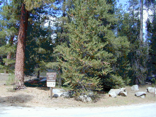
Marvin Pass trailhead
Marvin Pass trailhead, 12 miles down Rd#14S11

Another Big Meadows?
Indeed, southern SEQ NF, on the East Kern Plateau.

Golden Trout Wilderness

Golden Trout Wilderness Area

granite Upper Kern River is Mount Whitney snow melt
  • 303,511 acres
  • elevation range 1,000′ – ­13,000′
  • pine forest, chaparral
  • granite walls, domes
  • 379 miles of trail
  • summers are busy
  • snow in winter
  • best in early spring
  • wood fires may be restricted
  • portable stoves permitted
  • water plentiful
  • rock climbing & mountaineering
  • fishing
  • backpacking
  • primitive hot springs
  • waterfalls, swimming holes
  • wilderness permits required for overnight
Golden Trout Wilderness surrounds the mighty gorge of the Upper Kern Canyon, south of Mount Whitney.
Inside

TULARE COUNTY

bordering

Inyo National Forest

Sequoia National Forest

Eastern Sierra Interagency Center
760-876-6200

Golden Trout / South Sierra Wilderness Map USDA

Golden Trout Trail Map

Located in the South Sierra Nevada mountains alongside the Southern Sierra Wilderness. Inside the remote rugged peaks of a deep, granite crevasse known as the Upper Kern River with ancient Sequoia forest to the west and to the eats, some of the tallest peaks in the Sierra range. This wild land area is home to the California golden trout and is the main water flow southward from the tallest peak in the lower 48  – Mount Whitney on the Eastern Sierra front.

Sequoia National Forest
Monache Meadows
Inyo National Forest
Mountain Home State Forest
Sequoia National Park
Mineral King

Golden Trout Wilderness

Roads, campgrounds and trailheads surrounding Golden Trout Wilderness

Eastern Sierra –

Horseshoe Meadows Road (paved) leads up to high elevation meadows from the high deserts of Lone Pine, CA. Pacific Crest Trail (PCT) access; Mount Whitney and John Muir Wilderness are to the north. Equestrian corrals and horse trails. Camping is limited to a one night stay at any of the 3 campgrounds up here.

Golden Trout Trailhead Campground: elevation 10,000′ / 12 walk-in sites / closed winter
Horseshoe Meadows Campground: elevation 10,000′ / 18 walk-in sites / closed winter
Cottonwood Equestrian Camp: elevation 10,000′ / 10 horse corrals / closed winter

Forks of  the Kern –

Fork of the Kern / Loyds Meadow Road #22S82 – This main paved road connects the Kern River (Sierra Hwy Road #99) to the lower elevation, granite slopes of the Western Divide, and the route dead ends at Jerky Meadow parking lot. Camp 1-6 are primitive camp areas located on dirt side roads and 4×4 might be required on some of them. Obtain a campfire permit from rangers in Kernville. Fishing, camping, waterfalls and swimming holes are popular in this region. The big developed camp along this road, is located 10 miles up, in a pine filled valley on Peppermint Creek on the west side of the street and is within the Giant Sequoia National Monument.

Lower Peppermint Campground: elevation 5300′ / 17 camp sites / open year round

Lloyd Meadows @ Sequoia Forest Road# 20S67 – is the Forks of the Kern Trailhead & the dirt road that accesses it, is very popular among equestrian campers.

Western Divide Highway –

Road #20S79 leads from Western Divide Hwy to Lewis trailhead.
Road #20S50 leads from Western Divide Hwy to 2 hiking trailheads.

Sequoia National Park, Three Rivers, CA –topo maps

South Fork Road leads up Kaweah River at Southfork trailhead.
Mineral King Road is only open seasonally, access to high country lakes and trailheads.


SEQUOIA AREA MAPS –

Golden Trout Wilderness Maps
Sequoia National Forest Map USDA
Inyo National Forest Map USDA
Mineral King Map
Sequoia & Kings Canyon NP Map
NatGeo Sequoia Kings Map

Golden Trout Wilderness trailheads:

east side –
Cottonwood Trailhead (near Lone Pine)
Blackrock Trailhead (Monache Mdws)

south side –
Jerky Trailhead
Forks of the Kern Trailhead
Lewis Camp Trailhead (Western Divide)
Summit Trailhead (Western Divide)
Clicks Creek Trailhead (Western Divide)
Camp Wishon Trailhead (Western Divide)

west side –
South Fork Trailhead (Three Rivers)
Atwell Mill Trailhead (Silver City)
Franklin Pass Trailhead (Mineral King)

List of nearby towns:

Partington Cove Hike in Big Sur

Big Sur – Partington Cove

DSCN3026
Go west to & visit the oceans edge or head east to explore a deep redwood canyon.big

Approx. 5 miles South of Big Sur State Park and just north of Julia Pfeiffer Burn State Park, this unmarked dirt turnout area on Highway 1 is a rare find. Rocky shorelines at the historic point, plus the scenic tree lined waterfall & cross the highway & head east for a shady Redwood canyon forest with plenty of backpacking options into the Big Sur back country of Los Padres National Forest. From bright sunny ocean view hillsides to dark shady forests.

This portion of the highway cuts into a deep bend along the coast & has no markings to the paradise that lies within. A steep dirt fire road (down to the cove) with metal gate is your only clue. Dirt parking area on both sides of the road indicate that people have parked here before.

This un-signed secluded hide-away has a variety of landscape & sites to see. You could easily kill 6-8 hours just in this canyon alone!! Definitely not a hurry through kind of place. Take your time, enjoy the view, tide pools, bring your swim suits & refresh in the creek. Carry a picnic eastbound into a shady creek-bed canyon & watch the sun dance through the towering pines above.

Driving northbound on Highway 1, look for large hair-pin turn out in canyon area – approx. 3-5 mi. North of Julia Pfeiffer State Park in wide dirt areas along roadside. Located in between Julia State Park & Pfeiffer Big Sur State Park.

Hike down the dusty wide gated fire road in dry brush chaparral. The view of Redwood trees, the royal blue ocean in front of you, the sounds of a water falling creek. The trail forks off in 3 directions:

Right / Rock Beach – this a boulder lined cove where the clear fresh water stream meets the ocean. Small pools & waterfalls can be found just upstream .

Bridge Crossing / Point – through a wooden tunnel to a cliff area with tide pools & wooden structure (an old boat launch?)

Left / Up Stream – a forested canyon w/ a variety of trees; dead ends a few hundred yards up into the canyon

DSCN3021Another option to this canyon is the East side:
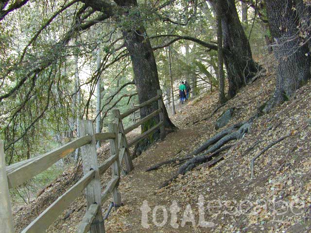
Hike up inland (away from ocean) into a densely forested creek area. Redwoods, waterfalls & boulders. Deer sightings are quite common in this area. Shady & dark this trail climbs gradually in elevation. One fork of the trail leads to an old Redwood Grove. A portion of the trail is closed 2.5 mi. up due to a landslide. But overall the is a perfect option for backpackers wanting a short hike.

  • Los Padres Maps (USDA)
  • Big Sur Map (NatGeo)
  • Ventana Wilderness Map w/ Silver Peak
  • Pine Creek Wilderness

    Pine Creek Wilderness Area
    East of San Diego, California

    • 13,400 acres
    • gently sloping area
    • elevations range – 2,000′ ­ 4,000′
    • vegetation is chaparral & scrub
      oak
    • riparian & woodland vegetation in stream
      bottoms
    • Pine Creek & drain the area north to
      south
    • rainbow trout in Pine Creek
    • streams are dry for parts of the year
    • several trails provide access to area
    • wood fires prohibited
    • portable stoves permitted
    • groups limit – 15 people
    • visitor permit required
    Cleveland National Forest
    Descanso Ranger District
    3348 Alpine Boulevard
    Alpine, CA 91901
    619-445-6235

    Pine Creek Wilderness Map

    San Diego Mountains

    San Diego Mountain / Hiking San Diego / SoCal Camping

    hiking San Diego

    San Diego forests & parks – 

    Cleveland National Forest

    Palomar Mountain State Park

    Anza Borrego Desert State Park

    San Diego maps & trails –

    San Diego mountain towns nearby Alpine, Descanso, Julian, Mount Laguna, Palomar, Ramona

    mt laguna lodge

    9N09 – Los Padres NF

    Quatal Canyon

    Quattale

    Quatal Cyn: Forest Road #9N09 – Los Padres National Forest

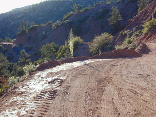
    Toad Spring Campground is located at high elevations (5700′) of Quatal Canyon, on a dirt road, half mile off the pavement of Cerro Noroeste Rd. The Chumash Wilderness, the Cuyama River Valley, Apache Saddle, Mount Abel plus the Bittercreek National Wildlife Refuge all surround this region. Los Padres National Forest meets the vineyards, orchards & farmlands, near Ventucopa. This is the badlands – 18 mile scenic dirt road, well signed at Hwy 33 & mostly graded. Quatal Cyn connects Ojai’s Highway 33 to the pinyon pine forest above near Pine Mountain Club (@ nearly a straight line?) Motorcycle dirt bikes & off-roaders dig this place. Street bikes will prefer paved Cerro Noroeste which runs the rim above to the north.

    This major dirt road is not gated at either end, but winter sometimes closes the route due to snow depth. It never stays closed very long, as some beefy 4×4 will break thru the snow berm soon enough. Top elevation @ Cerro Noreste is approximately 5500′.

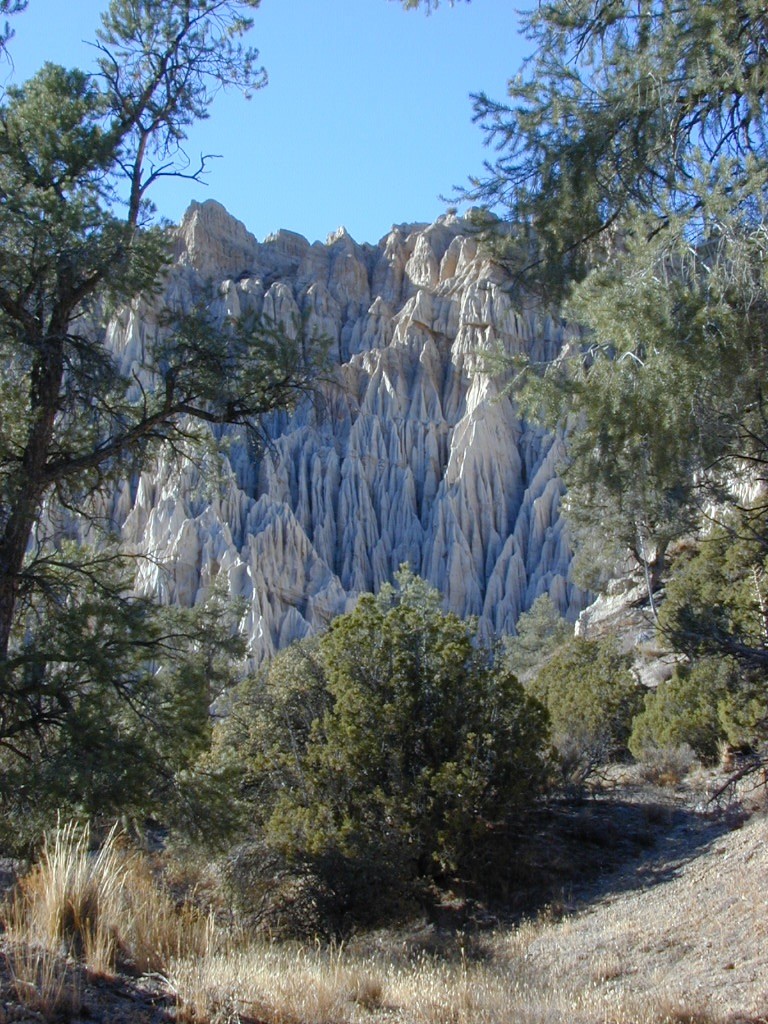
    Quatal Canyon (possible Chumash word for Snake) is a giant high desert wash, ripping down from Cerro Noroeste (aka Mt Abel). Serious erosion w/ San Andreas fault lines – make it a very interesting canyon to explore on foot, horseback, motorbike, or mountain bike. The lupine & wildflowers here are incredible in late Spring in this red dirt canyon. Both nearby mountain peaks of Mount Abel & Mount Pinos are the tallest in Kern County.

    This rugged primitive canyon gets torn up during a good storm in late summer or a big winter storm. Red dirt gets very slippery – especially on the edges of a cliff. Boulders in the road, flash floods – or no road, river of mud! 2WD passenger cars can take this route in dry months, but high clearance is usually preferred. 4×4 is needed during heavy rain or snow – which could be half the year (Nov-April). Flash flooding is possible all over Los Padres NF, so know the weather forecast in advance.

    Seen small RVs, trucks pulling trailers & even a U-haul moving truck down this way. MapQuest always amazes me where they route you. This is a graded dirt road, some of the time. MapQuest should post a ‘see Total Escape for this route’. Come on folks, if you’re traveling cross-country, while moving your residence, buy a real map to explore the National Forests of California. You may end up sleeping way out here – broken down in the moving van, in the boonies & no cell coverage, cuz you had a one page, wrinkled map in faded ink, wet & smeared. And MapQuest told you it was paved. It’s not paved 90% of the way.

    Primitive camping is also allowed in the canyon wash or on the side routes, in certain seasons. Use an existing camp site when possible. Clean out the rock fire ring of litter & bottles, pull back all dry brush at camps & leave these places better than you found ’em. There are hundreds of dispersed campsites out here. The open wash is especially nice on a full moon hike, just bring friends – cuz it is considered “big cat country”. Camp fire restrictions are in tight control on this SoCal region. You will need a camp fire permit, a big shovel & lotsa water. Check with the Los Padres rangers to make sure. Recently Zaca Fire (2007) & the month long Day Fire (2006) both came very close to this precious sanctuary.

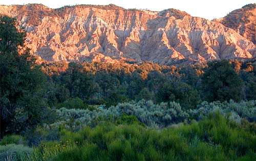
    The high desert terrain is pinyon forest, with yucca & manzanita. The eroded cliffs of red rock, white & orange hues, glow best during the clearest sunsets. You will almost think your in Utah, until you get up on a ridge & see the smog in the Central Valley of California.

    Mahu Tasen, a Native American camp and sweat lodge, has ceremonial grounds in a canyon off of Quatal. There is also a large rock quarry mining operation, as well as numerous wineries and ranches along this route. Several private residences too.

    Ballinger Canyon OHV Park is close by, 5 miles N on Hwy 33

    Carrizo Plain National Monument is also pretty close, N off Hwy 166

    towns nearby –

    PINE MOUNTAIN CA

    MARICOPA CA

    VENTUCOPA CA

    helpful maps of the region –

    Quatal Chumash Lands