John Muir Hiking / John Muir Map
| California Wilderness Area | Acres | Topographical Maps |
| John Muir Wilderness
elevations: 4000′-14,496′ |
584,000 | John Muir Wilderness Maps Inyo National Forest |
JMT
High Sierra Nevada / Eastern Sierra
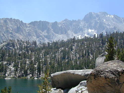
Rugged Sierra Nevada high country. The highest peaks in the Sierra Nevada mountains can be found inside this Wilderness. Many peaks are well above 13,000 feet. Granite, glaciated basins, big snow, alpine lakes, meadows, wildflowers, streams, creeks, cliffs, jagged peaks. Mount Whitney stands as the tallest mountain in the lower 48 states.
John Muir Trail Maps
– JMT Topo Map
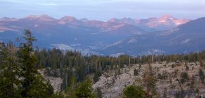
Eastern access via steep granite hiking, off US Hwy 395 (Bishop, Independence, Lone Pine)
Western access backpacking thru Kings Canyon National Park, Hwy 180
or Sequoia National Park, Hwy 198 (Mineral King, Three Rivers)
or Sierra National Forest, Hwy 168 (Lake Edison, Florence Lake, Courtright Reservoir)
North access via backcountry Yosemite National Park, Hwy 120
or Mammoth Area towns (Lee Vining, June Lake, Mammoth Lakes)
Hundreds of miles of hiking trails, some of the highest peaks in the nation. Trails open to equestrian and foot traffic only. Trailhead quotas limit the amount of day hikers and backpackers that an access the Wilderness daily. Wilderness permit required: Inyo National Forest Permits
Eastern Sierra Visitor Center
Inyo Visitors Office
 |
USDA National Forest
Eastern Sierra Interagency Office |
- Trailhead Quotas: Inyo National Forest
- Wikipedia John Muir Trail
- Sierra Nevada Wild on John Muir Hiking
- PCT John Muir Trail Hiking
- Elevation graph on the John Muir Trail
- Inyo National Forest on John Muir Wilderness
- PDF on John Muir Wilderness from Sierra NF
JMT
JOHN MUIR TRAIL- John Muir Wilderness
nearby towns, parks & resorts:
Aspendell
Big Pine
Bishop, CA
Courtright Reservoir
Florence Lake
Independence, CA
Kings Canyon National Park
Lake Edison
Lone Pine, CA
Mammoth Lakes
Olancha, CA
Tom’s Place
Wishon Reservoir
Yosemite National Park
| www.flickr.com
|

