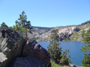
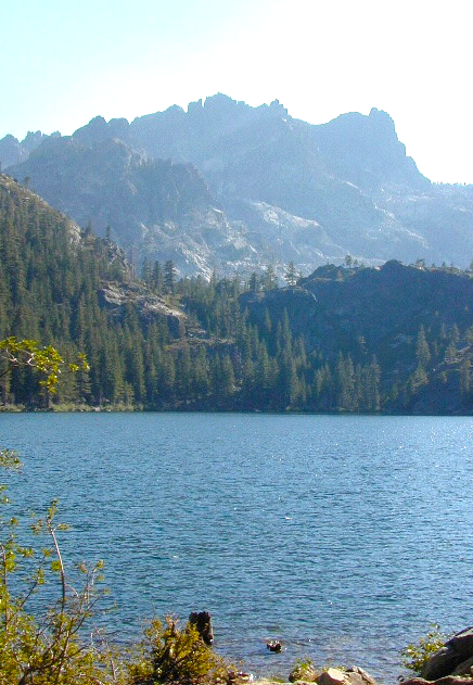
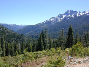
Snow Mtn Wilderness
Mendocino Forest, Lake Pillsbury
North of Wine Country, east of US Hwy 101
2018 (Mendo Complex Wildfire) Ranch Fire
burnt most of this area
Located in the coastal mountain range north of Clear Lake and west of Stonyford, California; in between I-5 and US 101
On the southern half of the Mendocino National Forest.
![]()
60,076 acres
East Snow Mountain Peak – 7056′ elevation
West Snow Mountain Peak – 7038′ elevation
Lake Pillsbury – 1818′ elevation
Mendocino National Forest
Eel River
Elk Creek
Cold Creek
Anderson Creek
Corbin Creek
Sheet Iron State Game Refuge
- backpacking
- camping
- hang gliding
- horseback trails
- off roading
- paragliding
- snowboarding
- snow shoeing
 Wilderness permits and campfire permits are required. Check local rangers for up to date weather conditions, road closures, parking and trail conditions.
Dirt Roads M10 and M3 are the major routes around this mountain area. Route M10 is also known as 43A on some older maps. Several 4×4 trails skirt the wilderness boundary near the tallest peaks, so you may see some OHV use in this region when hiking.
ranger stations
![]()
EAST SIDE
National Forest Office
Grindstone Ranger District
Willows, CA
530-934-3316
Stonyford Work Center
530-963-3128
WEST SIDE
Upper Lake Ranger
707-275-2361
Covelo Ranger District
707-983-6118
NFS campgrounds nearby
![]()
EAST SIDE
-
- North Fork Campground (Road# 18N03)
- South Fork Campground (Road M10)
- Fouts Campground (M10)
![]()
- Grey Pine Campground (M10)
- Mill Creek Campground (M10)
- Dixie Glade Campground (M10)
WEST SIDE
- Lower Nye Campground (Road M3)
- West Crockett Campground (M3)
- Upper Nye Camp (M3)
- Windy Point Campground (M3)
hiking trailheads
![]()
- Bloody Rock (Road M6)
- Crooked Tree (Road M3)
- North Ridge (M3)
- Windy Point (M3)
- Upper Nye (M3)
- Bear Wallow (Road# 18N06)
- Trout Creek (@ Fouts Springs)
- Dixie Glade (Road M10)
- Summit Spring (M10)
2017: a large landslide has closed the dirt road route in between Lake Pillsbury & Alder Springs, CA. Road M6 closed indefinitely.
off road routes nearby
- Bartlett Springs Road
- Stonyford Recreation Area
- Oak Flat Lake Pillsbury

