Forest Fires in California

A list of recent wildfires in California, with counties and acres affected. Forest fires listed here are the ones that have affected public lands – like National Forests, National Parks, State Parks and BLM land.
On public lands you may see signs like –
Warning: Entering a Burned Area
Potential Hazards include:
- LOOSE ROCKS
- FALLING TREES + LIMBS
- STUMP HOLES
- FLASH FLOODING
- DEBRIS FLOWS
>>> Entering a CLOSED FOREST with burn scar is a crime and can result in jail time. Check USFS forests web site for current closures.
Forest Fires listed below are alphabetical. Green & blue links to more data on these wildfires.
2022 Wildfires in California (coming soon)
- 2021 Wildfires in California
- 2020 Wildfires in California
- 2019 Wildfires in California
- 2018 Wildfires in California
- 2017 Wildfires in California
- 2016 Wildfires in California
- 2015 Wildfires in California
- 2014 Wildfires in California
- 2013 Wildfires in California
- 2012 Wildfires in California

In 2020 alone, old growth Redwoods, a million Joshua trees, and hundreds of giant Sequoias have perished. Shocking reality from the New York Times
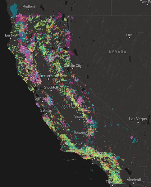
CapRadio WILDFIRES MAP