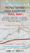
camp clueless transportation sample trips atlases & maps local travel
Advertisement


Destinations | Mountains | Journey | SampleTrips | Road-to-Nowhere

highway.168

South Lake Bishop

huntington lake

Sierra National Forest Maps Inyo National Forest Maps

Highway 168

Sierra High Country

Hwy 168 is divide into 2 portions: The Eastern Sierra (Aspendell, W of Bishop, CA) and the Western Sierra (Shaver/Huntington Lake). The paved route does not connect over the high country peaks in the Sierra Wilderness, and it must be traveled on foot or by horseback, or in winter by snowmobile.

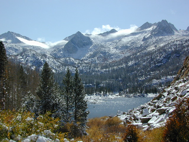
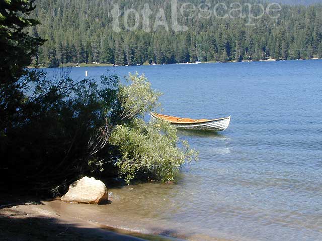
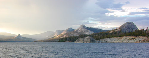
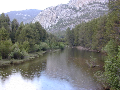
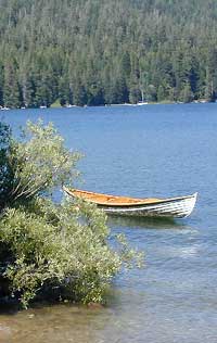
WEST SIDE, SHAVER LAKE - Alpine canyons, south of Yosemite National Park, lead east up the hill from Fresno to high elevations past Shaver Lake, CA. A dead end wilderness route goes far into the Sierra Nevada backcountry - nearly 100 miles deep into the mountains (including the narrow, paved, one lane Kaiser Pass). From the Central Valley, passing 2 large alpine lakes, this main roads can get you into the epic, alpine wilderness and the hot springs. Trailheads for Ansel Adams Wilderness & John Muir Wilderness are way back here. Tamarack Ridge is the place for cross country skiing and snowmobiling can be excellent in a good winter. This entire area has many recreation opportunities for both warm weather & snowy winters.

EAST SIDE, BISHOP - The Eastern Sierra part of highway 168 centers around the hub of Bishop. West Line Street is highway 168 which heads west into Inyo National Forest, and up to several alpine fishing lakes and campgrounds. South of Bishop, Highway 168 continues east from the town of Big Pine, up to Westgard Pass (7271') and Gilbert Summit (6374') toward the Nevada state line. Ancient Bristlecone Pine Forest is north of the highway, and Death Valley National Park is to the south. This 'north pass' for Saline Valley is off this route. Numerous group camp sites are located before Deep Springs Valley, and Deep Springs College (for public speaking, labor, and self-governance).

towns scenic areas lakes & creeks
Fresno
Clovis
Shaver Lake
Huntington Lake

Aspendell
Bishop
Big Pine
Sierra National Forest
Dinkey Lakes Wilderness
Rancheria Falls
Kaiser Wilderness
Ansel Adams Wilderness
John Muir Wilderness

Inyo National Forest
The Buttermilks
Ancient Bristlecone Pine Forest
Death Valley National Park
Piper Mountain Wilderness
Shaver Lake
Tamarack Creek
Dinkey Creek
Huntington Lake
Red Lake
Coyote Lake
Edison Lake
Florence Lake

Sabrina Lake
North Lake
South Lake
Bishop Creek
Coyote Creek
     
activities trailheads campgrounds
Backpacking
Backroad Exploration
Boating
Bouldering
Camping
Fishing
Hiking
Horse Packing
Kayaking
Mountain Biking
Mountaineering
Off Roading
Rock Climbing
Sailing
Snow Mobiling
Snow Skiing
Snow Boarding
Water Skiing
French Trail
Balsam Meadow Forebay
Tamarack Trailhead
Red Mountain OHV
Dinkey Lakes
Billy Creek
Potter Creek
Badger Flat
White Bark
Rattlesnake
Portal Forebay
Bolsillo
Edison Trailhead
Mono Creek
Onion Spring Meadow
Florence Lake

Lake Sabrina
Sabrina Basin
North Lake
South Lake
Willow Camp
Shaver Lake Campgrounds:
Dorabelle Campground
Swanson Meadow Campground
Camp Edison

Huntington Lake Campgrounds:
Rancheria Campground
College Campground
Billy Creek Campground

Kaiser Pass Campgrounds:
Badger Flat Campground
Midge Creek Campground
Portal Forebay Campground
Bolsillo Campground
Mono Hot Springs

Edison Lake Campgrounds:
Mono Creek Campground
Vermillion Campground

Florence Lake Campgrounds:
Jackass Meadow Campground
Ward Lake Campground

West Bishop Campgrounds:
North Lake Campground
Bishop Park Campground
Intake 2 Campground
Big Trees Campground
Forks Campground
Four Jeffery Campground
Mountain Glen Campground
Aspen Meadow Campground
Table Mountain Group
Sabrina Campground

Hwy 168, Eastern Sierra


View Larger Map


Sierra High country Map
NatGeo Mammoth / Mono Map
Ansel Adams Map
Ansel Adams Map
Mono Divide High Country Map
Dinkey Lakes Map
Dinkey Lakes Map
Sierra National Forest Maps
Sierra National Forest
Kaiser Wilderness Map
Kaiser Wilderness
Dinkey Lakes Wilderness Map
Dinkey Lakes Wilderness
Ansel Adams Topo
Ansel Adams Wilderness
Inyo National Forest Maps
Inyo National Forest


Thunder @ Courtright


Jackass Meadow


Total Escape California Camping

Advertisement


California Weekends


Total Escape has been an AmazonAssociate for 20 years!
Earnings from purchases keeps this site alive.


Copyright © 1996-2024 Total Escape, totalescape.com / All Rights Reserved.

classic | lodge | recreation | destinations | journey | ads | sitemap | outside | maps | gear | mobile