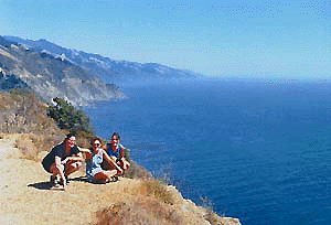
Drive partially north up the coast & stay overnight at
one of many interesting & beautiful towns along the Pacific Coastline:
Big Sur towns and lodging
|
Poison Oak
is abundant in this
area, so be careful
wear pants when hiking overgrown trails
|
- Area activities include:
- Back Packing
- Camping
- Hiking
- Hot Springs
- Mountain Biking Ridges
- Scenic drives & views
- Sea Kayaking
- Shops & Restaurants
- Sightseeing &Tours
- Surfing
- Swimming
- Tidepools

|
View Larger Map
Tips for Big Sur Travel:
- Camping can get expensive in this
region & hard top come by if you want toilets, so consider pairing up a few people in a cozy cabin instead. Or choose to rough it on the back roads with free camping options.
- Reservations for busy campgrounds should be made in advance. Try the remote campgrounds of Ponderosa & Nacimiento instead. Or the primitive style at Prewitt Ridge.
- Avoid the crowds - Explore the unmarked areas: Pull over
(well off the highway) & park you car for a few hours to
discover new waterfalls & trails to the oceanfront. Traffic is pretty constant on the main highway.
A detailed topographic map of the Big Sur coast and forest is advised for the visits listed below.
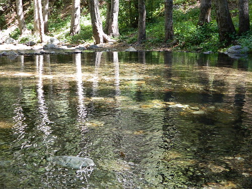
Partington Cove &
Redwood Canyon Hike
Salmon Creek Falls
This is another great waterfall close to the highway. A short
hike will bring you top the base, but make sure to wear pants
- due to poison oak all over the trail. Located 8-10 mi. south
of the town of Gorda in a huge hair-pin canyon turn .
Pfeiffer Beach
afterhours - The beach located
at the end of a turn off just south of Pfeiffer Big Sur State
Park on a residential street. Daily the attendant collects parking
fees. You can avoid these fees by arriving in late afternoon.
Off Roading / Back Roads
Many dirt roads in the Central Coast region are private driveways.
Be careful to check for 'no trespassing' signage & respect
other peoples property. The best area for back country exploration
is up off Nacimiento Rd. Big Sur
Backroads page has some details on specific routes. A Los Padres NF map would be handy and advisable.
The ridge areas offer great view from an even high elevation.
A few roads lead to backpackers trail heads / park spots.
The Nacimiento Road is a narrow, oak forested paved route, winding along & steep. Best route for missing San Simeon and the tourists; getting right into the Central portion of the Big Sur coast line.
Nacimiento Road connects Coast Highway 1 to US Hwy 101 (via Fort Hunter Leggett
military base). The drive includes ocean view spots &
creekside lined oaks canyons, and an off-limits military base thru oak meadows. Wild boars run in packs and can terrorize hikers and campers, so be aware of your surroundings and the animals, especially at night. Mountain lions and bobcats are also common all along the coastal Los Padres National Forests.
Camping
There are a number of campgrounds along the coast and a few
inland. Some are private campgrounds with showers located in beautiful redwood
canyons, which always charge expensive fees. The two Big Sur State Parks
require reservations well in advance. The Parks Management Company
in this region oversee a several good campgrounds. Most are first
come first serve, but double check to make sure.
Parks Management Co.
PO Box 1853
Morro Bay CA 93443
805-995-1976 |
Bottchers Gap
Kirk Creek
Plaskett Creek |
Nacimiento
Ponderosa
Cerro Alto |
Primitive car camping & backpacking options can be
found in the Los
Padres NF
Hot Springs
for the night owl - The Esalen
Institute, located on the coast, has their beautiful hot tubs
open to the public after hours (midnight - 3am). Call ahead to verify.
Primitive Sykes Hot
Springs can be accessed only by backpacking. Tasajara Hot Springs is
a retreat center & is located on the eastern slopes of the
coastal mountains & may not open to the public for day use.
Back to town page BIG SUR, CA
Big Sur