Deep Creek Hike-in Hot Springs
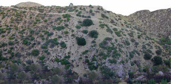
Several hot spring pools line this desert canyon on the SW side of Deep Creek. There are smaller hot tubs, as well a large warm tub that is big enough to swim in. The vegetation around the springs and main creek is fairly lush for this desert terrain. A variety of trees, including willows, plus small meadows and grasslands add to the visual balance of this land. Deep Creek is one of the popular Southern California hot springs due to its proximity to the big, urban areas.
East of Lake Arrowhead; South West of I-15 @ Hesperia & Victorville
Deep Creek Hot Springs is a hike in only site.
San Bernardino National Forest

option A: Bowen Ranch, 2 mile hike
Bowen Ranch parking area, pay a fee to the crazy man and have the shortest hike to springs. The word ‘ranch” is used to describe a small shack with some junker cars. No entry after 10PM and the man at this private property is not a friendly ranger, nor is he a pleasant person to deal with (which is why we list 2 other parking options).
Interstate 15, exit Bear Valley in Victorville. Go East on Bear Valley 10 miles to Central. Turn right on Central. Just beyond the top of the hill turn left on Ocotillo, which becomes a dirt road. Turn right on Bowen Ranch Road and continue until you get to Bowen Ranch. National Forest Trail #3W02 the Goat Trail (aka Bowen trail) is 2 miles, the steepest and shortest route into the desert creek canyon.

option B: PCT Trail Route, 6 mile hike
Interstate 15, exit Hesperia & take Main St. @ Y veer left- Rock Springs Rd., right on Deep Creek Road and follow it up to Mojave River at the Saddle Dike Embankment. Park near the dam; Look for Pacific Crest Trail sign for hike up canyon to the hot springs.
option C: Bradford Ridge, 3 mile hike
Lake Arrowhead hike-in way via the Bradford Ridge Path. Take Highway 173 East, which becomes a wide graded dirt road heading toward the desert. From the shooting (rifle) range where the pavement ends, clock your trip meter on your vehicle 3 miles further down the road. Park at small pull out on the left side. Near the sign that says ‘Narrow Bridge’, where a gated old fire is directly across. Trail head was not marked. If you are into hiking, this option is for you. Narrow sandy ridge trails, single track. Bring flashlights for a successful hike out at night.
Deep Creek Forum – deepcreekhotsprings.net
Deep Creek Volunteers – deepcreekvolunteers.com
NFS link – http://www.fs.usda.gov/recarea/sbnf/recarea/?recid=34152


