Advertisement
Activities | Camp | Camping
| Camp Destinations | Deserts
state.park.anza

 |
| CAUTION Unless visitors know the park very well, or carry detailed maps, it is wise not to venture too far from vehicles or from marked highways or roads. Getting lost is one of the easiest things to do in the desert. It's always wise to educate yourself about desert hazards, and to make sure someone else knows where you are going.
|
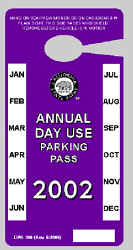
Fees
|
Annual
passes:
$35
pass -
good
for day-use & camping within state parks
Passes
may be purchased at the visitors center near the town of Borrego Springs
or through the mail by check, or money order.
Mail to -
Anza-Borrego
Desert State Park
200 Palm Canyon Drive
Borrego Springs, CA 92004
attn: District Administrative Chief

|
|

Helpful Phone Numbers:
State Park Info
760-767-5311
gov web site
|
Borrego Visitors Center @ Palm Cyn
760-767-4205
|
OHV Park
760-767-5391
SVRA web site
|
Borrego Desert Wildflower Info
760-767-4684
|
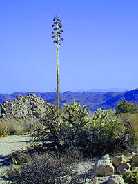
Backpacking Anza
Allows open camping throughout its 600,000 acres
- permits are required for overnight backcountry camping
- no ground fires allowed in park
- check with the ranger for all back country camping restrictions
Pacific Crest Trail Association

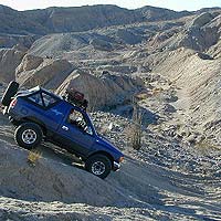
BackRoads Anza
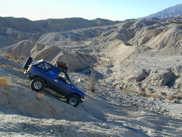
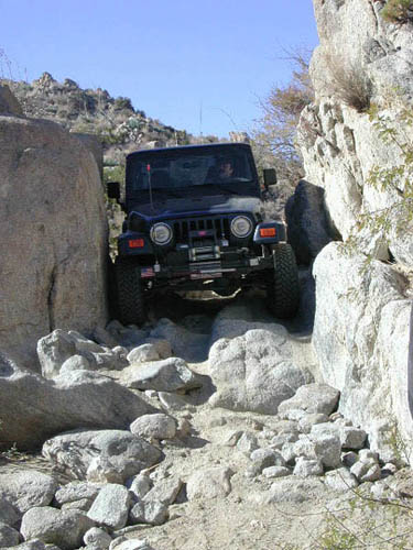
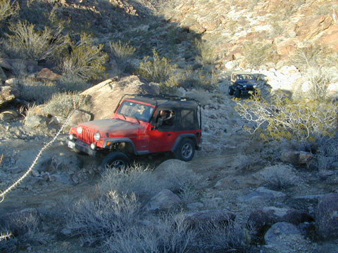
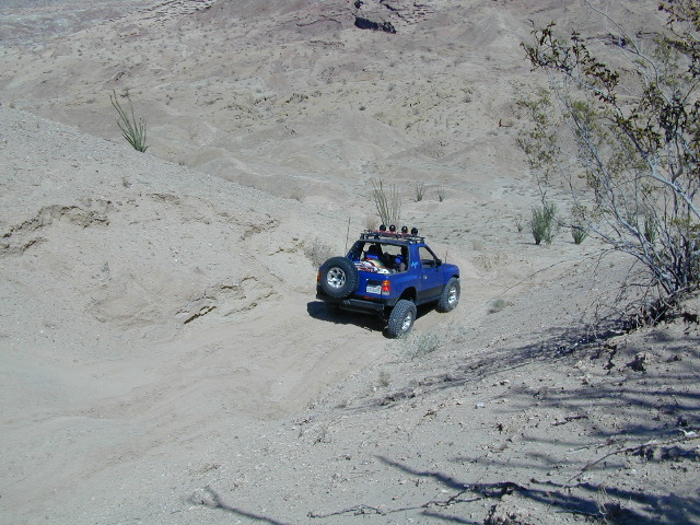
One of the best areas in southern California for back road
exploration. Get that SUV dusty, why don't ya?
Easy accessibilty & geographically desireable almost all year
long. But make sure to check
them high temps
before you head out in mid summer. Average
Weather Temps Chart
|
|
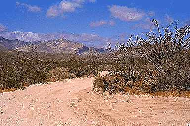
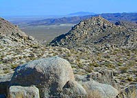
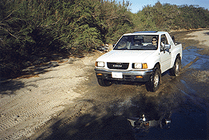
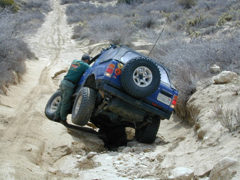
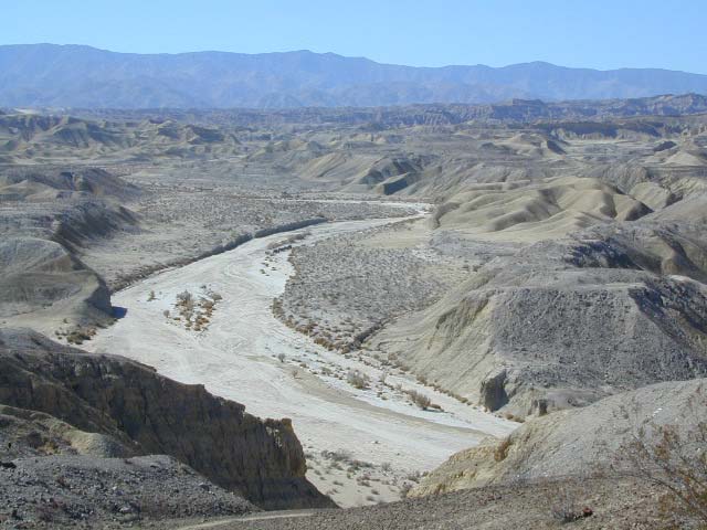
This 600,000 acre park has hundreds of miles of dirt roads. Most are accessible with 2WD high clearance vehicles. Soft sand in washes are common, so keep you speed up & do not come to a sudden stop in these areas. Small boulders on the road are not unhead of. There may be some rocky obstacles along the way, so take plenty of precautions & drive at a moderate speed. Racing around fast (over 25mph) , tears up the trails, damages the plants, disrupts the wildlife & may eventually lead to road closures.
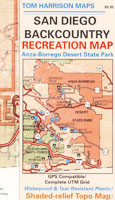
A great back country map of this region is
Tom Harrison San Diego BackCountry Map which can be found at
most stores that carry a good selection of wilderness maps.
|
paved back roads in Anza desert:
dirt back roads and trails:
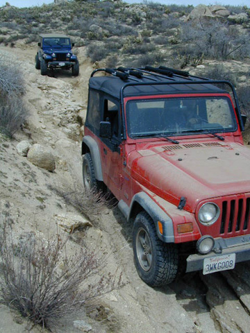
Spots for 4WD enthusiasts.
Some trails may require 4x4 for deep sand or steep hills, other routes are just awesome lil dirt roads. High clearance is usually advised if you plan to travel more than a mile off the pavement.
Anza Borrego State Park Campgrounds
760-767-5311, Anza Borrego Desert SP
BORREGO PALM CANYON CAMPGROUND
main campground near Visitors Center, in town
Borrego Springs, CA
120 camp sites for tents & RVs, flush toilets, overnight / day use fees
camping reservations accepted
TAMARISK GROVE CAMPGROUND
27 camp sites, flush toilets, fee
on S-3 @ Highway 78 jct (closed June - Sept)
 Vern Whitaker Horse Camp
elev, 960', located N of Borrego Springs, near the mouth of scenic and rugged Coyote Canyon.
equestrian campground w/ corrals, 10 camp sites, flush toilets
Backcountry Campgrounds Anza
Arroyo Salado
16 miles east of Borrego Springs on County Road S-22
 Blair Valley Camping Area Blair Valley Camping Area
open car camping & RV spots, vault toilets
on S-2 near Highway 78 jct
Bow Willow Campground
elev, 950', easy access, 16 camp sites, pit toilets, overnight fee
near Sweeney Pass & badlands overlook; located on S-2, 9 miles N of Interstate 8
Canon Sin Nombre
off S-2 near Sweeney Pass; entrance near Badlands Overlook
Coyote Canyon Camping
N of Borrego Springs via Di Giorgio Road
rugged backcountry dirt road, tent camping only
car camping near ocotillo gardens; 4x4 needed @ creek crossing & Sheep Canyon
Culp Valley Campground
elev, 3400', hwy access, 8 camp sites, pit toilets, free camp
located on S-22, atop Montezuma Grade
Culp Valley Boulders
elev, 3700', dirt road access, primitive camp sites, free
located off S-22, 4x4 near Montezuma Grade
Fish Creek Campground
Hwy 78 near Ocotillo Wells & Split Mtn
elev, 280', dirt road access, 8 camp sites, pit toilets, free camp
from hwy, go 12 miles south on Split Mountain Road
Yaqui Well
5 mi. south of Borrego Springs on County Road S-3 & right on Yaqui Pass Road
go 6 miles to the camping area on right side
Yaqui Pass
5 mi. south of Borrego Springs on County Road S-3 & right on Yaqui Pass Road
go 4 miles to the camping area on left side
All Desert Campgrounds Nearby
AGUA CALIENTE HOT SPRINGS
(San Diego County Park)
88 camp sites for tents & RVs, flush toilets, overnight / day use fees, 760-765-1188
located on S-2, 22 miles N of Interstate 8 (closed June-Aug)
BUTTERFIELD RANCH
(Private Campground Resort)
located on S-2 between Highway 78 & Interstate 8
LEAPIN LIZARD RV PARK
(Private Campground Resort)
85 acres, 60 camp sites
located on Split Mountain Road, Ocotillo Wells, CA
OCOTILLO WELLS SVRA
(State Vehicular Recreation Area)
elev. 160', 4x4 and off road camp sites for trailers & RVs
no water, no hook-ups, pit toilets, no fees, 760-767-5391
located on Highway 78 (closed June-Sept)
PALM CANYON RV RESORT
(Hotel & RV Campground Resort)
located in town, Borrego Springs, CA
SALTON SEA SRA
(State Recreation Area & Campground)
Mecca Beach, Corvina Beach, Salt Creek Campgrounds
located on Highway 111 on east side of inland sea
SLAB CITY @ SALTON SEA
old Camp Dunlap in California desert badlands
A snowbird campsite in the Sonoran Desert 156 miles NE of San Diego,
free & open RV camping near Salton Sea
located off Highway 111 on east side of inland sea
STAGECOACH TRAILS
(Private Campground Resort w/ horse corrals)
located on S-2 near Highway 78 junction
TRUCKHAVEN HILLS
(OHV trails & camp spots)
elev. 300', 4x4 & OHV, off road camp sites for car camping, toy hauler trailers & RVs
no water, no hook-ups, no fees,
located on S-22, East of Borrego Springs, CA
VALLECITO PARK
(San Diego County Park)
44 camp sites for tents & RVs, no hook-ups, toilets, overnight / day use fees, 760-765-1188
located on S-2, 22 miles N of Interstate 8 (closed June-Aug)
NOTE: Open, dispersed, free camping (often called primitive camping) is also allowed inside the State Park. Dirt roads lead to zillions of scenic destinations. Some roads suitable for passenger cars, others are not. Read below for more info.
Primitive Camping
|
The only park in the whole state that allows open camping throughout the park.
There are 9 designated primitive camp areas plus 1 horse camp. No tables, toilets or parking stalls. Plenty of dirt roads to explore. Most regular passenger cas can get to these sites. But many roads will require an SUV or even 4X4. Check our backcountry roads section. A backcountry road map is highly advisable.
Anza Ranger 760-767-5311

|
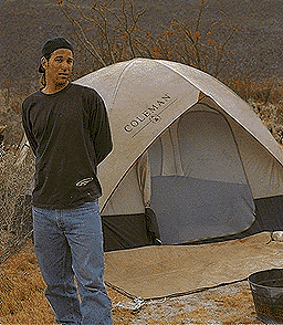
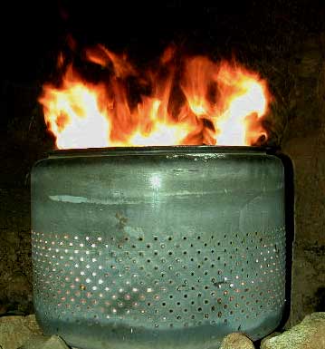
No ground fires allowed.
Better bring a metal container.
|
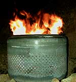
an old washing machine tub works very well for campfires
see portable camp fire pits
|
Just a few rules for primitive camping:
- pull your car one full car length off the road
- no off road driving (that means stay on the dirt road machismo)
- no ground fires - bring a large metal container, firepit & campfire wood
- pack and carry your ashes out (black, tough lawn and leaf bags are helpful)
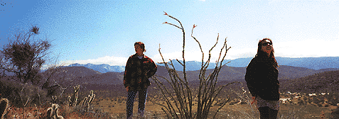
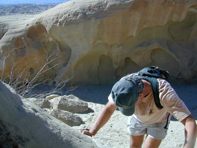
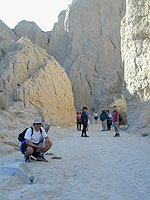
Anza Borrego Desert Hiking
|
Total Escape California Camping
Advertisement
|
|


