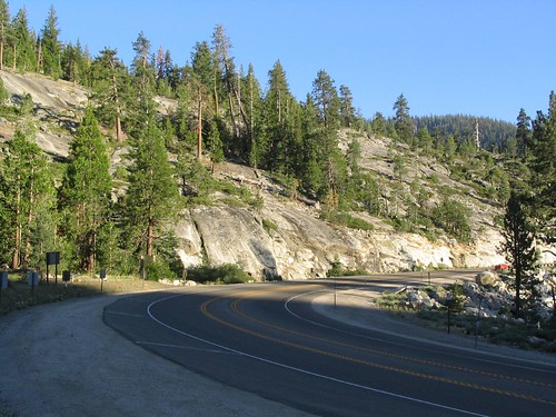
a d v e r t i s e m e n t s

Destinations | Mountain

town.strawberry (el dorado co.)

Strawberry (El Dorado Co.)

lodginglodging reservations in Strawberry (El Dorado Co.)

Photo Credit © Copyright Leon Turnbull from WaterfallsWest.com

In the middle of the Sierra Nevada, Highway 50 cuts thru from Placerville over to South Lake Tahoe. The alpine terrain is open all year as snow plows try to keep this route open as the main alternate for Donner Pass, I-80 (to the North). The area is also known as Kyburz CA

This Strawberry CA is one of several in California. There is a Strawberry in Tuolumne Couny, near Pinecrest Lake on Hwy 108 (Sonora Pass), plus a Strawberry Valley CA in Yuba County next to Sly Creek Reservoir.
elevation: 5800' population: 4,700 zip code: 95720

Mountain

terrain:
high elevation forests, lakes, waterfalls

location:
El Dorado County
SW of South Lake Tahoe
on Hwy 50

maps


recreation:

  • backpacking
  • camping
  • fishing
  • hiking
  • kayaking
  • Horsetail Falls
  • Ropi Lake Falls
  • parks, forests, rivers & lakes:

  • El Dorado National Forest
  • Mokelumne Wilderness
  • Desolation Wilderness
  • Echo Lake
  • Wrights Lake
  • Ice House Reservoir
  • Union Valley Reservoir
  • Central Sierra Nevada Forests Map Set
    Central Sierra Nevada Forests Map Set

    Campgrounds campground reservations
    To make a campground reservation nearby click below

    Yellowjacket Campground
    Fashoda - Union Valley Reservoir
    Wench Creek Campground
    Wrights Lake Camping
    Harvey West Cabin Reservations
    Van Vleck Bunkhouse

    tent camping

    description:
    Strawberry Canyon is a prime winter recreation area & there are many lakes closeby. The American River starts way up here.

    nearby towns:
    Placerville
    Meyers
    South Lake Tahoe
    Hope Valley
    local links:

    Strawberry Mountain Bike Trails

    Advertise on this site
    El Dorado National Forest Map
    El Dorado National Forest Map
    Mokelumne Wilderness Map
    Mokelumne Wilderness Map
    Tahoe National Forest Map
    Tahoe National Forest Map
    Lake Tahoe Basin
    Lake Tahoe Basin
    Topo Atlas Lake Tahoe Forest
    Topo Atlas Lake Tahoe Forest
    Desolation Wilderness Map
    Desolation Wilderness Map
    Desolation Wilderness Trail Map
    Desolation Wilderness Trail Map
    Search : Foghorn Outdoors California Waterfalls: More Than 200 Falls You Can Reach by Foot, Car, or Bike
    Foghorn Outdoors California Waterfalls: More Than 200 Falls You Can Reach by Foot, Car, or Bike

    Amazon.com's Price: $14.96
    Search : Waterfall Lovers Guide Northern California: More than 300 Waterfalls from the North Coast to the Southern Sierra
    Waterfall Lovers Guide Northern California: More than 300 Waterfalls from the North Coast to the Southern Sierra

    Amazon.com's Price: $12.71
    Search : Foghorn Outdoors: California Waterfalls
    Foghorn Outdoors: California Waterfalls

    Search : The Definitive Guide to the Waterfalls of Southern and Central California
    The Definitive Guide to the Waterfalls of Southern and Central California

    Search : The Humming-Bird of the California Water-Falls
    The Humming-Bird of the California Water-Falls


    California Weekends
    Copyright © 1996-2009 Total Escape, www.totalescape.com / All Rights Reserved.

    home | lodge | recreation | destinations | journey | forum | trips | advertise | site map | outside | maps | gear


    knitted sweaters for children


    Marmot -Gear you can rely on at Altrec


    California Escapes