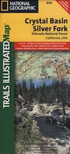
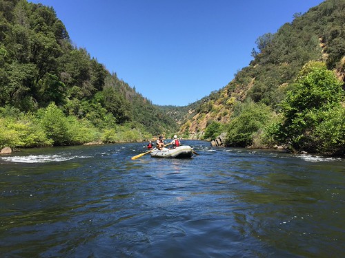
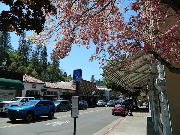
a d v e r t i s e m e n t s

Destinations | Country

town.placerville

Placerville

lodginglodging reservations in Placerville

In the early mining days of California's Gold Rush, the town of Placerville was known as 'HangTown'. Today it is a busling & busy centrally located city for thousands who live in the rural foothills of the Western Sierra.
elevation: 1866' population: 30,563 zip code: 95667

Country

terrain:
oak foothills & pines

location:
El Dorado County
NE of Sacramento
on Hwy 50 @ Hwy 49

maps


recreation:

  • backpacking
  • camping
  • River Rafting
  • Wineries
  • hiking
  • Bassi Falls
  • Bridal Veil Falls
  • Horsetail Falls
  • Traverse Creek Falls
  • parks, forests, rivers & lakes:

  • El Dorado National Forest
  • Auburn State Recreation Area
  • Folsom Lake State Recreation Area
  • Mokelumne Wilderness
  • Lumsden Park
  • Lions Park
  • Jenkinson Lake
  • Central Sierra Nevada Forests Map Set
    Central Sierra Nevada Forests Map Set

    Campgrounds campground reservations
    To make a campground reservation nearby click below

    Folsom Lake Camping
    Auburn Boat-In Campsites
    Stumpy Meadows Campground
    Van Vleck Bunkhouse Rental
    Sly Park Campground

    tent camping

    description:
    aka: Hang Town
    Historic Gold Country with main street shopping & many services. Restaurants, antique shops, sporting goods, jewelers & much more. Countryside with rolling hills, homes, oak trees & gold mining history. I guess the miners were pretty mean guys, cuz they are known to have killed off the California state grizzly bears & also hung their outlaw brothers.

    nearby towns:
    Auburn
    Jackson
    Plymouth
    Coloma
    local links:

    El Dorado County Chamber of Commerce
    542 Main St, Placerville, CA 95667
    530-621-5885
    http://www.eldoradocounty.org

    Historic Gold Country
    Hangtown's Gold Bug Park & Mine
    South Fork American River Raft Trip
    El Dorado Trail
    Placerville Hotels

    Advertise on this site
    Desolation Wilderness Map
    Desolation Wilderness Map
    Desolation Wilderness Trail Map
    Desolation Wilderness Trail Map
    El Dorado National Forest Map
    El Dorado National Forest Map
    Rock Creek OHV Map
    Rock Creek OHV Map
    Sierra Nevada Topo Map
    Sierra Nevada Topo Map
    Search : Sierra Nevada Trails Illustrated Explorer
    Sierra Nevada Trails Illustrated Explorer

    Amazon.com's Price: $49.95
    Search : Sierra Nevada: The John Muir Trail
    Sierra Nevada: The John Muir Trail

    Amazon.com's Price: $31.50
    Search : Trail of the First Wagons Over the Sierra Nevada (A Guide)
    Trail of the First Wagons Over the Sierra Nevada (A Guide)

    Search : 48 Dog-Friendly Trails: in California's Foothills and the Sierra Nevada
    48 Dog-Friendly Trails: in California's Foothills and the Sierra Nevada

    Amazon.com's Price: $13.49
    Search : The John Muir Trail: Through the Californian Sierra Nevada (Cicerone Guide)
    The John Muir Trail: Through the Californian Sierra Nevada (Cicerone Guide)

    Amazon.com's Price: $14.96


    California Weekends
    Copyright © 1996-2009 Total Escape, www.totalescape.com / All Rights Reserved.

    home | lodge | recreation | destinations | journey | forum | trips | advertise | site map | outside | maps | gear


    World Art Gifts


    Sierra Trading Post


    Arbico Organics