a d v e r t i s e m e n t s

Destinations | Mountain

town.tehachapi

Tehachapi

lodginglodging reservations in Tehachapi

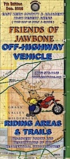
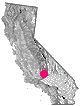
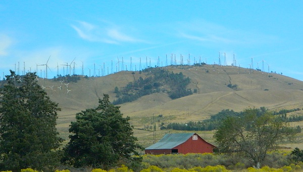
At the southern end of the Sierra Nevada mountain range & next to the Mojave Desert, this region is considerably dryer than the rest of the Sierra's. Rocks & soils found on Point Reyes in San Francisco match exactly with those found in this Tehachapi region. Just goes to show you, the earth moves in California.
PCT Map #2 Angeles
PCT Map #2 Angeles
Sequoia National Forest Map
Dome Land Wilderness Map
Angeles Forest OHV Map
Sierra Nevada Topo Map
Jawbone Canyon & Randsburg OHV Map
elevation: 3973' population: 10,957 zip code: 93561

Mountain

terrain:
mountain valley with pinyon pine forest


View Larger Map

location:
Kern County
E of Bakersfield
on Hwy 58

maps


= TEH

recreation:

  • backpacking
  • camping
  • mountain biking
  • off-roading
  • horseback riding
  • golf
  • parks, forests, rivers & lakes:

  • Sequoia National Forest
  • Jawbone Canyon OHV
  • Tejon Ranch
  • Bright Star Wilderness
  • Tomo-Kahni State Historic Park
  • Horse Canyon ACEC
  • Red Rock Canyon State Park
  • Southern Sierra Nevada Forests Map Set
    Southern Sierra Nevada Forests Map Set

    tehachapi campgrounds

    Red Rock Canyon State Park
    Jawbone Canyon Camping
    Indian Hill Ranch & RV Park
    Brite Lake Camping
    Tehachapi Mountain Park
    Mountain Valley RV Park

    tent camping

    description:
    mountain town with the most southern Sierra pass: easy access from Mojave Desert to the Central Valley; restaurants & shopping, few lodges

    nearby towns:
    Bakersfield
    Caliente
    Inyokern
    Mojave
    Randsburg
    local links:

    Tehachapi Chamber of Commerce
    http://www.tehachapi.com/chamber/

    Weiser Family Farms
    Pacific Crest Trail Association
    Guided Hikes: Naturalist For You
    Tehachapi Wind Farm
    Real Kern County
    Morgan Botanicals
    Mountain Valley Airport

    Advertise on this site
    Search : California Road and Recreation Atlas (Benchmark Atlas)
    California Road and Recreation Atlas (Benchmark Atlas)

    Amazon.com's Price: $22.45
    Search : Guide to Southern California Backroads & 4-Wheel Drive Trails
    Guide to Southern California Backroads & 4-Wheel Drive Trails

    Amazon.com's Price: $18.97
    Search : Guide To Northern California Backroads & 4-Wheel Drive Trails
    Guide To Northern California Backroads & 4-Wheel Drive Trails

    Amazon.com's Price: $18.94
    Search : Benchmark Arizona Road & Recreation Atlas - 7th edition
    Benchmark Arizona Road & Recreation Atlas - 7th edition

    Amazon.com's Price: $20.65


    California Weekends
    Copyright © 1996-2013 Total Escape, www.totalescape.com / All Rights Reserved.

    home | lodge | recreation | destinations | journey | trips | advertise | site map | outside | maps | gear


    El Monte RV Rentals & Motorhome Rentals


    FREE Shipping at Camping World

    tahoe cabins

    Free Shipping on Garmin GPS - Altrec Outdoors