a d v e r t i s e m e n t s

Destinations | Mountain

town.truckee

Truckee

lodginglodging reservations in Truckee

Photo Credit © Copyright Michael Rogers of Shinneyboo Creek Cabin Resort

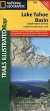
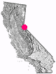
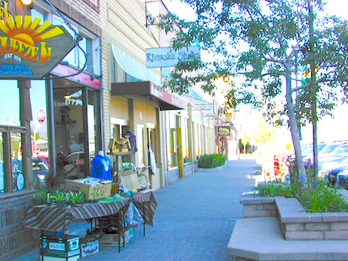
Dubbed as one of the coldest towns in the West, the high elevation Sierra town of Truckee, California features some of the best alpine scenery around. Lake Tahoe to the south, Gold Lake to the north, Reno down the hill, pine forest, granite peaks, big rivers & streams running all over, with meadows to picnic, trails to hike & bike, plus snowy slopes to ski.
Tahoe National Forest Map
Topo Atlas Lake Tahoe Forest
Desolation Wilderness Map
Lake Tahoe Map: Tahoe Recreation
Sierra Nevada Topo Map
Tahoe Lake Map
Tahoe Lake Map
elevation: 5820' population: 13,864 zip code: 96161

Mountain

terrain:
alpine lakes, rivers & ski slopes


View Larger Map

location:
Nevada County
NW of Tahoe
on Interstate 80

maps


= TRU

recreation:

  • backpacking
  • camping
  • Hiking
  • Horseback Trails
  • fishing
  • snowboarding
  • snow skiing
  • kayaking
  • mountain biking
  • golf
  • snowmobiling
  • parks, forests, rivers & lakes:

  • Tahoe National Forest
  • Donner Lake - Donner State Park
  • Truckee River
  • Truckee River Regional Park
  • Yuba Gap Snow Park
  • Fordyce Creek
  • Truckee River
  • Donner Summit Sno-Park
  • Upper Little Truckee Campground
  • Bear Valley Campground OHV
  • Hampshire Rocks Campground
  • Sterling Lake Campground
  • Woodchuck Campground
  • Northern Sierra Nevada Forests
    Northern Sierra Nevada Forests

    truckee campgrounds

    Donner State Park Camping
    Granite Flat Campground
    Goose Meadows Campground
    Truckee Campground - Prosser Lake
    Upper Little Truckee River Camps
    Boca Campground - Truckee
    Alpine Meadows - Martis Creek Lake
    Big Bend Group Camp - Yuba River
    Boyington Mill Campground
    Silver Creek Campground Truckee River
    Lower Little Truckee Campground

    tent camping

    description:
    Truckee is located atop the Sierra Nevada Mountains in the granite splendor & alpine country of Nevada County California. I-80 does get some serious snow & is known to close occassionally, so check weather conditions thru Cal-Trans anytime during winter months: October - April

    nearby towns:
    Norden
    Soda Springs (Nevada Co)
    Tahoe City
    Sierraville
    Squaw Valley
    local links:

    Truckee-Donner Chamber of Commerce
    10065 Donner Pass Rd, Truckee, CA 96161
    530-587-2757
    http://www.truckee.com

    Rafting the Truckee River
    Truckee River Winery
    Truckee River Legacy Foundation
    Moody's Bistro & Lounge
    Truckee Meadows Community College
    Truckee Trails - Hike & Bike
    Truckee Road Conditions: Cal Trans I-80
    Sierra Avalanche 530-587-3558
    Traffic Reports I-80

    Advertise on this site
    Search : The High Sierra: Peaks, Passes, and Trails
    The High Sierra: Peaks, Passes, and Trails

    Amazon.com's Price: $20.85
    Search : Starr's Guide to the John Muir Trail and the High Sierra Region
    Starr's Guide to the John Muir Trail and the High Sierra Region

    Search : The Sierra High Route: Traversing Timberline Country
    The Sierra High Route: Traversing Timberline Country

    Amazon.com's Price: $12.83
    Search : California Trails High Sierra Region
    California Trails High Sierra Region

    Amazon.com's Price: $22.46
    Search : High Sierra SUV Trails: Volume 1-The East Side
    High Sierra SUV Trails: Volume 1-The East Side


    California Weekends
    Copyright © 1996-2013 Total Escape, www.totalescape.com / All Rights Reserved.

    home | lodge | recreation | destinations | journey | trips | advertise | site map | outside | maps | gear


    El Monte RV Rentals & Motorhome Rentals


    FREE Shipping at Camping World

    tahoe cabins

    Free Shipping on Garmin GPS - Altrec Outdoors