camp clueless transportation sample trips atlases & maps local travel
Advertisement


Destinations | Mountains | Journey | SampleTrips | Road-to-Nowhere

highway.120

CA 120

Granite California

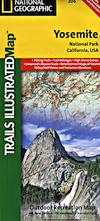
Groveland, Yosemite, Mono Lake, Benton Hot Springs

Stanislaus National Forest Maps

Sierra Forest Maps

California 120

Yosemite Park Highway

HWY 120 connects the California Central Valley to the high desert hot springs of Benton, via the highest pass in the Sierra Nevada mountain range. (Yosemite NP Tioga @ 9945' elev.) Groveland and Gold Country foothills climb past reservoirs and outdoor recreation abounds. Rivers, creeks, camps, canyons and giant domes. Slim pavement runs over meadows and granite within Yosemite National Park, and heads east to Lee Vining Canyon -- this area is kniwn as the Yosemite Highcountry. Tuolumne Meadows, Teneya Lake, Lambert Dome, Tioga Lake.

NOTE - Annual winter closure: October thru May
always check route plans w/ Caltrans before you travel

Inyo Forest Maps

Yosemite Park Map
Yosemite National Park Map
Yosemite High Country Map
Half Dome Map
Half Dome Map
Tuolumne Map
Tuolumne Meadows Map

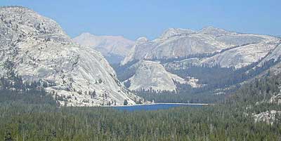
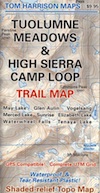
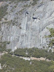
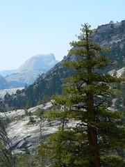
California 120 - The Tioga Pass
towns area attractions lakes & rivers
Manteca
Escalon
Oakdale
Knights Ferry
Chinese Camp
Moccasin
Big Oak Flat
Moccasin
Groveland
Coulterville
Buck Meadows
Harden Flat
Mather
Foresta
Yosemite Valley
Lee Vining
Benton
Stanislaus Rodeo Grounds
Hersey Chocolate Factory
Stanislaus National Forest
Red Cloud County Park
Yosemite National Park
Tuolumne Meadows
Tioga Pass
Inyo National Forest
Mono Lake County Park
Glass Mountain
Benton Hot Springs
Ancient Bristlecone Pines

Hot Tubs @ Benton
Stanislaus River
Woodward Reservoir
Rodden Lake
Tulloch Reservoir
Don Pedro Lake
Tuolumne River
Hetch Hetchy Reservoir
Cherry Lake
Lake Eleanor
Yosemite Creek
Tenaya Lake
Tioga Lake
Saddlebag Lake
Ellery Lake
Lee Vining Creek
Mono Lake Park
Mono Craters
Inyo Hot Springs
Dexter Creek
Adobe Creek
Black Lake
     
activities NP camping campgrounds
Antique Shopping
Backpacking
Backroads
Cross Country Ski
Fishing
Hangliding
Hiking
Horseback Riding
Kayaking
Mountain Biking
Off Roading
Paragliding
River Rafting
Rock Climbing
Snowboarding
Snow Skiing
Snow Shoeing
Wildflowers


Granite California
Hodgdon Meadow
Crane Flat
Tamarack Flat
White Wolf
Yosemite Creek
Porcupine Flat
Tuolumne Meadows
High Sierra Camp


Other Side of Half Dome

Yosemite Hiking Bridges

Don Pedro Reservoir:
Moccasin Point Campground

Stanislaus NF
Yosemite West:
The Pines Campground
Lost Claim Campground
Lumsden Bridge
Sweetwater Campground
Lumsden Campground
Moore Creek Group Camp
Dimond Campground
Middle Fork Campground
Carlon Campground

Inyo National Forest
Yosemite East:

Tioga Lake Campground
Junction Campground
Saddlebag Lake Campground
Ellery Lake Campground
Sawmill Lake Campground

Lee Vining Canyon:
Big Bend Campground
Aspen Grove Campground
Boulder Campground
Moraine Campground
Cattleguard Campground

Lee Vining Canyon


Hwy. 120 Chamber of Commerce
800/4-HWY-120

HWY 120 dead ends at HWY 6 at Benton, about 30 miles N of Bishop, CA. Continue driving straight (crossing 6) - the road becomes dirt, climbing up Montgomery Creek, leading to the historic mining camp known as Montgomery City. (4x4 required) This terrain is part of the Inyo NF White Mountains, with Ancient Bristlecone Pines to the south. Montgomery Peak sits at a hefty 13,441' elevation right on the California-Nevada state border.


View Larger Map

Vogelsang Pass Yosemite Mountain
Wild Yosemite View from the Top

Total Escape California Camping

Advertisement


California Weekends


Total Escape has been an AmazonAssociate for 20 years!
Earnings from purchases keeps this site alive.


Copyright © 1996-2024 Total Escape, totalescape.com / All Rights Reserved.

classic | lodge | recreation | destinations | journey | ads | sitemap | outside | maps | gear | mobile