


georgetown, California
![]() Mountain
Mountain
![]()
recreation:
parks, forests, rivers & lakes:
georgetown campgrounds
Stumpy Meadows Campground
Auburn SRA Boat-in Camps
Hell Hole Campground
Folsom Lake Camping
Forbes Creek Campground
Giant Gap - Sugarpine Reservoir
Big Meadows Campground
Black Oak Group Campground
Dru Barner Park
Middle Meadows Group Camp
Upper Hell Hole Boat In Campground

description:
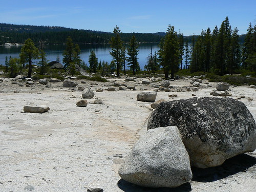
The town of Georgetown, formerly known as Growlersburg, is registered as California Historical Landmark #484. Forested roads & creeks of western Sierra Nevada where granite rules. 4x4 folks love this area for recreation. Backpacking, camping, fishing and hiking.
- nearby towns:
- Placerville
- Auburn
- Colfax
- Tahoma
- Camino
- Foresthill
- Placerville


Advertisement


Total Escape has been an AmazonAssociate for 20 years!
Earnings from purchases keeps this site alive.
Copyright © 1996-2024 Total Escape, totalescape.com / All Rights Reserved.
classic | lodge | recreation | destinations | journey | ads | sitemap | outside | maps | gear | mobile