a d v e r t i s e m e n t s

Destinations | Desert

town.olancha

Olancha

lodginglodging reservations in Olancha

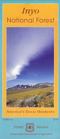
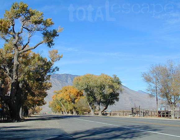
The southern start of the Eastern Sierra, Highway 395. Jagged Olancha Peak towers above at 12,123 feet. Few businesses stay open. The cafe is worth a visit and they do have gasoline right down the highway a piece.
elevation: 3648' population: 134 zip code: 93549

Desert

terrain:
High desert next to southern end of the Eastern Sierras.


View Larger Map

location:
Inyo County
S of Lone Pine
on Hwy 395 @ jct 190

maps


recreation:

  • Biking
  • backpacking
  • camping
  • fishing
  • hiking
  • Ghost Towns
  • Nine Mile Canyon Road
  • Walker Creek
  • Olancha Peak
  • Sage Flat
  • Owens Dry Lake Bed
  • Kennedy Meadows
  • Monache Meadows
  • Horseshoe Meadows Road
  • Saline Valley
  • parks, forests, rivers & lakes:

  • Inyo National Forest
  • Fossil Falls
  • Golden Trout Wilderness
  • N Mojave Desert BLM
  • Death Valley National Park
  • Malpais Mesa Wilderness
  • Coso Range Wilderness
  • Olancha Dunes
  • Eastern Sierra Nevada Forests Map Set
    Eastern Sierra Nevada Forests Map Set

    olancha campgrounds

    Lone Pine Campground
    Cottonwood Campground

    tent camping

    description:
    High desert area right next to the Southern Sierra's & Inyo range, with 10,000' peaks towering above on both sides of the highway; dry lake - Owens Lake nearby.

    nearby towns:
    Lone Pine
    Ridgecrest
    Mojave
    Randsburg
    Darwin
    Panamint Springs
    Kennedy Meadows
    local links:

    Lone Pine Chamber of Commerce
    760-876-4444
    877-253-8981
    http://www.lonepinechamber.org

    Friends of the Inyo
    Eastern Sierra - Highway 395
    Crystal Geyser
    The Coso Artifact

    Advertise on this site
    Inyo National Forest Map
    Inyo National Forest Map
    Jawbone Canyon & Randsburg OHV Map
    Jawbone Canyon & Randsburg OHV Map
    Dome Land Wilderness Map
    Dome Land Wilderness Map
    Golden Trout Wilderness / South Sierra Map
    Golden Trout Wilderness / South Sierra Map
    Death Valley NP Map
    Death Valley NP Map
    Eastern Sierra Recreation Topo Map
    $8.95
    Backcountry Skiing California's Eastern Sierra
    $29.00
    The Guide To Bodie and Eastern Sierra Historic Sites
    $12.95
    Eastern Sierra Ice: The Guide's Guide to Sierra Waterfalls and Alpine Ice Routes
    $14.95
    Mount Whitney - Complete Hiking Guide
    $16.95


    California Weekends
    Copyright © 1996-2012 Total Escape, www.totalescape.com / All Rights Reserved.

    home | lodge | recreation | destinations | journey | trips | advertise | site map | outside | maps | gear


    REI.com

    Vacation Rentals California


    Budget, National, Avis, Hertz, & Alamo!