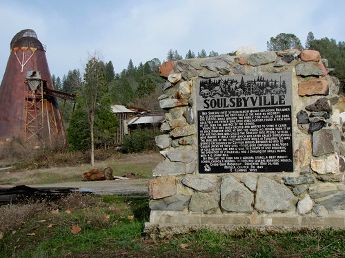
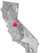
a d v e r t i s e m e n t s

Destinations | Mountain

town.soulsbyville

Soulsbyville

elevation: 2925' population: 1,732 zip code: 95372

Mountain

terrain:
dense forest

location:
Tuolumne County
E of Sonora
off Hwy 108

maps


recreation:

  • camping
  • hiking
  • mountain biking
  • Snow Skiing
  • Wineries
  • fishing
  • kayaking
  • river rafting
  • snow mobiling
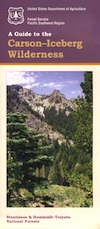
  • parks, forests, rivers & lakes:

  • New Melones Lake
  • Phoenix Reservoir
  • Stanislaus National Forest
  • Carson Iceberg Wilderness
  • Emigrant Wilderness
  • Stanislaus River
  • Central Sierra Nevada Forests Map Set
    Central Sierra Nevada Forests Map Set

    Campgrounds campground reservations
    To make a campground reservation nearby click below

    Pinecrest Lake Camping
    Pioneer Trails Campground

    tent camping

    description:
    Small mountain community in the Sierra Nevada

    nearby towns:
    Pinecrest
    Sugarpine
    Sonora
    Twain Harte
    Long Barn
    local links:

    Dodge Ridge Ski
    Historic Gold Country

    Advertise on this site
    Stanislaus National Forest Map
    Stanislaus National Forest Map
    Emigrant Wilderness Map
    Emigrant Wilderness Map
    Emigrant Wilderness Trail Map
    Emigrant Wilderness Trail Map
    Sierra Nevada Topo Map
    Sierra Nevada Topo Map
    Carson-Iceberg Wilderness Map
    Carson-Iceberg Wilderness Map
    Search : Mountain Biking the Eastern Sierra's Best 100 Trails
    Mountain Biking the Eastern Sierra's Best 100 Trails

    Search : Lone Pine Region Recreation Topo Map & Guide: Inyo National Forest, Kings Canyon National Park, Sequoia National Park, Tinemaha Reservoir, Owens River, Owens Lake, Sierra Nevadas, Inyo Mountains, Mount Whitney, Long Lake, Big Pine, Lone Pine, (Fresno County, Tulare County, Inyo County, Owens Valley, Interstate Highway 395, Intrastate Highway 136: Camping, Fishing, Hiking, Ohv, 4wd, Off-road, Climbing, Skiing, Mountain Biking, Street Maps, Campground Finder, Waterproof Topo Lines 3d Relief, Sierra Maps Eastern Sierra Series 2008)
    Lone Pine Region Recreation Topo Map & Guide: Inyo National Forest, Kings Canyon National Park, Sequoia National Park, Tinemaha Reservoir, Owens River, Owens Lake, Sierra Nevadas, Inyo Mountains, Mount Whitney, Long Lake, Big Pine, Lone Pine, (Fresno County, Tulare County, Inyo County, Owens Valley, Interstate Highway 395, Intrastate Highway 136: Camping, Fishing, Hiking, Ohv, 4wd, Off-road, Climbing, Skiing, Mountain Biking, Street Maps, Campground Finder, Waterproof Topo Lines 3d Relief, Sierra Maps Eastern Sierra Series 2008)

    Search : Mountain biking in the Northern Sierra: The Crystal Basin Recreation Area of the Eldorado National Forest
    Mountain biking in the Northern Sierra: The Crystal Basin Recreation Area of the Eldorado National Forest

    Search : Mammoth Lakes & Mono County (Mountain biking the High Sierra)
    Mammoth Lakes & Mono County (Mountain biking the High Sierra)

    Search : Mountain biking in the Northern Sierra: The Donner Burn and Points North in the Tahoe National Forest
    Mountain biking in the Northern Sierra: The Donner Burn and Points North in the Tahoe National Forest


    California Weekends
    Copyright © 1996-2009 Total Escape, www.totalescape.com / All Rights Reserved.

    home | lodge | recreation | destinations | journey | forum | trips | advertise | site map | outside | maps | gear


    knitted sweaters for children


    Marmot -Gear you can rely on at Altrec


    California Escapes