Advertisement
Activities
| Camp | Camping
| Destinations | Mountains | CA National Forests
nf.sequoia
| Desert |
Country |
Mountain |
| high desert terrain on eastern slopes
overlooking Mojave
|
sage brush meadows, reservoirs, pinyon
pine trees & ranch lands
|
pine forest with aspens, alpine meadows & recreational rivers
|
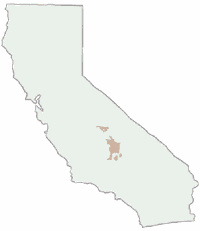
Sequoia National Forest is divided into 2 distinct sections:
| section |
near |
| Northern |
Sequoia & Kings Canyon |
| Southern |
Kern River & Dome Land |
Wilderness areas within forest:
|
 Fire Lookout Tower / Historic Cabins
|

|

|

|
| nearby cities & towns |
terrain |
lodging @ |
| Alta Sierra, CA |
mountains |
Alta Sierra
|
| Bakersfield, CA |
city |
Bakersfield
|
| Camp Nelson, CA |
mountains |
Camp Nelson
|
| California Hot Springs |
mountains |
California Hot Springs
|
| Fairview, CA |
mountains |
Fairview |
| Kernville, CA |
mountains |
Kernville |
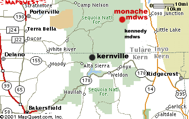
| Kennedy Meadows, CA |
mountains |
Kernville |
| Kings Canyon, CA |
mountains |
Kings Canyon NP
|
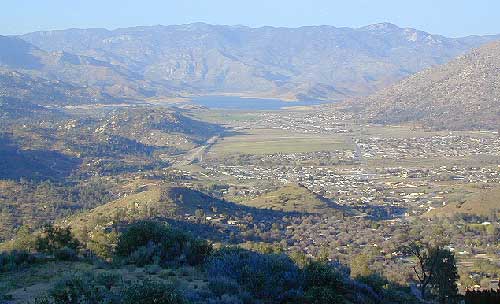
| Lake Isabella, CA |
mountains |
Lake Isabella
|
| Lindsay, CA |
country |
Lindsay |
| Ponderosa, CA |
mountains |
Ponderosa |
| Porterville, CA |
country |
Porterville
|
| Ridgecrest, CA |
desert |
Ridgecrest |
| Sequoia National Park |
mountains |
Sequoia NP
|
| Springville, CA |
mountains |
Springville
|
| Tehachapi, CA |
mountains |
Tehachapi |
| Three Rivers, CA |
mountains |
Three Rivers
|
| Wofford Heights, CA |
mountains |
Wofford Heights
|
|
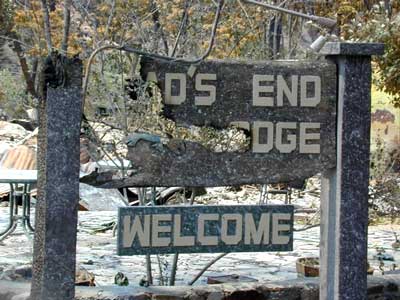
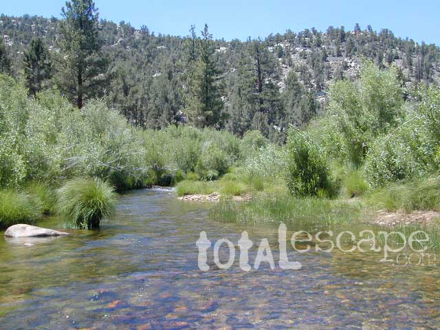
Photo dedication to Road's End
Sequoia National Forest
Sierra Nevada Mountains
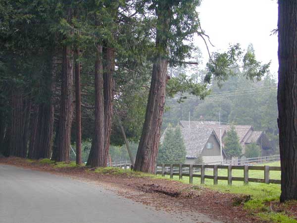
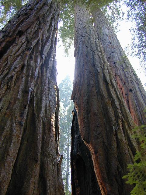
Meadows, mountain peaks, streams, waterfalls, huge granite rocks, domes & cliffs, plus the southern most Sequoia groves. Outdoor recreation & the best possible camping near Southern California.
Sequoia Area activities include:
- Back Road Exploration
- Backpacking
- Camping
- Hiking
- Fishing
- Kayaking
- Kern River CA
- Mountain Biking
- River Rafting
- Rock Climbing
- Sightseeing
- Sierra Creeks & Streams
- Sequoia Groves
- Tule River CA
|

Backpacking Sequoia NF
A Sequoia Forest Service Map or hiking topo map is highly advised for this rugged Sierra Nevada area. There are
many dirt roads & trails in order to get to some of these
spots. This lush pine forest is convenient & close to Bakersfield
& Fresno CA. Tent camping is allowed almost any place. Please camp 100
feet from trail or water sources. No camping on meadows. Ground fires
are very allowed with fire permit.
Check with the correct ranger district for all back country camping
rules.
Sequoia Ranger Stations:
Sequoia Forest
Headquarters
Porterville CA
559-784-1500
|
Western Divide District
32588 Highway 190
Springville, CA
559-539-2607
|
Hume Lake District
35860 East Kings Canyon
Dunlap, CA
559-338-2251
|
Sequoia National Forest
government web site
559-784-1500
|
Kern River District
4875 Ponderosa Dr
Lake Isabella CA
760-379-5646
|
Kern River Ranger Distr.
105 Whitnet Rd
Kernville CA
760-376-3781
|
|
Sequoia Backpacking
Trailhead & parking spots located at:
- Big Meadow Trailhead on Road #22S07 - to Domeland Wilderness
- Jackass Trailhead (near Fish Creek Campground, Road# 22S05) - to South Sierra Wilderness
- Jerky Meadow (end of Forest Service Road #22S82) - to Golden Trout Wilderness
- Lewis Camp Trailhead (end of road# 20S79) - to Golden Trout Wilderness
- Lion Meadow Trailhead (end of road# 21S60) - to Golden Trout Wilderness
- Marvin Pass Trailhead (end of road# 13S12, off of #14S11) - to Jennie Lakes Wilderness
- Powell Meadow Trailhead - to Monache Meadows / Olancha Peak
- Rowell Trailhead (end of road# 13S14, off of #14S11 ) - to Jennie Lakes Wilderness
- Stoney Creek Trailhead (near Stoney Creek Campground) - to Jennie Lakes Wilderness
- Summit Trailhead (end of road# 21S50) - to Golden Trout Wilderness
Western Divide Highway 190
Giant Sequoia National Monument
1 hour North of Kernville, CA
Shermans Pass, Kern Plateau
Sequoia National Forest
1 hour NE of Kernville, CA
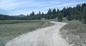
Backroads Sequoia
 The Southern Sierra Nevada is filled with old logging roads that lead to lush
dense forest & meadows. Be aware of the Forest Service Signage
& have a good map on hand. It is easy to get lost & you
could end up driving for hours. Make sure you have adequate gasoline, food & emergency gear if you plan to explore these forests roads & rural routes. The Southern Sierra Nevada is filled with old logging roads that lead to lush
dense forest & meadows. Be aware of the Forest Service Signage
& have a good map on hand. It is easy to get lost & you
could end up driving for hours. Make sure you have adequate gasoline, food & emergency gear if you plan to explore these forests roads & rural routes.
Sequoia Back Roads: Forest Service Road # - click on road number for detailed description
|
|
|
- 14S11 - Sequoia / Kings Cyn NP
- 19S09 - Dillonwood Grove
|
Areas of Interest for Back Road Exploration
Big Meadow
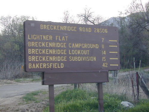
Breckenridge
Keyesville Kern River
Lloyd Meadows
Monache Meadows
Rincon Trail & Camp
Western Divide Highway
BLM Backcountry Camps on the east side -
Chimney Peak Backcountry Byway
Canebrake Road, south of Kennedy Meadows
Chimney Creek Campground
Long Valley Campground
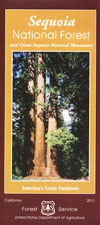
Sequoia Park Maps, Road Maps & Topo Hiking Maps
Sequoia National Forest Map
(USDA NFS)
Sequoia Kings Map
(NatGeo)
Domelands Wilderness Map
(USDA NFS)
Golden Trout Wilderness Trail Map
(Tom Harrison)
Golden Trout South Sierra Wilderness Map
(USDA NFS)
Jawbone Canyon / Randsburg OHV Map
Mineral King Hiking Map
(Tom Harrison)
Monarch Jennie Lakes Wilderness Map
(USDA NFS)
Pacific Crest Trail / Tehachapi
(USDA NFS)
Sequoia & Kings Canyon Topo Map
(Tom Harrison)
NFS Rental Cabins & Fire Lookouts
|
Total Escape California Camping
Advertisement
|
|


 Camping Sequoia NF Campgrounds
 Hiking Sequoia National Forest
 Primitive Camping Sequoia NF
 Sequoia Lakes / Sierra Nevada Lakes
 Sequoia Waterfalls in Sierra Nevada
 Mountain Biking Kern River
 Kern OHV Trails & Off Roading
 Sequoia XC Snow Skiing

