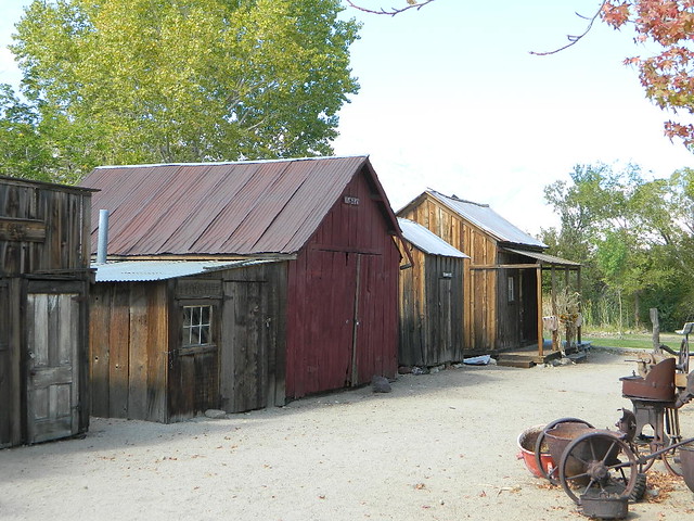
a d v e r t i s e m e n t s

Destinations | Desert

town.independence

Independence

lodginglodging reservations in Independence

Photo Credit © Copyright Morris Neer

This place is worth a stop, if you wanna stay away from the crowds at Bishop CA. Along Hwy 395 the majestic Eastern Sierras run their length, steep granite ridge lines, awesome views & diverse landscapes. The Indian Museum here in Independence is excellent & has plenty sites to see for that luxurious extra long stretch (from driving too much). Get out & stretch, for more than 5 minutes. How about a picnic & yoga on the lawn next to the creek!
elevation: 3925' population: 1,000 zip code: 93526

Desert

terrain:
valley with few trees & great access to mountains

location:
S of Bishop
on Hwy 395

maps


= IPC

recreation:

  • Backpacking
  • Back Road Exploration
  • Camping
  • Fishing
  • Hiking
  • Horse Pack Trips
  • Mountain Biking
  • Eastern California Museum
  • High Sierra Hiking Photos
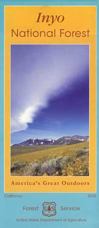
  • parks, forests, rivers & lakes:

  • Alabama Hills
  • Manzanar War Relocation Center
  • Inyo National Forest
  • John Muir Wilderness - Onion Valley
  • Eastern Sierra Nevada Forests Map Set
    Eastern Sierra Nevada Forests Map Set

    Campgrounds campground reservations
    To make a campground reservation nearby click below

    Grays Meadows Campgrounds
    Oak Creek Campground
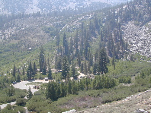
    Onion Valley Campground

    tent camping

    description:
    Owens Valley: Dispersed ranches & homes on valley floor at the base of the awesome Eastern Sierra Nevada range. Sagebrush high desert & granite alpine bliss all within a few miles of each other. Take the drive way up to Onion Valley for a picnic - or a full day hike, to the teal blue lakes of only dreams are made of.

    nearby towns:
    Big Pine
    Lone Pine
    Bishop
    local links:

    Independence Chamber of Commerce
    760-878-0084
    http://www.independence-ca.com

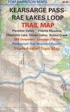
    Onion Valley Trailheads
    Friends of the Inyo
    Independence Indian Museum
    Eastern Sierra - Highway 395
    Onion Valley & Kearsarge Pass Photos

    Advertise on this site
    Inyo National Forest Map
    Inyo National Forest Map
    John Muir Wilderness / Kings Cyn Map
    John Muir Wilderness / Kings Cyn Map
    Mount Whitney High Country Map
    Mount Whitney High Country Map
    Mount Whitney Zone Map
    Mount Whitney Zone Map
    Golden Trout Wilderness Trail Map
    Golden Trout Wilderness Trail Map
    Kearsarge Pass Trail Map
    Kearsarge Pass Trail Map
    Search : Sierra North: Backcountry Trips in Californias Sierra Nevada
    Sierra North: Backcountry Trips in Californias Sierra Nevada

    Amazon.com's Price: $12.70
    Search : The Dream of the Earth
    The Dream of the Earth

    Amazon.com's Price: $10.46
    Search : The Sierra High Route: Traversing Timberline Country
    The Sierra High Route: Traversing Timberline Country

    Amazon.com's Price: $11.53
    Search : Hiking California's Golden Trout Wilderness: A Guide to Backpacking and Day Hiking in the Golden Trout and South Sierra Wildernesses
    Hiking California's Golden Trout Wilderness: A Guide to Backpacking and Day Hiking in the Golden Trout and South Sierra Wildernesses

    Amazon.com's Price: $12.89
    Search : Simple Foods for the Pack: More than 180 all-natural, trail-tested recipes (Sierra Club Outdoor Adventure Guides)
    Simple Foods for the Pack: More than 180 all-natural, trail-tested recipes (Sierra Club Outdoor Adventure Guides)

    Amazon.com's Price: $10.46


    California Weekends
    Copyright © 1996-2008 Total Escape, www.totalescape.com / All Rights Reserved.

    home | lodge | recreation | destinations | journey | forum | trips | advertise | site map | outside | maps | gear


    Sierra Trading Post