|
|
Wilderness around San Berdu forest:
|

San Bernardino Ranger Stations:
Forest
Headquarters
San Bernardino CA
909-383-5588
|
Arrowhead District
Rimforest CA
909-382-2782
|
Big Bear District
Fawnskin CA
909-382-2790
|
Cajon District
Lytle Creek CA
909-382-2850
|
San Gorgonio District
Mentone CA
909-382-2881
|
Barton Flats District
Barton Flats CA
909-794-4861
|
San Jacinto District
Idyllwild CA
909-82-2921
|
Mojave River Forks
Regional Park
|
California Desert District
Riverside CA
714-697-5200
800-446-6743
|
BLM Mojave Desert
Barstow
760-252-6000
Palm Springs
760-251-4800
|
San Jacinto Peak
Santa Rosa NM
Palm Desert CA
760-862-9984
|
San Berdu NF
government web site
|
Big Bear / Idyllwild Backpacking
- fire permits are required
- permits are required for overnight back country camping
- check with the correct ranger district for all back country
camping restrictions
Trail head parking spots located at:

Big Bear & Idyllwild Backroads
This place has got what you need to escape from the urban grind.
Get that 4x4 truck, Jeep or SUV dirty & explore
the hundreds of miles of dirt roads. From mild to wild! It's all here in SoCal.
OHV ( Off highway vehicle)
areas - In Big Bear region you are likely to experience busy trail
conditons on some of the most popular runs like "John Bull";
"Holcomb Creek" & "Deep Creek". Keep your
eyes peeled for motorcycles & quads at all times, as this
is a very well used area.
Plenty loop trails & day trips can be planned if you have
the correct NFS maps (see to the right). 4 wheel drive only may be required for some routes, but most forest dirt roads are suitable for a stock high clearance 2WD. Graded dirt roads accessible with passenger cars lead to most developed campgrounds & some yellow post sites.
San Bernardino Back Roads: Forest Service Road # - click on road number for detailed description
|
Big Bear Back Roads
|
Idyllwild Dirt Roads
|
- 1N01 - Pipes Canyon
- 1N02 - Heartbar Camp
- 1N05 - San Gorgonio
- 1N54 - Clarks Summit/Grade
- 2E03 - Santa Ana River Trail
- 2N10 - Grand View Point
- 2N93 - Wildhorse Meadows
- 3N03 - Lone Valley
- 3N09 - Van Dusen Canyon
- 3N10 - John Bull Trail 4x4
- 3N14 - Fawnskin Camping
- 3N34 - Deep Creek 4x4
- 3N34 - Dishpan Springs
- 3N69 - Gold Mountain 4x4
- 3N93 - Holcolmb Creek 4x4
- 3N97 - Ironwood Meadow
|
- 4S01 - Boulder Basin
- 4S06 - Indian Creek
- 4S10 - Cave Springs OHV
- 4S19 - Angelus Hill
- 5S15 - Rouse Ridge
- 6S05 - Fobes Canyon
- 6S13 - Thomas Mountain
- 7S02 - Toro Peak
|
 Be responsible & don't close our back roads!
Do not cut new trails, litter trash, cans, cigarettes OR ...drink
& drive. Trails get closed annually due to misuse & this
kinda neglecting behavior is giving SUV
/ 4x4 's a bad name. Please help the cause, not hinder it. See
backroads for more
info on this land use topic.
Be responsible & don't close our back roads!
Do not cut new trails, litter trash, cans, cigarettes OR ...drink
& drive. Trails get closed annually due to misuse & this
kinda neglecting behavior is giving SUV
/ 4x4 's a bad name. Please help the cause, not hinder it. See
backroads for more
info on this land use topic.
Check out the 1920's route to Big Bear via Clark's Grade.
|
Maps of San Bernardino Forests: OHV Big Bear, Idyllwild
San Bernardino National Forest Map
(USDA NFS)
San Jacinto Wilderness Trail Map
(Tom Harrison)
San Gorgonio Wilderness Trail Map
(Tom Harrison)
Big Bear Trail Map
Pacific Crest Trail Maps (USDA NFS)
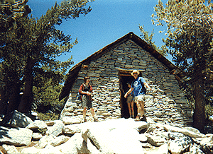
Fire Lookouts, Cabins & Equestrian Camp Reservations
- Coon Creek Cabin - Stone cabin & group camp site on Heartbar Rd #1N02
- Heartbar Equestrain Camp - on Heartbar Rd #1N02
- Wild Horse Equestrain Camp - near San Gorgonio & Santa Ana River
- Morton Peak Lookout
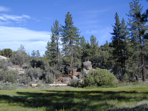
San Bernardino Forest Hiking
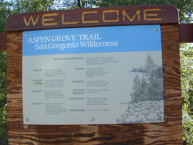
 Aspen Grove Hike in San Gorgonio
Forest Falls - Waterfall
Heaps Arboretum
Idyllwild Park, near Idyllwild CA
Mount San Jacinto State Park
Round Valley Loop atop San Jacinto (Palm Springs Tram)
San Jacinto Wilderness
San Gorgonio Wilderness
Aspen Grove Hike in San Gorgonio
Forest Falls - Waterfall
Heaps Arboretum
Idyllwild Park, near Idyllwild CA
Mount San Jacinto State Park
Round Valley Loop atop San Jacinto (Palm Springs Tram)
San Jacinto Wilderness
San Gorgonio Wilderness
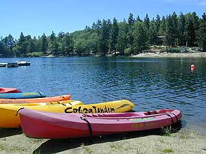
Big Bear Area Lakes & SoCal Rivers
Southern California Waterfalls
Minimal rain fall (10" per year) makes water scarse in the dry SoCal climate. This pine forest, sandwiched between 2 desert regions, has only a few waterfalls worthy of mention.
- Forest Falls CA
- Silverwood Falls in San Gorgonio Wilderness
- Snow Creek Falls, Palm Springs CA
- Strawberry Creek Falls, Idyllwild CA
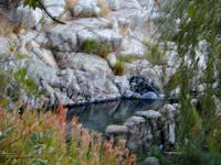
Southern California Hot Springs
Very few hot springs in this forested region & you'll hafta to hike to get to them. Rightly so.


|


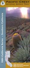 Pacific Crest Trail Map


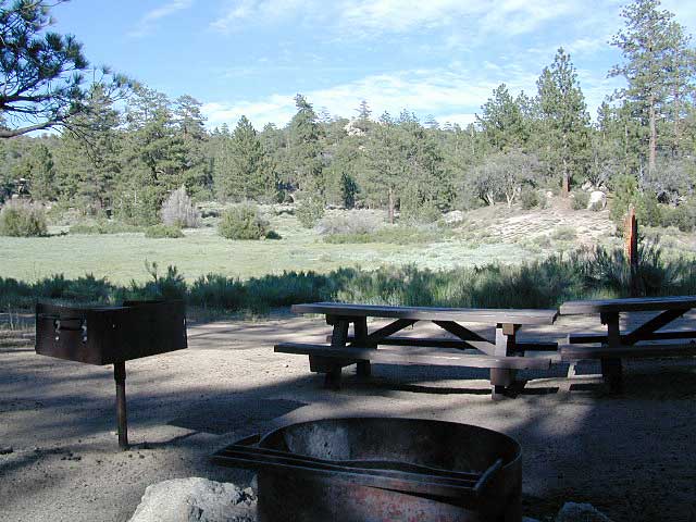
 San Bernardino Campgrounds, Big Bear Camping, Idyllwild
 Primitive Camps, Yellow Post Camp Sites (Dispersed Camping)

