|
|
2 National Forest
Maps to cover this Coastal Region
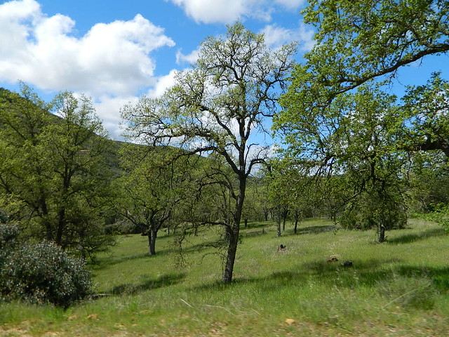
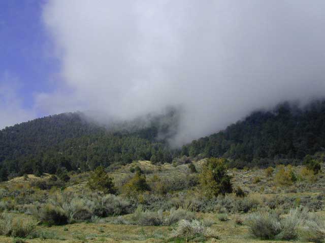
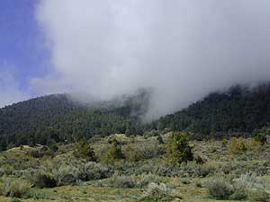
A diverse landscape makes this area interesting with plenty
of recreational activities. Dirt backroads
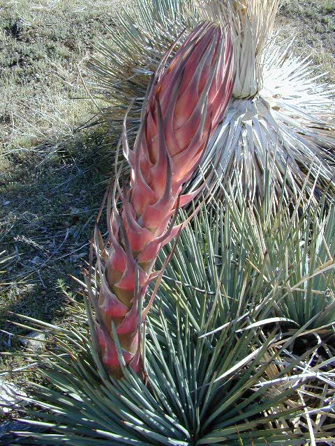
are all over the place. Pinyon pine to Jeffery Pine forest, Snow
in the mtns., cactus & manzanita chaparral, wide creek washes
plus the meadows makes this a very desirable destinations for
Californians seeking a break from the crowded urban areas.
The park stretches as far north as Carmel & lines the
Big Sur Coastline with plenty of primitive camping options away
from the crowded coastline. see Big
Sur BackRoads
|
|
|

Ranger Stations:
Backpacking
- convenient & close to Los Angeles / Ventura / Santa Barbara
/ San Luis Obispo / Santa Maria
- fires are very restricted, depending on fire danger risk
- fire permits are required
- permits are required for overnight back country camping
- check with the correct ranger district for all back country
camping restrictions
Some of the best remote backpacking in Southern California
can be found in this area. A Forest Service
Map is highly advised for this area. There are many dirt roads
& trails in order to get to some of these spots.
 Trail head parking spots located at:
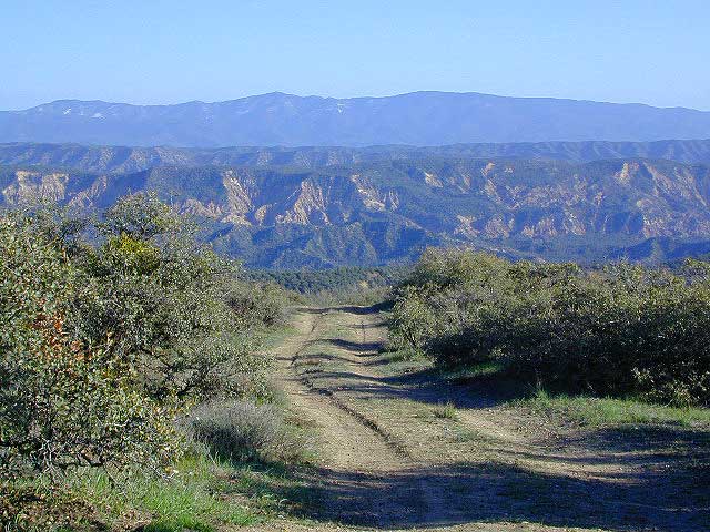
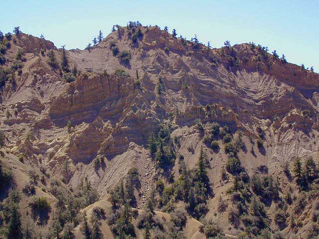
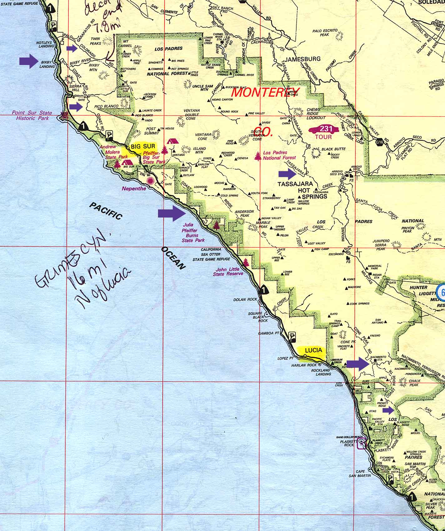
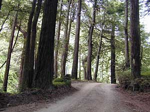
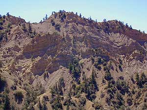
Big Sur / Central Coast Area - this coastal range offers
spectacular views of the coastline plus hiking among oaks &
some redwoods trees. From coastal Hwy.1 a few miles south of Lucia,
across from Kirk Creek Campground take the small & very windy
Naciemiento Ferguson Rd. (paved) up 7 mi. to the dirt road crossing.
Turn left /north & continue on dirt road to 3 different trail
head parking spots. There is no base camp areas.
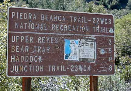
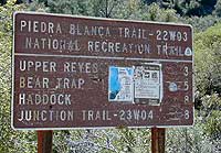
Trail camps:
Upper Nuevo - see directions & description
for Rancho Nuevo

-
off Lockwood Valley Rd. look for Reyes Creek campground &
park there. Hike into these back country campsites. They can be
found in order, heading south toward another other parking option
at Lion campground on road # 6N313 found off Hwy.33.
- Upper Reyes
- Bear Trap
- Haddock
- Three Mile
- Pine Mtn. Lodge
- Twin Forks
- Piedra Blanca
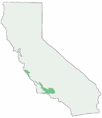
Los Padres Campgrounds
Los Padres is a long chunk of public forest land spanning nearly the entire Central Coast. Los Padres stretches from Monterey down to Ojai CA
Choose your desired camping area -
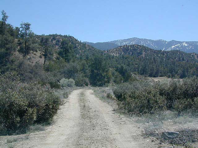
Back Roads
There is no better place is Southern California to hit the dirt & get away from the crowds. Big Bear in Santa Bernardino National Forest & Angeles National Forest, so close
to LA, are such popular destinations, that you can rarely feel
like you are in the wilderness. But merely 30-40 miles from San
Fernando Valley is this network of amazing dirt backroads. Check out the red dirt action in Quatal Canyon & Santa Barbara Canyon.

A Forest Service Map is highly advised for this area. Many
dirt roads to get to spectacular views.
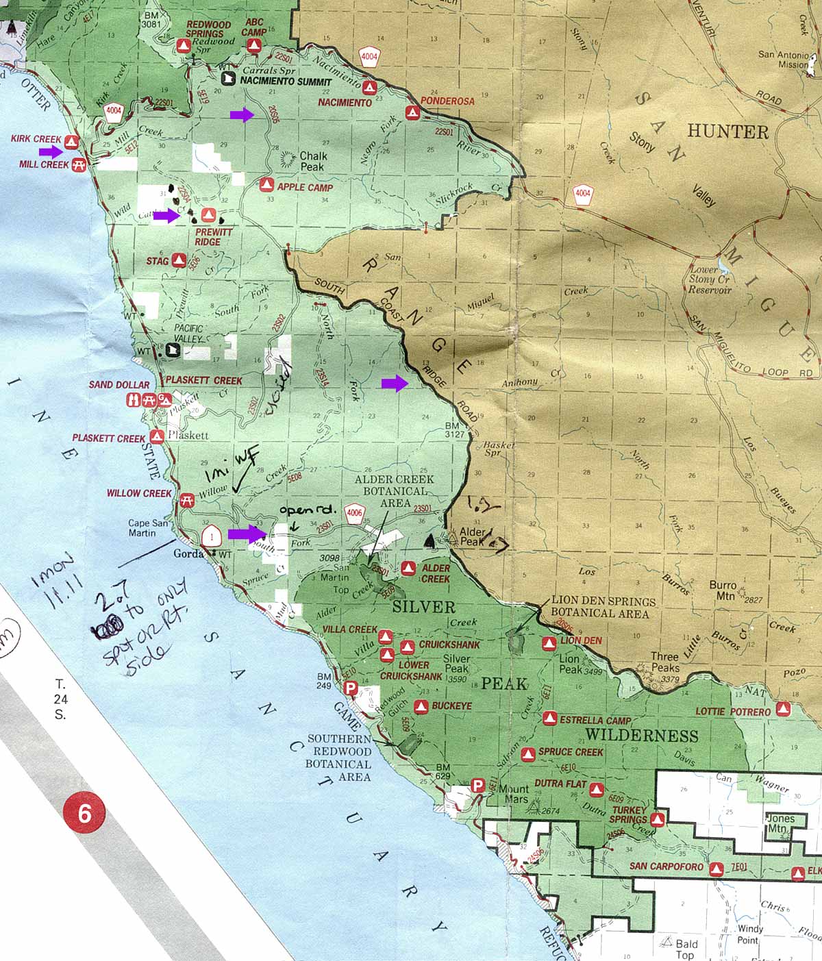
Central Coast - Ridge Roads
From Coast Highway 1, a few miles south of Lucia, across from
Kirk Creek Campground take narrow & very winding paved road
east up Naciemiento Ferguson, approx. 6-7 mi. to the dirt road
intersection/crossing.
-OR-
From Hwy.101 take exit for G18/ Jolon Rd. past Naciemiento Lake
& past town of Lockwood. Through Hunter Leggitt military base
on Mission Rd., veer left on Naciemiento Ferguson Rd. Pass campgrounds
Ponderosa & Naciemiento
Just West of Naciemiento campground will be an intersection of
dirt roads.
 North
segment
will bring you to Cone Peak Rd. Backpackers parking
areas & plenty of trails leading into the coastal wilderness.
Dead ends.
North
segment
will bring you to Cone Peak Rd. Backpackers parking
areas & plenty of trails leading into the coastal wilderness.
Dead ends.
Turn South on Coast Ridge Trail #20S05 & find primitive
camping spots: continue 5 mi. to right turn up hill & onto
ridge area. All out in the open with great view. A few oaks trees
for shade. Continue South on #20S05 & follow into confusion
dirt roads. Signs with map are hard to understand & some west
slope roads are washed out due to El Nino rains a few years back.
You CAN eventually get down the western side via Willow Creek
area (with a nice waterfall) Rd#23S01, but you will have to be
patient & not wander East into military land.
Willow Creek waterfall: From coast Hwy.1 just North
of town of Gorda, Highway widens to dirt area & up embankment.
Take Rd#23S01 up approx. 1 mi. (careful - no trespassing
on private lands)
to fern basins, redwoods & a waterfall.
see our special - Big Sur BackRoads

|
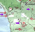
map credit NFS:
Los Padres - Mont. Distr.
CLICK TO ENLARGE
|
|
map credit Thomas Bros.
|
Sespe Hot Springs hike
Hungry
Valley OHV
- So. California
- near the Grapevine Area of Interstate 5
Ballinger Canyon OHV - great
for the motorcycle enthusiast beginner & intermediate, East
of Hwy. 33 near Ventucopa

Reyes Peak Camp @ Pine Mountain- ridge line, secluded campsites, 9 miles (half paved) from Highway 33
Lockwood Valley Rd. west of Frazier Park has plenty of Forest Service Roads that branch off of it. Take your pick & go exploring. Most are suitable for 2WD high clearance vehicles, except during wet weather.
Tecuya Mountain 4x4 Camps @ Cuddy Valley
San Emigdio road behind cabin community of Pine Mountain Club . Try westward, up to the Blue Ridge for a great sunset run.
Miller Jeep Trail - the over-crowded and super-popular 'city boy' weekend run. Call it extreme 4x4 rock crawling.
Mild graded dirt roads lead back to Half Moon Campground
Dome Springs is an east to reach campground along Lockwood Valley Road
Nettle Springs is a secluded camp geared toward dirt, located way back, off of Highway 33 @ Cuyama River
Valle Vista Campground is located way out on Cerro Noroeste Road, west of Pine Mountain Club

Hiking
Plenty of hiking & backpacking opportunities within this
forest.  Frazier Mountain area has some nice trails.
- Prewitt Ridge &
backpack opportunities, views to live for.
- Sykes Hot Springs near Big Sur is best donw as an overnight
trip
- Partington Cove
along the Big
Sur
coastline.
- Sespe Hot Springs - a really long day hike
- Mount Pinos is a great easy half day hike
- Mount Pinos over to Mount Able ( or vice versa, & swap
vehicles is a great plan for a group)
- Lyons & Piedras Blancas has some awesome terrain
- Rose Valley Falls is an easy hike for the family, even if
it is mostly a trickle (best days after a big rain)
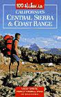
100 Hikes in California's Central Sierra & Coast Range
Lakes
This coastal range has a few lower elevation reservoirs, that
are perfect for recreation during that hot June, when the June Gloom is still in
full swing. While most have full service marinas & rent boats,
kayaks, bikes,& more, you should contact lake authorities
directly to see what is available as some items will be already
reserved or even discontinued for the season.
Rock Climbing
- Sespe Gorge Wall @ Potrero John Creek & Hwy.33, approx.
20 miles North of Ojai
- Devils playground - Sandstone area near Lyons campground,
Near Rose Valley at Hwy. 33

|